U.S. Geological Survey Open-File Report 2011–1222
Sea-Floor Geology and Sedimentary Processes in the Vicinity of Cross Rip Channel, Nantucket Sound, Offshore Southeastern Massachusetts
 |
||
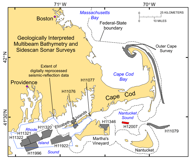
Figure 1. Index map of the coastal waters off southeastern New England showing location of the H12007 study area in central Nantucket Sound (red polygon) and the locations of earlier studies completed as part of this series (gray polygons). These earlier studies include (1) the Outer Cape survey (Poppe and others, 2006) and National Oceanic and Atmospheric Administration surveys H11076—Quicks Hole (Poppe and others, 2007a), H11079—Great Round Shoal Channel (Poppe and others, 2007b), H11077—Woods Hole (Poppe and others, 2008), and H11346—Edgartown (Poppe and others 2010) off Massachusetts; and (2) H11320 (McMullen and others, 2007), H11321 (McMullen and others, 2008), H11322 (McMullen and others, 2009a), H11922 (Poppe and others, 2011), H11996 (McMullen and others, 2011) and the extent of digitally reprocessed seismic-reflection data (McMullen and others, 2009b) (blue outline) off Rhode Island. |
||


