U.S. Geological Survey Open-File Report 2011–1222
Sea-Floor Geology and Sedimentary Processes in the Vicinity of Cross Rip Channel, Nantucket Sound, Offshore Southeastern Massachusetts
 |
||
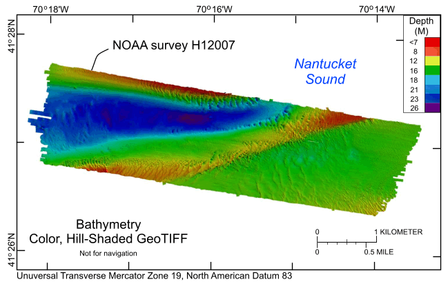
Figure 18. Digital terrain model (DTM) of the sea floor produced from multibeam bathymetry collected during National Oceanic and Atmospheric Administration survey H12007 in central Nantucket Sound, offshore of southeastern Masscahusetts. Image is sun-illuminated from the north and vertically exaggerated (5x). "Warmer" colors indicate shallower areas; "cooler" colors indicate deeper areas. See explanation for depth ranges. | ||