U.S. Geological Survey Open-File Report 2011–1222
Sea-Floor Geology and Sedimentary Processes in the Vicinity of Cross Rip Channel, Nantucket Sound, Offshore Southeastern Massachusetts
 |
||
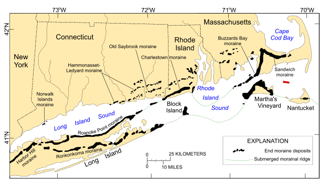
Figure 2. Map showing locations of end moraines (black polygons) in southern New England and on Long Island, New York. The Ronkonkoma-Nantucket moraine marks the southern extent of the Laurentide Ice Sheet at a glacial maximum about 20 to 24 ka and the Harbor Hill-Roanoke Point-Charlestown-Buzzards Bay moraine represents the ice-sheet position after a readvance about 18 ka (Uchupi and others, 1996). Underwater extensions of the moraines are shown as dashed lines. The study area is shown as a red polygon. (Modified from Stone and Borns, 1986; and Gustavson and Boothroyd, 1987.) | ||


