Skip past header information
USGS - science for a changing world
NOAA Logo with link to NOAA Home Page.Massachusetts CZM Logo with link to MA CZM Home Page.  

U.S. Geological Survey Open-File Report 2011–1222

Sea-Floor Geology and Sedimentary Processes in the Vicinity of Cross Rip Channel, Nantucket Sound, Offshore Southeastern Massachusetts


Skip past contents information

Title | List of Figures | Conversion Factors | Abstract | Introduction | Setting | Methods | Bathymetry | Sediment Distribution | Bottom Photography | GIS Data Catalog | Summary | Acknowledgments | References | Contacts


Figure 5. A map of shoals and channels in the study area.

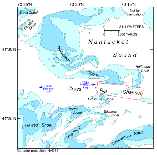
Figure 5. Map showing the major physiographic features in the vicinity of the study area (National Oceanic and Atmospheric Administration, 1996), the extent of the multibeam bathymetric dataset, and the maximum strengths and directions of the flood and ebb tidal flow in Cross Rip Channel (White and White, 2010), a section of the main channel that runs east-west through Nantucket Sound.

Skip USGS links group

Accessibility FOIA Privacy Policies and Notices

Take Pride in America logo USAGov logo U.S. Department of the Interior | U.S. Geological Survey
End of USGS links group