Skip Links

USGS - science for a changing world

U.S. Geological Survey Open-File Report 2011–1225

Geologic Map of Detrital, Hualapai, and Sacramento Valleys and Surrounding Areas, Northwest Arizona

By L. Sue Beard, Jeffrey Kennedy, Margot Truini, and Tracey Felger

Thumbnail of and link to report PDF (10.1 Size MB)Introduction

A 1:250,000-scale geologic map and report covering the Detrital, Hualapai, and Sacramento valleys in northwest Arizona is presented for the purpose of improving understanding of the geology and geohydrology of the basins beneath those valleys. The map was compiled from existing geologic mapping, augmented by digital photogeologic reconnaissance mapping. The most recent geologic map for the area, and the only digital one, is the 1:1,000,000-scale Geologic Map of Arizona. The larger scale map presented here includes significantly more detailed geology than the Geologic Map of Arizona in terms of accuracy of geologic unit contacts, number of faults, fault type, fault location, and details of Neogene and Quaternary deposits. Many sources were used to compile the geology; the accompanying geodatabase includes a source field in the polygon feature class that lists source references for polygon features. The citations for the source field are included in the reference section.

         Files for viewing and printing:

  • Pamphlet PDF (43 pages, 10.1 MB)
  • Map PDF (34" x 44", 10.1 MB)

         Data:

  • Readme TXT (4 kB)
  • Metadata TXT (12 kB)
  • GIS database Zipped package of files necessary to create an ArcMap Personal Geodatabase project (22.7 MB ZIP file that opens into a 62.2 MB directory).
  • Shapefiles Zipped package of feature classes converted to shapefiles to facilitate use of the data in ArcMap and other applications (7.8 MB ZIP file that opens into a 12.4 MB directory).
  • This report is available only on the Web.

For additional information:
Contact Information, Western Region Geology and Geophysics Field Science Center—Flagstaff
U.S. Geological Survey
2255 N. Gemini Drive
Flagstaff, AZ 86001-1600
http://geomaps.wr.usgs.gov/

Part of this report is presented in Portable Document Format (PDF); the latest version of Adobe Reader or similar software is required to view it. Download the latest version of Adobe Reader, free of charge.


Suggested citation:

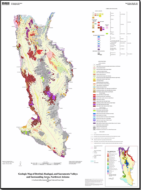
Beard, L. Sue, Kennedy, Jeffrey, Truini, Margot, and Felger, Tracey, 2011, Geologic map of Detrital, Hualapai, and Sacramento Valleys and surrounding areas, northwest Arizona: U.S. Geological Survey Open-File Report 2011–1225, pamphlet 43 p., 1 map sheet, scale 1:250,000, available at https://pubs.usgs.gov/of/2011/1225/.


Accessibility FOIA Privacy Policies and Notices

Take Pride in America logo USA.gov logo U.S. Department of the Interior | U.S. Geological Survey
URL: http://pubsdata.usgs.gov/pubs/of/2011/1225/index.html
Page Contact Information: GS Pubs Web Contact
Page Last Modified: Wednesday, 07-Dec-2016 23:52:53 EST