U.S. Geological Survey Open-File Report 2012-1038

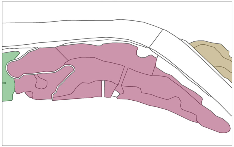
Figure 3. Illustration of the relationship between prioritization site designation and National Wetland Inventory polygons. In this example from the Alsea estuary, Oregon, the pink shaded area is a single prioritization site (Site A21 in fig.7) composed of 12 underlying NWI polygons (dark pink outlines). The NWI polygons were merged to form the prioritization site, based on their similar alteration level, land use history, and hydrologic connectivity. NWI polygons outside the pink prioritization site are non-tidal wetlands or wetlands in tidal wetland classes not included in this study (brown and green shaded areas plus the white river channel); or uplands (white areas at edges of figure). |
First posted May 10, 2013
For additional information contact: Part or all of this report is presented in Portable Document Format (PDF); the latest version of Adobe Reader or similar software is required to view it. Download the latest version of Adobe Reader, free of charge. |