U.S. Geological Survey Open-File Report 2012-1038

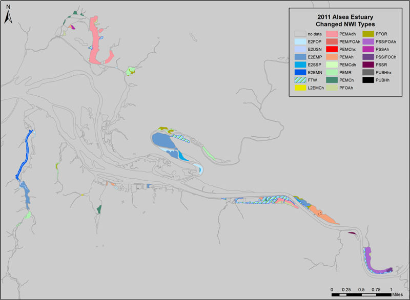
Figure 5. Map of recommended National Wetlands Inventory Cowardin et al. (1979) classification revisions resulting from this project for the Alsea estuary, Oregon, including areas identified as likely former tidal wetlands ("FTW"). NWI polygons without recommended revisions are shown as outlines only (fill = background color). Source data: Table 7—Alsea_tidal_NWI_2011. Projection: UTM Zone 10N NAD83. |
First posted May 10, 2013
For additional information contact: Part or all of this report is presented in Portable Document Format (PDF); the latest version of Adobe Reader or similar software is required to view it. Download the latest version of Adobe Reader, free of charge. |