U.S. Geological Survey Open-File Report 2013–1003
Sea-Floor Geology in Northeastern Block Island Sound, Rhode Island
![]() Title |
List of Figures |
Conversion Factors |
Abstract |
Introduction |
Setting |
Methods |
Bathymetry |
Sidescan Sonar |
Sediments |
Bottom Photography |
GIS Data Catalog |
Summary |
Acknowledgments |
References |
Contacts |
Index
Title |
List of Figures |
Conversion Factors |
Abstract |
Introduction |
Setting |
Methods |
Bathymetry |
Sidescan Sonar |
Sediments |
Bottom Photography |
GIS Data Catalog |
Summary |
Acknowledgments |
References |
Contacts |
Index
 |
||
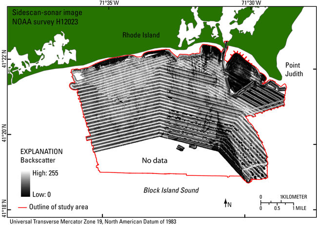
Figure 16. Image of sidescan-sonar data from National Oceanic and Atmospheric Administration (NOAA) survey H12023. Dark-shades are low backscatter and generally represent finer grained sediments and acoustic shadows; light-shades are high backscatter and generally represent coarser grained sediment and high acoustic reflectivity. Note that sidescan-sonar data were not collected in the entire survey area; stripes oriented along survey tracklines are artifacts of the data acquisition and processing and were not tonally matched. |
||

![]() U.S. Department of the Interior |
U.S. Geological Survey
U.S. Department of the Interior |
U.S. Geological Survey
URL: http://pubsdata.usgs.gov/pubs/of/2013/1003/html/fig16.html
Page Contact Information: GS Pubs Web Contact
Page Last Modified: Wednesday, 21-Aug-2013 16:01:45 EDT

