U.S. Geological Survey Open-File Report 2013–1060
Sea-floor geology and topography offshore in northeastern Long Island Sound
 |
||
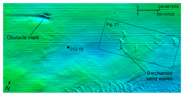
Figure 20. Detailed planar view of barchanoid sand waves from the southwestern part of the digital terrain model produced from bathymetric data collected during National Oceanic and Atmospheric Administration survey H12012. Orientation indicates westward net sediment transport; also shown are an obstacle mark, the location of station 012-15, and the location of figure 21. Location of view is shown in figure 13. |
||

![]() U.S. Department of the Interior |
U.S. Geological Survey
U.S. Department of the Interior |
U.S. Geological Survey
URL: http://pubsdata.usgs.gov/pubs/of/2013/1060/html/fig20.html
Page Contact Information: GS Pubs Web Contact
Page Last Modified: Friday, 27-Sep-2013 09:54:16 EDT


