U.S. Geological Survey Open-File Report 2013–1060
Sea-floor geology and topography offshore in northeastern Long Island Sound
 |
||
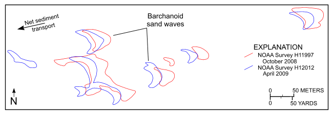
Figure 21. Barchanoid sand waves originally surveyed in September–October 2008 during National Oceanic and Atmospheric Administration (NOAA) survey H11997 (open red polygons) and resurveyed in April–May 2009 during NOAA survey H12012 (open blue polygons). Note that the sand waves have shifted toward the west southwest. Location of figure is shown in figure 20. |
||

![]() U.S. Department of the Interior |
U.S. Geological Survey
U.S. Department of the Interior |
U.S. Geological Survey
URL: http://pubsdata.usgs.gov/pubs/of/2013/1060/html/fig21.html
Page Contact Information: GS Pubs Web Contact
Page Last Modified: Friday, 27-Sep-2013 09:54:16 EDT


