U.S. Geological Survey Open-File Report 2013–1060
Sea-floor geology and topography offshore in northeastern Long Island Sound
 |
||
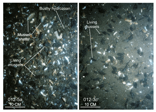
Figure 27. Bottom photographs from stations 012-5a and 012-3c showing shell beds typical of those that locally armor some of the sea floor. The beds are thin and composed primarily of mussels and mussel shell debris. Station locations are shown in figure 7. |
||

![]() U.S. Department of the Interior |
U.S. Geological Survey
U.S. Department of the Interior |
U.S. Geological Survey
URL: http://pubsdata.usgs.gov/pubs/of/2013/1060/html/fig27.html
Page Contact Information: GS Pubs Web Contact
Page Last Modified: Friday, 27-Sep-2013 10:11:30 EDT


