U.S. Geological Survey Open-File Report 2013–1060
Sea-floor geology and topography offshore in northeastern Long Island Sound
 |
||
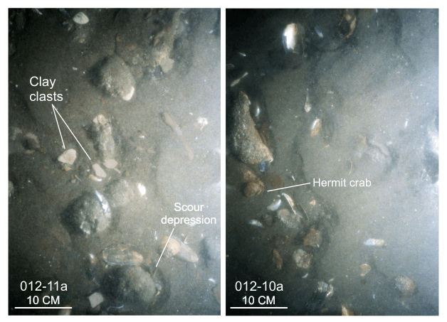
Figure 28. Bottom photographs from stations 012-10a and 012-11a showing current-rippled sand that is prevalent in areas with sedimentary environments characterized by processes associated with coarse-bedload transport. Note the presence of scour depressions around gravel and shells. Station locations are shown in figure 7. |
||

![]() U.S. Department of the Interior |
U.S. Geological Survey
U.S. Department of the Interior |
U.S. Geological Survey
URL: http://pubsdata.usgs.gov/pubs/of/2013/1060/html/fig28.html
Page Contact Information: GS Pubs Web Contact
Page Last Modified: Friday, 27-Sep-2013 10:11:30 EDT


