
Field Data Collection
USGS SPCMSC scientists collected sediment cores on four occasions during the following time periods (with corresponding FAN): 22–26 March 2012 (12BIM01); 10–12 July 2012 (12BIM02); 5–8 September 2012 (12BIM05); and 15–17 July 2013 (13BIM06). During the March and July 2012 sampling trips, a total of 14 sites were visited. The number of sites was reduced to ten for September 2012 and July 2013 due to time constraints and access difficulties with the southernmost sites. The September 2012 field sampling was conducted 2 weeks after Hurricane Isaac made landfall in the region on 28 August 2012 (Plant and Guy, 2013; Plant and others, 2014); these data represent post-storm changes to the back-barrier regions.
At each site for all sampling trips, accurate position and elevation were obtained with an Ashtech Z-Extreme Global Positioning System (GPS) with occupation times varying between 5 and 30 minutes (figs. 2 and 3). The accuracy of both horizontal position and elevation were improved by post-processing the GPS data using a local benchmark, which was occupied throughout the course of each field activity by a similar GPS system.
On every sampling trip, a 10.2-centimeter (cm) diameter, 20-cm-long push core was collected (figs. 3 and 4). The cores were sectioned at 2-cm intervals (fig. 5) to a depth of 10–16 cm in the field, placed in individual storage bags, and stored on ice. The only exception was the back-barrier marsh cores collected in March 2012 (12BIM01-M cores) which were subsampled at 1-cm intervals as part of a higher resolution collection effort. Surface sediment used for foraminiferal analysis was collected in duplicate and stained at the time of collection with Rose Bengal to aid in the discernment of living and dead specimens.
During the first sampling trip (March 2012; FAN 12BIM01), one core was collected at marsh site 04 in the open marsh (site M04, fig. 6) and a second core was taken inside a shallow pond, several meters from its edge (site M04A, fig. 6). During subsequent sampling trips, only site M04A was reoccupied.
As part of the March 2012 sampling effort, 8 longer (>50 cm) push cores were collected along the back-barrier marsh to quantify long-term (decadal to centennial) sediment accumulation in the back-barrier environments. Analysis of the longer sediment cores will be described in a separate report.
During the March 2012 survey, an additional 31 short (< 60 cm), 1-inch-diameter push cores were collected along 10 transects across the berm and natural island; 29 grab samples were collected from the sediment surface along the axis of the berm and adjacent natural island; and 10 grab samples were collected in shallow water north and west of the berm. These samples were collected as part of a complementary USGS CMGP BIER study investigating sediment movement between the berm and the natural island since berm construction. Analyses of those data are described in Bernier and others (2014).
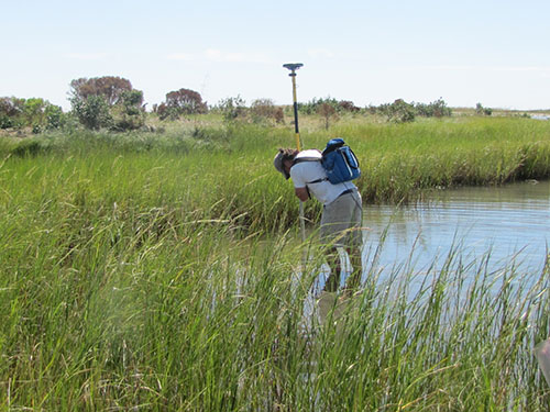
Figure 2. Global Positioning System (GPS) rover antenna to measure accurate position and elevation of coring locations. |
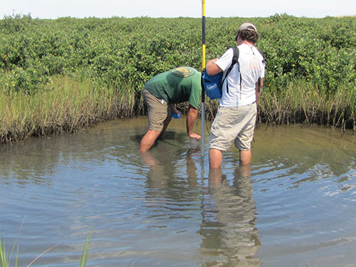
Figure 3. Short push core and Global Positioning System (GPS) location being collected in the shallow water back-barrier environment of the Chandeleur Islands. |
|
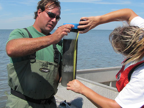
Figure 4. Push core collected from the back-barrier environment on the Chandeleur Islands. |
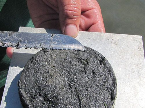
Figure 5. Two centimeter subsample of back-barrier push core. |
