
Physical Parameters, Grain Size, Radiochemistry, and Foraminiferal Data

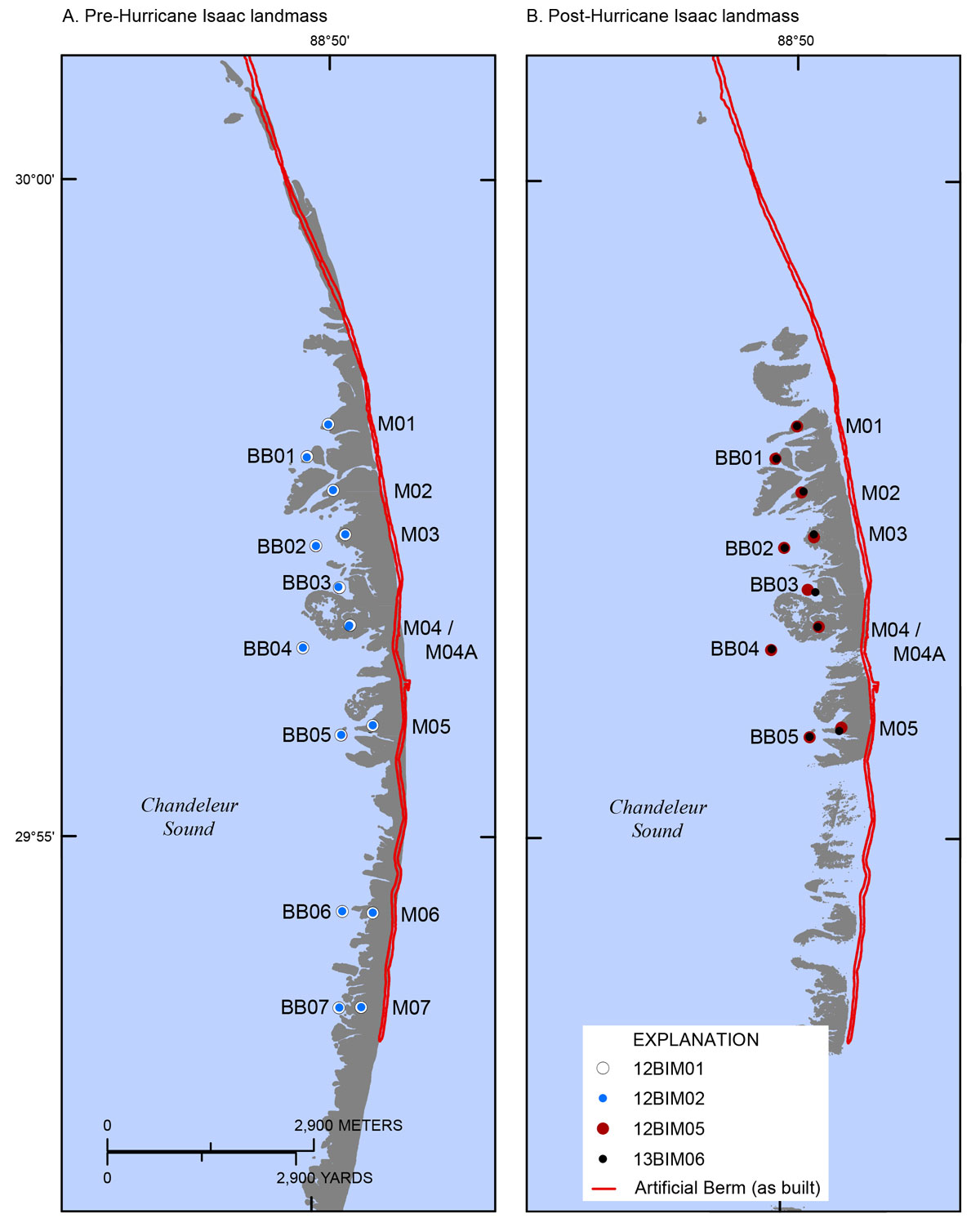
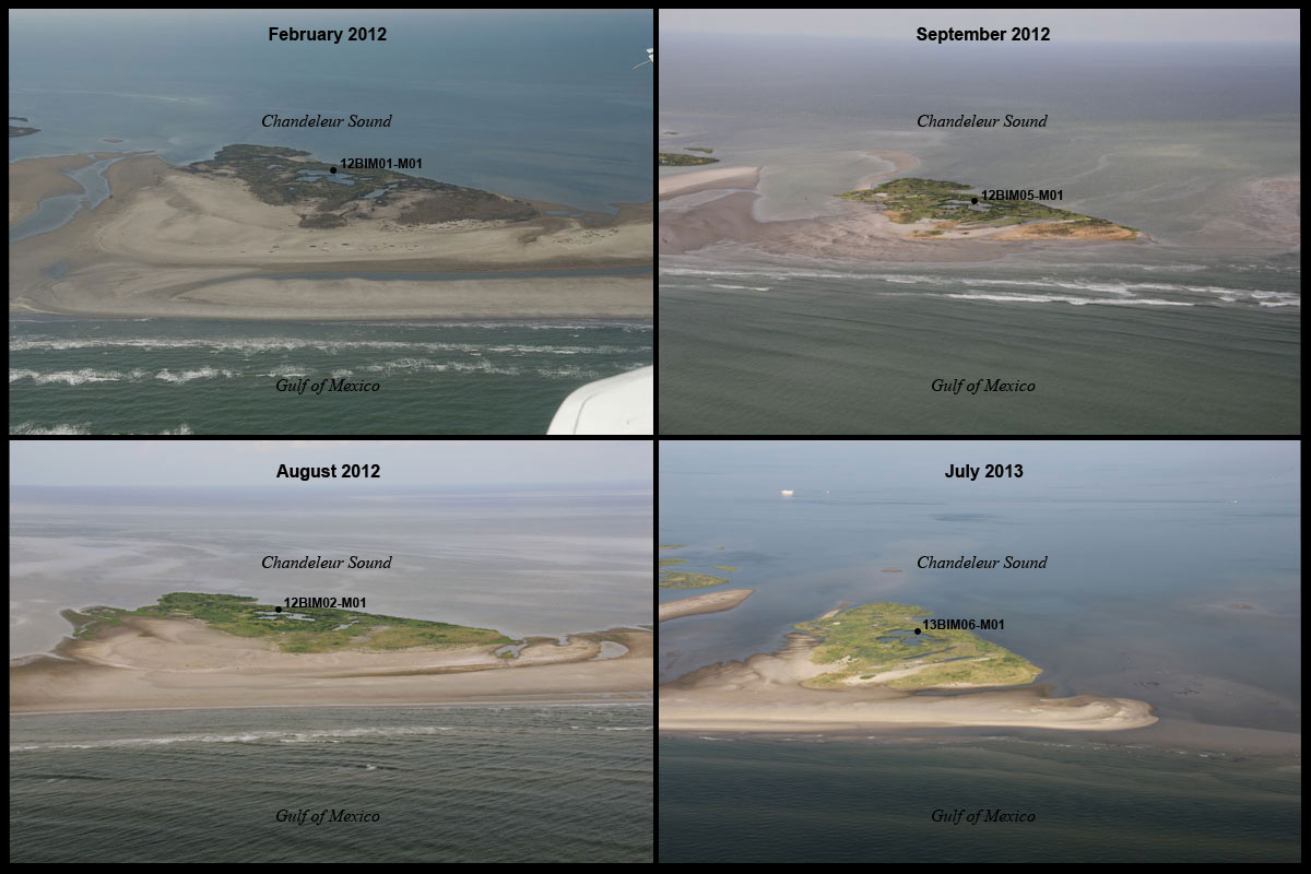
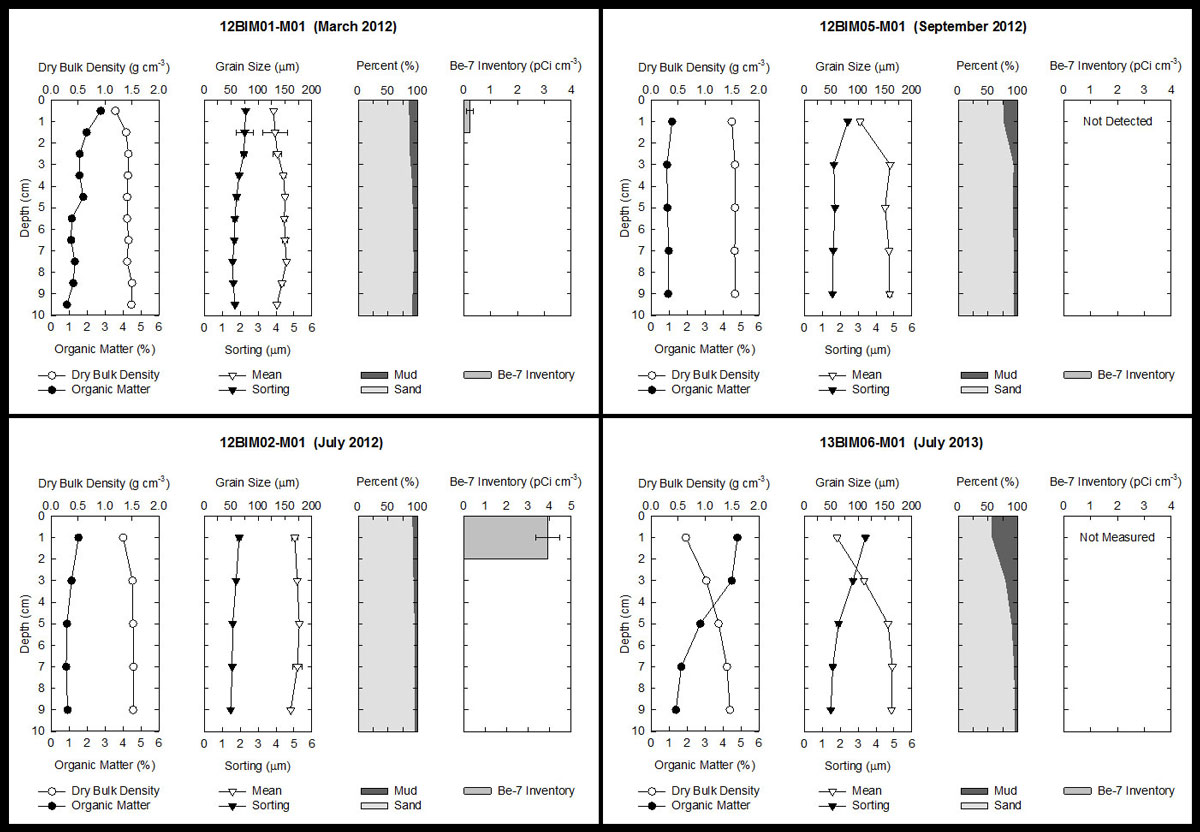
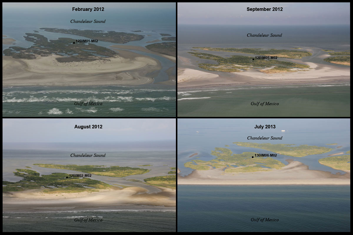
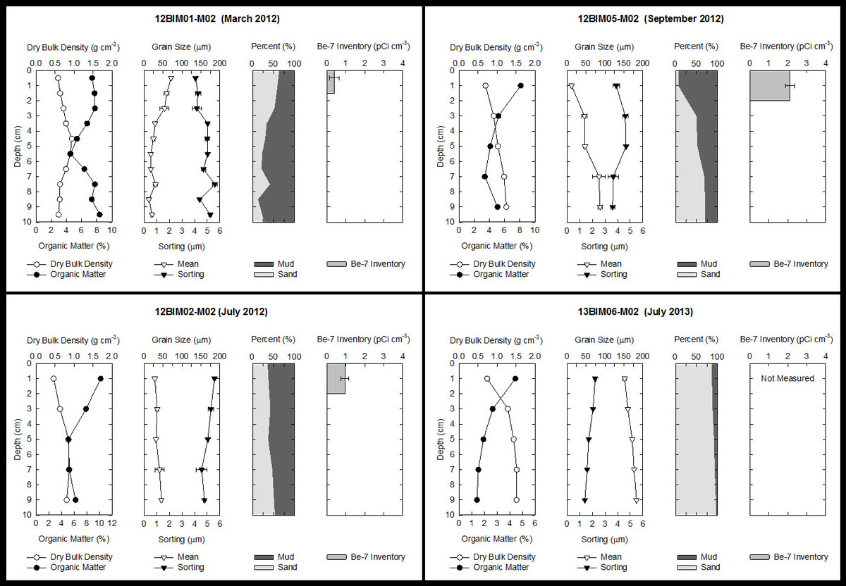
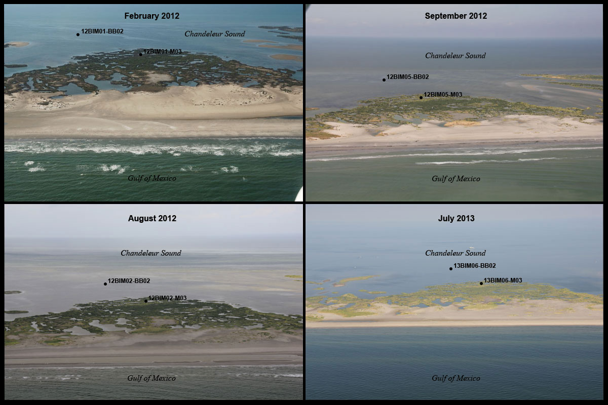
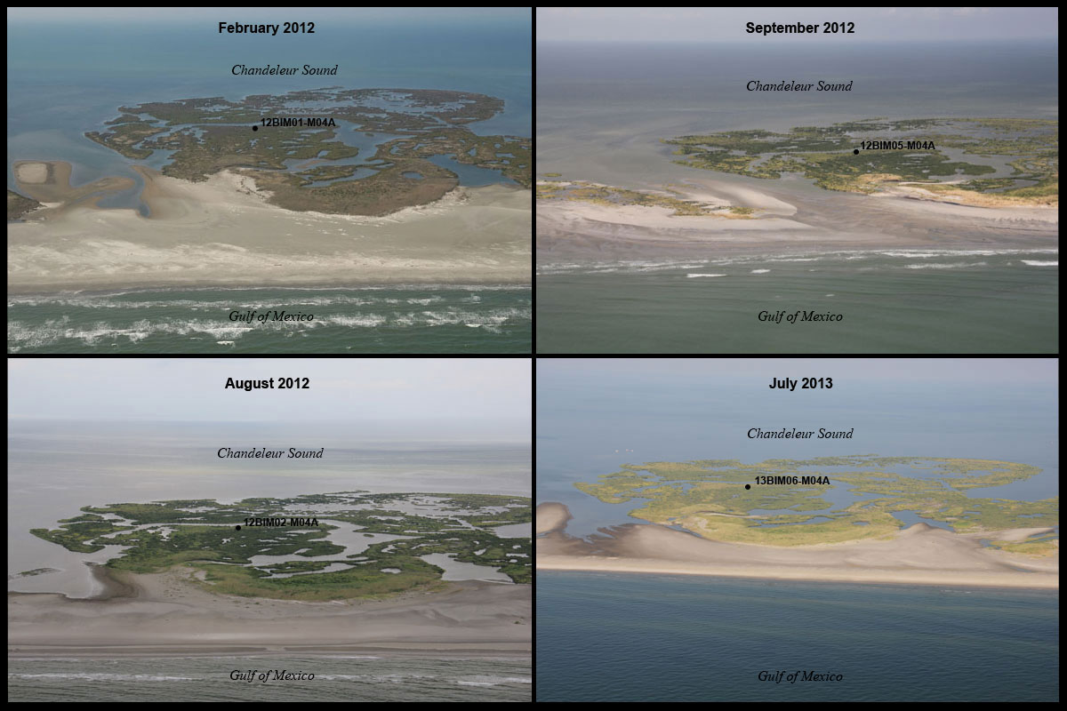
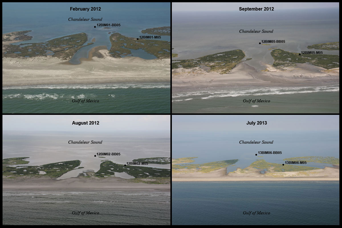
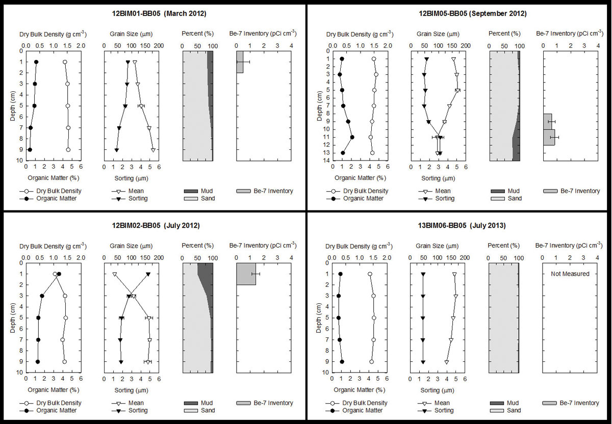
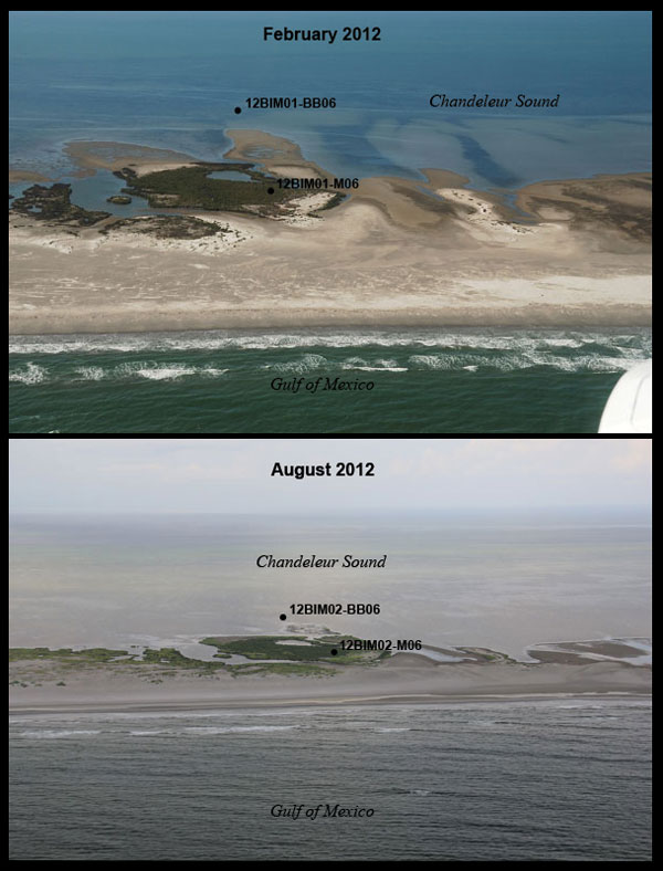
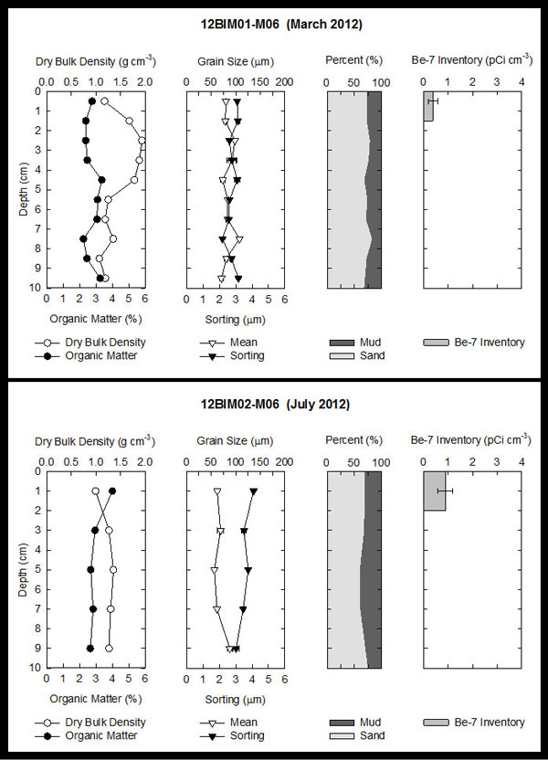
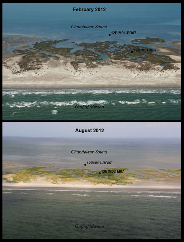
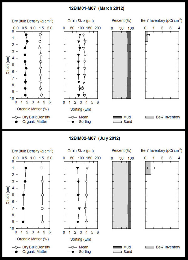
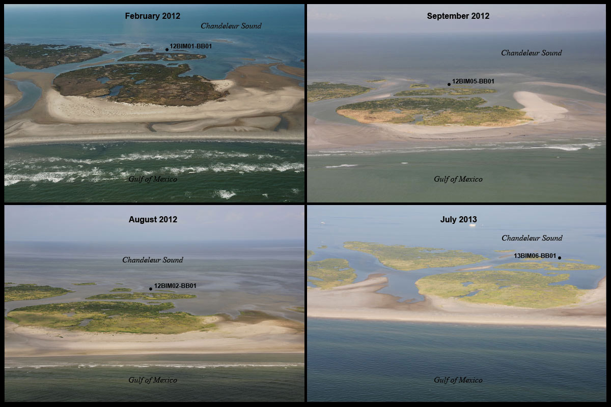
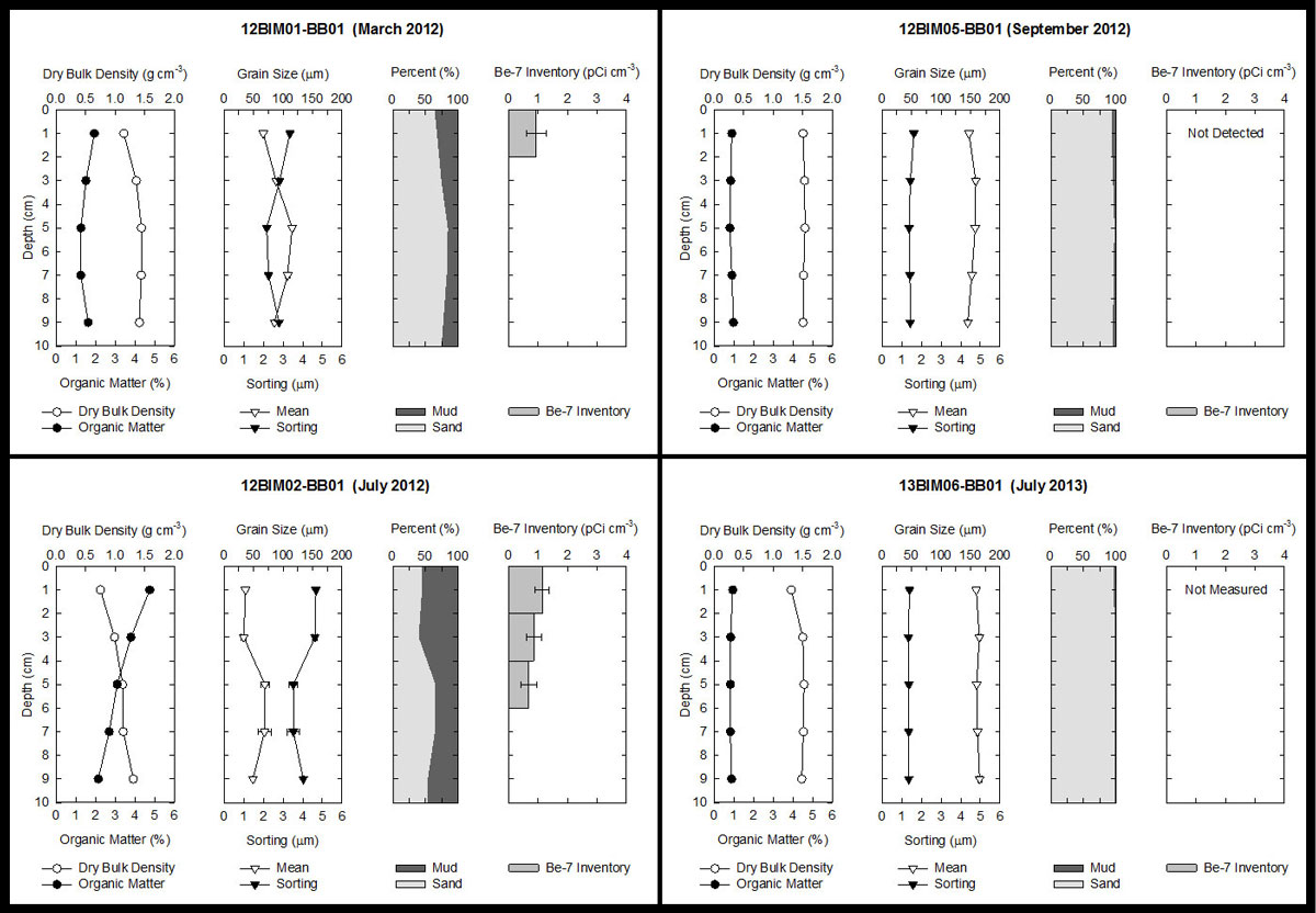
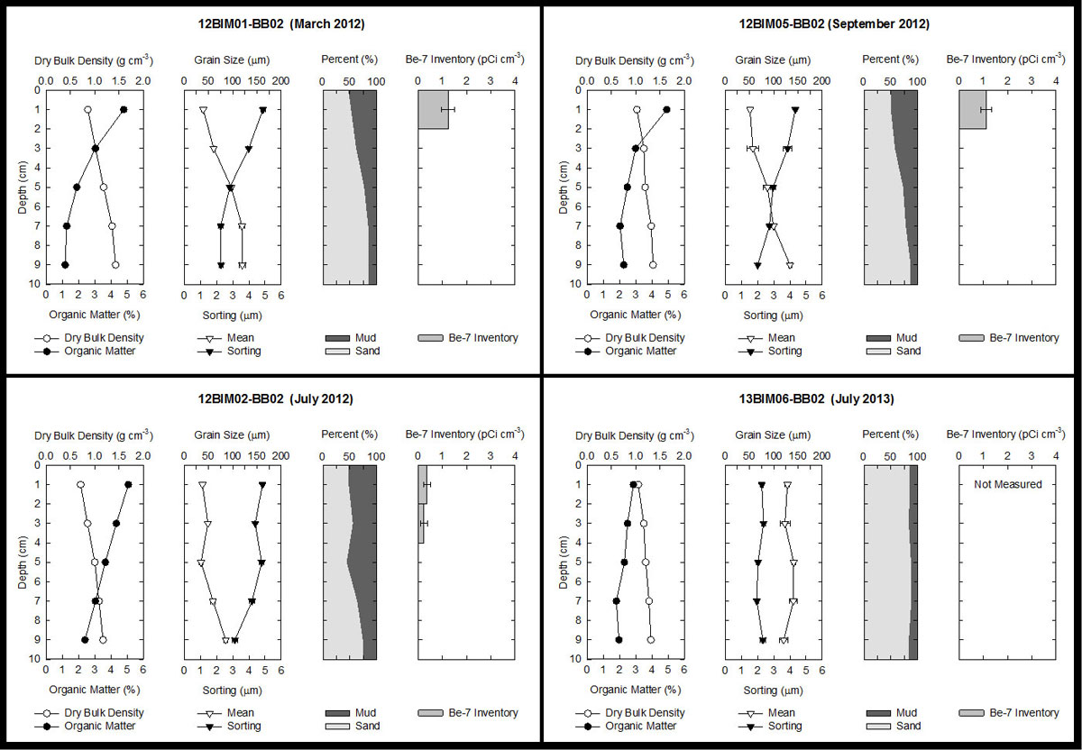
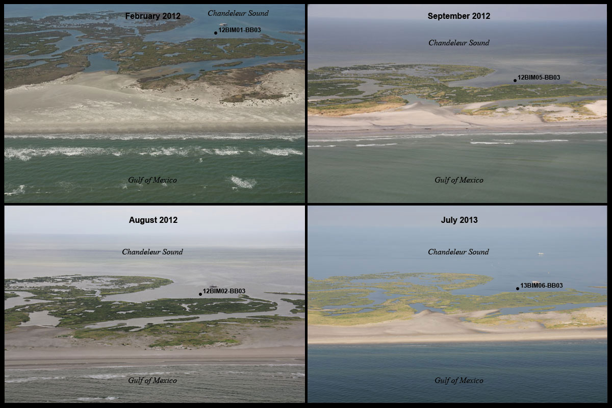
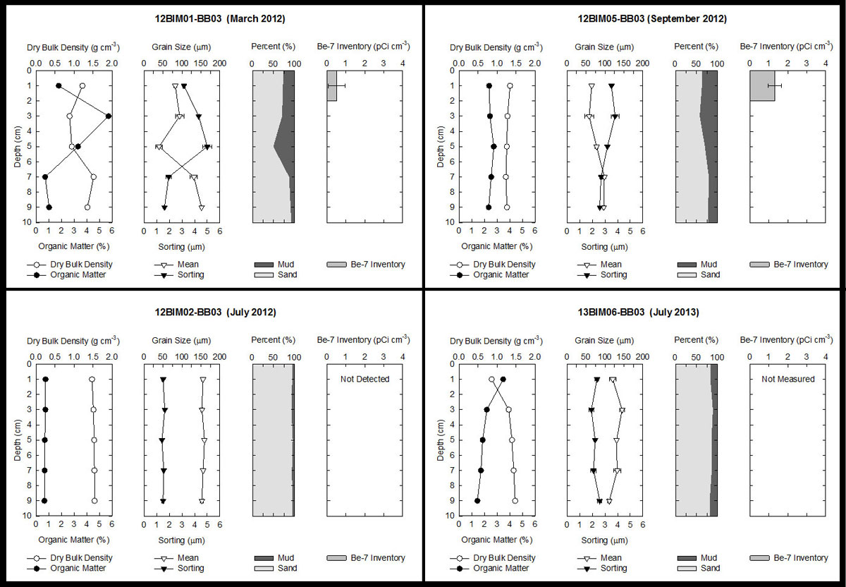
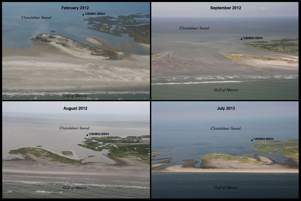
Figure 6A & B. Locations of sediment push cores collected on Chandeleur Islands, Louisiana from March 2012–July 2013. Island shoreline derived from USGS lidar collected (A) February 2012 (Guy and others, 2014) and (B) September 2012 (Guy and others, 2014) following the passing of Hurricane Isaac on August 28, 2012. Click on individual core locations in either map for a mosaic of oblique photos (Morgan and others, 2013, unpub. data) and data plots from each sampling period.
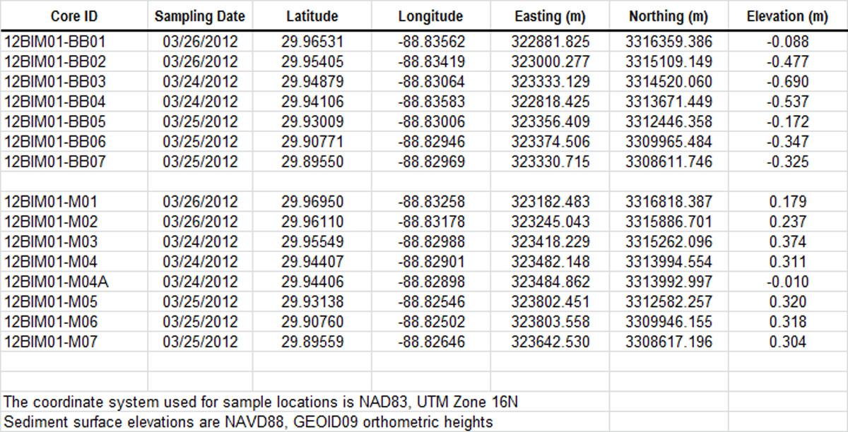
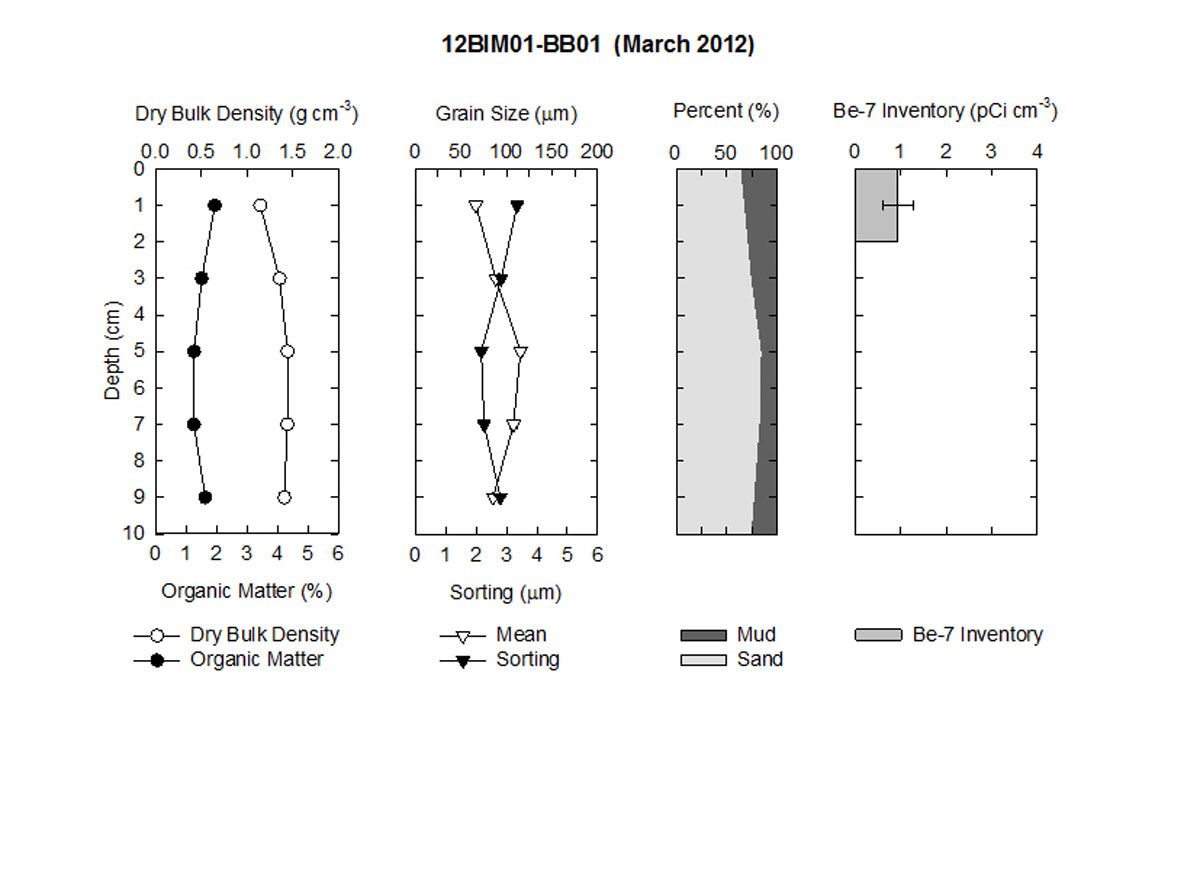
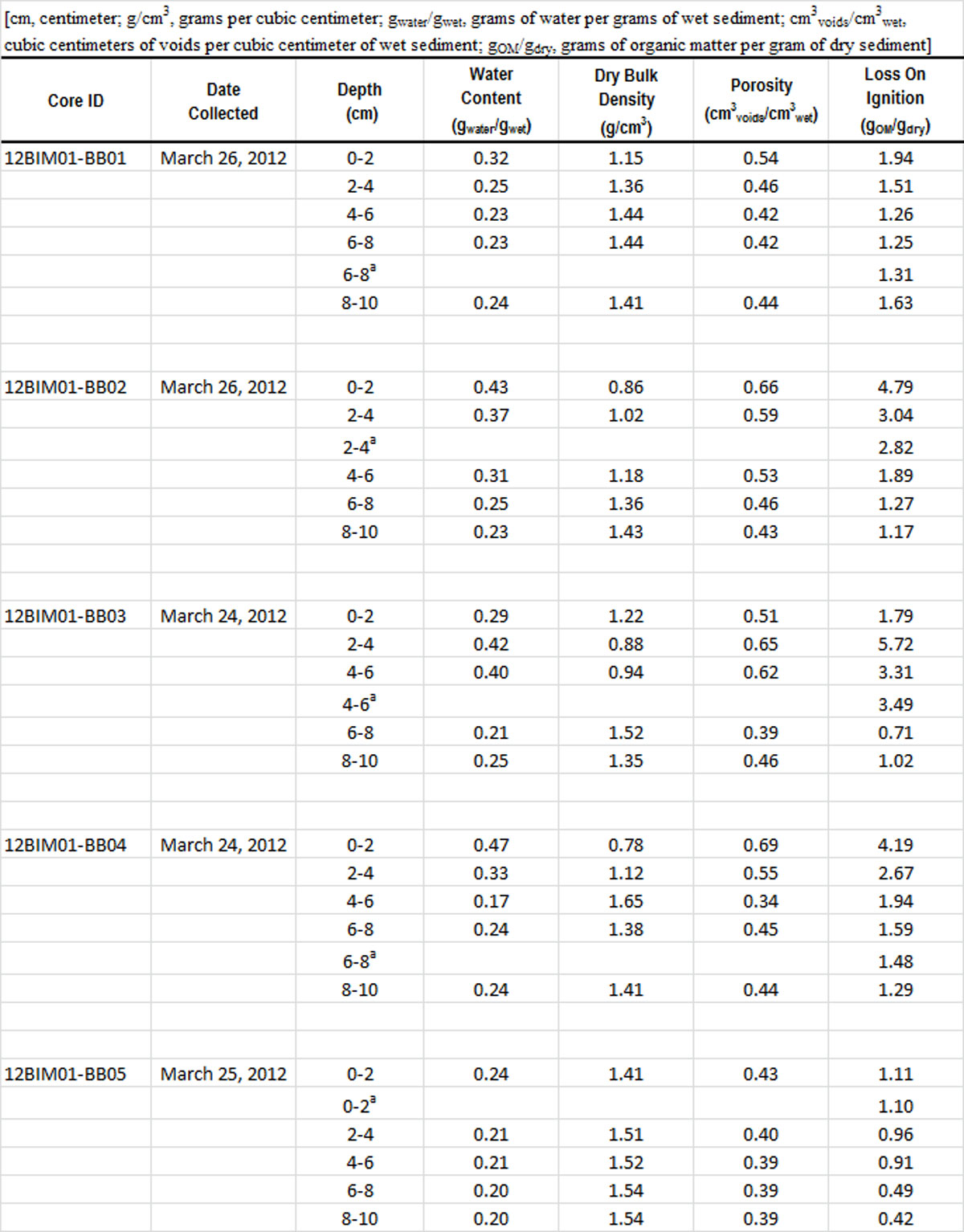
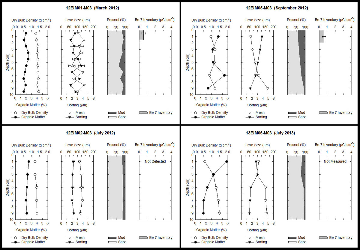
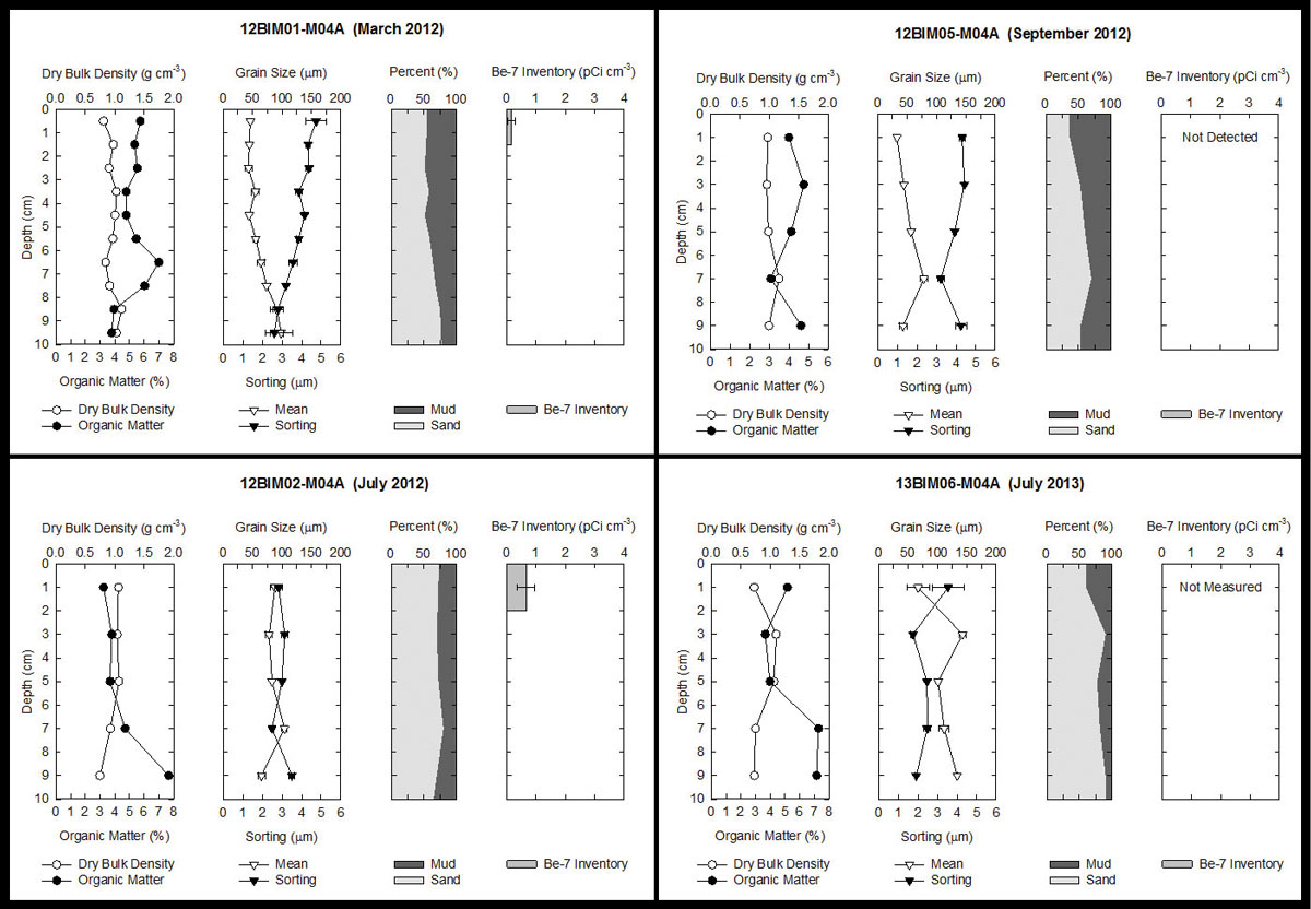
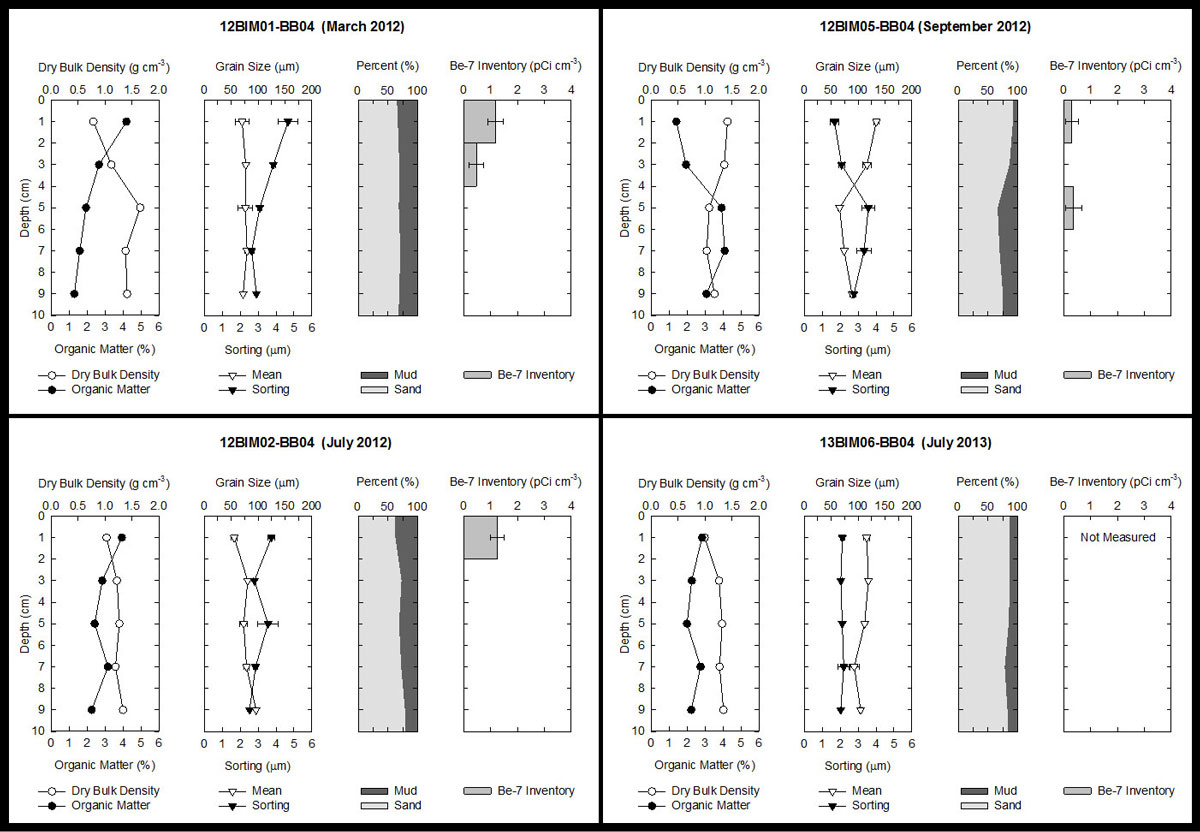
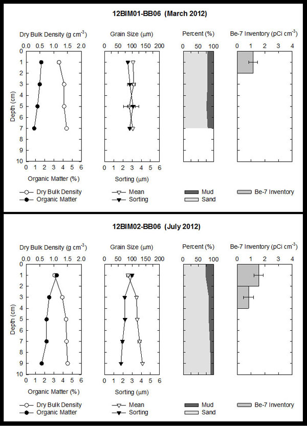
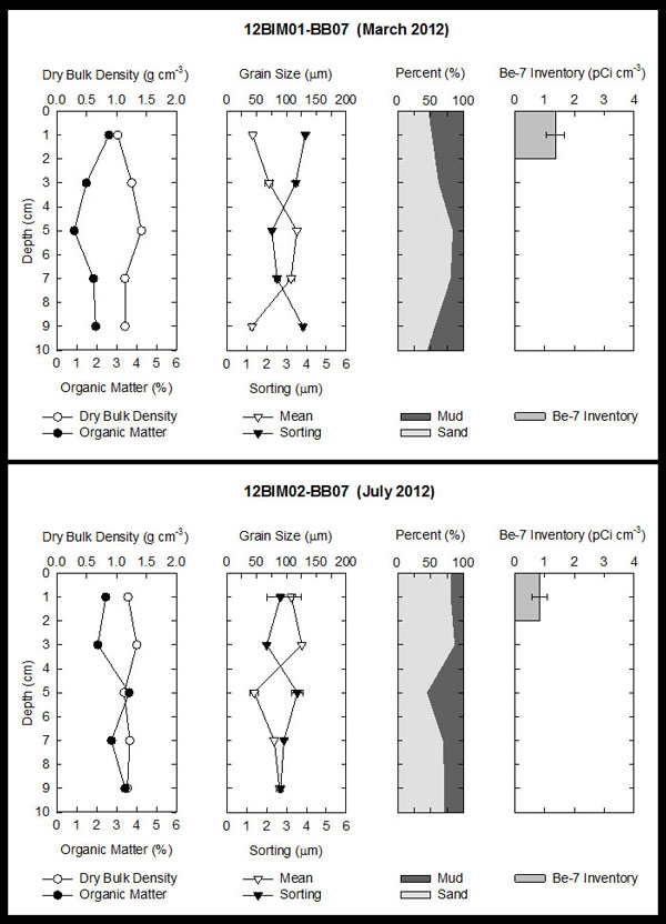
Downcore bulk density, organic matter, grain size, and radiochemical inventory graphs can be viewed for each of the four sampling periods by clicking the core location on the above map (fig. 6A, B), or they can be downloaded collectively as a zipped Joint Photographic Expert Group (JPEG) file from the table below. Map documents and shapefiles provided in this report were created in ESRI ArcGIS 10.0.2 and can be downloaded from the table below. To open this folder in ESRI ArcGIS, right-click and choose "Save As". The shapefiles provided may also be viewed using other versions of ArcView, ArcGIS, or ArcExplorer software available for download (http://www.esri.com/software/arcexplorer/). Spreadsheets and documents in this report were created in Microsoft Office 2010. Portable Document Format (PDF) files can be viewed using the free software Adobe Acrobat Reader (http://get.adobe.com/reader).
Data Downloads
Sediment Core Data
| Preview | File Description | File Format | Download File | Metadata |
|---|---|---|---|---|
 |
Core location GIS Core location maps image |
ESRI shapefile .jpg |
||
 |
Push core locations |
Microsoft Excel |
Core_Location_Tables.xlsx (16 kB) |
|
 |
Sediment core data plots |
.jpg |
Core_Data_Plots.zip (3.2 MB) |
Not applicable |
 |
Physical parameter data |
Microsoft Excel |
Physical_Parameter_Data.zip (86 kB) |
|
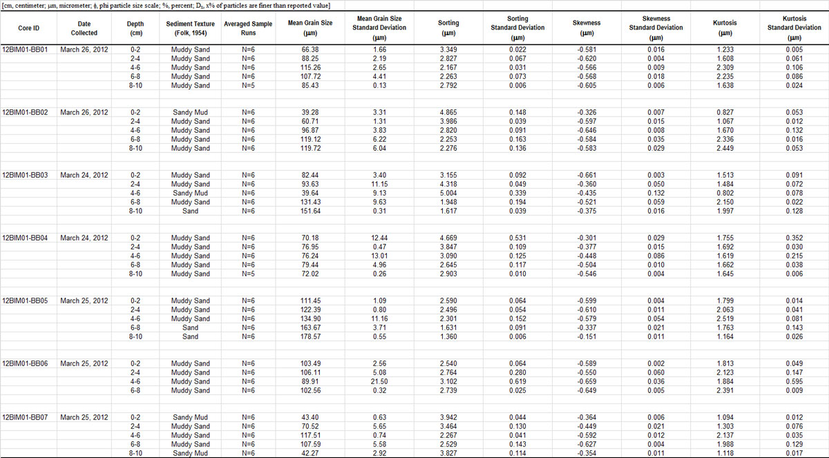 |
Grain size data |
Microsoft Excel |
Grain_Size_Data.zip (480 kB) |
|
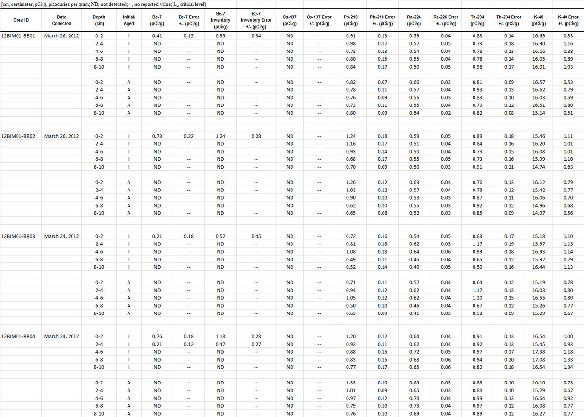 |
Radiochemistry data |
Microsoft Excel |
Radiochemistry_Data.zip (131 kB) |
Foraminiferal data |
Microsoft Excel |
Foraminiferal_Data.zip (121 kB) |
Supplemental Information
| Preview | File Description | File Format | Download File | Metadata |
|---|---|---|---|---|
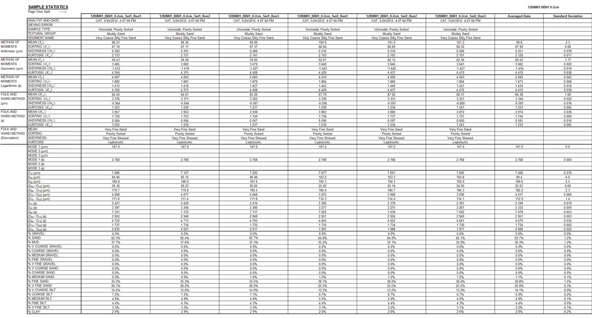 |
Grain size run statistics |
Microsoft Excel |
Grain_Size_Run_Statistics.zip (2.5 MB) |
Not applicable |
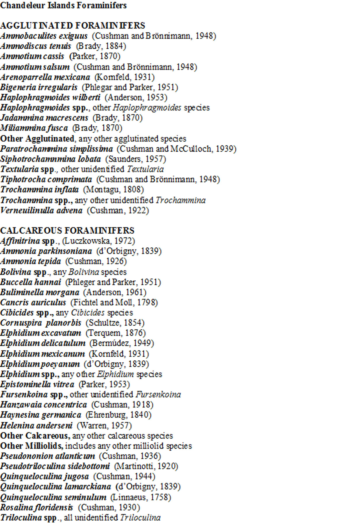 |
List of foraminifers |
Microsoft Word |
Foraminifera Appendix.docx (22 kB) |
Not applicable |
