Skip past header information
USGS - science for a changing world

Open-File Report 2014-1221


Geological Sampling Data and Benthic Biota Classification: Buzzards Bay and Vineyard Sound, Massachusetts


Bottom Photograph Gallery - September 13, 2010 - 12:00 to 24:00 UTC and September 14 - 00:00 to 00:15 UTC


return to the Main Photo Index Page  
   
Go to the previous page of photos  

Image of seabed - photo.
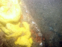
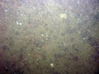
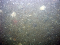
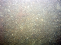
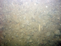
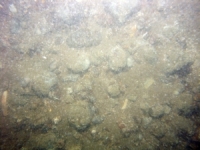
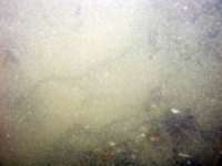
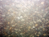
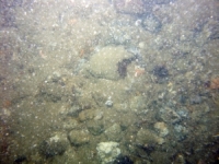
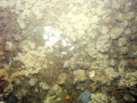
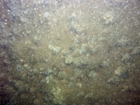
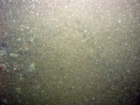
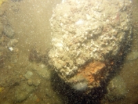
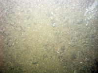
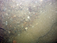
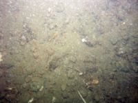
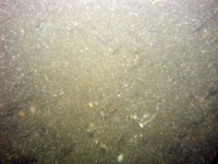
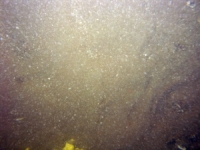
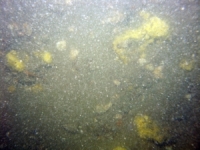
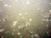
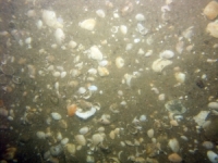
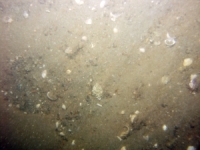
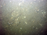
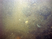
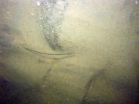
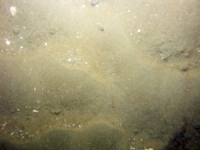
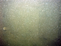
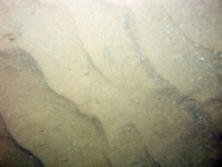
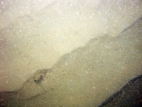
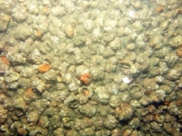
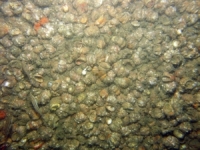
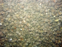
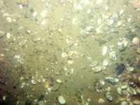
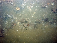
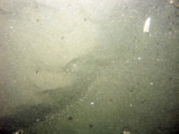
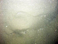
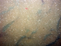
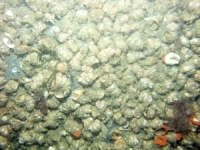
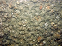
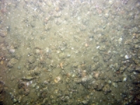
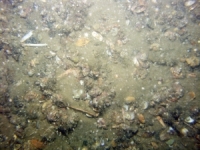
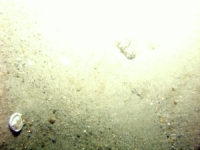
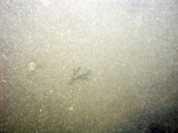
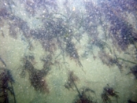
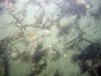
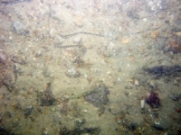
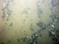
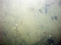
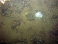
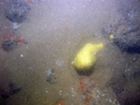
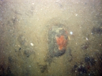
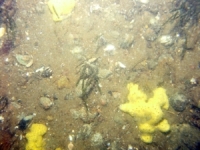
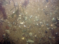
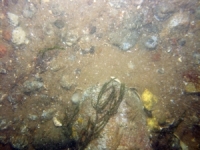
d4_PICT2155.JPG
Station # 267
Lat 41.474542
Long -70.682320
Time (UTC) 12:11:52
    Nearest Sediment Sample Info:
    • Classification = GRAVEL
    • Station Number = 267
    • Distance = 224.5 meters
Image of seabed - photo.
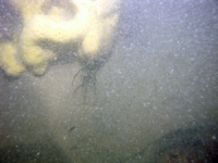
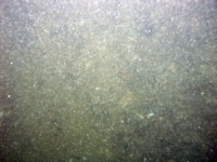
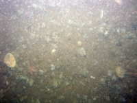
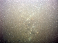
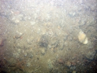
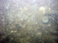
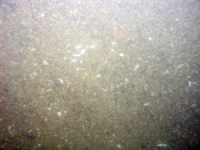
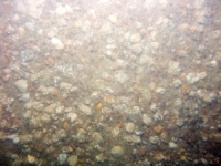
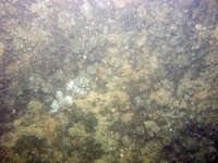
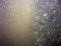
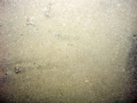
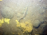
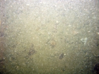
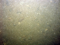
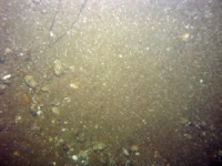
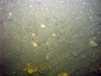
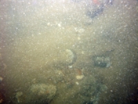
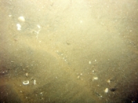
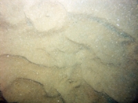
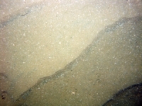
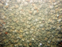
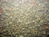
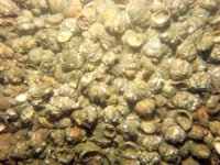
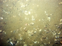
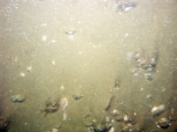
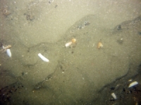
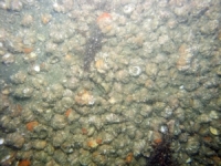
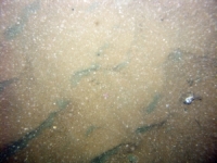
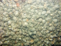
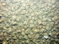
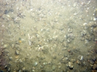
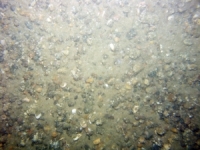
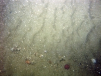
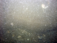
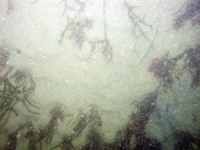
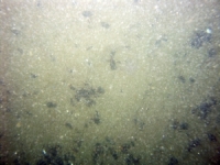
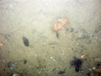
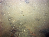
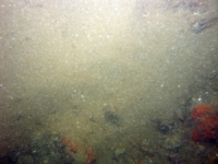
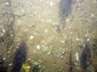
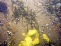
d4_PICT2156.JPG
Station # 267
Lat 41.474480
Long -70.682353
Time (UTC) 12:12:08
    Nearest Sediment Sample Info:
    • Classification = GRAVEL
    • Station Number = 267
    • Distance = 218.6 meters
Image of seabed - photo.
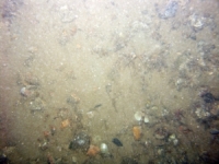
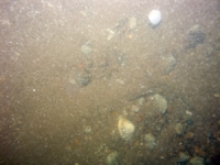
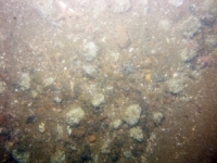
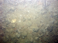
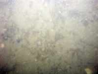
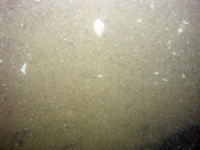
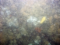
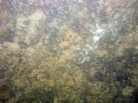
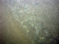
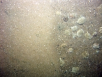
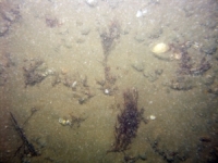
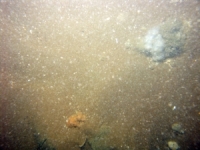
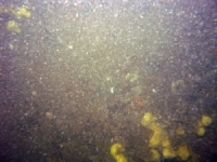
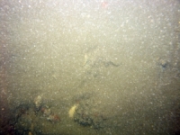
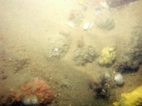
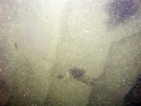
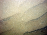
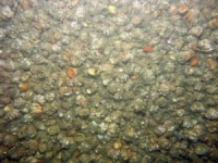
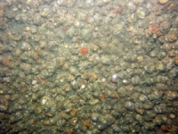
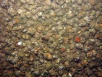
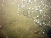
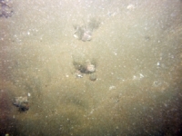
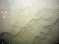
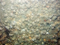
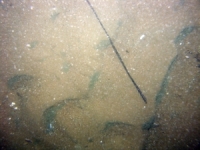
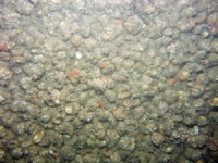
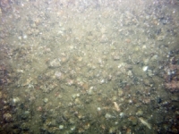
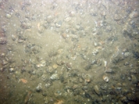
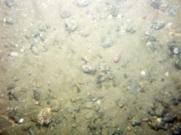
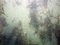
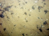
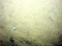
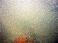
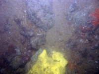
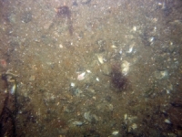
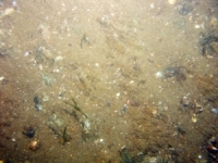
d4_PICT2157.JPG
Station # 267
Lat 41.474443
Long -70.682385
Time (UTC) 12:12:19
    Nearest Sediment Sample Info:
    • Classification = GRAVEL
    • Station Number = 267
    • Distance = 214.2 meters
Image of seabed - photo.
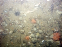
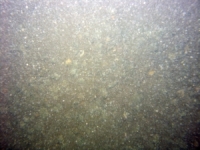
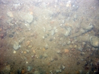
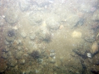
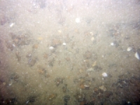
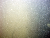
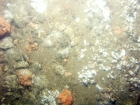
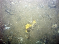
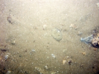
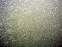
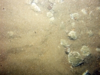
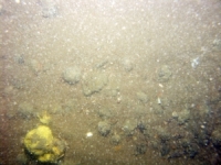
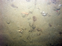
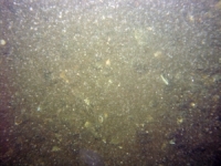
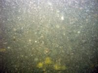
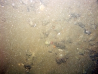
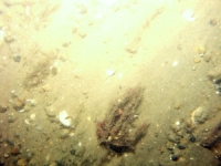
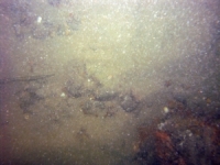
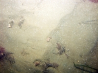
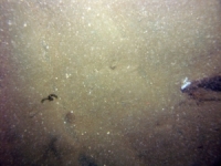
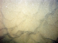
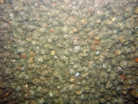
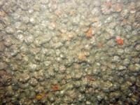
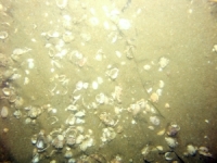
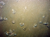
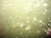
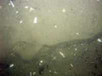
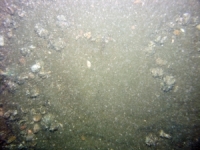
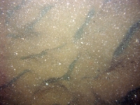
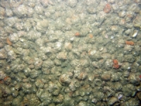
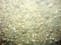
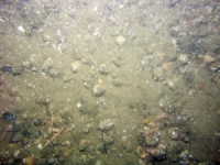
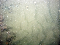
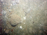
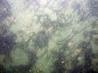
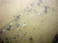
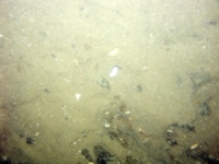
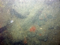
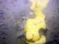
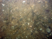
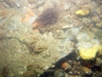
d4_PICT2158.JPG
Station # 267
Lat 41.474393
Long -70.682455
Time (UTC) 12:12:36
    Nearest Sediment Sample Info:
    • Classification = GRAVEL
    • Station Number = 267
    • Distance = 206.4 meters
Image of seabed - photo.
d4_PICT2159.JPG
Station # 267
Lat 41.474312
Long -70.682603
Time (UTC) 12:13:04
    Nearest Sediment Sample Info:
    • Classification = GRAVEL
    • Station Number = 267
    • Distance = 191.3 meters
Image of seabed - photo.
d4_PICT2160.JPG
Station # 267
Lat 41.474280
Long -70.682670
Time (UTC) 12:13:15
    Nearest Sediment Sample Info:
    • Classification = GRAVEL
    • Station Number = 267
    • Distance = 184.7 meters
Image of seabed - photo.
d4_PICT2161.JPG
Station # 267
Lat 41.474242
Long -70.682755
Time (UTC) 12:13:28
    Nearest Sediment Sample Info:
    • Classification = GRAVEL
    • Station Number = 267
    • Distance = 176.4 meters
Image of seabed - photo.
d4_PICT2162.JPG
Station # 267
Lat 41.474183
Long -70.682897
Time (UTC) 12:13:51
    Nearest Sediment Sample Info:
    • Classification = GRAVEL
    • Station Number = 267
    • Distance = 162.9 meters
Image of seabed - photo.
d4_PICT2163.JPG
Station # 267
Lat 41.474145
Long -70.682998
Time (UTC) 12:14:07
    Nearest Sediment Sample Info:
    • Classification = GRAVEL
    • Station Number = 267
    • Distance = 153.4 meters
Image of seabed - photo.
d4_PICT2164.JPG
Station # 267
Lat 41.474083
Long -70.683097
Time (UTC) 12:14:24
    Nearest Sediment Sample Info:
    • Classification = GRAVEL
    • Station Number = 267
    • Distance = 142.9 meters
Image of seabed - photo.
d4_PICT2165.JPG
Station # 267
Lat 41.474052
Long -70.683213
Time (UTC) 12:14:41
    Nearest Sediment Sample Info:
    • Classification = GRAVEL
    • Station Number = 267
    • Distance = 132.7 meters
Image of seabed - photo.
d4_PICT2166.JPG
Station # 267
Lat 41.474025
Long -70.683277
Time (UTC) 12:14:53
    Nearest Sediment Sample Info:
    • Classification = GRAVEL
    • Station Number = 267
    • Distance = 126.6 meters
Image of seabed - photo.
d4_PICT2167.JPG
Station # 267
Lat 41.473970
Long -70.683400
Time (UTC) 12:15:14
    Nearest Sediment Sample Info:
    • Classification = GRAVEL
    • Station Number = 267
    • Distance = 114.7 meters
Image of seabed - photo.
d4_PICT2168.JPG
Station # 267
Lat 41.473875
Long -70.683605
Time (UTC) 12:15:44
    Nearest Sediment Sample Info:
    • Classification = GRAVEL
    • Station Number = 267
    • Distance = 94.6 meters
Image of seabed - photo.
d4_PICT2169.JPG
Station # 267
Lat 41.473817
Long -70.683738
Time (UTC) 12:16:02
    Nearest Sediment Sample Info:
    • Classification = GRAVEL
    • Station Number = 267
    • Distance = 81.8 meters
Image of seabed - photo.
d4_PICT2170.JPG
Station # 267
Lat 41.473752
Long -70.683893
Time (UTC) 12:16:27
    Nearest Sediment Sample Info:
    • Classification = GRAVEL
    • Station Number = 267
    • Distance = 67 meters
Image of seabed - photo.
d4_PICT2171.JPG
Station # 267
Lat 41.473705
Long -70.684022
Time (UTC) 12:16:46
    Nearest Sediment Sample Info:
    • Classification = GRAVEL
    • Station Number = 267
    • Distance = 55 meters
Image of seabed - photo.
d4_PICT2172.JPG
Station # 267
Lat 41.473673
Long -70.684112
Time (UTC) 12:16:59
    Nearest Sediment Sample Info:
    • Classification = GRAVEL
    • Station Number = 267
    • Distance = 46.7 meters
Image of seabed - photo.
d4_PICT2173.JPG
Station # 267
Lat 41.473603
Long -70.684312
Time (UTC) 12:17:27
    Nearest Sediment Sample Info:
    • Classification = GRAVEL
    • Station Number = 267
    • Distance = 28.3 meters
Image of seabed - photo.
d4_PICT2174.JPG
Station # 267
Lat 41.473570
Long -70.684400
Time (UTC) 12:17:39
    Nearest Sediment Sample Info:
    • Classification = GRAVEL
    • Station Number = 267
    • Distance = 20.1 meters
Image of seabed - photo.
d4_PICT2175.JPG
Station # 267
Lat 41.473535
Long -70.684498
Time (UTC) 12:17:52
    Nearest Sediment Sample Info:
    • Classification = GRAVEL
    • Station Number = 267
    • Distance = 11 meters
Image of seabed - photo.
d4_PICT2176.JPG
Station # 267
Lat 41.473492
Long -70.684617
Time (UTC) 12:18:10
    Nearest Sediment Sample Info:
    • Classification = GRAVEL
    • Station Number = 267
    • Distance = 0 meters
Image of seabed - photo.
d4_PICT2177.JPG
Station # 268
Lat 41.483307
Long -70.662133
Time (UTC) 12:33:37
    Nearest Sediment Sample Info:
    • Classification = GRAVELLY SEDIMENT
    • Station Number = 268
    • Distance = 123.6 meters
Image of seabed - photo.
d4_PICT2178.JPG
Station # 268
Lat 41.483255
Long -70.662170
Time (UTC) 12:34:06
    Nearest Sediment Sample Info:
    • Classification = GRAVELLY SEDIMENT
    • Station Number = 268
    • Distance = 118.2 meters
Image of seabed - photo.
d4_PICT2179.JPG
Station # 268
Lat 41.483218
Long -70.662227
Time (UTC) 12:34:26
    Nearest Sediment Sample Info:
    • Classification = GRAVELLY SEDIMENT
    • Station Number = 268
    • Distance = 112 meters
Image of seabed - photo.
d4_PICT2180.JPG
Station # 268
Lat 41.483147
Long -70.662322
Time (UTC) 12:34:58
    Nearest Sediment Sample Info:
    • Classification = GRAVELLY SEDIMENT
    • Station Number = 268
    • Distance = 101.5 meters
Image of seabed - photo.
d4_PICT2181.JPG
Station # 268
Lat 41.483102
Long -70.662417
Time (UTC) 12:35:23
    Nearest Sediment Sample Info:
    • Classification = GRAVELLY SEDIMENT
    • Station Number = 268
    • Distance = 92.2 meters
Image of seabed - photo.
d4_PICT2182.JPG
Station # 268
Lat 41.483047
Long -70.662532
Time (UTC) 12:35:49
    Nearest Sediment Sample Info:
    • Classification = GRAVELLY SEDIMENT
    • Station Number = 268
    • Distance = 81 meters
Image of seabed - photo.
d4_PICT2183.JPG
Station # 268
Lat 41.482972
Long -70.662755
Time (UTC) 12:36:29
    Nearest Sediment Sample Info:
    • Classification = GRAVELLY SEDIMENT
    • Station Number = 268
    • Distance = 60.6 meters
Image of seabed - photo.
d4_PICT2184.JPG
Station # 268
Lat 41.482883
Long -70.662990
Time (UTC) 12:37:09
    Nearest Sediment Sample Info:
    • Classification = GRAVELLY SEDIMENT
    • Station Number = 268
    • Distance = 38.7 meters
Image of seabed - photo.
d4_PICT2185.JPG
Station # 268
Lat 41.482792
Long -70.663332
Time (UTC) 12:37:59
    Nearest Sediment Sample Info:
    • Classification = GRAVELLY SEDIMENT
    • Station Number = 268
    • Distance = 8.4 meters
Image of seabed - photo.
d4_PICT2186.JPG
Station # 268
Lat 41.482768
Long -70.663428
Time (UTC) 12:38:12
    Nearest Sediment Sample Info:
    • Classification = GRAVELLY SEDIMENT
    • Station Number = 268
    • Distance = 0 meters
Image of seabed - photo.
d4_PICT2187.JPG
Station # 269
Lat 41.498263
Long -70.681113
Time (UTC) 12:52:20
    Nearest Sediment Sample Info:
    • Classification = GRAVEL
    • Station Number = 269
    • Distance = 186.9 meters
Image of seabed - photo.
d4_PICT2188.JPG
Station # 269
Lat 41.498268
Long -70.681127
Time (UTC) 12:52:34
    Nearest Sediment Sample Info:
    • Classification = GRAVEL
    • Station Number = 269
    • Distance = 185.8 meters
Image of seabed - photo.
d4_PICT2189.JPG
Station # 269
Lat 41.498270
Long -70.681160
Time (UTC) 12:52:53
    Nearest Sediment Sample Info:
    • Classification = GRAVEL
    • Station Number = 269
    • Distance = 183 meters
Image of seabed - photo.
d4_PICT2190.JPG
Station # 269
Lat 41.498262
Long -70.681207
Time (UTC) 12:53:11
    Nearest Sediment Sample Info:
    • Classification = GRAVEL
    • Station Number = 269
    • Distance = 179.1 meters
Image of seabed - photo.
d4_PICT2191.JPG
Station # 269
Lat 41.498260
Long -70.681235
Time (UTC) 12:53:23
    Nearest Sediment Sample Info:
    • Classification = GRAVEL
    • Station Number = 269
    • Distance = 176.7 meters
Image of seabed - photo.
d4_PICT2192.JPG
Station # 269
Lat 41.498258
Long -70.681317
Time (UTC) 12:53:54
    Nearest Sediment Sample Info:
    • Classification = GRAVEL
    • Station Number = 269
    • Distance = 169.9 meters
Image of seabed - photo.
d4_PICT2193.JPG
Station # 269
Lat 41.498253
Long -70.681378
Time (UTC) 12:54:15
    Nearest Sediment Sample Info:
    • Classification = GRAVEL
    • Station Number = 269
    • Distance = 164.8 meters
Image of seabed - photo.
d4_PICT2194.JPG
Station # 269
Lat 41.498248
Long -70.681468
Time (UTC) 12:54:42
    Nearest Sediment Sample Info:
    • Classification = GRAVEL
    • Station Number = 269
    • Distance = 157.3 meters
Image of seabed - photo.
d4_PICT2195.JPG
Station # 269
Lat 41.498242
Long -70.681573
Time (UTC) 12:55:08
    Nearest Sediment Sample Info:
    • Classification = GRAVEL
    • Station Number = 269
    • Distance = 148.5 meters
Image of seabed - photo.
d4_PICT2196.JPG
Station # 269
Lat 41.498238
Long -70.681708
Time (UTC) 12:55:43
    Nearest Sediment Sample Info:
    • Classification = GRAVEL
    • Station Number = 269
    • Distance = 137.3 meters
Image of seabed - photo.
d4_PICT2197.JPG
Station # 269
Lat 41.498238
Long -70.681887
Time (UTC) 12:56:26
    Nearest Sediment Sample Info:
    • Classification = GRAVEL
    • Station Number = 269
    • Distance = 122.3 meters
Image of seabed - photo.
d4_PICT2198.JPG
Station # 269
Lat 41.498235
Long -70.681993
Time (UTC) 12:56:50
    Nearest Sediment Sample Info:
    • Classification = GRAVEL
    • Station Number = 269
    • Distance = 113.5 meters
Image of seabed - photo.
d4_PICT2199.JPG
Station # 269
Lat 41.498228
Long -70.682138
Time (UTC) 12:57:19
    Nearest Sediment Sample Info:
    • Classification = GRAVEL
    • Station Number = 269
    • Distance = 101.4 meters
Image of seabed - photo.
d4_PICT2200.JPG
Station # 269
Lat 41.498233
Long -70.682353
Time (UTC) 12:58:02
    Nearest Sediment Sample Info:
    • Classification = GRAVEL
    • Station Number = 269
    • Distance = 83.4 meters
Image of seabed - photo.
d4_PICT2201.JPG
Station # 269
Lat 41.498230
Long -70.682497
Time (UTC) 12:58:30
    Nearest Sediment Sample Info:
    • Classification = GRAVEL
    • Station Number = 269
    • Distance = 71.4 meters
Image of seabed - photo.
d4_PICT2202.JPG
Station # 269
Lat 41.498227
Long -70.682682
Time (UTC) 12:59:05
    Nearest Sediment Sample Info:
    • Classification = GRAVEL
    • Station Number = 269
    • Distance = 56 meters
Image of seabed - photo.
d4_PICT2203.JPG
Station # 269
Lat 41.498227
Long -70.682823
Time (UTC) 12:59:32
    Nearest Sediment Sample Info:
    • Classification = GRAVEL
    • Station Number = 269
    • Distance = 44.3 meters
Image of seabed - photo.
d4_PICT2204.JPG
Station # 269
Lat 41.498233
Long -70.683060
Time (UTC) 13:00:17
    Nearest Sediment Sample Info:
    • Classification = GRAVEL
    • Station Number = 269
    • Distance = 24.5 meters
Image of seabed - photo.
d4_PICT2205.JPG
Station # 269
Lat 41.498242
Long -70.683197
Time (UTC) 13:00:43
    Nearest Sediment Sample Info:
    • Classification = GRAVEL
    • Station Number = 269
    • Distance = 13 meters
Image of seabed - photo.
d4_PICT2206.JPG
Station # 269
Lat 41.498253
Long -70.683352
Time (UTC) 13:01:14
    Nearest Sediment Sample Info:
    • Classification = GRAVEL
    • Station Number = 269
    • Distance = 0 meters
Image of seabed - photo.
d4_PICT2207.JPG
Station # 270
Lat 41.504642
Long -70.662518
Time (UTC) 13:14:36
    Nearest Sediment Sample Info:
    • Classification = SAND
    • Station Number = 270
    • Distance = 52.3 meters
Image of seabed - photo.
d4_PICT2208.JPG
Station # 270
Lat 41.504585
Long -70.662457
Time (UTC) 13:15:13
    Nearest Sediment Sample Info:
    • Classification = SAND
    • Station Number = 270
    • Distance = 49.4 meters
Image of seabed - photo.
d4_PICT2209.JPG
Station # 270
Lat 41.504495
Long -70.662468
Time (UTC) 13:15:54
    Nearest Sediment Sample Info:
    • Classification = SAND
    • Station Number = 270
    • Distance = 41 meters
Image of seabed - photo.
d4_PICT2210.JPG
Station # 270
Lat 41.504470
Long -70.662478
Time (UTC) 13:16:05
    Nearest Sediment Sample Info:
    • Classification = SAND
    • Station Number = 270
    • Distance = 38.4 meters
Image of seabed - photo.
d4_PICT2211.JPG
Station # 270
Lat 41.504385
Long -70.662537
Time (UTC) 13:16:40
    Nearest Sediment Sample Info:
    • Classification = SAND
    • Station Number = 270
    • Distance = 28.3 meters
Image of seabed - photo.
d4_PICT2212.JPG
Station # 270
Lat 41.504355
Long -70.662562
Time (UTC) 13:16:57
    Nearest Sediment Sample Info:
    • Classification = SAND
    • Station Number = 270
    • Distance = 24.6 meters
Image of seabed - photo.
d4_PICT2213.JPG
Station # 270
Lat 41.504288
Long -70.662647
Time (UTC) 13:17:34
    Nearest Sediment Sample Info:
    • Classification = SAND
    • Station Number = 270
    • Distance = 14.5 meters
Image of seabed - photo.
d4_PICT2214.JPG
Station # 270
Lat 41.504248
Long -70.662720
Time (UTC) 13:17:57
    Nearest Sediment Sample Info:
    • Classification = SAND
    • Station Number = 270
    • Distance = 7 meters
Image of seabed - photo.
d4_PICT2215.JPG
Station # 271
Lat 41.501248
Long -70.657677
Time (UTC) 13:26:46
    Nearest Sediment Sample Info:
    • Classification = GRAVEL
    • Station Number = 271
    • Distance = 144.8 meters
Image of seabed - photo.
d4_PICT2216.JPG
Station # 271
Lat 41.501237
Long -70.657643
Time (UTC) 13:27:07
    Nearest Sediment Sample Info:
    • Classification = GRAVEL
    • Station Number = 271
    • Distance = 142.4 meters
Image of seabed - photo.
d4_PICT2217.JPG
Station # 271
Lat 41.501210
Long -70.657640
Time (UTC) 13:27:58
    Nearest Sediment Sample Info:
    • Classification = GRAVEL
    • Station Number = 271
    • Distance = 143 meters
Image of seabed - photo.
d4_PICT2218.JPG
Station # 271
Lat 41.501202
Long -70.657652
Time (UTC) 13:28:17
    Nearest Sediment Sample Info:
    • Classification = GRAVEL
    • Station Number = 271
    • Distance = 144.3 meters
Image of seabed - photo.
d4_PICT2219.JPG
Station # 271
Lat 41.501180
Long -70.657662
Time (UTC) 13:28:57
    Nearest Sediment Sample Info:
    • Classification = GRAVEL
    • Station Number = 271
    • Distance = 145.8 meters
Image of seabed - photo.
d4_PICT2220.JPG
Station # 271
Lat 41.501133
Long -70.657583
Time (UTC) 13:29:56
    Nearest Sediment Sample Info:
    • Classification = GRAVEL
    • Station Number = 271
    • Distance = 141.4 meters
Image of seabed - photo.
d4_PICT2221.JPG
Station # 271
Lat 41.501095
Long -70.657510
Time (UTC) 13:30:30
    Nearest Sediment Sample Info:
    • Classification = GRAVEL
    • Station Number = 271
    • Distance = 137.4 meters
Image of seabed - photo.
d4_PICT2222.JPG
Station # 271
Lat 41.501043
Long -70.657432
Time (UTC) 13:31:20
    Nearest Sediment Sample Info:
    • Classification = GRAVEL
    • Station Number = 271
    • Distance = 134.1 meters
Image of seabed - photo.
d4_PICT2223.JPG
Station # 271
Lat 41.501012
Long -70.657312
Time (UTC) 13:32:01
    Nearest Sediment Sample Info:
    • Classification = GRAVEL
    • Station Number = 271
    • Distance = 127.1 meters
Image of seabed - photo.
d4_PICT2224.JPG
Station # 271
Lat 41.501035
Long -70.657108
Time (UTC) 13:33:26
    Nearest Sediment Sample Info:
    • Classification = GRAVEL
    • Station Number = 271
    • Distance = 111.3 meters
Image of seabed - photo.
d4_PICT2225.JPG
Station # 271
Lat 41.501182
Long -70.656567
Time (UTC) 13:36:06
    Nearest Sediment Sample Info:
    • Classification = GRAVEL
    • Station Number = 271
    • Distance = 66 meters
Image of seabed - photo.
d4_PICT2226.JPG
Station # 271
Lat 41.501243
Long -70.656430
Time (UTC) 13:36:43
    Nearest Sediment Sample Info:
    • Classification = GRAVEL
    • Station Number = 271
    • Distance = 53.2 meters
Image of seabed - photo.
d4_PICT2227.JPG
Station # 271
Lat 41.501272
Long -70.656382
Time (UTC) 13:36:58
    Nearest Sediment Sample Info:
    • Classification = GRAVEL
    • Station Number = 271
    • Distance = 48.1 meters
Image of seabed - photo.
d4_PICT2228.JPG
Station # 271
Lat 41.501295
Long -70.656343
Time (UTC) 13:37:12
    Nearest Sediment Sample Info:
    • Classification = GRAVEL
    • Station Number = 271
    • Distance = 44.1 meters
Image of seabed - photo.
d4_PICT2229.JPG
Station # 271
Lat 41.501362
Long -70.656233
Time (UTC) 13:37:42
    Nearest Sediment Sample Info:
    • Classification = GRAVEL
    • Station Number = 271
    • Distance = 32.6 meters
Image of seabed - photo.
d4_PICT2230.JPG
Station # 271
Lat 41.501428
Long -70.656162
Time (UTC) 13:38:12
    Nearest Sediment Sample Info:
    • Classification = GRAVEL
    • Station Number = 271
    • Distance = 23.2 meters
Image of seabed - photo.
d4_PICT2231.JPG
Station # 271
Lat 41.501602
Long -70.656008
Time (UTC) 13:39:17
    Nearest Sediment Sample Info:
    • Classification = GRAVEL
    • Station Number = 271
    • Distance = 0 meters
Image of seabed - photo.
d4_PICT2232.JPG
Station # 272
Lat 41.494322
Long -70.659625
Time (UTC) 13:52:18
    Nearest Sediment Sample Info:
    • Classification = GRAVEL
    • Station Number = 272
    • Distance = 238.9 meters
Image of seabed - photo.
d4_PICT2233.JPG
Station # 272
Lat 41.494392
Long -70.659597
Time (UTC) 13:52:34
    Nearest Sediment Sample Info:
    • Classification = GRAVEL
    • Station Number = 272
    • Distance = 238.2 meters
Image of seabed - photo.
d4_PICT2234.JPG
Station # 272
Lat 41.494465
Long -70.659550
Time (UTC) 13:53:00
    Nearest Sediment Sample Info:
    • Classification = GRAVEL
    • Station Number = 272
    • Distance = 236.4 meters
Image of seabed - photo.
d4_PICT2235.JPG
Station # 272
Lat 41.494487
Long -70.659528
Time (UTC) 13:53:11
    Nearest Sediment Sample Info:
    • Classification = GRAVEL
    • Station Number = 272
    • Distance = 235.2 meters
Image of seabed - photo.
d4_PICT2236.JPG
Station # 272
Lat 41.494540
Long -70.659437
Time (UTC) 13:53:54
    Nearest Sediment Sample Info:
    • Classification = GRAVEL
    • Station Number = 272
    • Distance = 229.6 meters
Image of seabed - photo.
d4_PICT2237.JPG
Station # 272
Lat 41.494587
Long -70.659257
Time (UTC) 13:54:40
    Nearest Sediment Sample Info:
    • Classification = GRAVEL
    • Station Number = 272
    • Distance = 217.1 meters
Image of seabed - photo.
d4_PICT2238.JPG
Station # 272
Lat 41.494593
Long -70.659173
Time (UTC) 13:55:09
    Nearest Sediment Sample Info:
    • Classification = GRAVEL
    • Station Number = 272
    • Distance = 210.8 meters
Image of seabed - photo.
d4_PICT2239.JPG
Station # 272
Lat 41.494595
Long -70.658998
Time (UTC) 13:55:56
    Nearest Sediment Sample Info:
    • Classification = GRAVEL
    • Station Number = 272
    • Distance = 197.3 meters
Image of seabed - photo.
d4_PICT2240.JPG
Station # 272
Lat 41.494597
Long -70.658907
Time (UTC) 13:56:18
    Nearest Sediment Sample Info:
    • Classification = GRAVEL
    • Station Number = 272
    • Distance = 190.4 meters
Image of seabed - photo.
d4_PICT2241.JPG
Station # 272
Lat 41.494588
Long -70.658808
Time (UTC) 13:56:49
    Nearest Sediment Sample Info:
    • Classification = GRAVEL
    • Station Number = 272
    • Distance = 182.4 meters
Image of seabed - photo.
d4_PICT2242.JPG
Station # 272
Lat 41.494585
Long -70.658755
Time (UTC) 13:57:08
    Nearest Sediment Sample Info:
    • Classification = GRAVEL
    • Station Number = 272
    • Distance = 178.2 meters
Image of seabed - photo.
d4_PICT2243.JPG
Station # 272
Lat 41.494572
Long -70.658620
Time (UTC) 13:57:42
    Nearest Sediment Sample Info:
    • Classification = GRAVEL
    • Station Number = 272
    • Distance = 167.4 meters
Image of seabed - photo.
d4_PICT2244.JPG
Station # 272
Lat 41.494558
Long -70.658563
Time (UTC) 13:57:54
    Nearest Sediment Sample Info:
    • Classification = GRAVEL
    • Station Number = 272
    • Distance = 162.5 meters
Image of seabed - photo.
d4_PICT2245.JPG
Station # 272
Lat 41.494547
Long -70.658430
Time (UTC) 13:58:22
    Nearest Sediment Sample Info:
    • Classification = GRAVEL
    • Station Number = 272
    • Distance = 152 meters
Image of seabed - photo.
d4_PICT2246.JPG
Station # 272
Lat 41.494505
Long -70.658258
Time (UTC) 13:59:13
    Nearest Sediment Sample Info:
    • Classification = GRAVEL
    • Station Number = 272
    • Distance = 137.1 meters
Image of seabed - photo.
d4_PICT2247.JPG
Station # 272
Lat 41.494493
Long -70.658213
Time (UTC) 13:59:30
    Nearest Sediment Sample Info:
    • Classification = GRAVEL
    • Station Number = 272
    • Distance = 133.2 meters
Image of seabed - photo.
d4_PICT2248.JPG
Station # 272
Lat 41.494460
Long -70.658075
Time (UTC) 14:00:05
    Nearest Sediment Sample Info:
    • Classification = GRAVEL
    • Station Number = 272
    • Distance = 121.4 meters
Image of seabed - photo.
d4_PICT2249.JPG
Station # 272
Lat 41.494440
Long -70.657993
Time (UTC) 14:00:21
    Nearest Sediment Sample Info:
    • Classification = GRAVEL
    • Station Number = 272
    • Distance = 114.3 meters
Image of seabed - photo.
d4_PICT2250.JPG
Station # 272
Lat 41.494398
Long -70.657853
Time (UTC) 14:00:55
    Nearest Sediment Sample Info:
    • Classification = GRAVEL
    • Station Number = 272
    • Distance = 101.9 meters
Image of seabed - photo.
d4_PICT2251.JPG
Station # 272
Lat 41.494373
Long -70.657773
Time (UTC) 14:01:19
    Nearest Sediment Sample Info:
    • Classification = GRAVEL
    • Station Number = 272
    • Distance = 94.8 meters
Image of seabed - photo.
d4_PICT2252.JPG
Station # 272
Lat 41.494315
Long -70.657600
Time (UTC) 14:02:01
    Nearest Sediment Sample Info:
    • Classification = GRAVEL
    • Station Number = 272
    • Distance = 79.2 meters
Image of seabed - photo.
d4_PICT2253.JPG
Station # 272
Lat 41.494285
Long -70.657515
Time (UTC) 14:02:22
    Nearest Sediment Sample Info:
    • Classification = GRAVEL
    • Station Number = 272
    • Distance = 71.4 meters
Image of seabed - photo.
d4_PICT2254.JPG
Station # 272
Lat 41.494232
Long -70.657428
Time (UTC) 14:02:51
    Nearest Sediment Sample Info:
    • Classification = GRAVEL
    • Station Number = 272
    • Distance = 62.1 meters
Image of seabed - photo.
d4_PICT2255.JPG
Station # 272
Lat 41.494138
Long -70.657187
Time (UTC) 14:03:37
    Nearest Sediment Sample Info:
    • Classification = GRAVEL
    • Station Number = 272
    • Distance = 39.7 meters
Image of seabed - photo.
d4_PICT2256.JPG
Station # 272
Lat 41.494098
Long -70.657108
Time (UTC) 14:03:57
    Nearest Sediment Sample Info:
    • Classification = GRAVEL
    • Station Number = 272
    • Distance = 31.8 meters
Image of seabed - photo.
d4_PICT2257.JPG
Station # 272
Lat 41.493933
Long -70.656845
Time (UTC) 14:05:36
    Nearest Sediment Sample Info:
    • Classification = GRAVEL
    • Station Number = 272
    • Distance = 3.2 meters
Image of seabed - photo.
d4_PICT2258.JPG
Station # 272
Lat 41.493915
Long -70.656815
Time (UTC) 14:05:51
    Nearest Sediment Sample Info:
    • Classification = GRAVEL
    • Station Number = 272
    • Distance = 0 meters
Image of seabed - photo.
d4_PICT2259.JPG
Station # 273
Lat 41.494477
Long -70.641762
Time (UTC) 14:17:22
    Nearest Sediment Sample Info:
    • Classification = GRAVEL
    • Station Number = 273
    • Distance = 171.3 meters
Image of seabed - photo.
d4_PICT2260.JPG
Station # 273
Lat 41.494462
Long -70.641612
Time (UTC) 14:17:50
    Nearest Sediment Sample Info:
    • Classification = GRAVEL
    • Station Number = 273
    • Distance = 158.6 meters
Image of seabed - photo.
d4_PICT2261.JPG
Station # 273
Lat 41.494445
Long -70.641528
Time (UTC) 14:18:09
    Nearest Sediment Sample Info:
    • Classification = GRAVEL
    • Station Number = 273
    • Distance = 151.5 meters
Image of seabed - photo.
d4_PICT2262.JPG
Station # 273
Lat 41.494437
Long -70.641450
Time (UTC) 14:18:26
    Nearest Sediment Sample Info:
    • Classification = GRAVEL
    • Station Number = 273
    • Distance = 145 meters
Image of seabed - photo.
d4_PICT2263.JPG
Station # 273
Lat 41.494415
Long -70.641313
Time (UTC) 14:19:03
    Nearest Sediment Sample Info:
    • Classification = GRAVEL
    • Station Number = 273
    • Distance = 133.4 meters
Image of seabed - photo.
d4_PICT2264.JPG
Station # 273
Lat 41.494402
Long -70.641240
Time (UTC) 14:19:24
    Nearest Sediment Sample Info:
    • Classification = GRAVEL
    • Station Number = 273
    • Distance = 127.3 meters
Image of seabed - photo.
d4_PICT2265.JPG
Station # 273
Lat 41.494385
Long -70.641170
Time (UTC) 14:19:46
    Nearest Sediment Sample Info:
    • Classification = GRAVEL
    • Station Number = 273
    • Distance = 121.3 meters
Image of seabed - photo.
d4_PICT2266.JPG
Station # 273
Lat 41.494367
Long -70.641073
Time (UTC) 14:20:18
    Nearest Sediment Sample Info:
    • Classification = GRAVEL
    • Station Number = 273
    • Distance = 113.2 meters
Image of seabed - photo.
d4_PICT2267.JPG
Station # 273
Lat 41.494358
Long -70.641023
Time (UTC) 14:20:35
    Nearest Sediment Sample Info:
    • Classification = GRAVEL
    • Station Number = 273
    • Distance = 109 meters
Image of seabed - photo.
d4_PICT2268.JPG
Station # 273
Lat 41.494355
Long -70.640957
Time (UTC) 14:20:58
    Nearest Sediment Sample Info:
    • Classification = GRAVEL
    • Station Number = 273
    • Distance = 103.5 meters
Image of seabed - photo.
d4_PICT2269.JPG
Station # 273
Lat 41.494357
Long -70.640908
Time (UTC) 14:21:15
    Nearest Sediment Sample Info:
    • Classification = GRAVEL
    • Station Number = 273
    • Distance = 99.4 meters
Image of seabed - photo.
d4_PICT2270.JPG
Station # 273
Lat 41.494358
Long -70.640848
Time (UTC) 14:21:36
    Nearest Sediment Sample Info:
    • Classification = GRAVEL
    • Station Number = 273
    • Distance = 94.4 meters
Image of seabed - photo.
d4_PICT2271.JPG
Station # 273
Lat 41.494360
Long -70.640812
Time (UTC) 14:21:49
    Nearest Sediment Sample Info:
    • Classification = GRAVEL
    • Station Number = 273
    • Distance = 91.4 meters
Image of seabed - photo.
d4_PICT2272.JPG
Station # 273
Lat 41.494367
Long -70.640745
Time (UTC) 14:22:12
    Nearest Sediment Sample Info:
    • Classification = GRAVEL
    • Station Number = 273
    • Distance = 85.8 meters
Image of seabed - photo.
d4_PICT2273.JPG
Station # 273
Lat 41.494380
Long -70.640658
Time (UTC) 14:22:45
    Nearest Sediment Sample Info:
    • Classification = GRAVEL
    • Station Number = 273
    • Distance = 78.6 meters
Image of seabed - photo.
d4_PICT2274.JPG
Station # 273
Lat 41.494388
Long -70.640603
Time (UTC) 14:23:06
    Nearest Sediment Sample Info:
    • Classification = GRAVEL
    • Station Number = 273
    • Distance = 74.1 meters
Image of seabed - photo.
d4_PICT2275.JPG
Station # 273
Lat 41.494402
Long -70.640507
Time (UTC) 14:23:46
    Nearest Sediment Sample Info:
    • Classification = GRAVEL
    • Station Number = 273
    • Distance = 66.1 meters
Image of seabed - photo.
d4_PICT2276.JPG
Station # 273
Lat 41.494407
Long -70.640453
Time (UTC) 14:24:07
    Nearest Sediment Sample Info:
    • Classification = GRAVEL
    • Station Number = 273
    • Distance = 61.7 meters
Image of seabed - photo.
d4_PICT2277.JPG
Station # 273
Lat 41.494415
Long -70.640390
Time (UTC) 14:24:32
    Nearest Sediment Sample Info:
    • Classification = GRAVEL
    • Station Number = 273
    • Distance = 56.6 meters
Image of seabed - photo.
d4_PICT2278.JPG
Station # 273
Lat 41.494422
Long -70.640355
Time (UTC) 14:24:46
    Nearest Sediment Sample Info:
    • Classification = GRAVEL
    • Station Number = 273
    • Distance = 53.8 meters
Image of seabed - photo.
d4_PICT2279.JPG
Station # 273
Lat 41.494412
Long -70.640220
Time (UTC) 14:25:12
    Nearest Sediment Sample Info:
    • Classification = GRAVEL
    • Station Number = 273
    • Distance = 42.4 meters
Image of seabed - photo.
d4_PICT2280.JPG
Station # 273
Lat 41.494402
Long -70.640135
Time (UTC) 14:25:26
    Nearest Sediment Sample Info:
    • Classification = GRAVEL
    • Station Number = 273
    • Distance = 35.3 meters
Image of seabed - photo.
d4_PICT2281.JPG
Station # 273
Lat 41.494385
Long -70.639958
Time (UTC) 14:25:57
    Nearest Sediment Sample Info:
    • Classification = GRAVEL
    • Station Number = 273
    • Distance = 20.4 meters
Image of seabed - photo.
d4_PICT2282.JPG
Station # 273
Lat 41.494372
Long -70.639852
Time (UTC) 14:26:17
    Nearest Sediment Sample Info:
    • Classification = GRAVEL
    • Station Number = 273
    • Distance = 11.4 meters
Image of seabed - photo.
d4_PICT2283.JPG
Station # 273
Lat 41.494357
Long -70.639717
Time (UTC) 14:26:44
    Nearest Sediment Sample Info:
    • Classification = GRAVEL
    • Station Number = 273
    • Distance = 0 meters
Image of seabed - photo.
d4_PICT2284.JPG
Station # 274
Lat 41.507745
Long -70.607893
Time (UTC) 14:46:16
    Nearest Sediment Sample Info:
    • Classification = GRAVEL
    • Station Number = 274
    • Distance = 216 meters
Image of seabed - photo.
d4_PICT2285.JPG
Station # 274
Lat 41.507823
Long -70.607773
Time (UTC) 14:46:42
    Nearest Sediment Sample Info:
    • Classification = GRAVEL
    • Station Number = 274
    • Distance = 203.2 meters
Image of seabed - photo.
d4_PICT2286.JPG
Station # 274
Lat 41.507857
Long -70.607713
Time (UTC) 14:46:56
    Nearest Sediment Sample Info:
    • Classification = GRAVEL
    • Station Number = 274
    • Distance = 197.1 meters
Image of seabed - photo.
d4_PICT2287.JPG
Station # 274
Lat 41.507928
Long -70.607582
Time (UTC) 14:47:27
    Nearest Sediment Sample Info:
    • Classification = GRAVEL
    • Station Number = 274
    • Distance = 183.9 meters
Image of seabed - photo.
d4_PICT2288.JPG
Station # 274
Lat 41.508015
Long -70.607357
Time (UTC) 14:48:23
    Nearest Sediment Sample Info:
    • Classification = GRAVEL
    • Station Number = 274
    • Distance = 162.9 meters
Image of seabed - photo.
d4_PICT2289.JPG
Station # 274
Lat 41.508050
Long -70.607220
Time (UTC) 14:48:50
    Nearest Sediment Sample Info:
    • Classification = GRAVEL
    • Station Number = 274
    • Distance = 150.8 meters
Image of seabed - photo.
d4_PICT2290.JPG
Station # 274
Lat 41.508085
Long -70.607077
Time (UTC) 14:49:18
    Nearest Sediment Sample Info:
    • Classification = GRAVEL
    • Station Number = 274
    • Distance = 138.3 meters
Image of seabed - photo.
d4_PICT2291.JPG
Station # 274
Lat 41.508118
Long -70.606957
Time (UTC) 14:49:41
    Nearest Sediment Sample Info:
    • Classification = GRAVEL
    • Station Number = 274
    • Distance = 127.7 meters
Image of seabed - photo.
d4_PICT2292.JPG
Station # 274
Lat 41.508138
Long -70.606890
Time (UTC) 14:49:53
    Nearest Sediment Sample Info:
    • Classification = GRAVEL
    • Station Number = 274
    • Distance = 121.7 meters
Image of seabed - photo.
d4_PICT2293.JPG
Station # 274
Lat 41.508185
Long -70.606745
Time (UTC) 14:50:20
    Nearest Sediment Sample Info:
    • Classification = GRAVEL
    • Station Number = 274
    • Distance = 108.5 meters
Image of seabed - photo.
d4_PICT2294.JPG
Station # 274
Lat 41.508218
Long -70.606647
Time (UTC) 14:50:38
    Nearest Sediment Sample Info:
    • Classification = GRAVEL
    • Station Number = 274
    • Distance = 99.5 meters
Image of seabed - photo.
d4_PICT2295.JPG
Station # 274
Lat 41.508267
Long -70.606502
Time (UTC) 14:51:04
    Nearest Sediment Sample Info:
    • Classification = GRAVEL
    • Station Number = 274
    • Distance = 86.3 meters
Image of seabed - photo.
d4_PICT2296.JPG
Station # 274
Lat 41.508315
Long -70.606332
Time (UTC) 14:51:32
    Nearest Sediment Sample Info:
    • Classification = GRAVEL
    • Station Number = 274
    • Distance = 71.1 meters
Image of seabed - photo.
d4_PICT2297.JPG
Station # 274
Lat 41.508382
Long -70.606125
Time (UTC) 14:52:07
    Nearest Sediment Sample Info:
    • Classification = GRAVEL
    • Station Number = 274
    • Distance = 52.3 meters
Image of seabed - photo.
d4_PICT2298.JPG
Station # 274
Lat 41.508483
Long -70.605850
Time (UTC) 14:52:54
    Nearest Sediment Sample Info:
    • Classification = GRAVEL
    • Station Number = 274
    • Distance = 26.8 meters
Image of seabed - photo.
d4_PICT2299.JPG
Station # 274
Lat 41.508540
Long -70.605687
Time (UTC) 14:53:21
    Nearest Sediment Sample Info:
    • Classification = GRAVEL
    • Station Number = 274
    • Distance = 11.8 meters
Image of seabed - photo.
d4_PICT2300.JPG
Station # 274
Lat 41.508583
Long -70.605558
Time (UTC) 14:53:43
    Nearest Sediment Sample Info:
    • Classification = GRAVEL
    • Station Number = 274
    • Distance = 0 meters
Image of seabed - photo.
d4_PICT2301.JPG
Station # 275
Lat 41.507605
Long -70.565795
Time (UTC) 15:11:37
    Nearest Sediment Sample Info:
    • Classification = GRAVEL
    • Station Number = 275
    • Distance = 409.4 meters
Image of seabed - photo.
d4_PICT2302.JPG
Station # 275
Lat 41.507607
Long -70.565697
Time (UTC) 15:11:57
    Nearest Sediment Sample Info:
    • Classification = GRAVEL
    • Station Number = 275
    • Distance = 401.4 meters
Image of seabed - photo.
d4_PICT2303.JPG
Station # 275
Lat 41.507610
Long -70.565570
Time (UTC) 15:12:21
    Nearest Sediment Sample Info:
    • Classification = GRAVEL
    • Station Number = 275
    • Distance = 390.9 meters
Image of seabed - photo.
d4_PICT2304.JPG
Station # 275
Lat 41.507607
Long -70.565457
Time (UTC) 15:12:40
    Nearest Sediment Sample Info:
    • Classification = GRAVEL
    • Station Number = 275
    • Distance = 381.8 meters
Image of seabed - photo.
d4_PICT2305.JPG
Station # 275
Lat 41.507615
Long -70.565363
Time (UTC) 15:12:56
    Nearest Sediment Sample Info:
    • Classification = GRAVEL
    • Station Number = 275
    • Distance = 373.9 meters
Image of seabed - photo.
d4_PICT2306.JPG
Station # 275
Lat 41.507613
Long -70.565258
Time (UTC) 15:13:12
    Nearest Sediment Sample Info:
    • Classification = GRAVEL
    • Station Number = 275
    • Distance = 365.4 meters
Image of seabed - photo.
d4_PICT2307.JPG
Station # 275
Lat 41.507632
Long -70.565125
Time (UTC) 15:13:34
    Nearest Sediment Sample Info:
    • Classification = GRAVEL
    • Station Number = 275
    • Distance = 354.1 meters
Image of seabed - photo.
d4_PICT2308.JPG
Station # 275
Lat 41.507665
Long -70.564922
Time (UTC) 15:14:04
    Nearest Sediment Sample Info:
    • Classification = GRAVEL
    • Station Number = 275
    • Distance = 336.7 meters
Image of seabed - photo.
d4_PICT2309.JPG
Station # 275
Lat 41.507678
Long -70.564842
Time (UTC) 15:14:16
    Nearest Sediment Sample Info:
    • Classification = GRAVEL
    • Station Number = 275
    • Distance = 329.9 meters
Image of seabed - photo.
d4_PICT2310.JPG
Station # 275
Lat 41.507725
Long -70.564707
Time (UTC) 15:14:39
    Nearest Sediment Sample Info:
    • Classification = GRAVEL
    • Station Number = 275
    • Distance = 317.8 meters
Image of seabed - photo.
d4_PICT2311.JPG
Station # 275
Lat 41.507745
Long -70.564592
Time (UTC) 15:14:57
    Nearest Sediment Sample Info:
    • Classification = GRAVEL
    • Station Number = 275
    • Distance = 307.9 meters
Image of seabed - photo.
d4_PICT2312.JPG
Station # 275
Lat 41.507772
Long -70.564467
Time (UTC) 15:15:18
    Nearest Sediment Sample Info:
    • Classification = GRAVEL
    • Station Number = 275
    • Distance = 297.1 meters
Image of seabed - photo.
d4_PICT2313.JPG
Station # 275
Lat 41.507783
Long -70.564392
Time (UTC) 15:15:31
    Nearest Sediment Sample Info:
    • Classification = GRAVEL
    • Station Number = 275
    • Distance = 290.7 meters
Image of seabed - photo.
d4_PICT2314.JPG
Station # 275
Lat 41.507837
Long -70.563915
Time (UTC) 15:16:49
    Nearest Sediment Sample Info:
    • Classification = GRAVEL
    • Station Number = 275
    • Distance = 250.6 meters
Image of seabed - photo.
d4_PICT2315.JPG
Station # 275
Lat 41.507848
Long -70.563827
Time (UTC) 15:17:03
    Nearest Sediment Sample Info:
    • Classification = GRAVEL
    • Station Number = 275
    • Distance = 243.1 meters
Image of seabed - photo.
d4_PICT2316.JPG
Station # 275
Lat 41.507878
Long -70.563633
Time (UTC) 15:17:34
    Nearest Sediment Sample Info:
    • Classification = GRAVEL
    • Station Number = 275
    • Distance = 226.6 meters
Image of seabed - photo.
d4_PICT2317.JPG
Station # 275
Lat 41.507900
Long -70.563515
Time (UTC) 15:17:53
    Nearest Sediment Sample Info:
    • Classification = GRAVEL
    • Station Number = 275
    • Distance = 216.4 meters
Image of seabed - photo.
d4_PICT2318.JPG
Station # 275
Lat 41.507973
Long -70.563170
Time (UTC) 15:18:44
    Nearest Sediment Sample Info:
    • Classification = GRAVEL
    • Station Number = 275
    • Distance = 186.6 meters
Image of seabed - photo.
d4_PICT2319.JPG
Station # 275
Lat 41.508005
Long -70.563000
Time (UTC) 15:19:09
    Nearest Sediment Sample Info:
    • Classification = GRAVEL
    • Station Number = 275
    • Distance = 172 meters
Image of seabed - photo.
d4_PICT2320.JPG
Station # 275
Lat 41.508058
Long -70.562678
Time (UTC) 15:19:57
    Nearest Sediment Sample Info:
    • Classification = GRAVEL
    • Station Number = 275
    • Distance = 144.5 meters
Image of seabed - photo.
d4_PICT2321.JPG
Station # 275
Lat 41.508088
Long -70.562508
Time (UTC) 15:20:22
    Nearest Sediment Sample Info:
    • Classification = GRAVEL
    • Station Number = 275
    • Distance = 129.9 meters
Image of seabed - photo.
d4_PICT2322.JPG
Station # 275
Lat 41.508108
Long -70.562363
Time (UTC) 15:20:44
    Nearest Sediment Sample Info:
    • Classification = GRAVEL
    • Station Number = 275
    • Distance = 117.6 meters
Image of seabed - photo.
d4_PICT2323.JPG
Station # 275
Lat 41.508138
Long -70.562070
Time (UTC) 15:21:29
    Nearest Sediment Sample Info:
    • Classification = GRAVEL
    • Station Number = 275
    • Distance = 93 meters
Image of seabed - photo.
d4_PICT2324.JPG
Station # 275
Lat 41.508168
Long -70.561763
Time (UTC) 15:22:17
    Nearest Sediment Sample Info:
    • Classification = GRAVEL
    • Station Number = 275
    • Distance = 67.3 meters
Image of seabed - photo.
d4_PICT2325.JPG
Station # 275
Lat 41.508195
Long -70.561593
Time (UTC) 15:22:45
    Nearest Sediment Sample Info:
    • Classification = GRAVEL
    • Station Number = 275
    • Distance = 52.8 meters
Image of seabed - photo.
d4_PICT2326.JPG
Station # 275
Lat 41.508270
Long -70.561218
Time (UTC) 15:23:44
    Nearest Sediment Sample Info:
    • Classification = GRAVEL
    • Station Number = 275
    • Distance = 20.4 meters
Image of seabed - photo.
d4_PICT2327.JPG
Station # 275
Lat 41.508317
Long -70.560982
Time (UTC) 15:24:23
    Nearest Sediment Sample Info:
    • Classification = GRAVEL
    • Station Number = 275
    • Distance = 0 meters
Image of seabed - photo.
d4_PICT2328.JPG
Station # 276
Lat 41.504830
Long -70.535307
Time (UTC) 15:37:25
    Nearest Sediment Sample Info:
    • Classification = GRAVEL
    • Station Number = 276
    • Distance = 578.2 meters
Image of seabed - photo.
d4_PICT2329.JPG
Station # 276
Lat 41.504788
Long -70.535122
Time (UTC) 15:37:53
    Nearest Sediment Sample Info:
    • Classification = GRAVEL
    • Station Number = 276
    • Distance = 562.4 meters
Image of seabed - photo.
d4_PICT2330.JPG
Station # 276
Lat 41.504715
Long -70.534683
Time (UTC) 15:38:48
    Nearest Sediment Sample Info:
    • Classification = GRAVEL
    • Station Number = 276
    • Distance = 525.2 meters
Image of seabed - photo.
d4_PICT2331.JPG
Station # 276
Lat 41.504697
Long -70.534462
Time (UTC) 15:39:14
    Nearest Sediment Sample Info:
    • Classification = GRAVEL
    • Station Number = 276
    • Distance = 506.6 meters
Image of seabed - photo.
d4_PICT2332.JPG
Station # 276
Lat 41.504685
Long -70.534265
Time (UTC) 15:39:37
    Nearest Sediment Sample Info:
    • Classification = GRAVEL
    • Station Number = 276
    • Distance = 490.1 meters
Image of seabed - photo.
d4_PICT2333.JPG
Station # 276
Lat 41.504680
Long -70.534120
Time (UTC) 15:39:54
    Nearest Sediment Sample Info:
    • Classification = GRAVEL
    • Station Number = 276
    • Distance = 478 meters
Image of seabed - photo.
d4_PICT2334.JPG
Station # 276
Lat 41.504680
Long -70.533865
Time (UTC) 15:40:24
    Nearest Sediment Sample Info:
    • Classification = GRAVEL
    • Station Number = 276
    • Distance = 456.8 meters
Image of seabed - photo.
d4_PICT2335.JPG
Station # 276
Lat 41.504677
Long -70.533682
Time (UTC) 15:40:44
    Nearest Sediment Sample Info:
    • Classification = GRAVEL
    • Station Number = 276
    • Distance = 441.6 meters
Image of seabed - photo.
d4_PICT2336.JPG
Station # 276
Lat 41.504665
Long -70.533422
Time (UTC) 15:41:13
    Nearest Sediment Sample Info:
    • Classification = GRAVEL
    • Station Number = 276
    • Distance = 419.8 meters
Image of seabed - photo.
d4_PICT2337.JPG
Station # 276
Lat 41.504662
Long -70.533268
Time (UTC) 15:41:30
    Nearest Sediment Sample Info:
    • Classification = GRAVEL
    • Station Number = 276
    • Distance = 407 meters
Image of seabed - photo.
d4_PICT2338.JPG
Station # 276
Lat 41.504650
Long -70.533153
Time (UTC) 15:41:43
    Nearest Sediment Sample Info:
    • Classification = GRAVEL
    • Station Number = 276
    • Distance = 397.3 meters
Image of seabed - photo.
d4_PICT2339.JPG
Station # 276
Lat 41.504640
Long -70.533022
Time (UTC) 15:41:58
    Nearest Sediment Sample Info:
    • Classification = GRAVEL
    • Station Number = 276
    • Distance = 386.3 meters
Image of seabed - photo.
d4_PICT2340.JPG
Station # 276
Lat 41.504632
Long -70.532895
Time (UTC) 15:42:12
    Nearest Sediment Sample Info:
    • Classification = GRAVEL
    • Station Number = 276
    • Distance = 375.7 meters
Image of seabed - photo.
d4_PICT2341.JPG
Station # 276
Lat 41.504620
Long -70.532657
Time (UTC) 15:42:38
    Nearest Sediment Sample Info:
    • Classification = GRAVEL
    • Station Number = 276
    • Distance = 355.8 meters
Image of seabed - photo.
d4_PICT2342.JPG
Station # 276
Lat 41.504612
Long -70.532500
Time (UTC) 15:42:55
    Nearest Sediment Sample Info:
    • Classification = GRAVEL
    • Station Number = 276
    • Distance = 342.6 meters
Image of seabed - photo.
d4_PICT2343.JPG
Station # 276
Lat 41.504607
Long -70.532380
Time (UTC) 15:43:08
    Nearest Sediment Sample Info:
    • Classification = GRAVEL
    • Station Number = 276
    • Distance = 332.6 meters
Image of seabed - photo.
d4_PICT2344.JPG
Station # 276
Lat 41.504593
Long -70.532168
Time (UTC) 15:43:31
    Nearest Sediment Sample Info:
    • Classification = GRAVEL
    • Station Number = 276
    • Distance = 314.9 meters
Image of seabed - photo.
d4_PICT2345.JPG
Station # 276
Lat 41.504578
Long -70.531898
Time (UTC) 15:44:01
    Nearest Sediment Sample Info:
    • Classification = GRAVEL
    • Station Number = 276
    • Distance = 292.3 meters
Image of seabed - photo.
d4_PICT2346.JPG
Station # 276
Lat 41.504567
Long -70.531648
Time (UTC) 15:44:28
    Nearest Sediment Sample Info:
    • Classification = GRAVEL
    • Station Number = 276
    • Distance = 271.4 meters
Image of seabed - photo.
d4_PICT2347.JPG
Station # 276
Lat 41.504537
Long -70.530973
Time (UTC) 15:45:44
    Nearest Sediment Sample Info:
    • Classification = GRAVEL
    • Station Number = 276
    • Distance = 215 meters
Image of seabed - photo.
d4_PICT2348.JPG
Station # 276
Lat 41.504518
Long -70.530775
Time (UTC) 15:46:07
    Nearest Sediment Sample Info:
    • Classification = GRAVEL
    • Station Number = 276
    • Distance = 198.3 meters
Image of seabed - photo.
d4_PICT2349.JPG
Station # 276
Lat 41.504495
Long -70.530467
Time (UTC) 15:46:42
    Nearest Sediment Sample Info:
    • Classification = GRAVEL
    • Station Number = 276
    • Distance = 172.5 meters
Image of seabed - photo.
d4_PICT2350.JPG
Station # 276
Lat 41.504470
Long -70.530225
Time (UTC) 15:47:09
    Nearest Sediment Sample Info:
    • Classification = GRAVEL
    • Station Number = 276
    • Distance = 152.1 meters
Image of seabed - photo.
d4_PICT2351.JPG
Station # 276
Lat 41.504455
Long -70.530038
Time (UTC) 15:47:29
    Nearest Sediment Sample Info:
    • Classification = GRAVEL
    • Station Number = 276
    • Distance = 136.4 meters
Image of seabed - photo.
d4_PICT2352.JPG
Station # 276
Lat 41.504442
Long -70.529738
Time (UTC) 15:48:01
    Nearest Sediment Sample Info:
    • Classification = GRAVEL
    • Station Number = 276
    • Distance = 111.4 meters
Image of seabed - photo.
d4_PICT2353.JPG
Station # 276
Lat 41.504438
Long -70.529382
Time (UTC) 15:48:40
    Nearest Sediment Sample Info:
    • Classification = GRAVEL
    • Station Number = 276
    • Distance = 81.9 meters
Image of seabed - photo.
d4_PICT2354.JPG
Station # 276
Lat 41.504425
Long -70.529232
Time (UTC) 15:48:55
    Nearest Sediment Sample Info:
    • Classification = GRAVEL
    • Station Number = 276
    • Distance = 69.3 meters
Image of seabed - photo.
d4_PICT2355.JPG
Station # 276
Lat 41.504398
Long -70.528942
Time (UTC) 15:49:25
    Nearest Sediment Sample Info:
    • Classification = GRAVEL
    • Station Number = 276
    • Distance = 44.9 meters
Image of seabed - photo.
d4_PICT2356.JPG
Station # 276
Lat 41.504353
Long -70.528615
Time (UTC) 15:49:59
    Nearest Sediment Sample Info:
    • Classification = GRAVEL
    • Station Number = 276
    • Distance = 17.1 meters
Image of seabed - photo.
d4_PICT2357.JPG
Station # 276
Lat 41.504325
Long -70.528413
Time (UTC) 15:50:20
    Nearest Sediment Sample Info:
    • Classification = GRAVEL
    • Station Number = 276
    • Distance = 0 meters
Image of seabed - photo.
d4_PICT2358.JPG
Station # 277
Lat 41.502472
Long -70.505000
Time (UTC) 16:40:29
    Nearest Sediment Sample Info:
    • Classification = SAND
    • Station Number = 277
    • Distance = 186.8 meters
Image of seabed - photo.
d4_PICT2359.JPG
Station # 277
Lat 41.502523
Long -70.504788
Time (UTC) 16:40:54
    Nearest Sediment Sample Info:
    • Classification = SAND
    • Station Number = 277
    • Distance = 168.2 meters
Image of seabed - photo.
d4_PICT2360.JPG
Station # 277
Lat 41.502580
Long -70.504508
Time (UTC) 16:41:24
    Nearest Sediment Sample Info:
    • Classification = SAND
    • Station Number = 277
    • Distance = 144 meters
Image of seabed - photo.
d4_PICT2361.JPG
Station # 277
Lat 41.502625
Long -70.504322
Time (UTC) 16:41:45
    Nearest Sediment Sample Info:
    • Classification = SAND
    • Station Number = 277
    • Distance = 127.7 meters
Image of seabed - photo.
d4_PICT2362.JPG
Station # 277
Lat 41.502660
Long -70.504163
Time (UTC) 16:42:02
    Nearest Sediment Sample Info:
    • Classification = SAND
    • Station Number = 277
    • Distance = 113.9 meters
Image of seabed - photo.
d4_PICT2363.JPG
Station # 277
Lat 41.502688
Long -70.504037
Time (UTC) 16:42:15
    Nearest Sediment Sample Info:
    • Classification = SAND
    • Station Number = 277
    • Distance = 102.9 meters
Image of seabed - photo.
d4_PICT2364.JPG
Station # 277
Lat 41.502835
Long -70.503377
Time (UTC) 16:43:16
    Nearest Sediment Sample Info:
    • Classification = SAND
    • Station Number = 277
    • Distance = 45.5 meters
Image of seabed - photo.
d4_PICT2365.JPG
Station # 277
Lat 41.502885
Long -70.503207
Time (UTC) 16:43:32
    Nearest Sediment Sample Info:
    • Classification = SAND
    • Station Number = 277
    • Distance = 30.3 meters
Image of seabed - photo.
d4_PICT2366.JPG
Station # 277
Lat 41.502932
Long -70.503052
Time (UTC) 16:43:48
    Nearest Sediment Sample Info:
    • Classification = SAND
    • Station Number = 277
    • Distance = 16.3 meters
Image of seabed - photo.
d4_PICT2367.JPG
Station # 278
Lat 41.501652
Long -70.483128
Time (UTC) 16:55:20
    Nearest Sediment Sample Info:
    • Classification = GRAVEL
    • Station Number = 278
    • Distance = 186.7 meters
Image of seabed - photo.
d4_PICT2368.JPG
Station # 278
Lat 41.501632
Long -70.482933
Time (UTC) 16:55:44
    Nearest Sediment Sample Info:
    • Classification = GRAVEL
    • Station Number = 278
    • Distance = 170.4 meters
Image of seabed - photo.
d4_PICT2369.JPG
Station # 278
Lat 41.501607
Long -70.482715
Time (UTC) 16:56:09
    Nearest Sediment Sample Info:
    • Classification = GRAVEL
    • Station Number = 278
    • Distance = 152.4 meters
Image of seabed - photo.
d4_PICT2370.JPG
Station # 278
Lat 41.501587
Long -70.482572
Time (UTC) 16:56:25
    Nearest Sediment Sample Info:
    • Classification = GRAVEL
    • Station Number = 278
    • Distance = 140.6 meters
Image of seabed - photo.
d4_PICT2371.JPG
Station # 278
Lat 41.501570
Long -70.482463
Time (UTC) 16:56:37
    Nearest Sediment Sample Info:
    • Classification = GRAVEL
    • Station Number = 278
    • Distance = 131.6 meters
Image of seabed - photo.
d4_PICT2372.JPG
Station # 278
Lat 41.501548
Long -70.482323
Time (UTC) 16:56:52
    Nearest Sediment Sample Info:
    • Classification = GRAVEL
    • Station Number = 278
    • Distance = 120.3 meters
Image of seabed - photo.
d4_PICT2373.JPG
Station # 278
Lat 41.501493
Long -70.481935
Time (UTC) 16:57:33
    Nearest Sediment Sample Info:
    • Classification = GRAVEL
    • Station Number = 278
    • Distance = 89.3 meters
Image of seabed - photo.
d4_PICT2374.JPG
Station # 278
Lat 41.501498
Long -70.481803
Time (UTC) 16:57:46
    Nearest Sediment Sample Info:
    • Classification = GRAVEL
    • Station Number = 278
    • Distance = 78.5 meters
Image of seabed - photo.
d4_PICT2375.JPG
Station # 278
Lat 41.501505
Long -70.481667
Time (UTC) 16:58:00
    Nearest Sediment Sample Info:
    • Classification = GRAVEL
    • Station Number = 278
    • Distance = 67.3 meters
Image of seabed - photo.
d4_PICT2376.JPG
Station # 278
Lat 41.501535
Long -70.481480
Time (UTC) 16:58:20
    Nearest Sediment Sample Info:
    • Classification = GRAVEL
    • Station Number = 278
    • Distance = 51.4 meters
Image of seabed - photo.
d4_PICT2377.JPG
Station # 278
Lat 41.501550
Long -70.481377
Time (UTC) 16:58:31
    Nearest Sediment Sample Info:
    • Classification = GRAVEL
    • Station Number = 278
    • Distance = 42.7 meters
Image of seabed - photo.
d4_PICT2378.JPG
Station # 278
Lat 41.501563
Long -70.481283
Time (UTC) 16:58:43
    Nearest Sediment Sample Info:
    • Classification = GRAVEL
    • Station Number = 278
    • Distance = 34.8 meters
Image of seabed - photo.
d4_PICT2379.JPG
Station # 278
Lat 41.501597
Long -70.481185
Time (UTC) 16:58:58
    Nearest Sediment Sample Info:
    • Classification = GRAVEL
    • Station Number = 278
    • Distance = 25.9 meters
Image of seabed - photo.
d4_PICT2380.JPG
Station # 278
Lat 41.501620
Long -70.481095
Time (UTC) 16:59:13
    Nearest Sediment Sample Info:
    • Classification = GRAVEL
    • Station Number = 278
    • Distance = 17.9 meters
Image of seabed - photo.
d4_PICT2381.JPG
Station # 278
Lat 41.501647
Long -70.480967
Time (UTC) 16:59:33
    Nearest Sediment Sample Info:
    • Classification = GRAVEL
    • Station Number = 278
    • Distance = 6.9 meters
Image of seabed - photo.
d4_PICT2382.JPG
Station # 278
Lat 41.501673
Long -70.480892
Time (UTC) 16:59:48
    Nearest Sediment Sample Info:
    • Classification = GRAVEL
    • Station Number = 278
    • Distance = 0 meters
Image of seabed - photo.
d4_PICT2383.JPG
Station # 279
Lat 41.499245
Long -70.459852
Time (UTC) 17:12:45
    Nearest Sediment Sample Info:
    • Classification = SAND
    • Station Number = 279
    • Distance = 101.3 meters
Image of seabed - photo.
d4_PICT2384.JPG
Station # 279
Lat 41.499262
Long -70.459738
Time (UTC) 17:13:06
    Nearest Sediment Sample Info:
    • Classification = SAND
    • Station Number = 279
    • Distance = 91.6 meters
Image of seabed - photo.
d4_PICT2385.JPG
Station # 279
Lat 41.499273
Long -70.459585
Time (UTC) 17:13:32
    Nearest Sediment Sample Info:
    • Classification = SAND
    • Station Number = 279
    • Distance = 79 meters
Image of seabed - photo.
d4_PICT2386.JPG
Station # 279
Lat 41.499287
Long -70.459490
Time (UTC) 17:13:49
    Nearest Sediment Sample Info:
    • Classification = SAND
    • Station Number = 279
    • Distance = 70.9 meters
Image of seabed - photo.
d4_PICT2387.JPG
Station # 279
Lat 41.499313
Long -70.459340
Time (UTC) 17:14:16
    Nearest Sediment Sample Info:
    • Classification = SAND
    • Station Number = 279
    • Distance = 58.1 meters
Image of seabed - photo.
d4_PICT2388.JPG
Station # 279
Lat 41.499345
Long -70.459257
Time (UTC) 17:14:31
    Nearest Sediment Sample Info:
    • Classification = SAND
    • Station Number = 279
    • Distance = 50.4 meters
Image of seabed - photo.
d4_PICT2389.JPG
Station # 279
Lat 41.499355
Long -70.459137
Time (UTC) 17:14:52
    Nearest Sediment Sample Info:
    • Classification = SAND
    • Station Number = 279
    • Distance = 40.5 meters
Image of seabed - photo.
d4_PICT2390.JPG
Station # 279
Lat 41.499378
Long -70.459047
Time (UTC) 17:15:09
    Nearest Sediment Sample Info:
    • Classification = SAND
    • Station Number = 279
    • Distance = 32.6 meters
Image of seabed - photo.
d4_PICT2391.JPG
Station # 279
Lat 41.499407
Long -70.458928
Time (UTC) 17:15:30
    Nearest Sediment Sample Info:
    • Classification = SAND
    • Station Number = 279
    • Distance = 22.2 meters
Image of seabed - photo.
d4_PICT2392.JPG
Station # 279
Lat 41.499457
Long -70.458733
Time (UTC) 17:16:05
    Nearest Sediment Sample Info:
    • Classification = SAND
    • Station Number = 279
    • Distance = 5 meters
Image of seabed - photo.
d4_PICT2393.JPG
Station # 280
Lat 41.473843
Long -70.459815
Time (UTC) 17:34:58
    Nearest Sediment Sample Info:
    • Classification = SAND
    • Station Number = 280
    • Distance = 106.7 meters
Image of seabed - photo.
d4_PICT2394.JPG
Station # 280
Lat 41.474042
Long -70.459670
Time (UTC) 17:35:51
    Nearest Sediment Sample Info:
    • Classification = SAND
    • Station Number = 280
    • Distance = 83 meters
Image of seabed - photo.
d4_PICT2395.JPG
Station # 280
Lat 41.474123
Long -70.459585
Time (UTC) 17:36:15
    Nearest Sediment Sample Info:
    • Classification = SAND
    • Station Number = 280
    • Distance = 72 meters
Image of seabed - photo.
d4_PICT2396.JPG
Station # 280
Lat 41.474185
Long -70.459500
Time (UTC) 17:36:36
    Nearest Sediment Sample Info:
    • Classification = SAND
    • Station Number = 280
    • Distance = 62.2 meters
Image of seabed - photo.
d4_PICT2397.JPG
Station # 280
Lat 41.474240
Long -70.459418
Time (UTC) 17:36:56
    Nearest Sediment Sample Info:
    • Classification = SAND
    • Station Number = 280
    • Distance = 53.1 meters
Image of seabed - photo.
d4_PICT2398.JPG
Station # 280
Lat 41.474308
Long -70.459307
Time (UTC) 17:37:21
    Nearest Sediment Sample Info:
    • Classification = SAND
    • Station Number = 280
    • Distance = 41.2 meters
Image of seabed - photo.
d4_PICT2399.JPG
Station # 280
Lat 41.474343
Long -70.459212
Time (UTC) 17:37:38
    Nearest Sediment Sample Info:
    • Classification = SAND
    • Station Number = 280
    • Distance = 32.4 meters
Image of seabed - photo.
d4_PICT2400.JPG
Station # 280
Lat 41.474395
Long -70.459120
Time (UTC) 17:37:59
    Nearest Sediment Sample Info:
    • Classification = SAND
    • Station Number = 280
    • Distance = 22.9 meters
Image of seabed - photo.
d4_PICT2401.JPG
Station # 280
Lat 41.474435
Long -70.459038
Time (UTC) 17:38:17
    Nearest Sediment Sample Info:
    • Classification = SAND
    • Station Number = 280
    • Distance = 14.7 meters
Image of seabed - photo.
d4_PICT2402.JPG
Station # 280
Lat 41.474455
Long -70.458985
Time (UTC) 17:38:28
    Nearest Sediment Sample Info:
    • Classification = SAND
    • Station Number = 280
    • Distance = 9.8 meters
Image of seabed - photo.
d4_PICT2403.JPG
Station # 281
Lat 41.454582
Long -70.457483
Time (UTC) 17:55:22
    Nearest Sediment Sample Info:
    • Classification = SAND
    • Station Number = 281
    • Distance = 16.1 meters
Image of seabed - photo.
d4_PICT2404.JPG
Station # 281
Lat 41.454542
Long -70.457493
Time (UTC) 17:55:45
    Nearest Sediment Sample Info:
    • Classification = SAND
    • Station Number = 281
    • Distance = 16 meters
Image of seabed - photo.
d4_PICT2405.JPG
Station # 281
Lat 41.454520
Long -70.457493
Time (UTC) 17:56:36
    Nearest Sediment Sample Info:
    • Classification = SAND
    • Station Number = 281
    • Distance = 16 meters
Image of seabed - photo.
d4_PICT2406.JPG
Station # 281
Lat 41.454518
Long -70.457478
Time (UTC) 17:56:57
    Nearest Sediment Sample Info:
    • Classification = SAND
    • Station Number = 281
    • Distance = 14.8 meters
Image of seabed - photo.
d4_PICT2407.JPG
Station # 281
Lat 41.454525
Long -70.457457
Time (UTC) 17:57:23
    Nearest Sediment Sample Info:
    • Classification = SAND
    • Station Number = 281
    • Distance = 13 meters
Image of seabed - photo.
d4_PICT2408.JPG
Station # 281
Lat 41.454528
Long -70.457430
Time (UTC) 17:57:47
    Nearest Sediment Sample Info:
    • Classification = SAND
    • Station Number = 281
    • Distance = 10.7 meters
Image of seabed - photo.
d4_PICT2409.JPG
Station # 281
Lat 41.454530
Long -70.457395
Time (UTC) 17:58:13
    Nearest Sediment Sample Info:
    • Classification = SAND
    • Station Number = 281
    • Distance = 7.8 meters
Image of seabed - photo.
d4_PICT2410.JPG
Station # 281
Lat 41.454530
Long -70.457338
Time (UTC) 17:58:48
    Nearest Sediment Sample Info:
    • Classification = SAND
    • Station Number = 281
    • Distance = 3 meters
Image of seabed - photo.
d4_PICT2411.JPG
Station # 282
Lat 41.460938
Long -70.476773
Time (UTC) 18:14:23
    Nearest Sediment Sample Info:
    • Classification = SANDY SILT
    • Station Number = 282
    • Distance = 36.2 meters
Image of seabed - photo.
d4_PICT2412.JPG
Station # 282
Lat 41.460962
Long -70.476813
Time (UTC) 18:14:48
    Nearest Sediment Sample Info:
    • Classification = SANDY SILT
    • Station Number = 282
    • Distance = 39.2 meters
Image of seabed - photo.
d4_PICT2413.JPG
Station # 282
Lat 41.460972
Long -70.476818
Time (UTC) 18:15:02
    Nearest Sediment Sample Info:
    • Classification = SANDY SILT
    • Station Number = 282
    • Distance = 39.5 meters
Image of seabed - photo.
d4_PICT2414.JPG
Station # 282
Lat 41.460988
Long -70.476808
Time (UTC) 18:15:20
    Nearest Sediment Sample Info:
    • Classification = SANDY SILT
    • Station Number = 282
    • Distance = 38.7 meters
Image of seabed - photo.
d4_PICT2415.JPG
Station # 282
Lat 41.461003
Long -70.476787
Time (UTC) 18:15:39
    Nearest Sediment Sample Info:
    • Classification = SANDY SILT
    • Station Number = 282
    • Distance = 37 meters
Image of seabed - photo.
d4_PICT2416.JPG
Station # 282
Lat 41.461023
Long -70.476700
Time (UTC) 18:16:30
    Nearest Sediment Sample Info:
    • Classification = SANDY SILT
    • Station Number = 282
    • Distance = 29.9 meters
Image of seabed - photo.
d4_PICT2417.JPG
Station # 282
Lat 41.461027
Long -70.476660
Time (UTC) 18:16:49
    Nearest Sediment Sample Info:
    • Classification = SANDY SILT
    • Station Number = 282
    • Distance = 26.7 meters
Image of seabed - photo.
d4_PICT2418.JPG
Station # 282
Lat 41.461032
Long -70.476558
Time (UTC) 18:17:31
    Nearest Sediment Sample Info:
    • Classification = SANDY SILT
    • Station Number = 282
    • Distance = 18.5 meters
Image of seabed - photo.
d4_PICT2419.JPG
Station # 282
Lat 41.461018
Long -70.476453
Time (UTC) 18:18:10
    Nearest Sediment Sample Info:
    • Classification = SANDY SILT
    • Station Number = 282
    • Distance = 9.7 meters
Image of seabed - photo.
d4_PICT2420.JPG
Station # 282
Lat 41.461010
Long -70.476418
Time (UTC) 18:18:22
    Nearest Sediment Sample Info:
    • Classification = SANDY SILT
    • Station Number = 282
    • Distance = 6.6 meters
Image of seabed - photo.
d4_PICT2421.JPG
Station # 282
Lat 41.460997
Long -70.476377
Time (UTC) 18:18:34
    Nearest Sediment Sample Info:
    • Classification = SANDY SILT
    • Station Number = 282
    • Distance = 2.9 meters
Image of seabed - photo.
d4_PICT2422.JPG
Station # 283a
Lat 41.472415
Long -70.482395
Time (UTC) 18:32:13
    Nearest Sediment Sample Info:
    • Classification = SAND
    • Station Number = 283
    • Distance = 276.9 meters
Image of seabed - photo.
d4_PICT2423.JPG
Station # 283c
Lat 41.472762
Long -70.481178
Time (UTC) 18:34:55
    Nearest Sediment Sample Info:
    • Classification = SAND
    • Station Number = 283
    • Distance = 171.8 meters
Image of seabed - photo.
d4_PICT2424.JPG
Station # 283c
Lat 41.472767
Long -70.481065
Time (UTC) 18:35:08
    Nearest Sediment Sample Info:
    • Classification = SAND
    • Station Number = 283
    • Distance = 162.4 meters
Image of seabed - photo.
d4_PICT2425.JPG
Station # 283c
Lat 41.472772
Long -70.480883
Time (UTC) 18:35:30
    Nearest Sediment Sample Info:
    • Classification = SAND
    • Station Number = 283
    • Distance = 147.1 meters
Image of seabed - photo.
d4_PICT2426.JPG
Station # 283c
Lat 41.472777
Long -70.480770
Time (UTC) 18:35:45
    Nearest Sediment Sample Info:
    • Classification = SAND
    • Station Number = 283
    • Distance = 137.7 meters
Image of seabed - photo.
d4_PICT2427.JPG
Station # 283c
Lat 41.472787
Long -70.480590
Time (UTC) 18:36:11
    Nearest Sediment Sample Info:
    • Classification = SAND
    • Station Number = 283
    • Distance = 122.6 meters
Image of seabed - photo.
d4_PICT2428.JPG
Station # 283c
Lat 41.472797
Long -70.480440
Time (UTC) 18:36:34
    Nearest Sediment Sample Info:
    • Classification = SAND
    • Station Number = 283
    • Distance = 110.1 meters
Image of seabed - photo.
d4_PICT2429.JPG
Station # 283c
Lat 41.472803
Long -70.480327
Time (UTC) 18:36:52
    Nearest Sediment Sample Info:
    • Classification = SAND
    • Station Number = 283
    • Distance = 100.6 meters
Image of seabed - photo.
d4_PICT2430.JPG
Station # 283c
Lat 41.472808
Long -70.480217
Time (UTC) 18:37:09
    Nearest Sediment Sample Info:
    • Classification = SAND
    • Station Number = 283
    • Distance = 91.5 meters
Image of seabed - photo.
d4_PICT2431.JPG
Station # 283c
Lat 41.472818
Long -70.480075
Time (UTC) 18:37:32
    Nearest Sediment Sample Info:
    • Classification = SAND
    • Station Number = 283
    • Distance = 79.6 meters
Image of seabed - photo.
d4_PICT2432.JPG
Station # 283c
Lat 41.472828
Long -70.479837
Time (UTC) 18:38:10
    Nearest Sediment Sample Info:
    • Classification = SAND
    • Station Number = 283
    • Distance = 59.7 meters
Image of seabed - photo.
d4_PICT2433.JPG
Station # 283c
Lat 41.472830
Long -70.479632
Time (UTC) 18:38:45
    Nearest Sediment Sample Info:
    • Classification = SAND
    • Station Number = 283
    • Distance = 42.6 meters
Image of seabed - photo.
d4_PICT2434.JPG
Station # 283c
Lat 41.472823
Long -70.479382
Time (UTC) 18:39:27
    Nearest Sediment Sample Info:
    • Classification = SAND
    • Station Number = 283
    • Distance = 21.7 meters
Image of seabed - photo.
d4_PICT2435.JPG
Station # 283c
Lat 41.472817
Long -70.479252
Time (UTC) 18:39:50
    Nearest Sediment Sample Info:
    • Classification = SAND
    • Station Number = 283
    • Distance = 10.9 meters
Image of seabed - photo.
d4_PICT2436.JPG
Station # 284
Lat 41.469562
Long -70.498278
Time (UTC) 18:55:22
    Nearest Sediment Sample Info:
    • Classification = SAND
    • Station Number = 284
    • Distance = 19.6 meters
Image of seabed - photo.
d4_PICT2437.JPG
Station # 284
Lat 41.469582
Long -70.498283
Time (UTC) 18:55:36
    Nearest Sediment Sample Info:
    • Classification = SAND
    • Station Number = 284
    • Distance = 18.1 meters
Image of seabed - photo.
d4_PICT2438.JPG
Station # 284
Lat 41.469603
Long -70.498280
Time (UTC) 18:55:55
    Nearest Sediment Sample Info:
    • Classification = SAND
    • Station Number = 284
    • Distance = 16.3 meters
Image of seabed - photo.
d4_PICT2439.JPG
Station # 284
Lat 41.469623
Long -70.498272
Time (UTC) 18:56:14
    Nearest Sediment Sample Info:
    • Classification = SAND
    • Station Number = 284
    • Distance = 14.3 meters
Image of seabed - photo.
d4_PICT2440.JPG
Station # 284
Lat 41.469642
Long -70.498253
Time (UTC) 18:56:34
    Nearest Sediment Sample Info:
    • Classification = SAND
    • Station Number = 284
    • Distance = 11.7 meters
Image of seabed - photo.
d4_PICT2441.JPG
Station # 284
Lat 41.469663
Long -70.498227
Time (UTC) 18:56:59
    Nearest Sediment Sample Info:
    • Classification = SAND
    • Station Number = 284
    • Distance = 8.6 meters
Image of seabed - photo.
d4_PICT2442.JPG
Station # 284
Lat 41.469675
Long -70.498202
Time (UTC) 18:57:18
    Nearest Sediment Sample Info:
    • Classification = SAND
    • Station Number = 284
    • Distance = 6.2 meters
Image of seabed - photo.
d4_PICT2443.JPG
Station # 284
Lat 41.469705
Long -70.498152
Time (UTC) 18:58:11
    Nearest Sediment Sample Info:
    • Classification = SAND
    • Station Number = 284
    • Distance = 1 meters
Image of seabed - photo.
d4_PICT2444.JPG
Station # 285
Lat 41.462577
Long -70.495143
Time (UTC) 19:07:18
    Nearest Sediment Sample Info:
    • Classification = SANDY SILT
    • Station Number = 285
    • Distance = 146 meters
Image of seabed - photo.
d4_PICT2445.JPG
Station # 285
Lat 41.462525
Long -70.495087
Time (UTC) 19:07:48
    Nearest Sediment Sample Info:
    • Classification = SANDY SILT
    • Station Number = 285
    • Distance = 138.6 meters
Image of seabed - photo.
d4_PICT2446.JPG
Station # 285
Lat 41.462467
Long -70.495013
Time (UTC) 19:08:24
    Nearest Sediment Sample Info:
    • Classification = SANDY SILT
    • Station Number = 285
    • Distance = 129.8 meters
Image of seabed - photo.
d4_PICT2447.JPG
Station # 285
Lat 41.462430
Long -70.494948
Time (UTC) 19:08:51
    Nearest Sediment Sample Info:
    • Classification = SANDY SILT
    • Station Number = 285
    • Distance = 123.5 meters
Image of seabed - photo.
d4_PICT2448.JPG
Station # 285
Lat 41.462403
Long -70.494890
Time (UTC) 19:09:09
    Nearest Sediment Sample Info:
    • Classification = SANDY SILT
    • Station Number = 285
    • Distance = 118.5 meters
Image of seabed - photo.
d4_PICT2449.JPG
Station # 285
Lat 41.462388
Long -70.494863
Time (UTC) 19:09:21
    Nearest Sediment Sample Info:
    • Classification = SANDY SILT
    • Station Number = 285
    • Distance = 115.9 meters
Image of seabed - photo.
d4_PICT2450.JPG
Station # 285
Lat 41.462365
Long -70.494802
Time (UTC) 19:09:46
    Nearest Sediment Sample Info:
    • Classification = SANDY SILT
    • Station Number = 285
    • Distance = 111.3 meters
Image of seabed - photo.
d4_PICT2451.JPG
Station # 285
Lat 41.462337
Long -70.494725
Time (UTC) 19:10:12
    Nearest Sediment Sample Info:
    • Classification = SANDY SILT
    • Station Number = 285
    • Distance = 105.6 meters
Image of seabed - photo.
d4_PICT2452.JPG
Station # 285
Lat 41.462317
Long -70.494655
Time (UTC) 19:10:37
    Nearest Sediment Sample Info:
    • Classification = SANDY SILT
    • Station Number = 285
    • Distance = 101.2 meters
Image of seabed - photo.
d4_PICT2453.JPG
Station # 285
Lat 41.462308
Long -70.494620
Time (UTC) 19:10:49
    Nearest Sediment Sample Info:
    • Classification = SANDY SILT
    • Station Number = 285
    • Distance = 99.2 meters
Image of seabed - photo.
d4_PICT2454.JPG
Station # 285
Lat 41.462295
Long -70.494552
Time (UTC) 19:11:12
    Nearest Sediment Sample Info:
    • Classification = SANDY SILT
    • Station Number = 285
    • Distance = 95.9 meters
Image of seabed - photo.
d4_PICT2455.JPG
Station # 285
Lat 41.462287
Long -70.494510
Time (UTC) 19:11:26
    Nearest Sediment Sample Info:
    • Classification = SANDY SILT
    • Station Number = 285
    • Distance = 94 meters
Image of seabed - photo.
d4_PICT2456.JPG
Station # 285
Lat 41.462255
Long -70.494327
Time (UTC) 19:12:24
    Nearest Sediment Sample Info:
    • Classification = SANDY SILT
    • Station Number = 285
    • Distance = 87.4 meters
Image of seabed - photo.
d4_PICT2457.JPG
Station # 285
Lat 41.462107
Long -70.494318
Time (UTC) 19:13:20
    Nearest Sediment Sample Info:
    • Classification = SANDY SILT
    • Station Number = 285
    • Distance = 71 meters
Image of seabed - photo.
d4_PICT2458.JPG
Station # 285
Lat 41.461847
Long -70.494282
Time (UTC) 19:14:02
    Nearest Sediment Sample Info:
    • Classification = SANDY SILT
    • Station Number = 285
    • Distance = 42 meters
Image of seabed - photo.
d4_PICT2459.JPG
Station # 285
Lat 41.461755
Long -70.494268
Time (UTC) 19:14:16
    Nearest Sediment Sample Info:
    • Classification = SANDY SILT
    • Station Number = 285
    • Distance = 31.8 meters
Image of seabed - photo.
d4_PICT2460.JPG
Station # 285
Lat 41.461483
Long -70.494198
Time (UTC) 19:15:19
    Nearest Sediment Sample Info:
    • Classification = SANDY SILT
    • Station Number = 285
    • Distance = 1.1 meters
Image of seabed - photo.
d4_PICT2461.JPG
Station # 286
Lat 41.457420
Long -70.494657
Time (UTC) 19:33:44
    Nearest Sediment Sample Info:
    • Classification = SAND
    • Station Number = 286
    • Distance = 5.6 meters
Image of seabed - photo.
d4_PICT2462.JPG
Station # 286
Lat 41.457415
Long -70.494657
Time (UTC) 19:34:10
    Nearest Sediment Sample Info:
    • Classification = SAND
    • Station Number = 286
    • Distance = 6.1 meters
Image of seabed - photo.
d4_PICT2463.JPG
Station # 286
Lat 41.457420
Long -70.494652
Time (UTC) 19:34:26
    Nearest Sediment Sample Info:
    • Classification = SAND
    • Station Number = 286
    • Distance = 5.4 meters
Image of seabed - photo.
d4_PICT2464.JPG
Station # 286
Lat 41.457437
Long -70.494643
Time (UTC) 19:34:53
    Nearest Sediment Sample Info:
    • Classification = SAND
    • Station Number = 286
    • Distance = 3.4 meters
Image of seabed - photo.
d4_PICT2465.JPG
Station # 286
Lat 41.457453
Long -70.494672
Time (UTC) 19:35:12
    Nearest Sediment Sample Info:
    • Classification = SAND
    • Station Number = 286
    • Distance = 3.9 meters
Image of seabed - photo.
d4_PICT2466.JPG
Station # 286
Lat 41.457460
Long -70.494645
Time (UTC) 19:35:23
    Nearest Sediment Sample Info:
    • Classification = SAND
    • Station Number = 286
    • Distance = 1.5 meters
Image of seabed - photo.
d4_PICT2467.JPG
Station # 287
Lat 41.462120
Long -70.504253
Time (UTC) 19:46:54
    Nearest Sediment Sample Info:
    • Classification = SILTY SAND
    • Station Number = 287
    • Distance = 25.9 meters
Image of seabed - photo.
d4_PICT2468.JPG
Station # 287
Lat 41.462130
Long -70.504343
Time (UTC) 19:47:18
    Nearest Sediment Sample Info:
    • Classification = SILTY SAND
    • Station Number = 287
    • Distance = 18.4 meters
Image of seabed - photo.
d4_PICT2469.JPG
Station # 287
Lat 41.462127
Long -70.504418
Time (UTC) 19:47:46
    Nearest Sediment Sample Info:
    • Classification = SILTY SAND
    • Station Number = 287
    • Distance = 12.1 meters
Image of seabed - photo.
d4_PICT2470.JPG
Station # 287
Lat 41.462120
Long -70.504477
Time (UTC) 19:48:13
    Nearest Sediment Sample Info:
    • Classification = SILTY SAND
    • Station Number = 287
    • Distance = 7.3 meters
Image of seabed - photo.
d4_PICT2471.JPG
Station # 287
Lat 41.462125
Long -70.504500
Time (UTC) 19:48:30
    Nearest Sediment Sample Info:
    • Classification = SILTY SAND
    • Station Number = 287
    • Distance = 5.3 meters
Image of seabed - photo.
d4_PICT2472.JPG
Station # 287
Lat 41.462122
Long -70.504560
Time (UTC) 19:49:29
    Nearest Sediment Sample Info:
    • Classification = SILTY SAND
    • Station Number = 287
    • Distance = 0.9 meters
Image of seabed - photo.
d4_PICT2473.JPG
Station # 288
Lat 41.474525
Long -70.518230
Time (UTC) 20:03:58
    Nearest Sediment Sample Info:
    • Classification = SAND
    • Station Number = 288
    • Distance = 82.5 meters
Image of seabed - photo.
d4_PICT2474.JPG
Station # 288
Lat 41.474545
Long -70.518257
Time (UTC) 20:04:22
    Nearest Sediment Sample Info:
    • Classification = SAND
    • Station Number = 288
    • Distance = 82.5 meters
Image of seabed - photo.
d4_PICT2475.JPG
Station # 288
Lat 41.474557
Long -70.518265
Time (UTC) 20:04:36
    Nearest Sediment Sample Info:
    • Classification = SAND
    • Station Number = 288
    • Distance = 82 meters
Image of seabed - photo.
d4_PICT2476.JPG
Station # 288
Lat 41.474585
Long -70.518270
Time (UTC) 20:05:06
    Nearest Sediment Sample Info:
    • Classification = SAND
    • Station Number = 288
    • Distance = 80.2 meters
Image of seabed - photo.
d4_PICT2477.JPG
Station # 288
Lat 41.474607
Long -70.518268
Time (UTC) 20:05:30
    Nearest Sediment Sample Info:
    • Classification = SAND
    • Station Number = 288
    • Distance = 78.5 meters
Image of seabed - photo.
d4_PICT2478.JPG
Station # 288
Lat 41.474638
Long -70.518250
Time (UTC) 20:05:57
    Nearest Sediment Sample Info:
    • Classification = SAND
    • Station Number = 288
    • Distance = 75.1 meters
Image of seabed - photo.
d4_PICT2479.JPG
Station # 288
Lat 41.474677
Long -70.518232
Time (UTC) 20:06:25
    Nearest Sediment Sample Info:
    • Classification = SAND
    • Station Number = 288
    • Distance = 71.3 meters
Image of seabed - photo.
d4_PICT2480.JPG
Station # 288
Lat 41.474722
Long -70.518193
Time (UTC) 20:07:04
    Nearest Sediment Sample Info:
    • Classification = SAND
    • Station Number = 288
    • Distance = 65.7 meters
Image of seabed - photo.
d4_PICT2481.JPG
Station # 288
Lat 41.474767
Long -70.518137
Time (UTC) 20:07:42
    Nearest Sediment Sample Info:
    • Classification = SAND
    • Station Number = 288
    • Distance = 59 meters
Image of seabed - photo.
d4_PICT2482.JPG
Station # 288
Lat 41.474795
Long -70.518088
Time (UTC) 20:08:08
    Nearest Sediment Sample Info:
    • Classification = SAND
    • Station Number = 288
    • Distance = 53.9 meters
Image of seabed - photo.
d4_PICT2483.JPG
Station # 288
Lat 41.474827
Long -70.518035
Time (UTC) 20:08:36
    Nearest Sediment Sample Info:
    • Classification = SAND
    • Station Number = 288
    • Distance = 48.2 meters
Image of seabed - photo.
d4_PICT2484.JPG
Station # 288
Lat 41.474858
Long -70.517973
Time (UTC) 20:09:01
    Nearest Sediment Sample Info:
    • Classification = SAND
    • Station Number = 288
    • Distance = 42 meters
Image of seabed - photo.
d4_PICT2485.JPG
Station # 288
Lat 41.474953
Long -70.517788
Time (UTC) 20:10:15
    Nearest Sediment Sample Info:
    • Classification = SAND
    • Station Number = 288
    • Distance = 23.3 meters
Image of seabed - photo.
d4_PICT2486.JPG
Station # 288
Lat 41.474975
Long -70.517740
Time (UTC) 20:10:36
    Nearest Sediment Sample Info:
    • Classification = SAND
    • Station Number = 288
    • Distance = 18.6 meters
Image of seabed - photo.
d4_PICT2487.JPG
Station # 288
Lat 41.475022
Long -70.517648
Time (UTC) 20:11:13
    Nearest Sediment Sample Info:
    • Classification = SAND
    • Station Number = 288
    • Distance = 9.3 meters
Image of seabed - photo.
d4_PICT2488.JPG
Station # 288
Lat 41.475035
Long -70.517620
Time (UTC) 20:11:26
    Nearest Sediment Sample Info:
    • Classification = SAND
    • Station Number = 288
    • Distance = 6.6 meters
Image of seabed - photo.
d4_PICT2489.JPG
Station # 289
Lat 41.472122
Long -70.534907
Time (UTC) 20:25:29
    Nearest Sediment Sample Info:
    • Classification = SAND
    • Station Number = 289
    • Distance = 103.9 meters
Image of seabed - photo.
d4_PICT2490.JPG
Station # 289
Lat 41.472187
Long -70.534937
Time (UTC) 20:25:43
    Nearest Sediment Sample Info:
    • Classification = SAND
    • Station Number = 289
    • Distance = 96.3 meters
Image of seabed - photo.
d4_PICT2491.JPG
Station # 289
Lat 41.472275
Long -70.534987
Time (UTC) 20:26:05
    Nearest Sediment Sample Info:
    • Classification = SAND
    • Station Number = 289
    • Distance = 86 meters
Image of seabed - photo.
d4_PICT2492.JPG
Station # 289
Lat 41.472343
Long -70.534997
Time (UTC) 20:26:17
    Nearest Sediment Sample Info:
    • Classification = SAND
    • Station Number = 289
    • Distance = 78.4 meters
Image of seabed - photo.
d4_PICT2493.JPG
Station # 289
Lat 41.472453
Long -70.535050
Time (UTC) 20:26:46
    Nearest Sediment Sample Info:
    • Classification = SAND
    • Station Number = 289
    • Distance = 65.8 meters
Image of seabed - photo.
d4_PICT2494.JPG
Station # 289
Lat 41.472515
Long -70.535067
Time (UTC) 20:26:59
    Nearest Sediment Sample Info:
    • Classification = SAND
    • Station Number = 289
    • Distance = 58.8 meters
Image of seabed - photo.
d4_PICT2495.JPG
Station # 289
Lat 41.472817
Long -70.535125
Time (UTC) 20:28:03
    Nearest Sediment Sample Info:
    • Classification = SAND
    • Station Number = 289
    • Distance = 25 meters
Image of seabed - photo.
d4_PICT2496.JPG
Station # 290
Lat 41.459822
Long -70.537475
Time (UTC) 20:42:52
    Nearest Sediment Sample Info:
    • Classification = SAND
    • Station Number = 290
    • Distance = 184.4 meters
Image of seabed - photo.
d4_PICT2497.JPG
Station # 290
Lat 41.459843
Long -70.537447
Time (UTC) 20:43:19
    Nearest Sediment Sample Info:
    • Classification = SAND
    • Station Number = 290
    • Distance = 182.2 meters
Image of seabed - photo.
d4_PICT2498.JPG
Station # 290
Lat 41.459977
Long -70.537390
Time (UTC) 20:44:03
    Nearest Sediment Sample Info:
    • Classification = SAND
    • Station Number = 290
    • Distance = 167.9 meters
Image of seabed - photo.
d4_PICT2499.JPG
Station # 290
Lat 41.460098
Long -70.537362
Time (UTC) 20:44:32
    Nearest Sediment Sample Info:
    • Classification = SAND
    • Station Number = 290
    • Distance = 154.9 meters
Image of seabed - photo.
d4_PICT2500.JPG
Station # 290
Lat 41.460157
Long -70.537352
Time (UTC) 20:44:44
    Nearest Sediment Sample Info:
    • Classification = SAND
    • Station Number = 290
    • Distance = 148.6 meters
Image of seabed - photo.
d4_PICT2501.JPG
Station # 290
Lat 41.460328
Long -70.537340
Time (UTC) 20:45:18
    Nearest Sediment Sample Info:
    • Classification = SAND
    • Station Number = 290
    • Distance = 130.1 meters
Image of seabed - photo.
d4_PICT2502.JPG
Station # 290
Lat 41.460498
Long -70.537352
Time (UTC) 20:45:51
    Nearest Sediment Sample Info:
    • Classification = SAND
    • Station Number = 290
    • Distance = 111.4 meters
Image of seabed - photo.
d4_PICT2503.JPG
Station # 290
Lat 41.460902
Long -70.537445
Time (UTC) 20:47:06
    Nearest Sediment Sample Info:
    • Classification = SAND
    • Station Number = 290
    • Distance = 65.9 meters
Image of seabed - photo.
d4_PICT2504.JPG
Station # 290
Lat 41.461145
Long -70.537520
Time (UTC) 20:47:47
    Nearest Sediment Sample Info:
    • Classification = SAND
    • Station Number = 290
    • Distance = 38.2 meters
Image of seabed - photo.
d4_PICT2505.JPG
Station # 291
Lat 41.482050
Long -70.551628
Time (UTC) 21:03:53
    Nearest Sediment Sample Info:
    • Classification = GRAVELLY SEDIMENT
    • Station Number = 291
    • Distance = 80.3 meters
Image of seabed - photo.
d4_PICT2506.JPG
Station # 291
Lat 41.482123
Long -70.551750
Time (UTC) 21:04:15
    Nearest Sediment Sample Info:
    • Classification = GRAVELLY SEDIMENT
    • Station Number = 291
    • Distance = 67.3 meters
Image of seabed - photo.
d4_PICT2507.JPG
Station # 291
Lat 41.482218
Long -70.551925
Time (UTC) 21:04:44
    Nearest Sediment Sample Info:
    • Classification = GRAVELLY SEDIMENT
    • Station Number = 291
    • Distance = 49.3 meters
Image of seabed - photo.
d4_PICT2508.JPG
Station # 291
Lat 41.482273
Long -70.552035
Time (UTC) 21:05:01
    Nearest Sediment Sample Info:
    • Classification = GRAVELLY SEDIMENT
    • Station Number = 291
    • Distance = 38.3 meters
Image of seabed - photo.
d4_PICT2509.JPG
Station # 291
Lat 41.482335
Long -70.552162
Time (UTC) 21:05:20
    Nearest Sediment Sample Info:
    • Classification = GRAVELLY SEDIMENT
    • Station Number = 291
    • Distance = 25.6 meters
Image of seabed - photo.
d4_PICT2510.JPG
Station # 291
Lat 41.482398
Long -70.552297
Time (UTC) 21:05:40
    Nearest Sediment Sample Info:
    • Classification = GRAVELLY SEDIMENT
    • Station Number = 291
    • Distance = 12.4 meters
Image of seabed - photo.
d4_PICT2511.JPG
Station # 292
Lat 41.477475
Long -70.568572
Time (UTC) 21:19:02
    Nearest Sediment Sample Info:
    • Classification = SAND
    • Station Number = 292
    • Distance = 66.5 meters
Image of seabed - photo.
d4_PICT2512.JPG
Station # 292
Lat 41.477520
Long -70.568713
Time (UTC) 21:19:39
    Nearest Sediment Sample Info:
    • Classification = SAND
    • Station Number = 292
    • Distance = 53.7 meters
Image of seabed - photo.
d4_PICT2513.JPG
Station # 292
Lat 41.477557
Long -70.568795
Time (UTC) 21:19:58
    Nearest Sediment Sample Info:
    • Classification = SAND
    • Station Number = 292
    • Distance = 45.8 meters
Image of seabed - photo.
d4_PICT2514.JPG
Station # 292
Lat 41.477635
Long -70.568973
Time (UTC) 21:20:35
    Nearest Sediment Sample Info:
    • Classification = SAND
    • Station Number = 292
    • Distance = 28.8 meters
Image of seabed - photo.
d4_PICT2515.JPG
Station # 292
Lat 41.477667
Long -70.569063
Time (UTC) 21:20:52
    Nearest Sediment Sample Info:
    • Classification = SAND
    • Station Number = 292
    • Distance = 20.6 meters
Image of seabed - photo.
d4_PICT2516.JPG
Station # 293
Lat 41.485855
Long -70.586322
Time (UTC) 21:34:27
    Nearest Sediment Sample Info:
    • Classification = GRAVEL
    • Station Number = 293
    • Distance = 63.3 meters
Image of seabed - photo.
d4_PICT2517.JPG
Station # 293
Lat 41.485877
Long -70.586453
Time (UTC) 21:34:45
    Nearest Sediment Sample Info:
    • Classification = GRAVEL
    • Station Number = 293
    • Distance = 52.3 meters
Image of seabed - photo.
d4_PICT2518.JPG
Station # 293
Lat 41.485910
Long -70.586590
Time (UTC) 21:35:06
    Nearest Sediment Sample Info:
    • Classification = GRAVEL
    • Station Number = 293
    • Distance = 40.4 meters
Image of seabed - photo.
d4_PICT2519.JPG
Station # 293
Lat 41.485957
Long -70.586740
Time (UTC) 21:35:32
    Nearest Sediment Sample Info:
    • Classification = GRAVEL
    • Station Number = 293
    • Distance = 26.9 meters
Image of seabed - photo.
d4_PICT2520.JPG
Station # 293
Lat 41.486015
Long -70.586895
Time (UTC) 21:36:00
    Nearest Sediment Sample Info:
    • Classification = GRAVEL
    • Station Number = 293
    • Distance = 12.5 meters
Image of seabed - photo.
d4_PICT2521.JPG
Station # 294
Lat 41.450245
Long -70.695030
Time (UTC) 22:29:53
    Nearest Sediment Sample Info:
    • Classification = SAND
    • Station Number = 294
    • Distance = 19.4 meters
Image of seabed - photo.
d4_PICT2522.JPG
Station # 294
Lat 41.450165
Long -70.695085
Time (UTC) 22:30:18
    Nearest Sediment Sample Info:
    • Classification = SAND
    • Station Number = 294
    • Distance = 9.4 meters
Image of seabed - photo.
d4_PICT2523.JPG
Station # 294
Lat 41.450048
Long -70.695160
Time (UTC) 22:30:53
    Nearest Sediment Sample Info:
    • Classification = SAND
    • Station Number = 294
    • Distance = 5.1 meters
Image of seabed - photo.
d4_PICT2524.JPG
Station # 294
Lat 41.449972
Long -70.695193
Time (UTC) 22:31:16
    Nearest Sediment Sample Info:
    • Classification = SAND
    • Station Number = 294
    • Distance = 14 meters
Image of seabed - photo.
d4_PICT2525.JPG
Station # 294
Lat 41.449913
Long -70.695238
Time (UTC) 22:31:35
    Nearest Sediment Sample Info:
    • Classification = SAND
    • Station Number = 294
    • Distance = 21.4 meters
Image of seabed - photo.
d4_PICT2526.JPG
Station # 294
Lat 41.449657
Long -70.695438
Time (UTC) 22:32:47
    Nearest Sediment Sample Info:
    • Classification = SAND
    • Station Number = 294
    • Distance = 54.3 meters
Image of seabed - photo.
d4_PICT2527.JPG
Station # 295
Lat 41.449348
Long -70.686100
Time (UTC) 22:42:31
    Nearest Sediment Sample Info:
    • Classification = GRAVELLY SEDIMENT
    • Station Number = 295
    • Distance = 81.2 meters
Image of seabed - photo.
d4_PICT2528.JPG
Station # 295
Lat 41.449278
Long -70.686098
Time (UTC) 22:42:55
    Nearest Sediment Sample Info:
    • Classification = GRAVELLY SEDIMENT
    • Station Number = 295
    • Distance = 73.9 meters
Image of seabed - photo.
d4_PICT2529.JPG
Station # 295
Lat 41.449217
Long -70.686120
Time (UTC) 22:43:14
    Nearest Sediment Sample Info:
    • Classification = GRAVELLY SEDIMENT
    • Station Number = 295
    • Distance = 66.9 meters
Image of seabed - photo.
d4_PICT2530.JPG
Station # 295
Lat 41.449162
Long -70.686173
Time (UTC) 22:43:30
    Nearest Sediment Sample Info:
    • Classification = GRAVELLY SEDIMENT
    • Station Number = 295
    • Distance = 59.7 meters
Image of seabed - photo.
d4_PICT2531.JPG
Station # 295
Lat 41.449065
Long -70.686212
Time (UTC) 22:43:57
    Nearest Sediment Sample Info:
    • Classification = GRAVELLY SEDIMENT
    • Station Number = 295
    • Distance = 48.4 meters
Image of seabed - photo.
d4_PICT2532.JPG
Station # 295
Lat 41.448655
Long -70.686410
Time (UTC) 22:45:39
    Nearest Sediment Sample Info:
    • Classification = GRAVELLY SEDIMENT
    • Station Number = 295
    • Distance = 0 meters
Image of seabed - photo.
d4_PICT2533.JPG
Station # 296
Lat 41.457903
Long -70.689122
Time (UTC) 22:58:24
    Nearest Sediment Sample Info:
    • Classification = GRAVELLY SEDIMENT
    • Station Number = 296
    • Distance = 50.6 meters
Image of seabed - photo.
d4_PICT2534.JPG
Station # 296
Lat 41.457875
Long -70.689145
Time (UTC) 22:58:37
    Nearest Sediment Sample Info:
    • Classification = GRAVELLY SEDIMENT
    • Station Number = 296
    • Distance = 47.1 meters
Image of seabed - photo.
d4_PICT2535.JPG
Station # 296
Lat 41.457828
Long -70.689175
Time (UTC) 22:58:55
    Nearest Sediment Sample Info:
    • Classification = GRAVELLY SEDIMENT
    • Station Number = 296
    • Distance = 41.5 meters
Image of seabed - photo.
d4_PICT2536.JPG
Station # 296
Lat 41.457750
Long -70.689220
Time (UTC) 22:59:27
    Nearest Sediment Sample Info:
    • Classification = GRAVELLY SEDIMENT
    • Station Number = 296
    • Distance = 32.4 meters
Image of seabed - photo.
d4_PICT2537.JPG
Station # 296
Lat 41.457647
Long -70.689227
Time (UTC) 23:00:02
    Nearest Sediment Sample Info:
    • Classification = GRAVELLY SEDIMENT
    • Station Number = 296
    • Distance = 21 meters
Image of seabed - photo.
d4_PICT2538.JPG
Station # 296
Lat 41.457460
Long -70.689262
Time (UTC) 23:01:00
    Nearest Sediment Sample Info:
    • Classification = GRAVELLY SEDIMENT
    • Station Number = 296
    • Distance = 0 meters
Image of seabed - photo.
d4_PICT2539.JPG
Station # 297
Lat 41.456988
Long -70.678165
Time (UTC) 23:12:18
    Nearest Sediment Sample Info:
    • Classification = GRAVELLY SEDIMENT
    • Station Number = 297
    • Distance = 107.1 meters
Image of seabed - photo.
d4_PICT2540.JPG
Station # 297
Lat 41.456930
Long -70.678202
Time (UTC) 23:12:30
    Nearest Sediment Sample Info:
    • Classification = GRAVELLY SEDIMENT
    • Station Number = 297
    • Distance = 100 meters
Image of seabed - photo.
d4_PICT2541.JPG
Station # 297
Lat 41.456772
Long -70.678302
Time (UTC) 23:13:01
    Nearest Sediment Sample Info:
    • Classification = GRAVELLY SEDIMENT
    • Station Number = 297
    • Distance = 80.6 meters
Image of seabed - photo.
d4_PICT2542.JPG
Station # 297
Lat 41.456592
Long -70.678427
Time (UTC) 23:13:38
    Nearest Sediment Sample Info:
    • Classification = GRAVELLY SEDIMENT
    • Station Number = 297
    • Distance = 58.1 meters
Image of seabed - photo.
d4_PICT2543.JPG
Station # 297
Lat 41.456383
Long -70.678615
Time (UTC) 23:14:24
    Nearest Sediment Sample Info:
    • Classification = GRAVELLY SEDIMENT
    • Station Number = 297
    • Distance = 30.1 meters
Image of seabed - photo.
d4_PICT2544.JPG
Station # 297
Lat 41.456298
Long -70.678693
Time (UTC) 23:14:42
    Nearest Sediment Sample Info:
    • Classification = GRAVELLY SEDIMENT
    • Station Number = 297
    • Distance = 18.7 meters
Image of seabed - photo.
d4_PICT2545.JPG
Station # 298
Lat 41.462730
Long -70.674687
Time (UTC) 23:25:39
    Nearest Sediment Sample Info:
    • Classification = GRAVELLY SEDIMENT
    • Station Number = 298
    • Distance = 115.9 meters
Image of seabed - photo.
d4_PICT2546.JPG
Station # 298
Lat 41.462653
Long -70.674752
Time (UTC) 23:26:05
    Nearest Sediment Sample Info:
    • Classification = GRAVELLY SEDIMENT
    • Station Number = 298
    • Distance = 105.8 meters
Image of seabed - photo.
d4_PICT2547.JPG
Station # 298
Lat 41.462542
Long -70.674875
Time (UTC) 23:26:39
    Nearest Sediment Sample Info:
    • Classification = GRAVELLY SEDIMENT
    • Station Number = 298
    • Distance = 90 meters
Image of seabed - photo.
d4_PICT2548.JPG
Station # 298
Lat 41.462350
Long -70.675058
Time (UTC) 23:27:21
    Nearest Sediment Sample Info:
    • Classification = GRAVELLY SEDIMENT
    • Station Number = 298
    • Distance = 64 meters
Image of seabed - photo.
d4_PICT2549.JPG
Station # 298
Lat 41.462250
Long -70.675155
Time (UTC) 23:27:42
    Nearest Sediment Sample Info:
    • Classification = GRAVELLY SEDIMENT
    • Station Number = 298
    • Distance = 50.6 meters
Image of seabed - photo.
d4_PICT2550.JPG
Station # 298
Lat 41.462085
Long -70.675263
Time (UTC) 23:28:15
    Nearest Sediment Sample Info:
    • Classification = GRAVELLY SEDIMENT
    • Station Number = 298
    • Distance = 30.2 meters
Image of seabed - photo.
d4_PICT2551.JPG
Station # 298
Lat 41.461795
Long -70.675400
Time (UTC) 23:29:13
    Nearest Sediment Sample Info:
    • Classification = GRAVELLY SEDIMENT
    • Station Number = 298
    • Distance = 4.1 meters
Image of seabed - photo.
d4_PICT2552.JPG
Station # 299
Lat 41.469683
Long -70.664632
Time (UTC) 23:41:50
    Nearest Sediment Sample Info:
    • Classification = GRAVEL
    • Station Number = 299
    • Distance = 214.7 meters
Image of seabed - photo.
d4_PICT2553.JPG
Station # 299
Lat 41.469607
Long -70.664677
Time (UTC) 23:42:19
    Nearest Sediment Sample Info:
    • Classification = GRAVEL
    • Station Number = 299
    • Distance = 205.5 meters
Image of seabed - photo.
d4_PICT2554.JPG
Station # 299
Lat 41.469505
Long -70.664763
Time (UTC) 23:42:49
    Nearest Sediment Sample Info:
    • Classification = GRAVEL
    • Station Number = 299
    • Distance = 192.1 meters
Image of seabed - photo.
d4_PICT2555.JPG
Station # 299
Lat 41.469455
Long -70.664805
Time (UTC) 23:43:01
    Nearest Sediment Sample Info:
    • Classification = GRAVEL
    • Station Number = 299
    • Distance = 185.5 meters
Image of seabed - photo.
d4_PICT2556.JPG
Station # 299
Lat 41.469393
Long -70.664850
Time (UTC) 23:43:15
    Nearest Sediment Sample Info:
    • Classification = GRAVEL
    • Station Number = 299
    • Distance = 177.7 meters
Image of seabed - photo.
d4_PICT2557.JPG
Station # 299
Lat 41.469198
Long -70.665012
Time (UTC) 23:43:59
    Nearest Sediment Sample Info:
    • Classification = GRAVEL
    • Station Number = 299
    • Distance = 152.2 meters
Image of seabed - photo.
d4_PICT2558.JPG
Station # 299
Lat 41.469062
Long -70.665143
Time (UTC) 23:44:29
    Nearest Sediment Sample Info:
    • Classification = GRAVEL
    • Station Number = 299
    • Distance = 133.6 meters
Image of seabed - photo.
d4_PICT2559.JPG
Station # 299
Lat 41.468978
Long -70.665222
Time (UTC) 23:44:46
    Nearest Sediment Sample Info:
    • Classification = GRAVEL
    • Station Number = 299
    • Distance = 122.2 meters
Image of seabed - photo.
d4_PICT2560.JPG
Station # 299
Lat 41.468868
Long -70.665298
Time (UTC) 23:45:07
    Nearest Sediment Sample Info:
    • Classification = GRAVEL
    • Station Number = 299
    • Distance = 108.4 meters
Image of seabed - photo.
d4_PICT2561.JPG
Station # 299
Lat 41.468802
Long -70.665348
Time (UTC) 23:45:21
    Nearest Sediment Sample Info:
    • Classification = GRAVEL
    • Station Number = 299
    • Distance = 100 meters
Image of seabed - photo.
d4_PICT2562.JPG
Station # 299
Lat 41.468708
Long -70.665423
Time (UTC) 23:45:41
    Nearest Sediment Sample Info:
    • Classification = GRAVEL
    • Station Number = 299
    • Distance = 87.8 meters
Image of seabed - photo.
d4_PICT2563.JPG
Station # 299
Lat 41.468590
Long -70.665530
Time (UTC) 23:46:07
    Nearest Sediment Sample Info:
    • Classification = GRAVEL
    • Station Number = 299
    • Distance = 72 meters
Image of seabed - photo.
d4_PICT2564.JPG
Station # 299
Lat 41.468498
Long -70.665613
Time (UTC) 23:46:26
    Nearest Sediment Sample Info:
    • Classification = GRAVEL
    • Station Number = 299
    • Distance = 59.7 meters
Image of seabed - photo.
d4_PICT2565.JPG
Station # 299
Lat 41.468368
Long -70.665715
Time (UTC) 23:46:52
    Nearest Sediment Sample Info:
    • Classification = GRAVEL
    • Station Number = 299
    • Distance = 42.9 meters
Image of seabed - photo.
d4_PICT2566.JPG
Station # 299
Lat 41.468312
Long -70.665755
Time (UTC) 23:47:03
    Nearest Sediment Sample Info:
    • Classification = GRAVEL
    • Station Number = 299
    • Distance = 35.9 meters
Image of seabed - photo.
d4_PICT2567.JPG
Station # 299
Lat 41.468235
Long -70.665815
Time (UTC) 23:47:18
    Nearest Sediment Sample Info:
    • Classification = GRAVEL
    • Station Number = 299
    • Distance = 25.9 meters
Image of seabed - photo.
d4_PICT2568.JPG
Station # 299
Lat 41.468037
Long -70.665980
Time (UTC) 23:47:56
    Nearest Sediment Sample Info:
    • Classification = GRAVEL
    • Station Number = 299
    • Distance = 0 meters
Image of seabed - photo.
d4_PICT2569.JPG
Station # 300
Lat 41.470890
Long -70.653877
Time (UTC) 00:03:48
    Nearest Sediment Sample Info:
    • Classification = GRAVEL
    • Station Number = 300
    • Distance = 90.4 meters
Image of seabed - photo.
d4_PICT2570.JPG
Station # 300
Lat 41.470882
Long -70.653927
Time (UTC) 00:04:35
    Nearest Sediment Sample Info:
    • Classification = GRAVEL
    • Station Number = 300
    • Distance = 86.5 meters
Image of seabed - photo.
d4_PICT2571.JPG
Station # 300
Lat 41.470855
Long -70.654005
Time (UTC) 00:05:02
    Nearest Sediment Sample Info:
    • Classification = GRAVEL
    • Station Number = 300
    • Distance = 79.4 meters
Image of seabed - photo.
d4_PICT2572.JPG
Station # 300
Lat 41.470823
Long -70.654090
Time (UTC) 00:05:30
    Nearest Sediment Sample Info:
    • Classification = GRAVEL
    • Station Number = 300
    • Distance = 71.5 meters
Image of seabed - photo.
d4_PICT2573.JPG
Station # 300
Lat 41.470803
Long -70.654138
Time (UTC) 00:05:46
    Nearest Sediment Sample Info:
    • Classification = GRAVEL
    • Station Number = 300
    • Distance = 67 meters
Image of seabed - photo.
d4_PICT2574.JPG
Station # 300
Lat 41.470778
Long -70.654197
Time (UTC) 00:06:05
    Nearest Sediment Sample Info:
    • Classification = GRAVEL
    • Station Number = 300
    • Distance = 61.3 meters
Image of seabed - photo.
d4_PICT2575.JPG
Station # 300
Lat 41.470757
Long -70.654243
Time (UTC) 00:06:20
    Nearest Sediment Sample Info:
    • Classification = GRAVEL
    • Station Number = 300
    • Distance = 56.9 meters
Image of seabed - photo.
d4_PICT2576.JPG
Station # 300
Lat 41.470720
Long -70.654315
Time (UTC) 00:06:42
    Nearest Sediment Sample Info:
    • Classification = GRAVEL
    • Station Number = 300
    • Distance = 49.6 meters
Image of seabed - photo.
d4_PICT2577.JPG
Station # 300
Lat 41.470662
Long -70.654418
Time (UTC) 00:07:12
    Nearest Sediment Sample Info:
    • Classification = GRAVEL
    • Station Number = 300
    • Distance = 38.8 meters
Image of seabed - photo.
d4_PICT2578.JPG
Station # 300
Lat 41.470615
Long -70.654513
Time (UTC) 00:07:39
    Nearest Sediment Sample Info:
    • Classification = GRAVEL
    • Station Number = 300
    • Distance = 29.4 meters
Image of seabed - photo.
d4_PICT2579.JPG
Station # 300
Lat 41.470573
Long -70.654587
Time (UTC) 00:07:59
    Nearest Sediment Sample Info:
    • Classification = GRAVEL
    • Station Number = 300
    • Distance = 21.6 meters
Image of seabed - photo.
d4_PICT2580.JPG
Station # 300
Lat 41.470540
Long -70.654643
Time (UTC) 00:08:14
    Nearest Sediment Sample Info:
    • Classification = GRAVEL
    • Station Number = 300
    • Distance = 15.7 meters
Image of seabed - photo.
d4_PICT2581.JPG
Station # 300
Lat 41.470488
Long -70.654725
Time (UTC) 00:08:32
    Nearest Sediment Sample Info:
    • Classification = GRAVEL
    • Station Number = 300
    • Distance = 6.7 meters
Image of seabed - photo.
d4_PICT2582.JPG
Station # 300
Lat 41.470452
Long -70.654790
Time (UTC) 00:08:51
    Nearest Sediment Sample Info:
    • Classification = GRAVEL
    • Station Number = 300
    • Distance = 0 meters


Go to the previous page of photos  
   
return to the Main Photo Index Page  

Accessibility FOIA Privacy Policies and Notices

Take Pride in America logo USA.gov logo U.S. Department of the Interior | U.S. Geological Survey
URL: http://pubsdata.usgs.gov/pubs/of/2014/1221/html/botphoto_gallery/ofr2014-1221-index_sept13b14.html
Page Contact Information: GS Pubs Web Contact
Page Last Modified: Wednesday, 07-Dec-2016 20:02:54 EST