Skip past header information
USGS - science for a changing world

Open-File Report 2014-1221


Geological Sampling Data and Benthic Biota Classification: Buzzards Bay and Vineyard Sound, Massachusetts


Bottom Photograph Gallery - September 13, 2010 - 00:00 to 12:00 UTC


return to the Main Photo Index Page  
   
Go to the previous page of photos Go to the next page of photos

Image of seabed - photo.
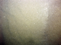
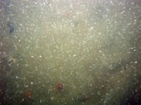
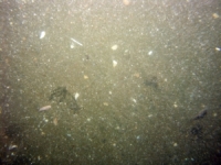
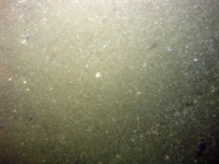
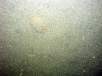
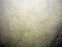
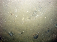
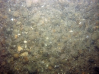
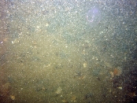
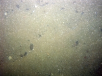
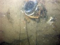
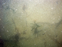
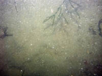
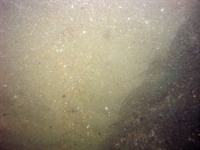
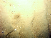
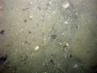
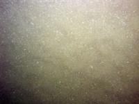
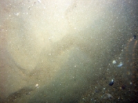
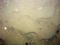
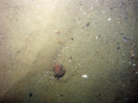
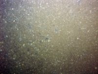
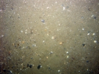
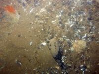
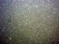
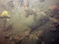
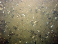
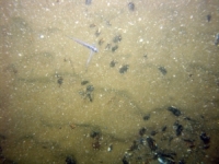
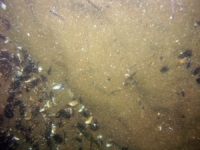
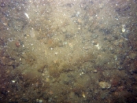
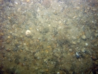
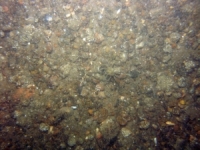
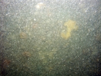
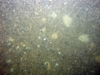
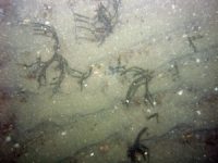
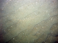
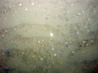
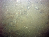
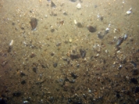
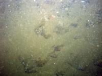
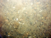
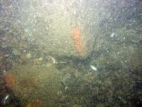
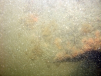
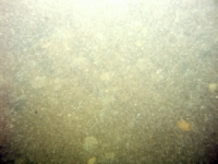
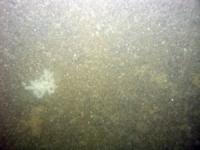
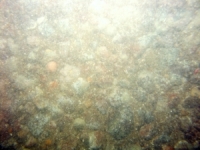
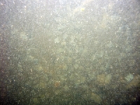
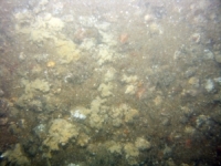
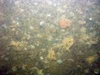
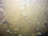
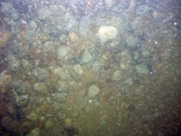
d4_PICT1766.JPG
Station # 229
Lat 41.413368
Long -70.808070
Time (UTC) 00:09:46
    Nearest Sediment Sample Info:
    • Classification = SAND
    • Station Number = 229
    • Distance = 94.7 meters
Image of seabed - photo.
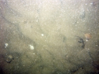
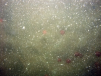
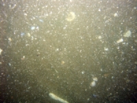
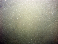
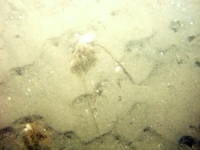
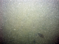
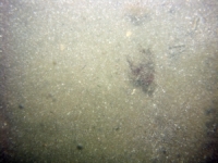
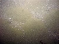
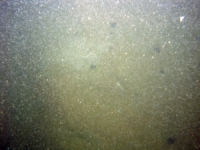
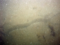
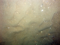
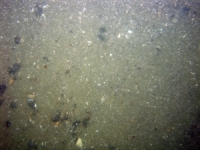
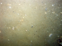
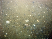
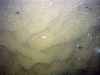
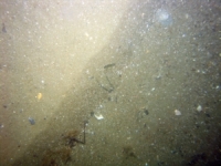
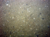
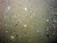
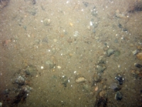
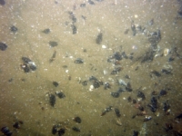
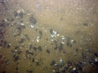
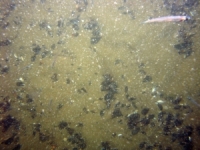
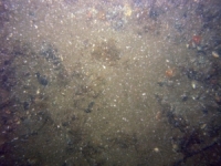
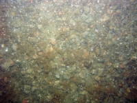
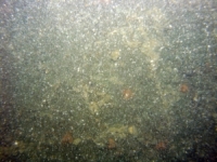
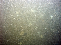
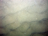
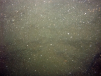
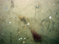
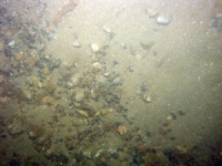
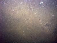
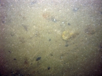
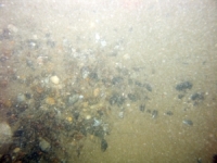
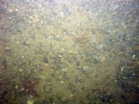
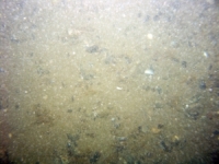
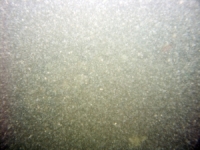
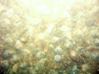
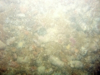
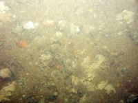
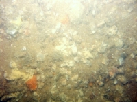
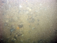
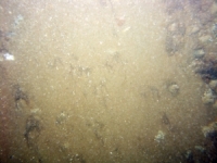
d4_PICT1767.JPG
Station # 229
Lat 41.413432
Long -70.808235
Time (UTC) 00:10:24
    Nearest Sediment Sample Info:
    • Classification = SAND
    • Station Number = 229
    • Distance = 81.2 meters
Image of seabed - photo.
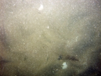
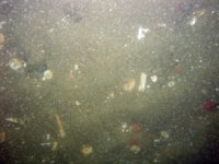
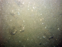
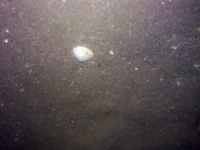
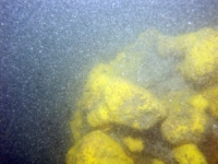
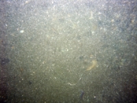
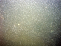
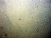
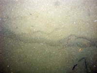
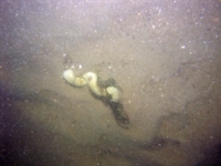
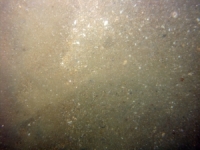
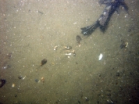
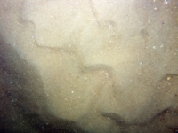
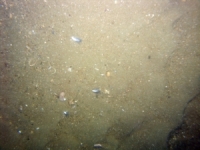
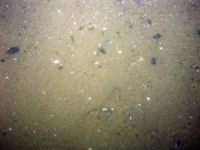
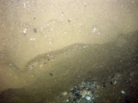
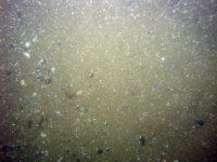
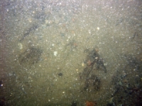
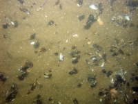
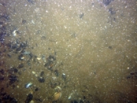
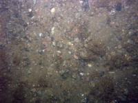
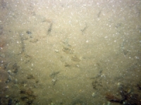
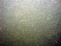
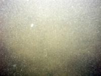
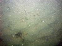
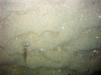
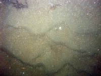
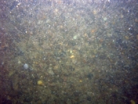
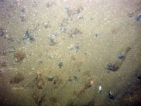
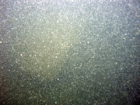
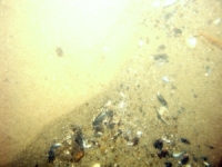
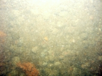
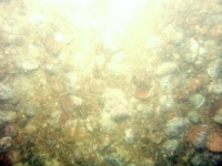
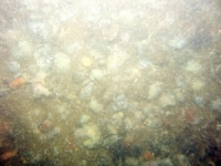
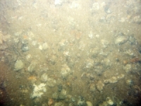
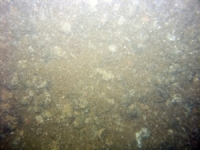
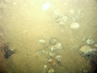
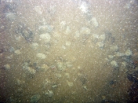
d4_PICT1768.JPG
Station # 229
Lat 41.413447
Long -70.808352
Time (UTC) 00:10:49
    Nearest Sediment Sample Info:
    • Classification = SAND
    • Station Number = 229
    • Distance = 71.6 meters
Image of seabed - photo.
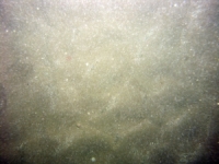
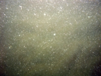
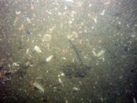
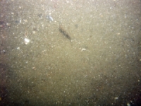
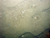
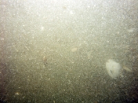
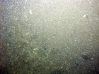
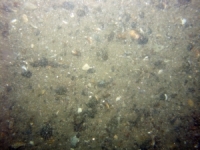
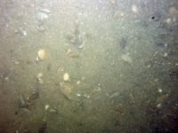
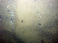
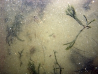
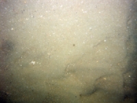
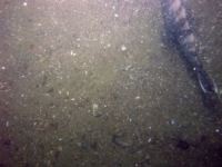
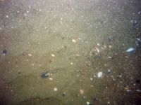
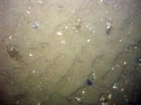
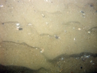
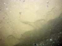
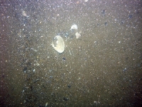
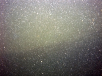
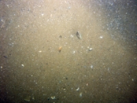
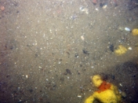
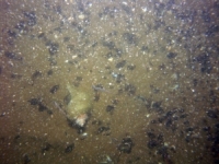
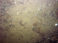
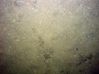
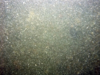
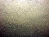
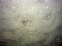
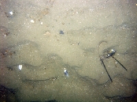
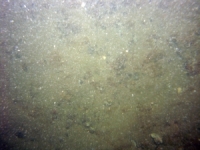
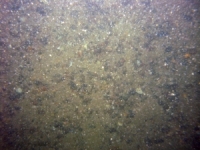
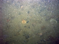
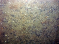
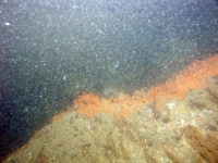
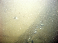
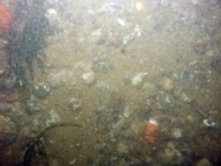
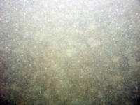
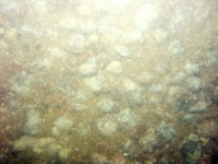
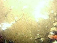
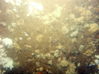
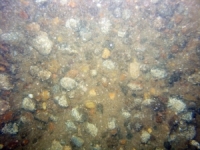
d4_PICT1769.JPG
Station # 229
Lat 41.413448
Long -70.808607
Time (UTC) 00:11:38
    Nearest Sediment Sample Info:
    • Classification = SAND
    • Station Number = 229
    • Distance = 50.4 meters
Image of seabed - photo.
d4_PICT1770.JPG
Station # 229
Lat 41.413425
Long -70.808797
Time (UTC) 00:12:11
    Nearest Sediment Sample Info:
    • Classification = SAND
    • Station Number = 229
    • Distance = 34.4 meters
Image of seabed - photo.
d4_PICT1771.JPG
Station # 229
Lat 41.413412
Long -70.808923
Time (UTC) 00:12:31
    Nearest Sediment Sample Info:
    • Classification = SAND
    • Station Number = 229
    • Distance = 23.7 meters
Image of seabed - photo.
d4_PICT1772.JPG
Station # 229
Lat 41.413403
Long -70.809000
Time (UTC) 00:12:43
    Nearest Sediment Sample Info:
    • Classification = SAND
    • Station Number = 229
    • Distance = 17.2 meters
Image of seabed - photo.
d4_PICT1773.JPG
Station # 230
Lat 41.393807
Long -70.796197
Time (UTC) 00:34:01
    Nearest Sediment Sample Info:
    • Classification = SAND
    • Station Number = 230
    • Distance = 86.1 meters
Image of seabed - photo.
d4_PICT1774.JPG
Station # 230
Lat 41.393838
Long -70.796280
Time (UTC) 00:34:24
    Nearest Sediment Sample Info:
    • Classification = SAND
    • Station Number = 230
    • Distance = 79 meters
Image of seabed - photo.
d4_PICT1775.JPG
Station # 230
Lat 41.393837
Long -70.796342
Time (UTC) 00:34:44
    Nearest Sediment Sample Info:
    • Classification = SAND
    • Station Number = 230
    • Distance = 73.9 meters
Image of seabed - photo.
d4_PICT1776.JPG
Station # 230
Lat 41.393867
Long -70.796582
Time (UTC) 00:35:41
    Nearest Sediment Sample Info:
    • Classification = SAND
    • Station Number = 230
    • Distance = 53.8 meters
Image of seabed - photo.
d4_PICT1777.JPG
Station # 230
Lat 41.393873
Long -70.796688
Time (UTC) 00:36:03
    Nearest Sediment Sample Info:
    • Classification = SAND
    • Station Number = 230
    • Distance = 45 meters
Image of seabed - photo.
d4_PICT1778.JPG
Station # 230
Lat 41.393878
Long -70.796917
Time (UTC) 00:36:53
    Nearest Sediment Sample Info:
    • Classification = SAND
    • Station Number = 230
    • Distance = 25.9 meters
Image of seabed - photo.
d4_PICT1779.JPG
Station # 230
Lat 41.393863
Long -70.797065
Time (UTC) 00:37:26
    Nearest Sediment Sample Info:
    • Classification = SAND
    • Station Number = 230
    • Distance = 13.4 meters
Image of seabed - photo.
d4_PICT1780.JPG
Station # 231
Lat 41.391377
Long -70.786327
Time (UTC) 00:48:59
    Nearest Sediment Sample Info:
    • Classification = GRAVELLY SEDIMENT
    • Station Number = 231
    • Distance = 97.8 meters
Image of seabed - photo.
d4_PICT1781.JPG
Station # 231
Lat 41.391375
Long -70.786565
Time (UTC) 00:49:56
    Nearest Sediment Sample Info:
    • Classification = GRAVELLY SEDIMENT
    • Station Number = 231
    • Distance = 77.9 meters
Image of seabed - photo.
d4_PICT1782.JPG
Station # 231
Lat 41.391393
Long -70.786782
Time (UTC) 00:50:46
    Nearest Sediment Sample Info:
    • Classification = GRAVELLY SEDIMENT
    • Station Number = 231
    • Distance = 59.7 meters
Image of seabed - photo.
d4_PICT1783.JPG
Station # 231
Lat 41.391405
Long -70.786878
Time (UTC) 00:51:08
    Nearest Sediment Sample Info:
    • Classification = GRAVELLY SEDIMENT
    • Station Number = 231
    • Distance = 51.6 meters
Image of seabed - photo.
d4_PICT1784.JPG
Station # 231
Lat 41.391412
Long -70.787068
Time (UTC) 00:51:58
    Nearest Sediment Sample Info:
    • Classification = GRAVELLY SEDIMENT
    • Station Number = 231
    • Distance = 35.7 meters
Image of seabed - photo.
d4_PICT1785.JPG
Station # 231
Lat 41.391418
Long -70.787170
Time (UTC) 00:52:23
    Nearest Sediment Sample Info:
    • Classification = GRAVELLY SEDIMENT
    • Station Number = 231
    • Distance = 27.2 meters
Image of seabed - photo.
d4_PICT1786.JPG
Station # 231
Lat 41.391415
Long -70.787425
Time (UTC) 00:53:27
    Nearest Sediment Sample Info:
    • Classification = GRAVELLY SEDIMENT
    • Station Number = 231
    • Distance = 5.9 meters
Image of seabed - photo.
d4_PICT1787.JPG
Station # 231
Lat 41.391333
Long -70.788005
Time (UTC) 00:55:53
    Nearest Sediment Sample Info:
    • Classification = GRAVELLY SEDIMENT
    • Station Number = 231
    • Distance = 43.5 meters
Image of seabed - photo.
d4_PICT1788.JPG
Station # 231
Lat 41.391345
Long -70.788198
Time (UTC) 00:56:37
    Nearest Sediment Sample Info:
    • Classification = GRAVELLY SEDIMENT
    • Station Number = 231
    • Distance = 59.3 meters
Image of seabed - photo.
d4_PICT1789.JPG
Station # 231
Lat 41.391337
Long -70.788277
Time (UTC) 00:56:56
    Nearest Sediment Sample Info:
    • Classification = GRAVELLY SEDIMENT
    • Station Number = 231
    • Distance = 65.9 meters
Image of seabed - photo.
d4_PICT1790.JPG
Station # 231
Lat 41.391330
Long -70.788338
Time (UTC) 00:57:12
    Nearest Sediment Sample Info:
    • Classification = GRAVELLY SEDIMENT
    • Station Number = 231
    • Distance = 71.1 meters
Image of seabed - photo.
d4_PICT1791.JPG
Station # 232a
Lat 41.390823
Long -70.782090
Time (UTC) 01:11:18
    Nearest Sediment Sample Info:
    • Classification = SAND
    • Station Number = 232
    • Distance = 100.2 meters
Image of seabed - photo.
d4_PICT1792.JPG
Station # 232a
Lat 41.390815
Long -70.782200
Time (UTC) 01:11:46
    Nearest Sediment Sample Info:
    • Classification = SAND
    • Station Number = 232
    • Distance = 91.1 meters
Image of seabed - photo.
d4_PICT1793.JPG
Station # 232a
Lat 41.390803
Long -70.782395
Time (UTC) 01:12:34
    Nearest Sediment Sample Info:
    • Classification = SAND
    • Station Number = 232
    • Distance = 74.9 meters
Image of seabed - photo.
d4_PICT1794.JPG
Station # 232a
Lat 41.390802
Long -70.782500
Time (UTC) 01:12:59
    Nearest Sediment Sample Info:
    • Classification = SAND
    • Station Number = 232
    • Distance = 66.2 meters
Image of seabed - photo.
d4_PICT1795.JPG
Station # 232a
Lat 41.390807
Long -70.782593
Time (UTC) 01:13:21
    Nearest Sediment Sample Info:
    • Classification = SAND
    • Station Number = 232
    • Distance = 58.4 meters
Image of seabed - photo.
d4_PICT1796.JPG
Station # 232a
Lat 41.390815
Long -70.782707
Time (UTC) 01:13:49
    Nearest Sediment Sample Info:
    • Classification = SAND
    • Station Number = 232
    • Distance = 48.8 meters
Image of seabed - photo.
d4_PICT1797.JPG
Station # 232a
Lat 41.390832
Long -70.782858
Time (UTC) 01:14:23
    Nearest Sediment Sample Info:
    • Classification = SAND
    • Station Number = 232
    • Distance = 36.1 meters
Image of seabed - photo.
d4_PICT1798.JPG
Station # 232a
Lat 41.390840
Long -70.782967
Time (UTC) 01:14:50
    Nearest Sediment Sample Info:
    • Classification = SAND
    • Station Number = 232
    • Distance = 26.9 meters
Image of seabed - photo.
d4_PICT1799.JPG
Station # 232a
Lat 41.390857
Long -70.783212
Time (UTC) 01:15:52
    Nearest Sediment Sample Info:
    • Classification = SAND
    • Station Number = 232
    • Distance = 6.3 meters
Image of seabed - photo.
d4_PICT1800.JPG
Station # 232a
Lat 41.390888
Long -70.783645
Time (UTC) 01:17:49
    Nearest Sediment Sample Info:
    • Classification = SAND
    • Station Number = 232
    • Distance = 30 meters
Image of seabed - photo.
d4_PICT1801.JPG
Station # 232a
Lat 41.390907
Long -70.783790
Time (UTC) 01:18:25
    Nearest Sediment Sample Info:
    • Classification = SAND
    • Station Number = 232
    • Distance = 42.3 meters
Image of seabed - photo.
d4_PICT1802.JPG
Station # 232a
Lat 41.390923
Long -70.784035
Time (UTC) 01:19:31
    Nearest Sediment Sample Info:
    • Classification = SAND
    • Station Number = 232
    • Distance = 62.9 meters
Image of seabed - photo.
d4_PICT1803.JPG
Station # 232a
Lat 41.390937
Long -70.784142
Time (UTC) 01:20:00
    Nearest Sediment Sample Info:
    • Classification = SAND
    • Station Number = 232
    • Distance = 71.9 meters
Image of seabed - photo.
d4_PICT1804.JPG
Station # 232a
Lat 41.390952
Long -70.784287
Time (UTC) 01:20:36
    Nearest Sediment Sample Info:
    • Classification = SAND
    • Station Number = 232
    • Distance = 84.2 meters
Image of seabed - photo.
d4_PICT1805.JPG
Station # 232a
Lat 41.390975
Long -70.784565
Time (UTC) 01:21:50
    Nearest Sediment Sample Info:
    • Classification = SAND
    • Station Number = 232
    • Distance = 107.6 meters
Image of seabed - photo.
d4_PICT1806.JPG
Station # 232a
Lat 41.391015
Long -70.784945
Time (UTC) 01:23:34
    Nearest Sediment Sample Info:
    • Classification = SAND
    • Station Number = 232
    • Distance = 139.6 meters
Image of seabed - photo.
d4_PICT1807.JPG
Station # 232a
Lat 41.391022
Long -70.785005
Time (UTC) 01:23:52
    Nearest Sediment Sample Info:
    • Classification = SAND
    • Station Number = 232
    • Distance = 144.7 meters
Image of seabed - photo.
d4_PICT1808.JPG
Station # 232a
Lat 41.391043
Long -70.785182
Time (UTC) 01:24:49
    Nearest Sediment Sample Info:
    • Classification = SAND
    • Station Number = 232
    • Distance = 159.7 meters
Image of seabed - photo.
d4_PICT1809.JPG
Station # 232a
Lat 41.391040
Long -70.785225
Time (UTC) 01:25:05
    Nearest Sediment Sample Info:
    • Classification = SAND
    • Station Number = 232
    • Distance = 163.2 meters
Image of seabed - photo.
d4_PICT1810.JPG
Station # 233
Lat 41.403490
Long -70.789515
Time (UTC) 01:37:21
    Nearest Sediment Sample Info:
    • Classification = SAND
    • Station Number = 233
    • Distance = 57.7 meters
Image of seabed - photo.
d4_PICT1811.JPG
Station # 233
Lat 41.403537
Long -70.789520
Time (UTC) 01:37:55
    Nearest Sediment Sample Info:
    • Classification = SAND
    • Station Number = 233
    • Distance = 52.5 meters
Image of seabed - photo.
d4_PICT1812.JPG
Station # 233
Lat 41.403565
Long -70.789532
Time (UTC) 01:38:29
    Nearest Sediment Sample Info:
    • Classification = SAND
    • Station Number = 233
    • Distance = 49.3 meters
Image of seabed - photo.
d4_PICT1813.JPG
Station # 233
Lat 41.403617
Long -70.789567
Time (UTC) 01:39:21
    Nearest Sediment Sample Info:
    • Classification = SAND
    • Station Number = 233
    • Distance = 43.4 meters
Image of seabed - photo.
d4_PICT1814.JPG
Station # 233
Lat 41.403657
Long -70.789597
Time (UTC) 01:39:58
    Nearest Sediment Sample Info:
    • Classification = SAND
    • Station Number = 233
    • Distance = 39 meters
Image of seabed - photo.
d4_PICT1815.JPG
Station # 233
Lat 41.403815
Long -70.789627
Time (UTC) 01:40:53
    Nearest Sediment Sample Info:
    • Classification = SAND
    • Station Number = 233
    • Distance = 21.9 meters
Image of seabed - photo.
d4_PICT1816.JPG
Station # 233
Lat 41.403848
Long -70.789623
Time (UTC) 01:41:07
    Nearest Sediment Sample Info:
    • Classification = SAND
    • Station Number = 233
    • Distance = 18.3 meters
Image of seabed - photo.
d4_PICT1817.JPG
Station # 233
Lat 41.403913
Long -70.789600
Time (UTC) 01:41:37
    Nearest Sediment Sample Info:
    • Classification = SAND
    • Station Number = 233
    • Distance = 10.8 meters
Image of seabed - photo.
d4_PICT1818.JPG
Station # 233
Lat 41.403933
Long -70.789592
Time (UTC) 01:41:48
    Nearest Sediment Sample Info:
    • Classification = SAND
    • Station Number = 233
    • Distance = 8.5 meters
Image of seabed - photo.
d4_PICT1819.JPG
Station # 233
Lat 41.403980
Long -70.789583
Time (UTC) 01:42:16
    Nearest Sediment Sample Info:
    • Classification = SAND
    • Station Number = 233
    • Distance = 3.2 meters
Image of seabed - photo.
d4_PICT1820.JPG
Station # 234
Lat 41.407623
Long -70.782998
Time (UTC) 01:52:26
    Nearest Sediment Sample Info:
    • Classification = SAND
    • Station Number = 234
    • Distance = 38.9 meters
Image of seabed - photo.
d4_PICT1821.JPG
Station # 234
Lat 41.407733
Long -70.782958
Time (UTC) 01:53:24
    Nearest Sediment Sample Info:
    • Classification = SAND
    • Station Number = 234
    • Distance = 26.4 meters
Image of seabed - photo.
d4_PICT1822.JPG
Station # 234
Lat 41.407767
Long -70.782935
Time (UTC) 01:53:47
    Nearest Sediment Sample Info:
    • Classification = SAND
    • Station Number = 234
    • Distance = 22.2 meters
Image of seabed - photo.
d4_PICT1823.JPG
Station # 234
Lat 41.407802
Long -70.782913
Time (UTC) 01:54:10
    Nearest Sediment Sample Info:
    • Classification = SAND
    • Station Number = 234
    • Distance = 17.9 meters
Image of seabed - photo.
d4_PICT1824.JPG
Station # 234
Lat 41.407847
Long -70.782878
Time (UTC) 01:54:42
    Nearest Sediment Sample Info:
    • Classification = SAND
    • Station Number = 234
    • Distance = 12.1 meters
Image of seabed - photo.
d4_PICT1825.JPG
Station # 234
Lat 41.407873
Long -70.782857
Time (UTC) 01:55:01
    Nearest Sediment Sample Info:
    • Classification = SAND
    • Station Number = 234
    • Distance = 8.7 meters
Image of seabed - photo.
d4_PICT1826.JPG
Station # 234
Lat 41.407913
Long -70.782832
Time (UTC) 01:55:32
    Nearest Sediment Sample Info:
    • Classification = SAND
    • Station Number = 234
    • Distance = 3.8 meters
Image of seabed - photo.
d4_PICT1827.JPG
Station # 234
Lat 41.407927
Long -70.782818
Time (UTC) 01:55:47
    Nearest Sediment Sample Info:
    • Classification = SAND
    • Station Number = 234
    • Distance = 1.9 meters
Image of seabed - photo.
d4_PICT1828.JPG
Station # 235
Lat 41.404658
Long -70.765525
Time (UTC) 02:20:36
    Nearest Sediment Sample Info:
    • Classification = SAND
    • Station Number = 235
    • Distance = 69.6 meters
Image of seabed - photo.
d4_PICT1829.JPG
Station # 235
Lat 41.404670
Long -70.765435
Time (UTC) 02:21:09
    Nearest Sediment Sample Info:
    • Classification = SAND
    • Station Number = 235
    • Distance = 62.3 meters
Image of seabed - photo.
d4_PICT1830.JPG
Station # 235
Lat 41.404708
Long -70.765293
Time (UTC) 02:22:02
    Nearest Sediment Sample Info:
    • Classification = SAND
    • Station Number = 235
    • Distance = 49.9 meters
Image of seabed - photo.
d4_PICT1831.JPG
Station # 235
Lat 41.404742
Long -70.765185
Time (UTC) 02:22:39
    Nearest Sediment Sample Info:
    • Classification = SAND
    • Station Number = 235
    • Distance = 40.2 meters
Image of seabed - photo.
d4_PICT1832.JPG
Station # 235
Lat 41.404785
Long -70.765077
Time (UTC) 02:23:18
    Nearest Sediment Sample Info:
    • Classification = SAND
    • Station Number = 235
    • Distance = 30.1 meters
Image of seabed - photo.
d4_PICT1833.JPG
Station # 235
Lat 41.404835
Long -70.764972
Time (UTC) 02:23:55
    Nearest Sediment Sample Info:
    • Classification = SAND
    • Station Number = 235
    • Distance = 19.7 meters
Image of seabed - photo.
d4_PICT1834.JPG
Station # 235
Lat 41.404905
Long -70.764843
Time (UTC) 02:24:41
    Nearest Sediment Sample Info:
    • Classification = SAND
    • Station Number = 235
    • Distance = 6.4 meters
Image of seabed - photo.
d4_PICT1835.JPG
Station # 236
Lat 41.399662
Long -70.756212
Time (UTC) 02:38:13
    Nearest Sediment Sample Info:
    • Classification = SAND
    • Station Number = 236
    • Distance = 101.8 meters
Image of seabed - photo.
d4_PICT1836.JPG
Station # 236
Lat 41.399755
Long -70.756115
Time (UTC) 02:38:57
    Nearest Sediment Sample Info:
    • Classification = SAND
    • Station Number = 236
    • Distance = 88.8 meters
Image of seabed - photo.
d4_PICT1837.JPG
Station # 236
Lat 41.399842
Long -70.756042
Time (UTC) 02:39:34
    Nearest Sediment Sample Info:
    • Classification = SAND
    • Station Number = 236
    • Distance = 77.5 meters
Image of seabed - photo.
d4_PICT1838.JPG
Station # 236
Lat 41.399925
Long -70.755978
Time (UTC) 02:40:10
    Nearest Sediment Sample Info:
    • Classification = SAND
    • Station Number = 236
    • Distance = 66.8 meters
Image of seabed - photo.
d4_PICT1839.JPG
Station # 236
Lat 41.400082
Long -70.755873
Time (UTC) 02:41:05
    Nearest Sediment Sample Info:
    • Classification = SAND
    • Station Number = 236
    • Distance = 47.3 meters
Image of seabed - photo.
d4_PICT1840.JPG
Station # 236
Lat 41.400208
Long -70.755768
Time (UTC) 02:41:49
    Nearest Sediment Sample Info:
    • Classification = SAND
    • Station Number = 236
    • Distance = 30.9 meters
Image of seabed - photo.
d4_PICT1841.JPG
Station # 236
Lat 41.400353
Long -70.755692
Time (UTC) 02:42:37
    Nearest Sediment Sample Info:
    • Classification = SAND
    • Station Number = 236
    • Distance = 13.6 meters
Image of seabed - photo.
d4_PICT1842.JPG
Station # 237
Lat 41.403635
Long -70.741193
Time (UTC) 02:55:21
    Nearest Sediment Sample Info:
    • Classification = SAND
    • Station Number = 237
    • Distance = 54.7 meters
Image of seabed - photo.
d4_PICT1843.JPG
Station # 237
Lat 41.403683
Long -70.741128
Time (UTC) 02:55:35
    Nearest Sediment Sample Info:
    • Classification = SAND
    • Station Number = 237
    • Distance = 47.1 meters
Image of seabed - photo.
d4_PICT1844.JPG
Station # 237
Lat 41.403835
Long -70.740890
Time (UTC) 02:56:26
    Nearest Sediment Sample Info:
    • Classification = SAND
    • Station Number = 237
    • Distance = 21 meters
Image of seabed - photo.
d4_PICT1845.JPG
Station # 237
Lat 41.403888
Long -70.740808
Time (UTC) 02:56:44
    Nearest Sediment Sample Info:
    • Classification = SAND
    • Station Number = 237
    • Distance = 11.9 meters
Image of seabed - photo.
d4_PICT1846.JPG
Station # 238
Lat 41.415822
Long -70.739813
Time (UTC) 03:09:05
    Nearest Sediment Sample Info:
    • Classification = GRAVELLY SEDIMENT
    • Station Number = 238
    • Distance = 205.6 meters
Image of seabed - photo.
d4_PICT1847.JPG
Station # 238
Lat 41.415893
Long -70.739695
Time (UTC) 03:09:26
    Nearest Sediment Sample Info:
    • Classification = GRAVELLY SEDIMENT
    • Station Number = 238
    • Distance = 193.1 meters
Image of seabed - photo.
d4_PICT1848.JPG
Station # 238
Lat 41.416002
Long -70.739523
Time (UTC) 03:09:54
    Nearest Sediment Sample Info:
    • Classification = GRAVELLY SEDIMENT
    • Station Number = 238
    • Distance = 174.3 meters
Image of seabed - photo.
d4_PICT1849.JPG
Station # 238
Lat 41.416133
Long -70.739320
Time (UTC) 03:10:28
    Nearest Sediment Sample Info:
    • Classification = GRAVELLY SEDIMENT
    • Station Number = 238
    • Distance = 152 meters
Image of seabed - photo.
d4_PICT1850.JPG
Station # 238
Lat 41.416205
Long -70.739192
Time (UTC) 03:10:48
    Nearest Sediment Sample Info:
    • Classification = GRAVELLY SEDIMENT
    • Station Number = 238
    • Distance = 138.9 meters
Image of seabed - photo.
d4_PICT1851.JPG
Station # 238
Lat 41.416310
Long -70.739008
Time (UTC) 03:11:14
    Nearest Sediment Sample Info:
    • Classification = GRAVELLY SEDIMENT
    • Station Number = 238
    • Distance = 119.8 meters
Image of seabed - photo.
d4_PICT1852.JPG
Station # 238
Lat 41.416375
Long -70.738905
Time (UTC) 03:11:29
    Nearest Sediment Sample Info:
    • Classification = GRAVELLY SEDIMENT
    • Station Number = 238
    • Distance = 108.7 meters
Image of seabed - photo.
d4_PICT1853.JPG
Station # 238
Lat 41.416602
Long -70.738625
Time (UTC) 03:12:11
    Nearest Sediment Sample Info:
    • Classification = GRAVELLY SEDIMENT
    • Station Number = 238
    • Distance = 74.3 meters
Image of seabed - photo.
d4_PICT1854.JPG
Station # 238
Lat 41.417108
Long -70.738043
Time (UTC) 03:13:44
    Nearest Sediment Sample Info:
    • Classification = GRAVELLY SEDIMENT
    • Station Number = 238
    • Distance = 0 meters
Image of seabed - photo.
d4_PICT1855.JPG
Station # 239
Lat 41.418690
Long -70.736082
Time (UTC) 03:19:15
    Nearest Sediment Sample Info:
    • Classification = SAND
    • Station Number = 239
    • Distance = 144.1 meters
Image of seabed - photo.
d4_PICT1856.JPG
Station # 239
Lat 41.418817
Long -70.735888
Time (UTC) 03:19:48
    Nearest Sediment Sample Info:
    • Classification = SAND
    • Station Number = 239
    • Distance = 122.9 meters
Image of seabed - photo.
d4_PICT1857.JPG
Station # 239
Lat 41.418883
Long -70.735788
Time (UTC) 03:20:08
    Nearest Sediment Sample Info:
    • Classification = SAND
    • Station Number = 239
    • Distance = 111.9 meters
Image of seabed - photo.
d4_PICT1858.JPG
Station # 239
Lat 41.418948
Long -70.735710
Time (UTC) 03:20:25
    Nearest Sediment Sample Info:
    • Classification = SAND
    • Station Number = 239
    • Distance = 102.2 meters
Image of seabed - photo.
d4_PICT1859.JPG
Station # 239
Lat 41.418998
Long -70.735658
Time (UTC) 03:20:37
    Nearest Sediment Sample Info:
    • Classification = SAND
    • Station Number = 239
    • Distance = 95.2 meters
Image of seabed - photo.
d4_PICT1860.JPG
Station # 239
Lat 41.419130
Long -70.735523
Time (UTC) 03:21:08
    Nearest Sediment Sample Info:
    • Classification = SAND
    • Station Number = 239
    • Distance = 76.7 meters
Image of seabed - photo.
d4_PICT1861.JPG
Station # 239
Lat 41.419282
Long -70.735370
Time (UTC) 03:21:42
    Nearest Sediment Sample Info:
    • Classification = SAND
    • Station Number = 239
    • Distance = 55.5 meters
Image of seabed - photo.
d4_PICT1862.JPG
Station # 239
Lat 41.419375
Long -70.735257
Time (UTC) 03:22:04
    Nearest Sediment Sample Info:
    • Classification = SAND
    • Station Number = 239
    • Distance = 41.5 meters
Image of seabed - photo.
d4_PICT1863.JPG
Station # 239
Lat 41.419483
Long -70.735147
Time (UTC) 03:22:28
    Nearest Sediment Sample Info:
    • Classification = SAND
    • Station Number = 239
    • Distance = 26.4 meters
Image of seabed - photo.
d4_PICT1864.JPG
Station # 240
Lat 41.424522
Long -70.724310
Time (UTC) 03:35:46
    Nearest Sediment Sample Info:
    • Classification = SAND
    • Station Number = 240
    • Distance = 118.9 meters
Image of seabed - photo.
d4_PICT1865.JPG
Station # 240
Lat 41.424528
Long -70.724205
Time (UTC) 03:35:59
    Nearest Sediment Sample Info:
    • Classification = SAND
    • Station Number = 240
    • Distance = 111.6 meters
Image of seabed - photo.
d4_PICT1866.JPG
Station # 240
Lat 41.424590
Long -70.723875
Time (UTC) 03:36:36
    Nearest Sediment Sample Info:
    • Classification = SAND
    • Station Number = 240
    • Distance = 86.8 meters
Image of seabed - photo.
d4_PICT1867.JPG
Station # 240
Lat 41.424650
Long -70.723668
Time (UTC) 03:36:57
    Nearest Sediment Sample Info:
    • Classification = SAND
    • Station Number = 240
    • Distance = 70.6 meters
Image of seabed - photo.
d4_PICT1868.JPG
Station # 240
Lat 41.424807
Long -70.723425
Time (UTC) 03:37:28
    Nearest Sediment Sample Info:
    • Classification = SAND
    • Station Number = 240
    • Distance = 45 meters
Image of seabed - photo.
d4_PICT1869.JPG
Station # 240
Lat 41.424947
Long -70.723313
Time (UTC) 03:37:53
    Nearest Sediment Sample Info:
    • Classification = SAND
    • Station Number = 240
    • Distance = 26.9 meters
Image of seabed - photo.
d4_PICT1870.JPG
Station # 240
Lat 41.425057
Long -70.723240
Time (UTC) 03:38:19
    Nearest Sediment Sample Info:
    • Classification = SAND
    • Station Number = 240
    • Distance = 13.3 meters
Image of seabed - photo.
d4_PICT1871.JPG
Station # 241
Lat 41.425448
Long -70.737272
Time (UTC) 03:54:04
    Nearest Sediment Sample Info:
    • Classification = GRAVELLY SEDIMENT
    • Station Number = 241
    • Distance = 251.2 meters
Image of seabed - photo.
d4_PICT1872.JPG
Station # 241
Lat 41.425510
Long -70.737202
Time (UTC) 03:54:23
    Nearest Sediment Sample Info:
    • Classification = GRAVELLY SEDIMENT
    • Station Number = 241
    • Distance = 242.2 meters
Image of seabed - photo.
d4_PICT1873.JPG
Station # 241
Lat 41.425552
Long -70.737150
Time (UTC) 03:54:35
    Nearest Sediment Sample Info:
    • Classification = GRAVELLY SEDIMENT
    • Station Number = 241
    • Distance = 235.8 meters
Image of seabed - photo.
d4_PICT1874.JPG
Station # 241
Lat 41.425710
Long -70.736973
Time (UTC) 03:55:13
    Nearest Sediment Sample Info:
    • Classification = GRAVELLY SEDIMENT
    • Station Number = 241
    • Distance = 212.9 meters
Image of seabed - photo.
d4_PICT1875.JPG
Station # 241
Lat 41.425833
Long -70.736825
Time (UTC) 03:55:41
    Nearest Sediment Sample Info:
    • Classification = GRAVELLY SEDIMENT
    • Station Number = 241
    • Distance = 194.5 meters
Image of seabed - photo.
d4_PICT1876.JPG
Station # 241
Lat 41.425908
Long -70.736742
Time (UTC) 03:55:56
    Nearest Sediment Sample Info:
    • Classification = GRAVELLY SEDIMENT
    • Station Number = 241
    • Distance = 183.7 meters
Image of seabed - photo.
d4_PICT1877.JPG
Station # 241
Lat 41.426073
Long -70.736580
Time (UTC) 03:56:25
    Nearest Sediment Sample Info:
    • Classification = GRAVELLY SEDIMENT
    • Station Number = 241
    • Distance = 160.9 meters
Image of seabed - photo.
d4_PICT1878.JPG
Station # 242
Lat 41.422913
Long -70.744980
Time (UTC) 04:14:57
    Nearest Sediment Sample Info:
    • Classification = SAND
    • Station Number = 243
    • Distance = 103 meters
Image of seabed - photo.
d4_PICT1879.JPG
Station # 242
Lat 41.422945
Long -70.745028
Time (UTC) 04:15:16
    Nearest Sediment Sample Info:
    • Classification = SAND
    • Station Number = 246
    • Distance = 107.3 meters
Image of seabed - photo.
d4_PICT1880.JPG
Station # 242
Lat 41.423038
Long -70.745078
Time (UTC) 04:16:04
    Nearest Sediment Sample Info:
    • Classification = SAND
    • Station Number = 242
    • Distance = 107.5 meters
Image of seabed - photo.
d4_PICT1881.JPG
Station # 242
Lat 41.423092
Long -70.745062
Time (UTC) 04:16:35
    Nearest Sediment Sample Info:
    • Classification = SAND
    • Station Number = 242
    • Distance = 101.5 meters
Image of seabed - photo.
d4_PICT1882.JPG
Station # 242
Lat 41.423203
Long -70.744990
Time (UTC) 04:17:23
    Nearest Sediment Sample Info:
    • Classification = SAND
    • Station Number = 242
    • Distance = 87.8 meters
Image of seabed - photo.
d4_PICT1883.JPG
Station # 242
Lat 41.423335
Long -70.744898
Time (UTC) 04:18:07
    Nearest Sediment Sample Info:
    • Classification = SAND
    • Station Number = 242
    • Distance = 71.3 meters
Image of seabed - photo.
d4_PICT1884.JPG
Station # 242
Lat 41.423555
Long -70.744775
Time (UTC) 04:19:02
    Nearest Sediment Sample Info:
    • Classification = SAND
    • Station Number = 242
    • Distance = 44.8 meters
Image of seabed - photo.
d4_PICT1885.JPG
Station # 242
Lat 41.423763
Long -70.744660
Time (UTC) 04:19:48
    Nearest Sediment Sample Info:
    • Classification = SAND
    • Station Number = 242
    • Distance = 19.8 meters
Image of seabed - photo.
d4_PICT1886.JPG
Station # 242
Lat 41.423930
Long -70.744578
Time (UTC) 04:20:27
    Nearest Sediment Sample Info:
    • Classification = SAND
    • Station Number = 242
    • Distance = 0 meters
Image of seabed - photo.
d4_PICT1887.JPG
Station # 243
Lat 41.422370
Long -70.744032
Time (UTC) 04:26:50
    Nearest Sediment Sample Info:
    • Classification = SAND
    • Station Number = 243
    • Distance = 3.8 meters
Image of seabed - photo.
d4_PICT1888.JPG
Station # 243
Lat 41.422363
Long -70.743997
Time (UTC) 04:27:02
    Nearest Sediment Sample Info:
    • Classification = SAND
    • Station Number = 243
    • Distance = 0.8 meters
Image of seabed - photo.
d4_PICT1889.JPG
Station # 244
Lat 41.422435
Long -70.752185
Time (UTC) 04:38:39
    Nearest Sediment Sample Info:
    • Classification = SAND
    • Station Number = 245
    • Distance = 46.6 meters
Image of seabed - photo.
d4_PICT1890.JPG
Station # 244
Lat 41.422512
Long -70.752267
Time (UTC) 04:38:57
    Nearest Sediment Sample Info:
    • Classification = SAND
    • Station Number = 245
    • Distance = 53.3 meters
Image of seabed - photo.
d4_PICT1891.JPG
Station # 244
Lat 41.422587
Long -70.752328
Time (UTC) 04:39:14
    Nearest Sediment Sample Info:
    • Classification = SAND
    • Station Number = 245
    • Distance = 61 meters
Image of seabed - photo.
d4_PICT1892.JPG
Station # 244
Lat 41.422695
Long -70.752403
Time (UTC) 04:39:39
    Nearest Sediment Sample Info:
    • Classification = SAND
    • Station Number = 245
    • Distance = 73 meters
Image of seabed - photo.
d4_PICT1893.JPG
Station # 244
Lat 41.422790
Long -70.752455
Time (UTC) 04:40:01
    Nearest Sediment Sample Info:
    • Classification = SAND
    • Station Number = 245
    • Distance = 83.8 meters
Image of seabed - photo.
d4_PICT1894.JPG
Station # 244
Lat 41.422957
Long -70.752515
Time (UTC) 04:40:36
    Nearest Sediment Sample Info:
    • Classification = SAND
    • Station Number = 245
    • Distance = 102.8 meters
Image of seabed - photo.
d4_PICT1895.JPG
Station # 244
Lat 41.423240
Long -70.752557
Time (UTC) 04:41:29
    Nearest Sediment Sample Info:
    • Classification = SAND
    • Station Number = 244
    • Distance = 93 meters
Image of seabed - photo.
d4_PICT1896.JPG
Station # 244
Lat 41.423420
Long -70.752562
Time (UTC) 04:42:01
    Nearest Sediment Sample Info:
    • Classification = SAND
    • Station Number = 244
    • Distance = 73.3 meters
Image of seabed - photo.
d4_PICT1897.JPG
Station # 244
Lat 41.424072
Long -70.752427
Time (UTC) 04:43:40
    Nearest Sediment Sample Info:
    • Classification = SAND
    • Station Number = 244
    • Distance = 0 meters
Image of seabed - photo.
d4_PICT1898.JPG
Station # 245
Lat 41.422088
Long -70.752378
Time (UTC) 04:51:00
    Nearest Sediment Sample Info:
    • Classification = SAND
    • Station Number = 245
    • Distance = 5.7 meters
Image of seabed - photo.
d4_PICT1899.JPG
Station # 246
Lat 41.420720
Long -70.746868
Time (UTC) 05:00:24
    Nearest Sediment Sample Info:
    • Classification = SAND
    • Station Number = 246
    • Distance = 191 meters
Image of seabed - photo.
d4_PICT1900.JPG
Station # 246
Lat 41.420862
Long -70.746652
Time (UTC) 05:00:53
    Nearest Sediment Sample Info:
    • Classification = SAND
    • Station Number = 246
    • Distance = 167.2 meters
Image of seabed - photo.
d4_PICT1901.JPG
Station # 246
Lat 41.421082
Long -70.746338
Time (UTC) 05:01:39
    Nearest Sediment Sample Info:
    • Classification = SAND
    • Station Number = 246
    • Distance = 131.7 meters
Image of seabed - photo.
d4_PICT1902.JPG
Station # 246
Lat 41.421177
Long -70.746213
Time (UTC) 05:01:59
    Nearest Sediment Sample Info:
    • Classification = SAND
    • Station Number = 246
    • Distance = 117 meters
Image of seabed - photo.
d4_PICT1903.JPG
Station # 246
Lat 41.421323
Long -70.746003
Time (UTC) 05:02:34
    Nearest Sediment Sample Info:
    • Classification = SAND
    • Station Number = 246
    • Distance = 93.5 meters
Image of seabed - photo.
d4_PICT1904.JPG
Station # 246
Lat 41.421565
Long -70.745752
Time (UTC) 05:03:24
    Nearest Sediment Sample Info:
    • Classification = SAND
    • Station Number = 246
    • Distance = 59.5 meters
Image of seabed - photo.
d4_PICT1905.JPG
Station # 246
Lat 41.421718
Long -70.745602
Time (UTC) 05:03:57
    Nearest Sediment Sample Info:
    • Classification = SAND
    • Station Number = 246
    • Distance = 38.4 meters
Image of seabed - photo.
d4_PICT1906.JPG
Station # 246
Lat 41.421947
Long -70.745407
Time (UTC) 05:04:47
    Nearest Sediment Sample Info:
    • Classification = SAND
    • Station Number = 246
    • Distance = 8.2 meters
Image of seabed - photo.
d4_PICT1907.JPG
Station # 247
Lat 41.418297
Long -70.744757
Time (UTC) 05:14:58
    Nearest Sediment Sample Info:
    • Classification = SAND
    • Station Number = 247
    • Distance = 145 meters
Image of seabed - photo.
d4_PICT1908.JPG
Station # 247
Lat 41.418382
Long -70.744663
Time (UTC) 05:15:24
    Nearest Sediment Sample Info:
    • Classification = SAND
    • Station Number = 247
    • Distance = 132.8 meters
Image of seabed - photo.
d4_PICT1909.JPG
Station # 247
Lat 41.418442
Long -70.744592
Time (UTC) 05:15:41
    Nearest Sediment Sample Info:
    • Classification = SAND
    • Station Number = 247
    • Distance = 123.8 meters
Image of seabed - photo.
d4_PICT1910.JPG
Station # 247
Lat 41.418600
Long -70.744390
Time (UTC) 05:16:22
    Nearest Sediment Sample Info:
    • Classification = SAND
    • Station Number = 247
    • Distance = 99.5 meters
Image of seabed - photo.
d4_PICT1911.JPG
Station # 247
Lat 41.418743
Long -70.744205
Time (UTC) 05:16:56
    Nearest Sediment Sample Info:
    • Classification = SAND
    • Station Number = 247
    • Distance = 77.3 meters
Image of seabed - photo.
d4_PICT1912.JPG
Station # 247
Lat 41.418832
Long -70.744088
Time (UTC) 05:17:15
    Nearest Sediment Sample Info:
    • Classification = SAND
    • Station Number = 247
    • Distance = 63.4 meters
Image of seabed - photo.
d4_PICT1913.JPG
Station # 247
Lat 41.418890
Long -70.744013
Time (UTC) 05:17:27
    Nearest Sediment Sample Info:
    • Classification = SAND
    • Station Number = 247
    • Distance = 54.4 meters
Image of seabed - photo.
d4_PICT1914.JPG
Station # 247
Lat 41.419237
Long -70.743553
Time (UTC) 05:18:37
    Nearest Sediment Sample Info:
    • Classification = SAND
    • Station Number = 247
    • Distance = 0 meters
Image of seabed - photo.
d4_PICT1915.JPG
Station # 248
Lat 41.419853
Long -70.741355
Time (UTC) 05:26:23
    Nearest Sediment Sample Info:
    • Classification = SAND
    • Station Number = 248
    • Distance = 47.6 meters
Image of seabed - photo.
d4_PICT1916.JPG
Station # 249
Lat 41.415735
Long -70.757422
Time (UTC) 05:46:19
    Nearest Sediment Sample Info:
    • Classification = SAND
    • Station Number = 249
    • Distance = 101.9 meters
Image of seabed - photo.
d4_PICT1917.JPG
Station # 249
Lat 41.415712
Long -70.757367
Time (UTC) 05:46:32
    Nearest Sediment Sample Info:
    • Classification = SAND
    • Station Number = 249
    • Distance = 99.1 meters
Image of seabed - photo.
d4_PICT1918.JPG
Station # 249
Lat 41.415682
Long -70.757258
Time (UTC) 05:47:00
    Nearest Sediment Sample Info:
    • Classification = SAND
    • Station Number = 249
    • Distance = 93 meters
Image of seabed - photo.
d4_PICT1919.JPG
Station # 249
Lat 41.415697
Long -70.757125
Time (UTC) 05:47:38
    Nearest Sediment Sample Info:
    • Classification = SAND
    • Station Number = 249
    • Distance = 83 meters
Image of seabed - photo.
d4_PICT1920.JPG
Station # 249
Lat 41.415728
Long -70.757015
Time (UTC) 05:48:08
    Nearest Sediment Sample Info:
    • Classification = SAND
    • Station Number = 249
    • Distance = 73.7 meters
Image of seabed - photo.
d4_PICT1921.JPG
Station # 249
Lat 41.415765
Long -70.756925
Time (UTC) 05:48:38
    Nearest Sediment Sample Info:
    • Classification = SAND
    • Station Number = 249
    • Distance = 65.3 meters
Image of seabed - photo.
d4_PICT1922.JPG
Station # 249
Lat 41.415798
Long -70.756832
Time (UTC) 05:49:07
    Nearest Sediment Sample Info:
    • Classification = SAND
    • Station Number = 249
    • Distance = 57 meters
Image of seabed - photo.
d4_PICT1923.JPG
Station # 249
Lat 41.415853
Long -70.756730
Time (UTC) 05:49:42
    Nearest Sediment Sample Info:
    • Classification = SAND
    • Station Number = 249
    • Distance = 46.6 meters
Image of seabed - photo.
d4_PICT1924.JPG
Station # 249
Lat 41.415940
Long -70.756588
Time (UTC) 05:50:31
    Nearest Sediment Sample Info:
    • Classification = SAND
    • Station Number = 249
    • Distance = 31.4 meters
Image of seabed - photo.
d4_PICT1925.JPG
Station # 249
Lat 41.416060
Long -70.756438
Time (UTC) 05:51:22
    Nearest Sediment Sample Info:
    • Classification = SAND
    • Station Number = 249
    • Distance = 13.1 meters
Image of seabed - photo.
d4_PICT1926.JPG
Station # 249
Lat 41.416130
Long -70.756355
Time (UTC) 05:51:52
    Nearest Sediment Sample Info:
    • Classification = SAND
    • Station Number = 249
    • Distance = 2.7 meters
Image of seabed - photo.
d4_PICT1927.JPG
Station # 250
Lat 41.422922
Long -70.763953
Time (UTC) 06:03:42
    Nearest Sediment Sample Info:
    • Classification = SAND
    • Station Number = 250
    • Distance = 68.5 meters
Image of seabed - photo.
d4_PICT1928.JPG
Station # 250
Lat 41.422892
Long -70.763927
Time (UTC) 06:04:06
    Nearest Sediment Sample Info:
    • Classification = SAND
    • Station Number = 250
    • Distance = 68.5 meters
Image of seabed - photo.
d4_PICT1929.JPG
Station # 250
Lat 41.422873
Long -70.763880
Time (UTC) 06:04:43
    Nearest Sediment Sample Info:
    • Classification = SAND
    • Station Number = 250
    • Distance = 66.6 meters
Image of seabed - photo.
d4_PICT1930.JPG
Station # 250
Lat 41.422870
Long -70.763808
Time (UTC) 06:05:27
    Nearest Sediment Sample Info:
    • Classification = SAND
    • Station Number = 250
    • Distance = 62.2 meters
Image of seabed - photo.
d4_PICT1931.JPG
Station # 250
Lat 41.422905
Long -70.763705
Time (UTC) 06:06:23
    Nearest Sediment Sample Info:
    • Classification = SAND
    • Station Number = 250
    • Distance = 53.3 meters
Image of seabed - photo.
d4_PICT1932.JPG
Station # 250
Lat 41.422927
Long -70.763665
Time (UTC) 06:06:43
    Nearest Sediment Sample Info:
    • Classification = SAND
    • Station Number = 250
    • Distance = 49.2 meters
Image of seabed - photo.
d4_PICT1933.JPG
Station # 250
Lat 41.422955
Long -70.763618
Time (UTC) 06:07:07
    Nearest Sediment Sample Info:
    • Classification = SAND
    • Station Number = 250
    • Distance = 44.2 meters
Image of seabed - photo.
d4_PICT1934.JPG
Station # 250
Lat 41.423053
Long -70.763480
Time (UTC) 06:08:14
    Nearest Sediment Sample Info:
    • Classification = SAND
    • Station Number = 250
    • Distance = 28.4 meters
Image of seabed - photo.
d4_PICT1935.JPG
Station # 250
Lat 41.423153
Long -70.763348
Time (UTC) 06:09:14
    Nearest Sediment Sample Info:
    • Classification = SAND
    • Station Number = 250
    • Distance = 12.8 meters
Image of seabed - photo.
d4_PICT1936.JPG
Station # 250
Lat 41.423238
Long -70.763260
Time (UTC) 06:09:57
    Nearest Sediment Sample Info:
    • Classification = SAND
    • Station Number = 250
    • Distance = 0.9 meters
Image of seabed - photo.
d4_PICT1937.JPG
Station # 251
Lat 41.421723
Long -70.784078
Time (UTC) 06:24:13
    Nearest Sediment Sample Info:
    • Classification = GRAVELLY SEDIMENT
    • Station Number = 251
    • Distance = 12.5 meters
Image of seabed - photo.
d4_PICT1938.JPG
Station # 251
Lat 41.421685
Long -70.784123
Time (UTC) 06:24:43
    Nearest Sediment Sample Info:
    • Classification = GRAVELLY SEDIMENT
    • Station Number = 251
    • Distance = 7 meters
Image of seabed - photo.
d4_PICT1939.JPG
Station # 251
Lat 41.421663
Long -70.784152
Time (UTC) 06:25:28
    Nearest Sediment Sample Info:
    • Classification = GRAVELLY SEDIMENT
    • Station Number = 251
    • Distance = 3.9 meters
Image of seabed - photo.
d4_PICT1940.JPG
Station # 251
Lat 41.421640
Long -70.784163
Time (UTC) 06:26:07
    Nearest Sediment Sample Info:
    • Classification = GRAVELLY SEDIMENT
    • Station Number = 251
    • Distance = 1.4 meters
Image of seabed - photo.
d4_PICT1941.JPG
Station # 252
Lat 41.421700
Long -70.783888
Time (UTC) 06:32:57
    Nearest Sediment Sample Info:
    • Classification = GRAVELLY SEDIMENT
    • Station Number = 251
    • Distance = 23.9 meters
Image of seabed - photo.
d4_PICT1942.JPG
Station # 252
Lat 41.421767
Long -70.783825
Time (UTC) 06:33:30
    Nearest Sediment Sample Info:
    • Classification = GRAVELLY SEDIMENT
    • Station Number = 251
    • Distance = 31.8 meters
Image of seabed - photo.
d4_PICT1943.JPG
Station # 252
Lat 41.421905
Long -70.783698
Time (UTC) 06:34:24
    Nearest Sediment Sample Info:
    • Classification = GRAVELLY SEDIMENT
    • Station Number = 251
    • Distance = 49.2 meters
Image of seabed - photo.
d4_PICT1944.JPG
Station # 252
Lat 41.421952
Long -70.783662
Time (UTC) 06:34:40
    Nearest Sediment Sample Info:
    • Classification = GRAVELLY SEDIMENT
    • Station Number = 251
    • Distance = 54.9 meters
Image of seabed - photo.
d4_PICT1945.JPG
Station # 252
Lat 41.422032
Long -70.783603
Time (UTC) 06:35:08
    Nearest Sediment Sample Info:
    • Classification = GRAVELLY SEDIMENT
    • Station Number = 251
    • Distance = 64.5 meters
Image of seabed - photo.
d4_PICT1946.JPG
Station # 252
Lat 41.422127
Long -70.783540
Time (UTC) 06:35:43
    Nearest Sediment Sample Info:
    • Classification = GRAVELLY SEDIMENT
    • Station Number = 251
    • Distance = 75.8 meters
Image of seabed - photo.
d4_PICT1947.JPG
Station # 252
Lat 41.422248
Long -70.783472
Time (UTC) 06:36:27
    Nearest Sediment Sample Info:
    • Classification = GRAVELLY SEDIMENT
    • Station Number = 251
    • Distance = 89.6 meters
Image of seabed - photo.
d4_PICT1948.JPG
Station # 252
Lat 41.422342
Long -70.783425
Time (UTC) 06:37:00
    Nearest Sediment Sample Info:
    • Classification = GRAVELLY SEDIMENT
    • Station Number = 251
    • Distance = 100.2 meters
Image of seabed - photo.
d4_PICT1949.JPG
Station # 252
Lat 41.422608
Long -70.783255
Time (UTC) 06:38:41
    Nearest Sediment Sample Info:
    • Classification = GRAVELLY SEDIMENT
    • Station Number = 252
    • Distance = 77.7 meters
Image of seabed - photo.
d4_PICT1950.JPG
Station # 252
Lat 41.422758
Long -70.783162
Time (UTC) 06:39:43
    Nearest Sediment Sample Info:
    • Classification = GRAVELLY SEDIMENT
    • Station Number = 252
    • Distance = 59.3 meters
Image of seabed - photo.
d4_PICT1951.JPG
Station # 252
Lat 41.422840
Long -70.783110
Time (UTC) 06:40:18
    Nearest Sediment Sample Info:
    • Classification = GRAVELLY SEDIMENT
    • Station Number = 252
    • Distance = 49.3 meters
Image of seabed - photo.
d4_PICT1952.JPG
Station # 252
Lat 41.422978
Long -70.783005
Time (UTC) 06:41:19
    Nearest Sediment Sample Info:
    • Classification = GRAVELLY SEDIMENT
    • Station Number = 252
    • Distance = 31.6 meters
Image of seabed - photo.
d4_PICT1953.JPG
Station # 252
Lat 41.423145
Long -70.782880
Time (UTC) 06:42:35
    Nearest Sediment Sample Info:
    • Classification = GRAVELLY SEDIMENT
    • Station Number = 252
    • Distance = 10.3 meters
Image of seabed - photo.
d4_PICT1954.JPG
Station # 252
Lat 41.423212
Long -70.782832
Time (UTC) 06:43:06
    Nearest Sediment Sample Info:
    • Classification = GRAVELLY SEDIMENT
    • Station Number = 252
    • Distance = 1.9 meters
Image of seabed - photo.
d4_PICT1955.JPG
Station # 253
Lat 41.424352
Long -70.795990
Time (UTC) 06:54:43
    Nearest Sediment Sample Info:
    • Classification = GRAVELLY SEDIMENT
    • Station Number = 253
    • Distance = 63 meters
Image of seabed - photo.
d4_PICT1956.JPG
Station # 253
Lat 41.424352
Long -70.796025
Time (UTC) 06:54:56
    Nearest Sediment Sample Info:
    • Classification = GRAVELLY SEDIMENT
    • Station Number = 253
    • Distance = 65.2 meters
Image of seabed - photo.
d4_PICT1957.JPG
Station # 253
Lat 41.424348
Long -70.796068
Time (UTC) 06:55:17
    Nearest Sediment Sample Info:
    • Classification = GRAVELLY SEDIMENT
    • Station Number = 253
    • Distance = 68.3 meters
Image of seabed - photo.
d4_PICT1958.JPG
Station # 253
Lat 41.424348
Long -70.796107
Time (UTC) 06:55:53
    Nearest Sediment Sample Info:
    • Classification = GRAVELLY SEDIMENT
    • Station Number = 253
    • Distance = 70.9 meters
Image of seabed - photo.
d4_PICT1959.JPG
Station # 253
Lat 41.424348
Long -70.796082
Time (UTC) 06:57:02
    Nearest Sediment Sample Info:
    • Classification = GRAVELLY SEDIMENT
    • Station Number = 253
    • Distance = 69.2 meters
Image of seabed - photo.
d4_PICT1960.JPG
Station # 253
Lat 41.424368
Long -70.795937
Time (UTC) 06:58:21
    Nearest Sediment Sample Info:
    • Classification = GRAVELLY SEDIMENT
    • Station Number = 253
    • Distance = 58.6 meters
Image of seabed - photo.
d4_PICT1961.JPG
Station # 253
Lat 41.424403
Long -70.795832
Time (UTC) 06:59:06
    Nearest Sediment Sample Info:
    • Classification = GRAVELLY SEDIMENT
    • Station Number = 253
    • Distance = 49.6 meters
Image of seabed - photo.
d4_PICT1962.JPG
Station # 253
Lat 41.424427
Long -70.795778
Time (UTC) 06:59:30
    Nearest Sediment Sample Info:
    • Classification = GRAVELLY SEDIMENT
    • Station Number = 253
    • Distance = 44.6 meters
Image of seabed - photo.
d4_PICT1963.JPG
Station # 253
Lat 41.424463
Long -70.795710
Time (UTC) 07:00:03
    Nearest Sediment Sample Info:
    • Classification = GRAVELLY SEDIMENT
    • Station Number = 253
    • Distance = 37.9 meters
Image of seabed - photo.
d4_PICT1964.JPG
Station # 253
Lat 41.424575
Long -70.795570
Time (UTC) 07:01:21
    Nearest Sediment Sample Info:
    • Classification = GRAVELLY SEDIMENT
    • Station Number = 253
    • Distance = 21 meters
Image of seabed - photo.
d4_PICT1965.JPG
Station # 253
Lat 41.424612
Long -70.795532
Time (UTC) 07:01:44
    Nearest Sediment Sample Info:
    • Classification = GRAVELLY SEDIMENT
    • Station Number = 253
    • Distance = 15.8 meters
Image of seabed - photo.
d4_PICT1966.JPG
Station # 254
Lat 41.435343
Long -70.786977
Time (UTC) 07:15:12
    Nearest Sediment Sample Info:
    • Classification = SAND
    • Station Number = 254
    • Distance = 82.5 meters
Image of seabed - photo.
d4_PICT1967.JPG
Station # 254
Lat 41.435375
Long -70.786958
Time (UTC) 07:15:24
    Nearest Sediment Sample Info:
    • Classification = SAND
    • Station Number = 254
    • Distance = 78.7 meters
Image of seabed - photo.
d4_PICT1968.JPG
Station # 254
Lat 41.435450
Long -70.786918
Time (UTC) 07:15:53
    Nearest Sediment Sample Info:
    • Classification = SAND
    • Station Number = 254
    • Distance = 70 meters
Image of seabed - photo.
d4_PICT1969.JPG
Station # 254
Lat 41.435510
Long -70.786892
Time (UTC) 07:16:16
    Nearest Sediment Sample Info:
    • Classification = SAND
    • Station Number = 254
    • Distance = 63.4 meters
Image of seabed - photo.
d4_PICT1970.JPG
Station # 254
Lat 41.435660
Long -70.786802
Time (UTC) 07:17:21
    Nearest Sediment Sample Info:
    • Classification = SAND
    • Station Number = 254
    • Distance = 46.1 meters
Image of seabed - photo.
d4_PICT1971.JPG
Station # 254
Lat 41.435755
Long -70.786725
Time (UTC) 07:18:07
    Nearest Sediment Sample Info:
    • Classification = SAND
    • Station Number = 254
    • Distance = 34.3 meters
Image of seabed - photo.
d4_PICT1972.JPG
Station # 254
Lat 41.435798
Long -70.786682
Time (UTC) 07:18:35
    Nearest Sediment Sample Info:
    • Classification = SAND
    • Station Number = 254
    • Distance = 28.6 meters
Image of seabed - photo.
d4_PICT1973.JPG
Station # 254
Lat 41.435860
Long -70.786582
Time (UTC) 07:19:40
    Nearest Sediment Sample Info:
    • Classification = SAND
    • Station Number = 254
    • Distance = 17.8 meters
Image of seabed - photo.
d4_PICT1974.JPG
Station # 254
Lat 41.435880
Long -70.786543
Time (UTC) 07:20:04
    Nearest Sediment Sample Info:
    • Classification = SAND
    • Station Number = 254
    • Distance = 13.9 meters
Image of seabed - photo.
d4_PICT1975.JPG
Station # 254
Lat 41.435917
Long -70.786470
Time (UTC) 07:20:49
    Nearest Sediment Sample Info:
    • Classification = SAND
    • Station Number = 254
    • Distance = 6.5 meters
Image of seabed - photo.
d4_PICT1976.JPG
Station # 254
Lat 41.435930
Long -70.786442
Time (UTC) 07:21:04
    Nearest Sediment Sample Info:
    • Classification = SAND
    • Station Number = 254
    • Distance = 3.8 meters
Image of seabed - photo.
d4_PICT1977.JPG
Station # 255
Lat 41.442027
Long -70.781570
Time (UTC) 07:30:29
    Nearest Sediment Sample Info:
    • Classification = GRAVELLY SEDIMENT
    • Station Number = 255
    • Distance = 48.2 meters
Image of seabed - photo.
d4_PICT1978.JPG
Station # 255
Lat 41.442043
Long -70.781487
Time (UTC) 07:30:53
    Nearest Sediment Sample Info:
    • Classification = GRAVELLY SEDIMENT
    • Station Number = 255
    • Distance = 47.5 meters
Image of seabed - photo.
d4_PICT1979.JPG
Station # 255
Lat 41.442053
Long -70.781410
Time (UTC) 07:31:17
    Nearest Sediment Sample Info:
    • Classification = GRAVELLY SEDIMENT
    • Station Number = 255
    • Distance = 47.4 meters
Image of seabed - photo.
d4_PICT1980.JPG
Station # 255
Lat 41.442063
Long -70.781300
Time (UTC) 07:31:58
    Nearest Sediment Sample Info:
    • Classification = GRAVELLY SEDIMENT
    • Station Number = 255
    • Distance = 48.2 meters
Image of seabed - photo.
d4_PICT1981.JPG
Station # 255
Lat 41.442062
Long -70.781250
Time (UTC) 07:32:21
    Nearest Sediment Sample Info:
    • Classification = GRAVELLY SEDIMENT
    • Station Number = 255
    • Distance = 48.5 meters
Image of seabed - photo.
d4_PICT1982.JPG
Station # 255
Lat 41.442050
Long -70.781173
Time (UTC) 07:33:05
    Nearest Sediment Sample Info:
    • Classification = GRAVELLY SEDIMENT
    • Station Number = 255
    • Distance = 48.6 meters
Image of seabed - photo.
d4_PICT1983.JPG
Station # 255
Lat 41.442037
Long -70.781133
Time (UTC) 07:33:33
    Nearest Sediment Sample Info:
    • Classification = GRAVELLY SEDIMENT
    • Station Number = 255
    • Distance = 48.3 meters
Image of seabed - photo.
d4_PICT1984.JPG
Station # 255
Lat 41.442028
Long -70.781118
Time (UTC) 07:33:49
    Nearest Sediment Sample Info:
    • Classification = GRAVELLY SEDIMENT
    • Station Number = 255
    • Distance = 47.8 meters
Image of seabed - photo.
d4_PICT1985.JPG
Station # 255
Lat 41.442018
Long -70.781103
Time (UTC) 07:34:05
    Nearest Sediment Sample Info:
    • Classification = GRAVELLY SEDIMENT
    • Station Number = 255
    • Distance = 47.3 meters
Image of seabed - photo.
d4_PICT1986.JPG
Station # 255
Lat 41.441982
Long -70.781082
Time (UTC) 07:34:55
    Nearest Sediment Sample Info:
    • Classification = GRAVELLY SEDIMENT
    • Station Number = 255
    • Distance = 44.5 meters
Image of seabed - photo.
d4_PICT1987.JPG
Station # 255
Lat 41.441933
Long -70.781082
Time (UTC) 07:35:50
    Nearest Sediment Sample Info:
    • Classification = GRAVELLY SEDIMENT
    • Station Number = 255
    • Distance = 39.8 meters
Image of seabed - photo.
d4_PICT1988.JPG
Station # 255
Lat 41.441922
Long -70.781087
Time (UTC) 07:36:03
    Nearest Sediment Sample Info:
    • Classification = GRAVELLY SEDIMENT
    • Station Number = 255
    • Distance = 38.6 meters
Image of seabed - photo.
d4_PICT1989.JPG
Station # 255
Lat 41.441877
Long -70.781103
Time (UTC) 07:36:48
    Nearest Sediment Sample Info:
    • Classification = GRAVELLY SEDIMENT
    • Station Number = 255
    • Distance = 33.7 meters
Image of seabed - photo.
d4_PICT1990.JPG
Station # 255
Lat 41.441847
Long -70.781140
Time (UTC) 07:37:28
    Nearest Sediment Sample Info:
    • Classification = GRAVELLY SEDIMENT
    • Station Number = 255
    • Distance = 29.2 meters
Image of seabed - photo.
d4_PICT1991.JPG
Station # 255
Lat 41.441790
Long -70.781157
Time (UTC) 07:38:09
    Nearest Sediment Sample Info:
    • Classification = GRAVELLY SEDIMENT
    • Station Number = 255
    • Distance = 23.3 meters
Image of seabed - photo.
d4_PICT1992.JPG
Station # 255
Lat 41.441757
Long -70.781182
Time (UTC) 07:38:47
    Nearest Sediment Sample Info:
    • Classification = GRAVELLY SEDIMENT
    • Station Number = 255
    • Distance = 19.1 meters
Image of seabed - photo.
d4_PICT1993.JPG
Station # 255
Lat 41.441752
Long -70.781193
Time (UTC) 07:38:59
    Nearest Sediment Sample Info:
    • Classification = GRAVELLY SEDIMENT
    • Station Number = 255
    • Distance = 18.1 meters
Image of seabed - photo.
d4_PICT1994.JPG
Station # 255
Lat 41.441723
Long -70.781232
Time (UTC) 07:39:51
    Nearest Sediment Sample Info:
    • Classification = GRAVELLY SEDIMENT
    • Station Number = 255
    • Distance = 13.6 meters
Image of seabed - photo.
d4_PICT1995.JPG
Station # 255
Lat 41.441690
Long -70.781263
Time (UTC) 07:40:25
    Nearest Sediment Sample Info:
    • Classification = GRAVELLY SEDIMENT
    • Station Number = 255
    • Distance = 9.1 meters
Image of seabed - photo.
d4_PICT1996.JPG
Station # 255
Lat 41.441630
Long -70.781337
Time (UTC) 07:41:36
    Nearest Sediment Sample Info:
    • Classification = GRAVELLY SEDIMENT
    • Station Number = 255
    • Distance = 0 meters
Image of seabed - photo.
d4_PICT1997.JPG
Station # 256
Lat 41.442028
Long -70.768268
Time (UTC) 07:53:31
    Nearest Sediment Sample Info:
    • Classification = GRAVELLY SEDIMENT
    • Station Number = 256
    • Distance = 78.5 meters
Image of seabed - photo.
d4_PICT1998.JPG
Station # 256
Lat 41.442030
Long -70.768260
Time (UTC) 07:53:43
    Nearest Sediment Sample Info:
    • Classification = GRAVELLY SEDIMENT
    • Station Number = 256
    • Distance = 79.2 meters
Image of seabed - photo.
d4_PICT1999.JPG
Station # 256
Lat 41.442037
Long -70.768252
Time (UTC) 07:54:04
    Nearest Sediment Sample Info:
    • Classification = GRAVELLY SEDIMENT
    • Station Number = 256
    • Distance = 80.1 meters
Image of seabed - photo.
d4_PICT2000.JPG
Station # 256
Lat 41.442040
Long -70.768277
Time (UTC) 07:55:14
    Nearest Sediment Sample Info:
    • Classification = GRAVELLY SEDIMENT
    • Station Number = 256
    • Distance = 78.5 meters
Image of seabed - photo.
d4_PICT2001.JPG
Station # 256
Lat 41.442038
Long -70.768308
Time (UTC) 07:55:46
    Nearest Sediment Sample Info:
    • Classification = GRAVELLY SEDIMENT
    • Station Number = 256
    • Distance = 76.1 meters
Image of seabed - photo.
d4_PICT2002.JPG
Station # 256
Lat 41.442028
Long -70.768358
Time (UTC) 07:56:29
    Nearest Sediment Sample Info:
    • Classification = GRAVELLY SEDIMENT
    • Station Number = 256
    • Distance = 72 meters
Image of seabed - photo.
d4_PICT2003.JPG
Station # 256
Lat 41.442017
Long -70.768402
Time (UTC) 07:57:08
    Nearest Sediment Sample Info:
    • Classification = GRAVELLY SEDIMENT
    • Station Number = 256
    • Distance = 68.2 meters
Image of seabed - photo.
d4_PICT2004.JPG
Station # 256
Lat 41.442007
Long -70.768430
Time (UTC) 07:57:28
    Nearest Sediment Sample Info:
    • Classification = GRAVELLY SEDIMENT
    • Station Number = 256
    • Distance = 65.6 meters
Image of seabed - photo.
d4_PICT2005.JPG
Station # 256
Lat 41.441995
Long -70.768460
Time (UTC) 07:57:49
    Nearest Sediment Sample Info:
    • Classification = GRAVELLY SEDIMENT
    • Station Number = 256
    • Distance = 62.8 meters
Image of seabed - photo.
d4_PICT2006.JPG
Station # 256
Lat 41.441972
Long -70.768513
Time (UTC) 07:58:30
    Nearest Sediment Sample Info:
    • Classification = GRAVELLY SEDIMENT
    • Station Number = 256
    • Distance = 57.7 meters
Image of seabed - photo.
d4_PICT2007.JPG
Station # 256
Lat 41.441698
Long -70.769072
Time (UTC) 08:03:25
    Nearest Sediment Sample Info:
    • Classification = GRAVELLY SEDIMENT
    • Station Number = 256
    • Distance = 2 meters
Image of seabed - photo.
d4_PICT2008.JPG
Station # 257
Lat 41.442387
Long -70.751225
Time (UTC) 08:17:22
    Nearest Sediment Sample Info:
    • Classification = GRAVELLY SEDIMENT
    • Station Number = 257
    • Distance = 111.6 meters
Image of seabed - photo.
d4_PICT2009.JPG
Station # 257
Lat 41.442410
Long -70.751248
Time (UTC) 08:17:34
    Nearest Sediment Sample Info:
    • Classification = GRAVELLY SEDIMENT
    • Station Number = 257
    • Distance = 109.6 meters
Image of seabed - photo.
d4_PICT2010.JPG
Station # 257
Lat 41.442430
Long -70.751273
Time (UTC) 08:17:47
    Nearest Sediment Sample Info:
    • Classification = GRAVELLY SEDIMENT
    • Station Number = 257
    • Distance = 107.6 meters
Image of seabed - photo.
d4_PICT2011.JPG
Station # 257
Lat 41.442450
Long -70.751302
Time (UTC) 08:18:00
    Nearest Sediment Sample Info:
    • Classification = GRAVELLY SEDIMENT
    • Station Number = 257
    • Distance = 105.2 meters
Image of seabed - photo.
d4_PICT2012.JPG
Station # 257
Lat 41.442473
Long -70.751350
Time (UTC) 08:18:21
    Nearest Sediment Sample Info:
    • Classification = GRAVELLY SEDIMENT
    • Station Number = 257
    • Distance = 101.4 meters
Image of seabed - photo.
d4_PICT2013.JPG
Station # 257
Lat 41.442503
Long -70.751503
Time (UTC) 08:19:20
    Nearest Sediment Sample Info:
    • Classification = GRAVELLY SEDIMENT
    • Station Number = 257
    • Distance = 89 meters
Image of seabed - photo.
d4_PICT2014.JPG
Station # 257
Lat 41.442510
Long -70.751618
Time (UTC) 08:19:56
    Nearest Sediment Sample Info:
    • Classification = GRAVELLY SEDIMENT
    • Station Number = 257
    • Distance = 79.6 meters
Image of seabed - photo.
d4_PICT2015.JPG
Station # 257
Lat 41.442503
Long -70.751778
Time (UTC) 08:20:39
    Nearest Sediment Sample Info:
    • Classification = GRAVELLY SEDIMENT
    • Station Number = 257
    • Distance = 66.2 meters
Image of seabed - photo.
d4_PICT2016.JPG
Station # 257
Lat 41.442488
Long -70.751950
Time (UTC) 08:21:20
    Nearest Sediment Sample Info:
    • Classification = GRAVELLY SEDIMENT
    • Station Number = 257
    • Distance = 51.8 meters
Image of seabed - photo.
d4_PICT2017.JPG
Station # 257
Lat 41.442455
Long -70.752227
Time (UTC) 08:22:20
    Nearest Sediment Sample Info:
    • Classification = GRAVELLY SEDIMENT
    • Station Number = 257
    • Distance = 28.4 meters
Image of seabed - photo.
d4_PICT2018.JPG
Station # 257
Lat 41.442438
Long -70.752337
Time (UTC) 08:22:43
    Nearest Sediment Sample Info:
    • Classification = GRAVELLY SEDIMENT
    • Station Number = 257
    • Distance = 19 meters
Image of seabed - photo.
d4_PICT2019.JPG
Station # 257
Lat 41.442420
Long -70.752462
Time (UTC) 08:23:08
    Nearest Sediment Sample Info:
    • Classification = GRAVELLY SEDIMENT
    • Station Number = 257
    • Distance = 8.4 meters
Image of seabed - photo.
d4_PICT2020.JPG
Station # 257
Lat 41.442405
Long -70.752560
Time (UTC) 08:23:28
    Nearest Sediment Sample Info:
    • Classification = GRAVELLY SEDIMENT
    • Station Number = 257
    • Distance = 0 meters
Image of seabed - photo.
d4_PICT2021.JPG
Station # 258
Lat 41.454108
Long -70.766713
Time (UTC) 08:38:03
    Nearest Sediment Sample Info:
    • Classification = GRAVEL
    • Station Number = 258
    • Distance = 188.5 meters
Image of seabed - photo.
d4_PICT2022.JPG
Station # 258
Lat 41.454065
Long -70.766857
Time (UTC) 08:38:23
    Nearest Sediment Sample Info:
    • Classification = GRAVEL
    • Station Number = 258
    • Distance = 175.6 meters
Image of seabed - photo.
d4_PICT2023.JPG
Station # 258
Lat 41.453975
Long -70.767130
Time (UTC) 08:39:01
    Nearest Sediment Sample Info:
    • Classification = GRAVEL
    • Station Number = 258
    • Distance = 150.7 meters
Image of seabed - photo.
d4_PICT2024.JPG
Station # 258
Lat 41.453870
Long -70.767430
Time (UTC) 08:39:41
    Nearest Sediment Sample Info:
    • Classification = GRAVEL
    • Station Number = 258
    • Distance = 123.1 meters
Image of seabed - photo.
d4_PICT2025.JPG
Station # 258
Lat 41.453660
Long -70.768062
Time (UTC) 08:40:59
    Nearest Sediment Sample Info:
    • Classification = GRAVEL
    • Station Number = 258
    • Distance = 65.4 meters
Image of seabed - photo.
d4_PICT2026.JPG
Station # 258
Lat 41.453555
Long -70.768395
Time (UTC) 08:41:39
    Nearest Sediment Sample Info:
    • Classification = GRAVEL
    • Station Number = 258
    • Distance = 35.2 meters
Image of seabed - photo.
d4_PICT2027.JPG
Station # 258
Lat 41.453435
Long -70.768785
Time (UTC) 08:42:25
    Nearest Sediment Sample Info:
    • Classification = GRAVEL
    • Station Number = 258
    • Distance = 0 meters
Image of seabed - photo.
d4_PICT2028.JPG
Station # 259
Lat 41.452550
Long -70.752945
Time (UTC) 08:58:49
    Nearest Sediment Sample Info:
    • Classification = SAND
    • Station Number = 259
    • Distance = 452 meters
Image of seabed - photo.
d4_PICT2029.JPG
Station # 259
Lat 41.452462
Long -70.752955
Time (UTC) 08:59:23
    Nearest Sediment Sample Info:
    • Classification = SAND
    • Station Number = 259
    • Distance = 444.9 meters
Image of seabed - photo.
d4_PICT2030.JPG
Station # 259
Lat 41.452397
Long -70.752983
Time (UTC) 08:59:42
    Nearest Sediment Sample Info:
    • Classification = SAND
    • Station Number = 259
    • Distance = 438.5 meters
Image of seabed - photo.
d4_PICT2031.JPG
Station # 259
Lat 41.452328
Long -70.753020
Time (UTC) 09:00:00
    Nearest Sediment Sample Info:
    • Classification = SAND
    • Station Number = 259
    • Distance = 431.2 meters
Image of seabed - photo.
d4_PICT2032.JPG
Station # 259
Lat 41.452248
Long -70.753073
Time (UTC) 09:00:20
    Nearest Sediment Sample Info:
    • Classification = SAND
    • Station Number = 259
    • Distance = 422.1 meters
Image of seabed - photo.
d4_PICT2033.JPG
Station # 259
Lat 41.452140
Long -70.753160
Time (UTC) 09:00:46
    Nearest Sediment Sample Info:
    • Classification = SAND
    • Station Number = 259
    • Distance = 408.9 meters
Image of seabed - photo.
d4_PICT2034.JPG
Station # 259
Lat 41.451905
Long -70.753397
Time (UTC) 09:01:39
    Nearest Sediment Sample Info:
    • Classification = SAND
    • Station Number = 259
    • Distance = 377.3 meters
Image of seabed - photo.
d4_PICT2035.JPG
Station # 259
Lat 41.451632
Long -70.753745
Time (UTC) 09:02:47
    Nearest Sediment Sample Info:
    • Classification = SAND
    • Station Number = 259
    • Distance = 335.9 meters
Image of seabed - photo.
d4_PICT2036.JPG
Station # 259
Lat 41.451538
Long -70.753863
Time (UTC) 09:03:09
    Nearest Sediment Sample Info:
    • Classification = SAND
    • Station Number = 259
    • Distance = 321.7 meters
Image of seabed - photo.
d4_PICT2037.JPG
Station # 259
Lat 41.451475
Long -70.753958
Time (UTC) 09:03:25
    Nearest Sediment Sample Info:
    • Classification = SAND
    • Station Number = 259
    • Distance = 311.2 meters
Image of seabed - photo.
d4_PICT2038.JPG
Station # 259
Lat 41.451333
Long -70.754183
Time (UTC) 09:04:01
    Nearest Sediment Sample Info:
    • Classification = SAND
    • Station Number = 259
    • Distance = 286.8 meters
Image of seabed - photo.
d4_PICT2039.JPG
Station # 259
Lat 41.451253
Long -70.754320
Time (UTC) 09:04:22
    Nearest Sediment Sample Info:
    • Classification = SAND
    • Station Number = 259
    • Distance = 272.3 meters
Image of seabed - photo.
d4_PICT2040.JPG
Station # 259
Lat 41.451213
Long -70.754393
Time (UTC) 09:04:33
    Nearest Sediment Sample Info:
    • Classification = SAND
    • Station Number = 259
    • Distance = 264.8 meters
Image of seabed - photo.
d4_PICT2041.JPG
Station # 259
Lat 41.449868
Long -70.756952
Time (UTC) 09:09:57
    Nearest Sediment Sample Info:
    • Classification = SAND
    • Station Number = 259
    • Distance = 4 meters
Image of seabed - photo.
d4_PICT2042.JPG
Station # 260
Lat 41.445290
Long -70.722520
Time (UTC) 09:28:43
    Nearest Sediment Sample Info:
    • Classification = GRAVELLY SEDIMENT
    • Station Number = 260
    • Distance = 140.4 meters
Image of seabed - photo.
d4_PICT2043.JPG
Station # 260
Lat 41.445250
Long -70.722403
Time (UTC) 09:29:31
    Nearest Sediment Sample Info:
    • Classification = GRAVELLY SEDIMENT
    • Station Number = 260
    • Distance = 141.6 meters
Image of seabed - photo.
d4_PICT2044.JPG
Station # 260
Lat 41.445190
Long -70.722388
Time (UTC) 09:30:01
    Nearest Sediment Sample Info:
    • Classification = GRAVELLY SEDIMENT
    • Station Number = 260
    • Distance = 136.8 meters
Image of seabed - photo.
d4_PICT2045.JPG
Station # 260
Lat 41.445107
Long -70.722407
Time (UTC) 09:30:35
    Nearest Sediment Sample Info:
    • Classification = GRAVELLY SEDIMENT
    • Station Number = 260
    • Distance = 128.4 meters
Image of seabed - photo.
d4_PICT2046.JPG
Station # 260
Lat 41.445007
Long -70.722453
Time (UTC) 09:31:09
    Nearest Sediment Sample Info:
    • Classification = GRAVELLY SEDIMENT
    • Station Number = 260
    • Distance = 117.2 meters
Image of seabed - photo.
d4_PICT2047.JPG
Station # 260
Lat 41.444835
Long -70.722565
Time (UTC) 09:32:04
    Nearest Sediment Sample Info:
    • Classification = GRAVELLY SEDIMENT
    • Station Number = 260
    • Distance = 96.6 meters
Image of seabed - photo.
d4_PICT2048.JPG
Station # 260
Lat 41.444790
Long -70.722603
Time (UTC) 09:32:18
    Nearest Sediment Sample Info:
    • Classification = GRAVELLY SEDIMENT
    • Station Number = 260
    • Distance = 90.7 meters
Image of seabed - photo.
d4_PICT2049.JPG
Station # 260
Lat 41.444680
Long -70.722702
Time (UTC) 09:32:51
    Nearest Sediment Sample Info:
    • Classification = GRAVELLY SEDIMENT
    • Station Number = 260
    • Distance = 76.1 meters
Image of seabed - photo.
d4_PICT2050.JPG
Station # 260
Lat 41.444540
Long -70.722848
Time (UTC) 09:33:34
    Nearest Sediment Sample Info:
    • Classification = GRAVELLY SEDIMENT
    • Station Number = 260
    • Distance = 56.5 meters
Image of seabed - photo.
d4_PICT2051.JPG
Station # 260
Lat 41.444413
Long -70.722995
Time (UTC) 09:34:10
    Nearest Sediment Sample Info:
    • Classification = GRAVELLY SEDIMENT
    • Station Number = 260
    • Distance = 37.8 meters
Image of seabed - photo.
d4_PICT2052.JPG
Station # 260
Lat 41.444348
Long -70.723088
Time (UTC) 09:34:33
    Nearest Sediment Sample Info:
    • Classification = GRAVELLY SEDIMENT
    • Station Number = 260
    • Distance = 27.2 meters
Image of seabed - photo.
d4_PICT2053.JPG
Station # 260
Lat 41.444255
Long -70.723198
Time (UTC) 09:35:00
    Nearest Sediment Sample Info:
    • Classification = GRAVELLY SEDIMENT
    • Station Number = 260
    • Distance = 13.5 meters
Image of seabed - photo.
d4_PICT2054.JPG
Station # 261
Lat 41.454842
Long -70.730032
Time (UTC) 09:48:54
    Nearest Sediment Sample Info:
    • Classification = GRAVEL
    • Station Number = 261
    • Distance = 404.7 meters
Image of seabed - photo.
d4_PICT2055.JPG
Station # 261
Lat 41.454710
Long -70.730130
Time (UTC) 09:49:09
    Nearest Sediment Sample Info:
    • Classification = GRAVEL
    • Station Number = 261
    • Distance = 388.6 meters
Image of seabed - photo.
d4_PICT2056.JPG
Station # 261
Lat 41.454492
Long -70.730322
Time (UTC) 09:49:34
    Nearest Sediment Sample Info:
    • Classification = GRAVEL
    • Station Number = 261
    • Distance = 360.3 meters
Image of seabed - photo.
d4_PICT2057.JPG
Station # 261
Lat 41.454195
Long -70.730637
Time (UTC) 09:50:09
    Nearest Sediment Sample Info:
    • Classification = GRAVEL
    • Station Number = 261
    • Distance = 318.6 meters
Image of seabed - photo.
d4_PICT2058.JPG
Station # 261
Lat 41.454025
Long -70.730873
Time (UTC) 09:50:33
    Nearest Sediment Sample Info:
    • Classification = GRAVEL
    • Station Number = 261
    • Distance = 291.3 meters
Image of seabed - photo.
d4_PICT2059.JPG
Station # 261
Lat 41.453912
Long -70.731065
Time (UTC) 09:50:53
    Nearest Sediment Sample Info:
    • Classification = GRAVEL
    • Station Number = 261
    • Distance = 271 meters
Image of seabed - photo.
d4_PICT2060.JPG
Station # 261
Lat 41.453842
Long -70.731187
Time (UTC) 09:51:06
    Nearest Sediment Sample Info:
    • Classification = GRAVEL
    • Station Number = 261
    • Distance = 258.2 meters
Image of seabed - photo.
d4_PICT2061.JPG
Station # 261
Lat 41.453770
Long -70.731313
Time (UTC) 09:51:20
    Nearest Sediment Sample Info:
    • Classification = GRAVEL
    • Station Number = 261
    • Distance = 245.1 meters
Image of seabed - photo.
d4_PICT2062.JPG
Station # 261
Lat 41.453672
Long -70.731487
Time (UTC) 09:51:39
    Nearest Sediment Sample Info:
    • Classification = GRAVEL
    • Station Number = 261
    • Distance = 227 meters
Image of seabed - photo.
d4_PICT2063.JPG
Station # 261
Lat 41.453488
Long -70.731785
Time (UTC) 09:52:15
    Nearest Sediment Sample Info:
    • Classification = GRAVEL
    • Station Number = 261
    • Distance = 194.9 meters
Image of seabed - photo.
d4_PICT2064.JPG
Station # 261
Lat 41.453410
Long -70.731903
Time (UTC) 09:52:30
    Nearest Sediment Sample Info:
    • Classification = GRAVEL
    • Station Number = 261
    • Distance = 181.8 meters
Image of seabed - photo.
d4_PICT2065.JPG
Station # 261
Lat 41.453180
Long -70.732237
Time (UTC) 09:53:14
    Nearest Sediment Sample Info:
    • Classification = GRAVEL
    • Station Number = 261
    • Distance = 144 meters
Image of seabed - photo.
d4_PICT2066.JPG
Station # 261
Lat 41.453047
Long -70.732423
Time (UTC) 09:53:39
    Nearest Sediment Sample Info:
    • Classification = GRAVEL
    • Station Number = 261
    • Distance = 122.5 meters
Image of seabed - photo.
d4_PICT2067.JPG
Station # 261
Lat 41.452838
Long -70.732682
Time (UTC) 09:54:14
    Nearest Sediment Sample Info:
    • Classification = GRAVEL
    • Station Number = 261
    • Distance = 90.8 meters
Image of seabed - photo.
d4_PICT2068.JPG
Station # 261
Lat 41.452713
Long -70.732830
Time (UTC) 09:54:34
    Nearest Sediment Sample Info:
    • Classification = GRAVEL
    • Station Number = 261
    • Distance = 72.3 meters
Image of seabed - photo.
d4_PICT2069.JPG
Station # 261
Lat 41.452268
Long -70.733462
Time (UTC) 09:55:48
    Nearest Sediment Sample Info:
    • Classification = GRAVEL
    • Station Number = 261
    • Distance = 0 meters
Image of seabed - photo.
d4_PICT2070.JPG
Station # 262
Lat 41.464642
Long -70.729918
Time (UTC) 10:19:54
    Nearest Sediment Sample Info:
    • Classification = GRAVEL
    • Station Number = 262
    • Distance = 290.2 meters
Image of seabed - photo.
d4_PICT2071.JPG
Station # 262
Lat 41.464583
Long -70.729955
Time (UTC) 10:20:15
    Nearest Sediment Sample Info:
    • Classification = GRAVEL
    • Station Number = 262
    • Distance = 283.2 meters
Image of seabed - photo.
d4_PICT2072.JPG
Station # 262
Lat 41.464522
Long -70.730010
Time (UTC) 10:20:33
    Nearest Sediment Sample Info:
    • Classification = GRAVEL
    • Station Number = 262
    • Distance = 275 meters
Image of seabed - photo.
d4_PICT2073.JPG
Station # 262
Lat 41.464475
Long -70.730055
Time (UTC) 10:20:47
    Nearest Sediment Sample Info:
    • Classification = GRAVEL
    • Station Number = 262
    • Distance = 268.6 meters
Image of seabed - photo.
d4_PICT2074.JPG
Station # 262
Lat 41.464382
Long -70.730135
Time (UTC) 10:21:13
    Nearest Sediment Sample Info:
    • Classification = GRAVEL
    • Station Number = 262
    • Distance = 256.3 meters
Image of seabed - photo.
d4_PICT2075.JPG
Station # 262
Lat 41.464318
Long -70.730198
Time (UTC) 10:21:28
    Nearest Sediment Sample Info:
    • Classification = GRAVEL
    • Station Number = 262
    • Distance = 247.5 meters
Image of seabed - photo.
d4_PICT2076.JPG
Station # 262
Lat 41.464165
Long -70.730312
Time (UTC) 10:22:05
    Nearest Sediment Sample Info:
    • Classification = GRAVEL
    • Station Number = 262
    • Distance = 228.3 meters
Image of seabed - photo.
d4_PICT2077.JPG
Station # 262
Lat 41.464105
Long -70.730377
Time (UTC) 10:22:23
    Nearest Sediment Sample Info:
    • Classification = GRAVEL
    • Station Number = 262
    • Distance = 219.7 meters
Image of seabed - photo.
d4_PICT2078.JPG
Station # 262
Lat 41.464037
Long -70.730467
Time (UTC) 10:22:43
    Nearest Sediment Sample Info:
    • Classification = GRAVEL
    • Station Number = 262
    • Distance = 209.1 meters
Image of seabed - photo.
d4_PICT2079.JPG
Station # 262
Lat 41.463915
Long -70.730642
Time (UTC) 10:23:15
    Nearest Sediment Sample Info:
    • Classification = GRAVEL
    • Station Number = 262
    • Distance = 189.4 meters
Image of seabed - photo.
d4_PICT2080.JPG
Station # 262
Lat 41.463867
Long -70.730715
Time (UTC) 10:23:27
    Nearest Sediment Sample Info:
    • Classification = GRAVEL
    • Station Number = 262
    • Distance = 181.4 meters
Image of seabed - photo.
d4_PICT2081.JPG
Station # 262
Lat 41.463773
Long -70.730838
Time (UTC) 10:23:53
    Nearest Sediment Sample Info:
    • Classification = GRAVEL
    • Station Number = 262
    • Distance = 166.9 meters
Image of seabed - photo.
d4_PICT2082.JPG
Station # 262
Lat 41.463648
Long -70.730975
Time (UTC) 10:24:22
    Nearest Sediment Sample Info:
    • Classification = GRAVEL
    • Station Number = 262
    • Distance = 148.9 meters
Image of seabed - photo.
d4_PICT2083.JPG
Station # 262
Lat 41.463370
Long -70.731285
Time (UTC) 10:25:22
    Nearest Sediment Sample Info:
    • Classification = GRAVEL
    • Station Number = 262
    • Distance = 108.7 meters
Image of seabed - photo.
d4_PICT2084.JPG
Station # 262
Lat 41.463100
Long -70.731490
Time (UTC) 10:26:17
    Nearest Sediment Sample Info:
    • Classification = GRAVEL
    • Station Number = 262
    • Distance = 74.5 meters
Image of seabed - photo.
d4_PICT2085.JPG
Station # 262
Lat 41.462968
Long -70.731573
Time (UTC) 10:26:43
    Nearest Sediment Sample Info:
    • Classification = GRAVEL
    • Station Number = 262
    • Distance = 58.9 meters
Image of seabed - photo.
d4_PICT2086.JPG
Station # 262
Lat 41.462872
Long -70.731668
Time (UTC) 10:27:04
    Nearest Sediment Sample Info:
    • Classification = GRAVEL
    • Station Number = 262
    • Distance = 45.7 meters
Image of seabed - photo.
d4_PICT2087.JPG
Station # 262
Lat 41.462727
Long -70.731825
Time (UTC) 10:27:47
    Nearest Sediment Sample Info:
    • Classification = GRAVEL
    • Station Number = 262
    • Distance = 25.2 meters
Image of seabed - photo.
d4_PICT2088.JPG
Station # 262
Lat 41.462630
Long -70.731978
Time (UTC) 10:28:18
    Nearest Sediment Sample Info:
    • Classification = GRAVEL
    • Station Number = 262
    • Distance = 8.5 meters
Image of seabed - photo.
d4_PICT2089.JPG
Station # 262
Lat 41.462583
Long -70.732058
Time (UTC) 10:28:32
    Nearest Sediment Sample Info:
    • Classification = GRAVEL
    • Station Number = 262
    • Distance = 0 meters
Image of seabed - photo.
d4_PICT2090.JPG
Station # 263
Lat 41.472305
Long -70.713862
Time (UTC) 10:49:43
    Nearest Sediment Sample Info:
    • Classification = GRAVEL
    • Station Number = 263
    • Distance = 210.7 meters
Image of seabed - photo.
d4_PICT2091.JPG
Station # 263
Lat 41.472290
Long -70.713947
Time (UTC) 10:50:04
    Nearest Sediment Sample Info:
    • Classification = GRAVEL
    • Station Number = 263
    • Distance = 204.1 meters
Image of seabed - photo.
d4_PICT2092.JPG
Station # 263
Lat 41.472233
Long -70.714108
Time (UTC) 10:50:34
    Nearest Sediment Sample Info:
    • Classification = GRAVEL
    • Station Number = 263
    • Distance = 189.6 meters
Image of seabed - photo.
d4_PICT2093.JPG
Station # 263
Lat 41.472155
Long -70.714263
Time (UTC) 10:51:03
    Nearest Sediment Sample Info:
    • Classification = GRAVEL
    • Station Number = 263
    • Distance = 174.1 meters
Image of seabed - photo.
d4_PICT2094.JPG
Station # 263
Lat 41.472100
Long -70.714337
Time (UTC) 10:51:22
    Nearest Sediment Sample Info:
    • Classification = GRAVEL
    • Station Number = 263
    • Distance = 165.4 meters
Image of seabed - photo.
d4_PICT2095.JPG
Station # 263
Lat 41.471985
Long -70.714477
Time (UTC) 10:51:55
    Nearest Sediment Sample Info:
    • Classification = GRAVEL
    • Station Number = 263
    • Distance = 148.3 meters
Image of seabed - photo.
d4_PICT2096.JPG
Station # 263
Lat 41.471845
Long -70.714655
Time (UTC) 10:52:32
    Nearest Sediment Sample Info:
    • Classification = GRAVEL
    • Station Number = 263
    • Distance = 127.1 meters
Image of seabed - photo.
d4_PICT2097.JPG
Station # 263
Lat 41.471712
Long -70.714812
Time (UTC) 10:53:09
    Nearest Sediment Sample Info:
    • Classification = GRAVEL
    • Station Number = 263
    • Distance = 107.9 meters
Image of seabed - photo.
d4_PICT2098.JPG
Station # 263
Lat 41.471668
Long -70.714877
Time (UTC) 10:53:20
    Nearest Sediment Sample Info:
    • Classification = GRAVEL
    • Station Number = 263
    • Distance = 100.6 meters
Image of seabed - photo.
d4_PICT2099.JPG
Station # 263
Lat 41.471572
Long -70.715030
Time (UTC) 10:53:49
    Nearest Sediment Sample Info:
    • Classification = GRAVEL
    • Station Number = 263
    • Distance = 84.1 meters
Image of seabed - photo.
d4_PICT2100.JPG
Station # 263
Lat 41.471513
Long -70.715132
Time (UTC) 10:54:07
    Nearest Sediment Sample Info:
    • Classification = GRAVEL
    • Station Number = 263
    • Distance = 73.4 meters
Image of seabed - photo.
d4_PICT2101.JPG
Station # 263
Lat 41.471400
Long -70.715348
Time (UTC) 10:54:44
    Nearest Sediment Sample Info:
    • Classification = GRAVEL
    • Station Number = 263
    • Distance = 51.5 meters
Image of seabed - photo.
d4_PICT2102.JPG
Station # 263
Lat 41.471292
Long -70.715607
Time (UTC) 10:55:30
    Nearest Sediment Sample Info:
    • Classification = GRAVEL
    • Station Number = 263
    • Distance = 26.8 meters
Image of seabed - photo.
d4_PICT2103.JPG
Station # 263
Lat 41.471207
Long -70.715808
Time (UTC) 10:56:02
    Nearest Sediment Sample Info:
    • Classification = GRAVEL
    • Station Number = 263
    • Distance = 7.5 meters
Image of seabed - photo.
d4_PICT2104.JPG
Station # 263
Lat 41.471168
Long -70.715882
Time (UTC) 10:56:16
    Nearest Sediment Sample Info:
    • Classification = GRAVEL
    • Station Number = 263
    • Distance = 0 meters
Image of seabed - photo.
d4_PICT2105.JPG
Station # 264
Lat 41.484798
Long -70.703412
Time (UTC) 11:11:21
    Nearest Sediment Sample Info:
    • Classification = GRAVEL
    • Station Number = 264
    • Distance = 163.5 meters
Image of seabed - photo.
d4_PICT2106.JPG
Station # 264
Lat 41.484733
Long -70.703497
Time (UTC) 11:11:47
    Nearest Sediment Sample Info:
    • Classification = GRAVEL
    • Station Number = 264
    • Distance = 153.4 meters
Image of seabed - photo.
d4_PICT2107.JPG
Station # 264
Lat 41.484618
Long -70.703733
Time (UTC) 11:12:29
    Nearest Sediment Sample Info:
    • Classification = GRAVEL
    • Station Number = 264
    • Distance = 130.2 meters
Image of seabed - photo.
d4_PICT2108.JPG
Station # 264
Lat 41.484495
Long -70.703958
Time (UTC) 11:13:11
    Nearest Sediment Sample Info:
    • Classification = GRAVEL
    • Station Number = 264
    • Distance = 107.2 meters
Image of seabed - photo.
d4_PICT2109.JPG
Station # 264
Lat 41.484283
Long -70.704263
Time (UTC) 11:14:12
    Nearest Sediment Sample Info:
    • Classification = GRAVEL
    • Station Number = 264
    • Distance = 72.5 meters
Image of seabed - photo.
d4_PICT2110.JPG
Station # 264
Lat 41.484152
Long -70.704465
Time (UTC) 11:14:48
    Nearest Sediment Sample Info:
    • Classification = GRAVEL
    • Station Number = 264
    • Distance = 50.4 meters
Image of seabed - photo.
d4_PICT2111.JPG
Station # 264
Lat 41.483978
Long -70.704668
Time (UTC) 11:15:32
    Nearest Sediment Sample Info:
    • Classification = GRAVEL
    • Station Number = 264
    • Distance = 24.7 meters
Image of seabed - photo.
d4_PICT2112.JPG
Station # 264
Lat 41.483818
Long -70.704873
Time (UTC) 11:16:18
    Nearest Sediment Sample Info:
    • Classification = GRAVEL
    • Station Number = 264
    • Distance = 0 meters
Image of seabed - photo.
d4_PICT2113.JPG
Station # 265
Lat 41.483590
Long -70.687270
Time (UTC) 11:30:24
    Nearest Sediment Sample Info:
    • Classification = GRAVEL
    • Station Number = 265
    • Distance = 303.3 meters
Image of seabed - photo.
d4_PICT2114.JPG
Station # 265
Lat 41.483543
Long -70.687340
Time (UTC) 11:30:38
    Nearest Sediment Sample Info:
    • Classification = GRAVEL
    • Station Number = 265
    • Distance = 295.6 meters
Image of seabed - photo.
d4_PICT2115.JPG
Station # 265
Lat 41.483395
Long -70.687548
Time (UTC) 11:31:18
    Nearest Sediment Sample Info:
    • Classification = GRAVEL
    • Station Number = 265
    • Distance = 272 meters
Image of seabed - photo.
d4_PICT2116.JPG
Station # 265
Lat 41.483305
Long -70.687660
Time (UTC) 11:31:42
    Nearest Sediment Sample Info:
    • Classification = GRAVEL
    • Station Number = 265
    • Distance = 258.7 meters
Image of seabed - photo.
d4_PICT2117.JPG
Station # 265
Lat 41.483247
Long -70.687750
Time (UTC) 11:31:57
    Nearest Sediment Sample Info:
    • Classification = GRAVEL
    • Station Number = 265
    • Distance = 248.9 meters
Image of seabed - photo.
d4_PICT2118.JPG
Station # 265
Lat 41.483135
Long -70.687910
Time (UTC) 11:32:31
    Nearest Sediment Sample Info:
    • Classification = GRAVEL
    • Station Number = 265
    • Distance = 231 meters
Image of seabed - photo.
d4_PICT2119.JPG
Station # 265
Lat 41.483027
Long -70.688155
Time (UTC) 11:33:10
    Nearest Sediment Sample Info:
    • Classification = GRAVEL
    • Station Number = 265
    • Distance = 207.3 meters
Image of seabed - photo.
d4_PICT2120.JPG
Station # 265
Lat 41.482897
Long -70.688418
Time (UTC) 11:33:53
    Nearest Sediment Sample Info:
    • Classification = GRAVEL
    • Station Number = 265
    • Distance = 181 meters
Image of seabed - photo.
d4_PICT2121.JPG
Station # 265
Lat 41.482858
Long -70.688503
Time (UTC) 11:34:06
    Nearest Sediment Sample Info:
    • Classification = GRAVEL
    • Station Number = 265
    • Distance = 172.7 meters
Image of seabed - photo.
d4_PICT2122.JPG
Station # 265
Lat 41.482695
Long -70.688915
Time (UTC) 11:34:58
    Nearest Sediment Sample Info:
    • Classification = GRAVEL
    • Station Number = 265
    • Distance = 133.9 meters
Image of seabed - photo.
d4_PICT2123.JPG
Station # 265
Lat 41.482617
Long -70.689108
Time (UTC) 11:35:21
    Nearest Sediment Sample Info:
    • Classification = GRAVEL
    • Station Number = 265
    • Distance = 115.7 meters
Image of seabed - photo.
d4_PICT2124.JPG
Station # 265
Lat 41.482552
Long -70.689252
Time (UTC) 11:35:47
    Nearest Sediment Sample Info:
    • Classification = GRAVEL
    • Station Number = 265
    • Distance = 101.7 meters
Image of seabed - photo.
d4_PICT2125.JPG
Station # 265
Lat 41.482452
Long -70.689472
Time (UTC) 11:36:20
    Nearest Sediment Sample Info:
    • Classification = GRAVEL
    • Station Number = 265
    • Distance = 80.2 meters
Image of seabed - photo.
d4_PICT2126.JPG
Station # 265
Lat 41.482387
Long -70.689595
Time (UTC) 11:36:44
    Nearest Sediment Sample Info:
    • Classification = GRAVEL
    • Station Number = 265
    • Distance = 67.7 meters
Image of seabed - photo.
d4_PICT2127.JPG
Station # 265
Lat 41.482308
Long -70.689752
Time (UTC) 11:37:15
    Nearest Sediment Sample Info:
    • Classification = GRAVEL
    • Station Number = 265
    • Distance = 51.9 meters
Image of seabed - photo.
d4_PICT2128.JPG
Station # 265
Lat 41.482170
Long -70.690053
Time (UTC) 11:38:00
    Nearest Sediment Sample Info:
    • Classification = GRAVEL
    • Station Number = 265
    • Distance = 22.5 meters
Image of seabed - photo.
d4_PICT2129.JPG
Station # 265
Lat 41.482105
Long -70.690188
Time (UTC) 11:38:18
    Nearest Sediment Sample Info:
    • Classification = GRAVEL
    • Station Number = 265
    • Distance = 9.2 meters
Image of seabed - photo.
d4_PICT2130.JPG
Station # 265
Lat 41.482050
Long -70.690270
Time (UTC) 11:38:33
    Nearest Sediment Sample Info:
    • Classification = GRAVEL
    • Station Number = 265
    • Distance = 0 meters
Image of seabed - photo.
d4_PICT2131.JPG
Station # 266
Lat 41.478660
Long -70.685267
Time (UTC) 11:48:04
    Nearest Sediment Sample Info:
    • Classification = GRAVELLY SEDIMENT
    • Station Number = 266
    • Distance = 422.6 meters
Image of seabed - photo.
d4_PICT2132.JPG
Station # 266
Lat 41.478592
Long -70.685363
Time (UTC) 11:48:21
    Nearest Sediment Sample Info:
    • Classification = GRAVELLY SEDIMENT
    • Station Number = 266
    • Distance = 411.8 meters
Image of seabed - photo.
d4_PICT2133.JPG
Station # 266
Lat 41.478497
Long -70.685507
Time (UTC) 11:48:43
    Nearest Sediment Sample Info:
    • Classification = GRAVELLY SEDIMENT
    • Station Number = 266
    • Distance = 396.2 meters
Image of seabed - photo.
d4_PICT2134.JPG
Station # 266
Lat 41.478423
Long -70.685625
Time (UTC) 11:49:01
    Nearest Sediment Sample Info:
    • Classification = GRAVELLY SEDIMENT
    • Station Number = 266
    • Distance = 383.6 meters
Image of seabed - photo.
d4_PICT2135.JPG
Station # 266
Lat 41.478362
Long -70.685742
Time (UTC) 11:49:17
    Nearest Sediment Sample Info:
    • Classification = GRAVELLY SEDIMENT
    • Station Number = 266
    • Distance = 371.8 meters
Image of seabed - photo.
d4_PICT2136.JPG
Station # 266
Lat 41.478260
Long -70.686010
Time (UTC) 11:49:56
    Nearest Sediment Sample Info:
    • Classification = GRAVELLY SEDIMENT
    • Station Number = 266
    • Distance = 346.7 meters
Image of seabed - photo.
d4_PICT2137.JPG
Station # 266
Lat 41.478220
Long -70.686140
Time (UTC) 11:50:14
    Nearest Sediment Sample Info:
    • Classification = GRAVELLY SEDIMENT
    • Station Number = 266
    • Distance = 335.1 meters
Image of seabed - photo.
d4_PICT2138.JPG
Station # 266
Lat 41.478158
Long -70.686317
Time (UTC) 11:50:36
    Nearest Sediment Sample Info:
    • Classification = GRAVELLY SEDIMENT
    • Station Number = 266
    • Distance = 318.8 meters
Image of seabed - photo.
d4_PICT2139.JPG
Station # 266
Lat 41.478060
Long -70.686520
Time (UTC) 11:51:07
    Nearest Sediment Sample Info:
    • Classification = GRAVELLY SEDIMENT
    • Station Number = 266
    • Distance = 298.7 meters
Image of seabed - photo.
d4_PICT2140.JPG
Station # 266
Lat 41.477847
Long -70.687037
Time (UTC) 11:52:09
    Nearest Sediment Sample Info:
    • Classification = GRAVELLY SEDIMENT
    • Station Number = 266
    • Distance = 249.5 meters
Image of seabed - photo.
d4_PICT2141.JPG
Station # 266
Lat 41.477723
Long -70.687363
Time (UTC) 11:52:48
    Nearest Sediment Sample Info:
    • Classification = GRAVELLY SEDIMENT
    • Station Number = 266
    • Distance = 219 meters
Image of seabed - photo.
d4_PICT2142.JPG
Station # 266
Lat 41.477665
Long -70.687537
Time (UTC) 11:53:07
    Nearest Sediment Sample Info:
    • Classification = GRAVELLY SEDIMENT
    • Station Number = 266
    • Distance = 203.1 meters
Image of seabed - photo.
d4_PICT2143.JPG
Station # 266
Lat 41.477615
Long -70.687722
Time (UTC) 11:53:34
    Nearest Sediment Sample Info:
    • Classification = GRAVELLY SEDIMENT
    • Station Number = 266
    • Distance = 187 meters
Image of seabed - photo.
d4_PICT2144.JPG
Station # 266
Lat 41.477583
Long -70.687837
Time (UTC) 11:53:49
    Nearest Sediment Sample Info:
    • Classification = GRAVELLY SEDIMENT
    • Station Number = 266
    • Distance = 176.9 meters
Image of seabed - photo.
d4_PICT2145.JPG
Station # 266
Lat 41.477513
Long -70.688097
Time (UTC) 11:54:19
    Nearest Sediment Sample Info:
    • Classification = GRAVELLY SEDIMENT
    • Station Number = 266
    • Distance = 154.3 meters
Image of seabed - photo.
d4_PICT2146.JPG
Station # 266
Lat 41.477493
Long -70.688187
Time (UTC) 11:54:31
    Nearest Sediment Sample Info:
    • Classification = GRAVELLY SEDIMENT
    • Station Number = 266
    • Distance = 146.8 meters
Image of seabed - photo.
d4_PICT2147.JPG
Station # 266
Lat 41.477452
Long -70.688328
Time (UTC) 11:54:49
    Nearest Sediment Sample Info:
    • Classification = GRAVELLY SEDIMENT
    • Station Number = 266
    • Distance = 134.5 meters
Image of seabed - photo.
d4_PICT2148.JPG
Station # 266
Lat 41.477388
Long -70.688498
Time (UTC) 11:55:14
    Nearest Sediment Sample Info:
    • Classification = GRAVELLY SEDIMENT
    • Station Number = 266
    • Distance = 118.8 meters
Image of seabed - photo.
d4_PICT2149.JPG
Station # 266
Lat 41.477338
Long -70.688612
Time (UTC) 11:55:29
    Nearest Sediment Sample Info:
    • Classification = GRAVELLY SEDIMENT
    • Station Number = 266
    • Distance = 107.8 meters
Image of seabed - photo.
d4_PICT2150.JPG
Station # 266
Lat 41.477097
Long -70.689033
Time (UTC) 11:56:29
    Nearest Sediment Sample Info:
    • Classification = GRAVELLY SEDIMENT
    • Station Number = 266
    • Distance = 63.6 meters
Image of seabed - photo.
d4_PICT2151.JPG
Station # 266
Lat 41.477052
Long -70.689115
Time (UTC) 11:56:41
    Nearest Sediment Sample Info:
    • Classification = GRAVELLY SEDIMENT
    • Station Number = 266
    • Distance = 55.2 meters
Image of seabed - photo.
d4_PICT2152.JPG
Station # 266
Lat 41.477000
Long -70.689218
Time (UTC) 11:56:55
    Nearest Sediment Sample Info:
    • Classification = GRAVELLY SEDIMENT
    • Station Number = 266
    • Distance = 44.8 meters
Image of seabed - photo.
d4_PICT2153.JPG
Station # 266
Lat 41.476908
Long -70.689388
Time (UTC) 11:57:20
    Nearest Sediment Sample Info:
    • Classification = GRAVELLY SEDIMENT
    • Station Number = 266
    • Distance = 27.3 meters
Image of seabed - photo.
d4_PICT2154.JPG
Station # 266
Lat 41.476853
Long -70.689483
Time (UTC) 11:57:38
    Nearest Sediment Sample Info:
    • Classification = GRAVELLY SEDIMENT
    • Station Number = 266
    • Distance = 17.3 meters


Go to the previous page of photos Go to the next page of photos
   
return to the Main Photo Index Page  

Accessibility FOIA Privacy Policies and Notices

Take Pride in America logo USA.gov logo U.S. Department of the Interior | U.S. Geological Survey
URL: http://pubsdata.usgs.gov/pubs/of/2014/1221/html/botphoto_gallery/ofr2014-1221-index_sept13a.html
Page Contact Information: GS Pubs Web Contact
Page Last Modified: Wednesday, 07-Dec-2016 20:02:53 EST