Skip past header information
USGS - science for a changing world

Open-File Report 2014-1221


Geological Sampling Data and Benthic Biota Classification: Buzzards Bay and Vineyard Sound, Massachusetts


Bottom Photograph Gallery - September 9, 2010


return to the Main Photo Index Page  
   
Go to the next page of photos

Image of seabed - photo.
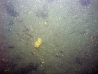
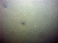
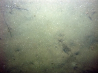
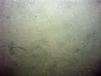
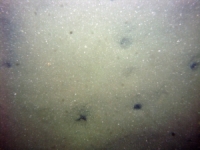
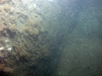
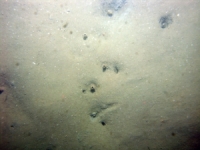
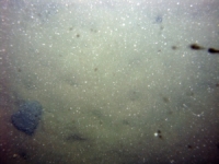
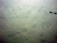
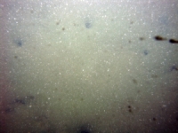
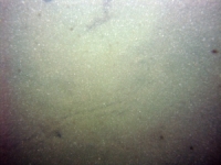
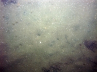
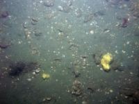
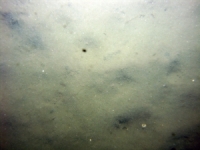
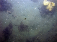
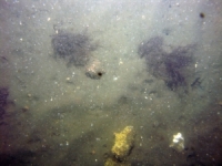
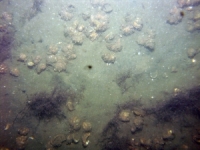
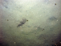
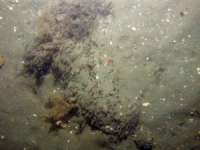
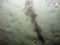
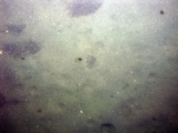
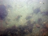
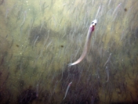
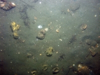
d1_PICT0364.JPG
Station # 001
Lat 41.626543
Long -70.740440
Time (UTC) 12:36:12
    Nearest Sediment Sample Info:
    • Classification = SAND
    • Station Number = 001
    • Distance = 1.3 meters
Image of seabed - photo.
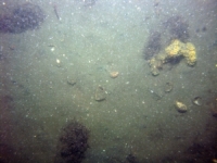
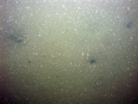
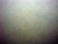
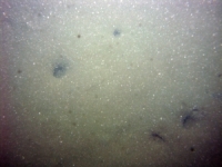
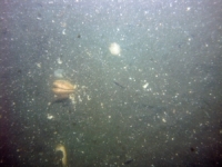
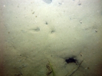
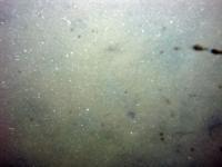
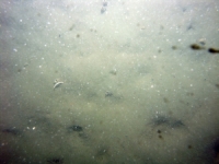
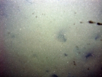
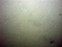
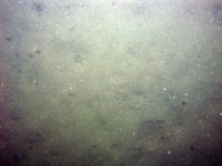
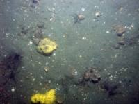
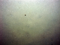
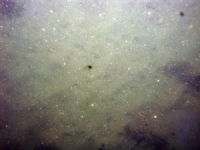
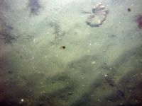
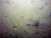
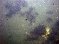
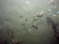
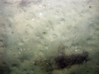
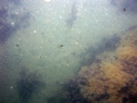
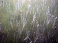
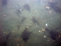
d1_PICT0365.JPG
Station # 001
Lat 41.626530
Long -70.740458
Time (UTC) 12:37:19
    Nearest Sediment Sample Info:
    • Classification = SAND
    • Station Number = 001
    • Distance = 2.7 meters
Image of seabed - photo.
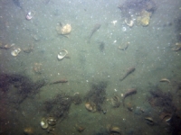
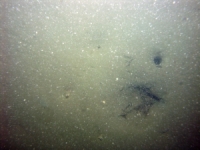
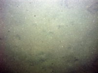
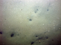
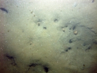
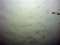
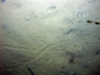
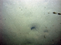
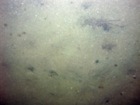
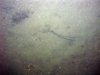
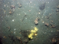
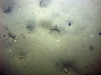
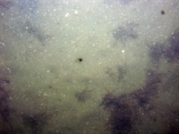
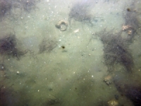
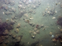
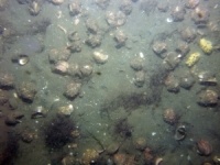
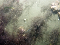
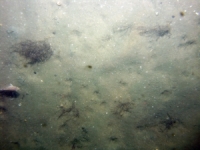
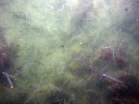
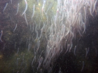
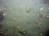
d1_PICT0366.JPG
Station # 001
Lat 41.626528
Long -70.740443
Time (UTC) 12:38:08
    Nearest Sediment Sample Info:
    • Classification = SAND
    • Station Number = 001
    • Distance = 2.8 meters
Image of seabed - photo.
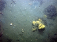
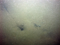
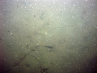
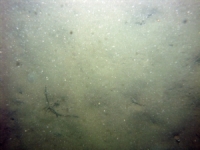
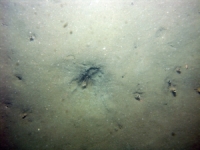
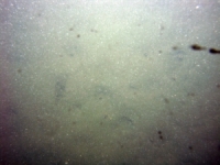
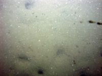
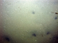
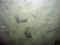
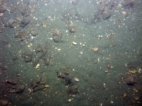
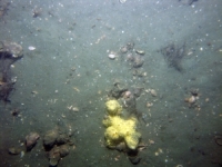
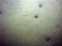
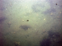
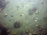
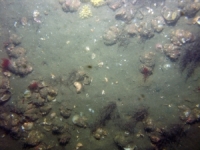
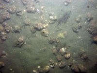
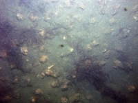
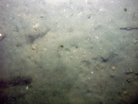
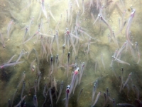
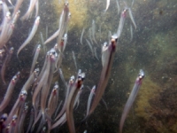
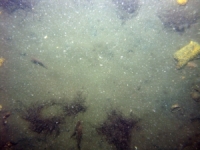
d1_PICT0367.JPG
Station # 002
Lat 41.623527
Long -70.744152
Time (UTC) 12:59:16
    Nearest Sediment Sample Info:
    • Classification = SAND
    • Station Number = 002
    • Distance = 35.9 meters
Image of seabed - photo.
d1_PICT0368.JPG
Station # 002
Lat 41.623515
Long -70.744162
Time (UTC) 12:59:40
    Nearest Sediment Sample Info:
    • Classification = SAND
    • Station Number = 002
    • Distance = 36.1 meters
Image of seabed - photo.
d1_PICT0369.JPG
Station # 002
Lat 41.623503
Long -70.744155
Time (UTC) 13:00:19
    Nearest Sediment Sample Info:
    • Classification = SAND
    • Station Number = 002
    • Distance = 35 meters
Image of seabed - photo.
d1_PICT0370.JPG
Station # 002
Lat 41.623492
Long -70.744160
Time (UTC) 13:00:54
    Nearest Sediment Sample Info:
    • Classification = SAND
    • Station Number = 002
    • Distance = 35 meters
Image of seabed - photo.
d1_PICT0371.JPG
Station # 002
Lat 41.623493
Long -70.744167
Time (UTC) 13:01:51
    Nearest Sediment Sample Info:
    • Classification = SAND
    • Station Number = 002
    • Distance = 35.5 meters
Image of seabed - photo.
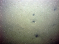
d1_PICT0372.JPG
Station # 003
Lat 41.616398
Long -70.755803
Time (UTC) 13:25:46
    Nearest Sediment Sample Info:
    • Classification = SAND SILT CLAY
    • Station Number = 003
    • Distance = 9.1 meters
Image of seabed - photo.
d1_PICT0373.JPG
Station # 003
Lat 41.616415
Long -70.755783
Time (UTC) 13:26:08
    Nearest Sediment Sample Info:
    • Classification = SAND SILT CLAY
    • Station Number = 003
    • Distance = 7 meters
Image of seabed - photo.
d1_PICT0374.JPG
Station # 003
Lat 41.616443
Long -70.755770
Time (UTC) 13:26:28
    Nearest Sediment Sample Info:
    • Classification = SAND SILT CLAY
    • Station Number = 003
    • Distance = 3.9 meters
Image of seabed - photo.
d1_PICT0375.JPG
Station # 003
Lat 41.616470
Long -70.755772
Time (UTC) 13:26:54
    Nearest Sediment Sample Info:
    • Classification = SAND SILT CLAY
    • Station Number = 003
    • Distance = 1 meters
Image of seabed - photo.
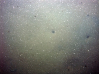
d1_PICT0376.JPG
Station # 004
Lat 41.607652
Long -70.757830
Time (UTC) 13:46:15
    Nearest Sediment Sample Info:
    • Classification = SAND
    • Station Number = 004
    • Distance = 1.7 meters
Image of seabed - photo.
d1_PICT0377.JPG
Station # 004
Lat 41.607660
Long -70.757840
Time (UTC) 13:46:35
    Nearest Sediment Sample Info:
    • Classification = SAND
    • Station Number = 004
    • Distance = 2.3 meters
Image of seabed - photo.
d1_PICT0378.JPG
Station # 004
Lat 41.607665
Long -70.757840
Time (UTC) 13:46:47
    Nearest Sediment Sample Info:
    • Classification = SAND
    • Station Number = 004
    • Distance = 2.3 meters
Image of seabed - photo.
d1_PICT0379.JPG
Station # 004
Lat 41.607668
Long -70.757823
Time (UTC) 13:47:20
    Nearest Sediment Sample Info:
    • Classification = SAND
    • Station Number = 004
    • Distance = 1.2 meters
Image of seabed - photo.
d1_PICT0380.JPG
Station # 004
Lat 41.607665
Long -70.757822
Time (UTC) 13:47:40
    Nearest Sediment Sample Info:
    • Classification = SAND
    • Station Number = 004
    • Distance = 0.9 meters
Image of seabed - photo.
d1_PICT0381.JPG
Station # 005
Lat 41.607833
Long -70.764532
Time (UTC) 14:02:04
    Nearest Sediment Sample Info:
    • Classification = CLAYEY SILT
    • Station Number = 005
    • Distance = 8 meters
Image of seabed - photo.
d1_PICT0382.JPG
Station # 005
Lat 41.607843
Long -70.764535
Time (UTC) 14:02:26
    Nearest Sediment Sample Info:
    • Classification = CLAYEY SILT
    • Station Number = 005
    • Distance = 7.1 meters
Image of seabed - photo.
d1_PICT0383.JPG
Station # 005
Lat 41.607890
Long -70.764513
Time (UTC) 14:03:56
    Nearest Sediment Sample Info:
    • Classification = CLAYEY SILT
    • Station Number = 005
    • Distance = 1.6 meters
Image of seabed - photo.
d1_PICT0384.JPG
Station # 006a
Lat 41.603208
Long -70.769845
Time (UTC) 14:15:33
    Nearest Sediment Sample Info:
    • Classification = SANDY SILT
    • Station Number = 006
    • Distance = 139.5 meters
Image of seabed - photo.
d1_PICT0385.JPG
Station # 006a
Lat 41.603222
Long -70.769855
Time (UTC) 14:16:19
    Nearest Sediment Sample Info:
    • Classification = SANDY SILT
    • Station Number = 006
    • Distance = 141.3 meters
Image of seabed - photo.
d1_PICT0386.JPG
Station # 006a
Lat 41.603287
Long -70.769733
Time (UTC) 14:17:20
    Nearest Sediment Sample Info:
    • Classification = SANDY SILT
    • Station Number = 006
    • Distance = 142.8 meters
Image of seabed - photo.
d1_PICT0387.JPG
Station # 006a
Lat 41.603288
Long -70.769677
Time (UTC) 14:17:54
    Nearest Sediment Sample Info:
    • Classification = SANDY SILT
    • Station Number = 006
    • Distance = 140.9 meters
Image of seabed - photo.
d1_PICT0388.JPG
Station # 006a
Lat 41.603273
Long -70.769668
Time (UTC) 14:18:42
    Nearest Sediment Sample Info:
    • Classification = SANDY SILT
    • Station Number = 006
    • Distance = 139.1 meters
Image of seabed - photo.
d1_PICT0389.JPG
Station # 006a
Lat 41.603275
Long -70.769628
Time (UTC) 14:22:59
    Nearest Sediment Sample Info:
    • Classification = SANDY SILT
    • Station Number = 006
    • Distance = 138 meters
Image of seabed - photo.
d1_PICT0390.JPG
Station # 006a
Lat 41.603203
Long -70.769450
Time (UTC) 14:24:06
    Nearest Sediment Sample Info:
    • Classification = SANDY SILT
    • Station Number = 006
    • Distance = 125.3 meters
Image of seabed - photo.
d1_PICT0391.JPG
Station # 006a
Lat 41.602882
Long -70.769165
Time (UTC) 14:26:10
    Nearest Sediment Sample Info:
    • Classification = SANDY SILT
    • Station Number = 006
    • Distance = 84.8 meters
Image of seabed - photo.
d1_PICT0392.JPG
Station # 006a
Lat 41.602455
Long -70.768980
Time (UTC) 14:28:19
    Nearest Sediment Sample Info:
    • Classification = SANDY SILT
    • Station Number = 006
    • Distance = 36.1 meters
Image of seabed - photo.
d1_PICT0393.JPG
Station # 007a
Lat 41.597182
Long -70.769432
Time (UTC) 14:42:53
    Nearest Sediment Sample Info:
    • Classification = SAND
    • Station Number = 007
    • Distance = 72.7 meters
Image of seabed - photo.
d1_PICT0394.JPG
Station # 007a
Lat 41.597048
Long -70.769425
Time (UTC) 14:43:26
    Nearest Sediment Sample Info:
    • Classification = SAND
    • Station Number = 007
    • Distance = 81.3 meters
Image of seabed - photo.
d1_PICT0395.JPG
Station # 007a
Lat 41.596987
Long -70.769407
Time (UTC) 14:43:42
    Nearest Sediment Sample Info:
    • Classification = SAND
    • Station Number = 007
    • Distance = 85 meters
Image of seabed - photo.
d1_PICT0396.JPG
Station # 007a
Lat 41.596850
Long -70.769330
Time (UTC) 14:44:21
    Nearest Sediment Sample Info:
    • Classification = SAND
    • Station Number = 007
    • Distance = 92.8 meters
Image of seabed - photo.
d1_PICT0397.JPG
Station # 008
Lat 41.590192
Long -70.761145
Time (UTC) 15:14:16
    Nearest Sediment Sample Info:
    • Classification = SAND
    • Station Number = 008
    • Distance = 72 meters
Image of seabed - photo.
d1_PICT0398.JPG
Station # 008
Lat 41.589988
Long -70.761037
Time (UTC) 15:15:36
    Nearest Sediment Sample Info:
    • Classification = SAND
    • Station Number = 008
    • Distance = 49 meters
Image of seabed - photo.
d1_PICT0399.JPG
Station # 009
Lat 41.592317
Long -70.749977
Time (UTC) 15:38:31
    Nearest Sediment Sample Info:
    • Classification = SAND
    • Station Number = 009
    • Distance = 166.4 meters
Image of seabed - photo.
d1_PICT0400.JPG
Station # 009
Lat 41.592247
Long -70.749913
Time (UTC) 15:39:07
    Nearest Sediment Sample Info:
    • Classification = SAND
    • Station Number = 009
    • Distance = 158.2 meters
Image of seabed - photo.
d1_PICT0401.JPG
Station # 009
Lat 41.592128
Long -70.749828
Time (UTC) 15:39:53
    Nearest Sediment Sample Info:
    • Classification = SAND
    • Station Number = 009
    • Distance = 144.6 meters
Image of seabed - photo.
d1_PICT0402.JPG
Station # 009
Lat 41.591980
Long -70.749757
Time (UTC) 15:40:43
    Nearest Sediment Sample Info:
    • Classification = SAND
    • Station Number = 009
    • Distance = 128 meters
Image of seabed - photo.
d1_PICT0403.JPG
Station # 009
Lat 41.591798
Long -70.749685
Time (UTC) 15:41:35
    Nearest Sediment Sample Info:
    • Classification = SAND
    • Station Number = 009
    • Distance = 108 meters
Image of seabed - photo.
d1_PICT0404.JPG
Station # 009
Lat 41.591652
Long -70.749645
Time (UTC) 15:42:18
    Nearest Sediment Sample Info:
    • Classification = SAND
    • Station Number = 009
    • Distance = 92.2 meters
Image of seabed - photo.
d1_PICT0405.JPG
Station # 009
Lat 41.591145
Long -70.749543
Time (UTC) 15:44:47
    Nearest Sediment Sample Info:
    • Classification = SAND
    • Station Number = 009
    • Distance = 39.9 meters
Image of seabed - photo.
d1_PICT0406.JPG
Station # 010
Lat 41.595103
Long -70.743675
Time (UTC) 15:58:57
    Nearest Sediment Sample Info:
    • Classification = SANDY SILT
    • Station Number = 010
    • Distance = 73.8 meters
Image of seabed - photo.
d1_PICT0407.JPG
Station # 010
Lat 41.594878
Long -70.743590
Time (UTC) 16:01:35
    Nearest Sediment Sample Info:
    • Classification = SANDY SILT
    • Station Number = 010
    • Distance = 47.8 meters
Image of seabed - photo.
d1_PICT0408.JPG
Station # 010
Lat 41.594840
Long -70.743577
Time (UTC) 16:01:57
    Nearest Sediment Sample Info:
    • Classification = SANDY SILT
    • Station Number = 010
    • Distance = 43.5 meters
Image of seabed - photo.
d1_PICT0409.JPG
Station # 010
Lat 41.594735
Long -70.743532
Time (UTC) 16:02:50
    Nearest Sediment Sample Info:
    • Classification = SANDY SILT
    • Station Number = 010
    • Distance = 31.2 meters
Image of seabed - photo.
d1_PICT0410.JPG
Station # 010
Lat 41.594712
Long -70.743513
Time (UTC) 16:03:04
    Nearest Sediment Sample Info:
    • Classification = SANDY SILT
    • Station Number = 010
    • Distance = 28.3 meters
Image of seabed - photo.
d1_PICT0411.JPG
Station # 010
Lat 41.594605
Long -70.743472
Time (UTC) 16:03:55
    Nearest Sediment Sample Info:
    • Classification = SANDY SILT
    • Station Number = 010
    • Distance = 15.9 meters
Image of seabed - photo.
d1_PICT0412.JPG
Station # 010
Lat 41.594555
Long -70.743448
Time (UTC) 16:04:20
    Nearest Sediment Sample Info:
    • Classification = SANDY SILT
    • Station Number = 010
    • Distance = 10 meters
Image of seabed - photo.
d1_PICT0413.JPG
Station # 010
Lat 41.594497
Long -70.743420
Time (UTC) 16:04:48
    Nearest Sediment Sample Info:
    • Classification = SANDY SILT
    • Station Number = 010
    • Distance = 3.2 meters
Image of seabed - photo.
d1_PICT0414.JPG
Station # 011
Lat 41.597495
Long -70.738170
Time (UTC) 16:15:09
    Nearest Sediment Sample Info:
    • Classification = SAND
    • Station Number = 011
    • Distance = 125.9 meters
Image of seabed - photo.
d1_PICT0415.JPG
Station # 011
Lat 41.597333
Long -70.738143
Time (UTC) 16:15:59
    Nearest Sediment Sample Info:
    • Classification = SAND
    • Station Number = 011
    • Distance = 107.8 meters
Image of seabed - photo.
d1_PICT0416.JPG
Station # 011
Lat 41.597252
Long -70.738128
Time (UTC) 16:16:26
    Nearest Sediment Sample Info:
    • Classification = SAND
    • Station Number = 011
    • Distance = 98.8 meters
Image of seabed - photo.
d1_PICT0417.JPG
Station # 011
Lat 41.597093
Long -70.738098
Time (UTC) 16:17:11
    Nearest Sediment Sample Info:
    • Classification = SAND
    • Station Number = 011
    • Distance = 81 meters
Image of seabed - photo.
d1_PICT0418.JPG
Station # 011
Lat 41.596862
Long -70.738053
Time (UTC) 16:18:18
    Nearest Sediment Sample Info:
    • Classification = SAND
    • Station Number = 011
    • Distance = 55.2 meters
Image of seabed - photo.
d1_PICT0419.JPG
Station # 012
Lat 41.603185
Long -70.747075
Time (UTC) 16:37:28
    Nearest Sediment Sample Info:
    • Classification = SAND
    • Station Number = 012
    • Distance = 8.5 meters
Image of seabed - photo.
d1_PICT0420.JPG
Station # 012
Lat 41.603227
Long -70.747035
Time (UTC) 16:38:23
    Nearest Sediment Sample Info:
    • Classification = SAND
    • Station Number = 012
    • Distance = 2.9 meters
Image of seabed - photo.
d1_PICT0421.JPG
Station # 013
Lat 41.603188
Long -70.747010
Time (UTC) 16:46:26
    Nearest Sediment Sample Info:
    • Classification = SAND
    • Station Number = 012
    • Distance = 6 meters
Image of seabed - photo.
d1_PICT0422.JPG
Station # 013
Lat 41.603202
Long -70.747018
Time (UTC) 16:48:30
    Nearest Sediment Sample Info:
    • Classification = SAND
    • Station Number = 012
    • Distance = 4.5 meters
Image of seabed - photo.
d1_PICT0423.JPG
Station # 013
Lat 41.603395
Long -70.746842
Time (UTC) 16:50:23
    Nearest Sediment Sample Info:
    • Classification = SAND
    • Station Number = 012
    • Distance = 21.9 meters
Image of seabed - photo.
d1_PICT0424.JPG
Station # 013
Lat 41.603747
Long -70.746180
Time (UTC) 16:53:06
    Nearest Sediment Sample Info:
    • Classification = SAND
    • Station Number = 012
    • Distance = 88.9 meters
Image of seabed - photo.
d1_PICT0425.JPG
Station # 013
Lat 41.603858
Long -70.745935
Time (UTC) 16:54:02
    Nearest Sediment Sample Info:
    • Classification = CLAYEY SILT
    • Station Number = 013
    • Distance = 84.7 meters
Image of seabed - photo.
d1_PICT0426.JPG
Station # 013
Lat 41.603915
Long -70.745797
Time (UTC) 16:54:40
    Nearest Sediment Sample Info:
    • Classification = CLAYEY SILT
    • Station Number = 013
    • Distance = 71.6 meters
Image of seabed - photo.
d1_PICT0427.JPG
Station # 013
Lat 41.603960
Long -70.745655
Time (UTC) 16:55:16
    Nearest Sediment Sample Info:
    • Classification = CLAYEY SILT
    • Station Number = 013
    • Distance = 59 meters
Image of seabed - photo.
d1_PICT0428.JPG
Station # 013
Lat 41.604037
Long -70.745518
Time (UTC) 16:55:56
    Nearest Sediment Sample Info:
    • Classification = CLAYEY SILT
    • Station Number = 013
    • Distance = 44.7 meters
Image of seabed - photo.
d1_PICT0429.JPG
Station # 013
Lat 41.604102
Long -70.745402
Time (UTC) 16:56:33
    Nearest Sediment Sample Info:
    • Classification = CLAYEY SILT
    • Station Number = 013
    • Distance = 32.7 meters
Image of seabed - photo.
d1_PICT0430.JPG
Station # 013
Lat 41.604193
Long -70.745243
Time (UTC) 16:57:22
    Nearest Sediment Sample Info:
    • Classification = CLAYEY SILT
    • Station Number = 013
    • Distance = 16 meters
Image of seabed - photo.
d1_PICT0431.JPG
Station # 013
Lat 41.604273
Long -70.745082
Time (UTC) 16:58:23
    Nearest Sediment Sample Info:
    • Classification = CLAYEY SILT
    • Station Number = 013
    • Distance = 0.1 meters
Image of seabed - photo.
d1_PICT0432.JPG
Station # 014
Lat 41.604757
Long -70.742832
Time (UTC) 17:09:42
    Nearest Sediment Sample Info:
    • Classification = CLAYEY SILT
    • Station Number = 014
    • Distance = 54.8 meters
Image of seabed - photo.
d1_PICT0433.JPG
Station # 014
Lat 41.604295
Long -70.742753
Time (UTC) 17:11:43
    Nearest Sediment Sample Info:
    • Classification = CLAYEY SILT
    • Station Number = 014
    • Distance = 3.1 meters
Image of seabed - photo.
d1_PICT0434.JPG
Station # 015
Lat 41.607580
Long -70.740560
Time (UTC) 17:23:22
    Nearest Sediment Sample Info:
    • Classification = CLAYEY SILT
    • Station Number = 015
    • Distance = 16.3 meters
Image of seabed - photo.
d1_PICT0435.JPG
Station # 015
Lat 41.607588
Long -70.740467
Time (UTC) 17:24:22
    Nearest Sediment Sample Info:
    • Classification = CLAYEY SILT
    • Station Number = 015
    • Distance = 10 meters
Image of seabed - photo.
d1_PICT0436.JPG
Station # 015
Lat 41.607538
Long -70.740388
Time (UTC) 17:25:16
    Nearest Sediment Sample Info:
    • Classification = CLAYEY SILT
    • Station Number = 015
    • Distance = 1.4 meters
Image of seabed - photo.
d1_PICT0437.JPG
Station # 016
Lat 41.609138
Long -70.736223
Time (UTC) 17:34:28
    Nearest Sediment Sample Info:
    • Classification = SANDY SILT
    • Station Number = 016
    • Distance = 4.2 meters
Image of seabed - photo.
d1_PICT0438.JPG
Station # 016
Lat 41.609125
Long -70.736233
Time (UTC) 17:34:57
    Nearest Sediment Sample Info:
    • Classification = SANDY SILT
    • Station Number = 016
    • Distance = 3.8 meters
Image of seabed - photo.
d1_PICT0439.JPG
Station # 016
Lat 41.609145
Long -70.736290
Time (UTC) 17:36:49
    Nearest Sediment Sample Info:
    • Classification = SANDY SILT
    • Station Number = 016
    • Distance = 1.5 meters
Image of seabed - photo.
d1_PICT0440.JPG
Station # 017
Lat 41.611868
Long -70.731760
Time (UTC) 17:56:51
    Nearest Sediment Sample Info:
    • Classification = SAND
    • Station Number = 017
    • Distance = 89.4 meters
Image of seabed - photo.
d1_PICT0441.JPG
Station # 017
Lat 41.611732
Long -70.731573
Time (UTC) 17:58:08
    Nearest Sediment Sample Info:
    • Classification = SAND
    • Station Number = 017
    • Distance = 67.7 meters
Image of seabed - photo.
d1_PICT0442.JPG
Station # 017
Lat 41.611645
Long -70.731472
Time (UTC) 17:58:51
    Nearest Sediment Sample Info:
    • Classification = SAND
    • Station Number = 017
    • Distance = 54.9 meters
Image of seabed - photo.
d1_PICT0443.JPG
Station # 017
Lat 41.611505
Long -70.731307
Time (UTC) 17:59:56
    Nearest Sediment Sample Info:
    • Classification = SAND
    • Station Number = 017
    • Distance = 34.1 meters
Image of seabed - photo.
d1_PICT0444.JPG
Station # 017
Lat 41.611437
Long -70.731223
Time (UTC) 18:00:32
    Nearest Sediment Sample Info:
    • Classification = SAND
    • Station Number = 017
    • Distance = 23.8 meters
Image of seabed - photo.
d1_PICT0445.JPG
Station # 018
Lat 41.606827
Long -70.728960
Time (UTC) 18:14:34
    Nearest Sediment Sample Info:
    • Classification = SAND
    • Station Number = 018
    • Distance = 63.3 meters
Image of seabed - photo.
d1_PICT0446.JPG
Station # 018
Lat 41.606735
Long -70.728820
Time (UTC) 18:15:21
    Nearest Sediment Sample Info:
    • Classification = SAND
    • Station Number = 018
    • Distance = 47.8 meters
Image of seabed - photo.
d1_PICT0447.JPG
Station # 018
Lat 41.606695
Long -70.728752
Time (UTC) 18:15:45
    Nearest Sediment Sample Info:
    • Classification = SAND
    • Station Number = 018
    • Distance = 40.6 meters
Image of seabed - photo.
d1_PICT0448.JPG
Station # 018
Lat 41.606637
Long -70.728633
Time (UTC) 18:16:27
    Nearest Sediment Sample Info:
    • Classification = SAND
    • Station Number = 018
    • Distance = 28.9 meters
Image of seabed - photo.
d1_PICT0449.JPG
Station # 018
Lat 41.606522
Long -70.728450
Time (UTC) 18:17:36
    Nearest Sediment Sample Info:
    • Classification = SAND
    • Station Number = 018
    • Distance = 9 meters
Image of seabed - photo.
d1_PICT0450.JPG
Station # 018
Lat 41.606493
Long -70.728405
Time (UTC) 18:17:52
    Nearest Sediment Sample Info:
    • Classification = SAND
    • Station Number = 018
    • Distance = 4 meters
Image of seabed - photo.
d1_PICT0451.JPG
Station # 019
Lat 41.609263
Long -70.719777
Time (UTC) 18:31:14
    Nearest Sediment Sample Info:
    • Classification = SAND
    • Station Number = 019
    • Distance = 50.2 meters
Image of seabed - photo.
d1_PICT0452.JPG
Station # 019
Lat 41.609263
Long -70.719700
Time (UTC) 18:31:33
    Nearest Sediment Sample Info:
    • Classification = SAND
    • Station Number = 019
    • Distance = 43.9 meters
Image of seabed - photo.
d1_PICT0453.JPG
Station # 019
Lat 41.609333
Long -70.719293
Time (UTC) 18:33:16
    Nearest Sediment Sample Info:
    • Classification = SAND
    • Station Number = 019
    • Distance = 9.3 meters
Image of seabed - photo.
d1_PICT0454.JPG
Station # 020
Lat 41.612970
Long -70.709337
Time (UTC) 18:51:10
    Nearest Sediment Sample Info:
    • Classification = SANDY SILT
    • Station Number = 020
    • Distance = 46.7 meters
Image of seabed - photo.
d1_PICT0455.JPG
Station # 020
Lat 41.612862
Long -70.709185
Time (UTC) 18:51:57
    Nearest Sediment Sample Info:
    • Classification = SANDY SILT
    • Station Number = 020
    • Distance = 29.3 meters
Image of seabed - photo.
d1_PICT0456.JPG
Station # 020
Lat 41.612795
Long -70.709088
Time (UTC) 18:52:27
    Nearest Sediment Sample Info:
    • Classification = SANDY SILT
    • Station Number = 020
    • Distance = 18.3 meters
Image of seabed - photo.
d1_PICT0457.JPG
Station # 020
Lat 41.612710
Long -70.708958
Time (UTC) 18:53:06
    Nearest Sediment Sample Info:
    • Classification = SANDY SILT
    • Station Number = 020
    • Distance = 3.9 meters
Image of seabed - photo.
d1_PICT0458.JPG
Station # 021
Lat 41.618482
Long -70.714342
Time (UTC) 19:06:31
    Nearest Sediment Sample Info:
    • Classification = SAND
    • Station Number = 021
    • Distance = 55.3 meters
Image of seabed - photo.
d1_PICT0459.JPG
Station # 021
Lat 41.618460
Long -70.714112
Time (UTC) 19:07:27
    Nearest Sediment Sample Info:
    • Classification = SAND
    • Station Number = 021
    • Distance = 36.4 meters
Image of seabed - photo.
d1_PICT0460.JPG
Station # 021
Lat 41.618390
Long -70.713850
Time (UTC) 19:08:27
    Nearest Sediment Sample Info:
    • Classification = SAND
    • Station Number = 021
    • Distance = 13.2 meters
Image of seabed - photo.
d1_PICT0461.JPG
Station # 022
Lat 41.627502
Long -70.722948
Time (UTC) 19:23:40
    Nearest Sediment Sample Info:
    • Classification = CLAYEY SILT
    • Station Number = 022
    • Distance = 87.1 meters
Image of seabed - photo.
d1_PICT0462.JPG
Station # 022
Lat 41.627467
Long -70.722610
Time (UTC) 19:24:53
    Nearest Sediment Sample Info:
    • Classification = CLAYEY SILT
    • Station Number = 022
    • Distance = 61.1 meters
Image of seabed - photo.
d1_PICT0463.JPG
Station # 022
Lat 41.627417
Long -70.722493
Time (UTC) 19:25:21
    Nearest Sediment Sample Info:
    • Classification = CLAYEY SILT
    • Station Number = 022
    • Distance = 50 meters
Image of seabed - photo.
d1_PICT0464.JPG
Station # 022
Lat 41.627285
Long -70.722258
Time (UTC) 19:26:25
    Nearest Sediment Sample Info:
    • Classification = CLAYEY SILT
    • Station Number = 022
    • Distance = 25.6 meters
Image of seabed - photo.
d1_PICT0465.JPG
Station # 022
Lat 41.627152
Long -70.722042
Time (UTC) 19:27:29
    Nearest Sediment Sample Info:
    • Classification = CLAYEY SILT
    • Station Number = 022
    • Distance = 2.3 meters
Image of seabed - photo.
d1_PICT0466.JPG
Station # 023
Lat 41.622603
Long -70.699492
Time (UTC) 19:45:06
    Nearest Sediment Sample Info:
    • Classification = SILTY SAND
    • Station Number = 023
    • Distance = 36.8 meters
Image of seabed - photo.
d1_PICT0467.JPG
Station # 023
Lat 41.622642
Long -70.699218
Time (UTC) 19:46:05
    Nearest Sediment Sample Info:
    • Classification = SILTY SAND
    • Station Number = 023
    • Distance = 34.5 meters
Image of seabed - photo.
d1_PICT0468.JPG
Station # 023
Lat 41.622605
Long -70.699152
Time (UTC) 19:46:53
    Nearest Sediment Sample Info:
    • Classification = SILTY SAND
    • Station Number = 023
    • Distance = 31.2 meters
Image of seabed - photo.
d1_PICT0469.JPG
Station # 023
Lat 41.622488
Long -70.699193
Time (UTC) 19:47:39
    Nearest Sediment Sample Info:
    • Classification = SILTY SAND
    • Station Number = 023
    • Distance = 17.7 meters
Image of seabed - photo.
d1_PICT0470.JPG
Station # 023
Lat 41.622378
Long -70.699218
Time (UTC) 19:48:12
    Nearest Sediment Sample Info:
    • Classification = SILTY SAND
    • Station Number = 023
    • Distance = 5.4 meters
Image of seabed - photo.
d1_PICT0471.JPG
Station # 024
Lat 41.631358
Long -70.681655
Time (UTC) 20:06:47
    Nearest Sediment Sample Info:
    • Classification = SILTY SAND
    • Station Number = 024
    • Distance = 167.1 meters
Image of seabed - photo.
d1_PICT0472.JPG
Station # 024
Lat 41.631243
Long -70.681448
Time (UTC) 20:07:45
    Nearest Sediment Sample Info:
    • Classification = SILTY SAND
    • Station Number = 024
    • Distance = 145.8 meters
Image of seabed - photo.
d1_PICT0473.JPG
Station # 024
Lat 41.631125
Long -70.681198
Time (UTC) 20:08:50
    Nearest Sediment Sample Info:
    • Classification = SILTY SAND
    • Station Number = 024
    • Distance = 121.3 meters
Image of seabed - photo.
d1_PICT0474.JPG
Station # 024
Lat 41.631027
Long -70.680987
Time (UTC) 20:09:42
    Nearest Sediment Sample Info:
    • Classification = SILTY SAND
    • Station Number = 024
    • Distance = 100.8 meters
Image of seabed - photo.
d1_PICT0475.JPG
Station # 025
Lat 41.633548
Long -70.689370
Time (UTC) 20:26:45
    Nearest Sediment Sample Info:
    • Classification = SAND
    • Station Number = 025
    • Distance = 120.2 meters
Image of seabed - photo.
d1_PICT0476.JPG
Station # 025
Lat 41.633490
Long -70.689112
Time (UTC) 20:27:43
    Nearest Sediment Sample Info:
    • Classification = SAND
    • Station Number = 025
    • Distance = 97.8 meters
Image of seabed - photo.
d1_PICT0477.JPG
Station # 025
Lat 41.633413
Long -70.688875
Time (UTC) 20:28:36
    Nearest Sediment Sample Info:
    • Classification = SAND
    • Station Number = 025
    • Distance = 76.3 meters
Image of seabed - photo.
d1_PICT0478.JPG
Station # 025
Lat 41.633397
Long -70.688815
Time (UTC) 20:28:50
    Nearest Sediment Sample Info:
    • Classification = SAND
    • Station Number = 025
    • Distance = 71 meters
Image of seabed - photo.
d1_PICT0479.JPG
Station # 025
Lat 41.633340
Long -70.688708
Time (UTC) 20:29:12
    Nearest Sediment Sample Info:
    • Classification = SAND
    • Station Number = 025
    • Distance = 60.4 meters
Image of seabed - photo.
d1_PICT0480.JPG
Station # 025
Lat 41.633307
Long -70.688603
Time (UTC) 20:29:38
    Nearest Sediment Sample Info:
    • Classification = SAND
    • Station Number = 025
    • Distance = 51 meters
Image of seabed - photo.
d1_PICT0481.JPG
Station # 025
Lat 41.633268
Long -70.688377
Time (UTC) 20:30:37
    Nearest Sediment Sample Info:
    • Classification = SAND
    • Station Number = 025
    • Distance = 31.8 meters
Image of seabed - photo.
d1_PICT0482.JPG
Station # 025
Lat 41.633238
Long -70.688278
Time (UTC) 20:31:00
    Nearest Sediment Sample Info:
    • Classification = SAND
    • Station Number = 025
    • Distance = 22.9 meters
Image of seabed - photo.
d1_PICT0483.JPG
Station # 025
Lat 41.633168
Long -70.688085
Time (UTC) 20:31:46
    Nearest Sediment Sample Info:
    • Classification = SAND
    • Station Number = 025
    • Distance = 5.1 meters
Image of seabed - photo.
d1_PICT0484.JPG
Station # 026
Lat 41.649575
Long -70.687113
Time (UTC) 20:48:59
    Nearest Sediment Sample Info:
    • Classification = SILTY SAND
    • Station Number = 026
    • Distance = 85.5 meters
Image of seabed - photo.
d1_PICT0485.JPG
Station # 026
Lat 41.649502
Long -70.686912
Time (UTC) 20:49:50
    Nearest Sediment Sample Info:
    • Classification = SILTY SAND
    • Station Number = 026
    • Distance = 66.9 meters
Image of seabed - photo.
d1_PICT0486.JPG
Station # 026
Lat 41.649363
Long -70.686512
Time (UTC) 20:51:18
    Nearest Sediment Sample Info:
    • Classification = SILTY SAND
    • Station Number = 026
    • Distance = 30.3 meters
Image of seabed - photo.
d1_PICT0487.JPG
Station # 026
Lat 41.649322
Long -70.686335
Time (UTC) 20:51:55
    Nearest Sediment Sample Info:
    • Classification = SILTY SAND
    • Station Number = 026
    • Distance = 14.9 meters
Image of seabed - photo.
d1_PICT0488.JPG
Station # 027
Lat 41.649558
Long -70.668693
Time (UTC) 21:05:36
    Nearest Sediment Sample Info:
    • Classification = SAND
    • Station Number = 027
    • Distance = 105.3 meters
Image of seabed - photo.
d1_PICT0489.JPG
Station # 027
Lat 41.649532
Long -70.668420
Time (UTC) 21:06:28
    Nearest Sediment Sample Info:
    • Classification = SAND
    • Station Number = 027
    • Distance = 82.4 meters
Image of seabed - photo.
d1_PICT0490.JPG
Station # 027
Lat 41.649510
Long -70.668175
Time (UTC) 21:07:14
    Nearest Sediment Sample Info:
    • Classification = SAND
    • Station Number = 027
    • Distance = 61.9 meters
Image of seabed - photo.
d1_PICT0491.JPG
Station # 027
Lat 41.649493
Long -70.667987
Time (UTC) 21:07:49
    Nearest Sediment Sample Info:
    • Classification = SAND
    • Station Number = 027
    • Distance = 46.1 meters
Image of seabed - photo.
d1_PICT0492.JPG
Station # 027
Lat 41.649475
Long -70.667773
Time (UTC) 21:08:27
    Nearest Sediment Sample Info:
    • Classification = SAND
    • Station Number = 027
    • Distance = 28.2 meters
Image of seabed - photo.
d1_PICT0493.JPG
Station # 028
Lat 41.644977
Long -70.667612
Time (UTC) 21:19:55
    Nearest Sediment Sample Info:
    • Classification = SAND
    • Station Number = 028
    • Distance = 104 meters
Image of seabed - photo.
d1_PICT0494.JPG
Station # 028
Lat 41.644977
Long -70.667530
Time (UTC) 21:20:09
    Nearest Sediment Sample Info:
    • Classification = SAND
    • Station Number = 028
    • Distance = 97.3 meters
Image of seabed - photo.
d1_PICT0495.JPG
Station # 028
Lat 41.645002
Long -70.667257
Time (UTC) 21:21:00
    Nearest Sediment Sample Info:
    • Classification = SAND
    • Station Number = 028
    • Distance = 74.5 meters
Image of seabed - photo.
d1_PICT0496.JPG
Station # 028
Lat 41.645015
Long -70.667170
Time (UTC) 21:21:18
    Nearest Sediment Sample Info:
    • Classification = SAND
    • Station Number = 028
    • Distance = 67.1 meters
Image of seabed - photo.
d1_PICT0497.JPG
Station # 028
Lat 41.645047
Long -70.666957
Time (UTC) 21:22:01
    Nearest Sediment Sample Info:
    • Classification = SAND
    • Station Number = 028
    • Distance = 49 meters
Image of seabed - photo.
d1_PICT0498.JPG
Station # 028
Lat 41.645120
Long -70.666450
Time (UTC) 21:24:00
    Nearest Sediment Sample Info:
    • Classification = SAND
    • Station Number = 028
    • Distance = 6.1 meters
Image of seabed - photo.
d1_PICT0499.JPG
Station # 029
Lat 41.640853
Long -70.667595
Time (UTC) 21:36:40
    Nearest Sediment Sample Info:
    • Classification = SILTY SAND
    • Station Number = 029
    • Distance = 7 meters
Image of seabed - photo.
d1_PICT0500.JPG
Station # 029
Lat 41.640858
Long -70.667570
Time (UTC) 21:37:20
    Nearest Sediment Sample Info:
    • Classification = SILTY SAND
    • Station Number = 029
    • Distance = 4.8 meters
Image of seabed - photo.
d1_PICT0501.JPG
Station # 029
Lat 41.640855
Long -70.667563
Time (UTC) 21:37:31
    Nearest Sediment Sample Info:
    • Classification = SILTY SAND
    • Station Number = 029
    • Distance = 4.3 meters
Image of seabed - photo.
d1_PICT0502.JPG
Station # 029
Lat 41.640855
Long -70.667535
Time (UTC) 21:37:55
    Nearest Sediment Sample Info:
    • Classification = SILTY SAND
    • Station Number = 029
    • Distance = 2 meters
Image of seabed - photo.
d1_PICT0503.JPG
Station # 030
Lat 41.640893
Long -70.667500
Time (UTC) 21:45:34
    Nearest Sediment Sample Info:
    • Classification = SILTY SAND
    • Station Number = 029
    • Distance = 3.8 meters
Image of seabed - photo.
d1_PICT0504.JPG
Station # 030
Lat 41.640810
Long -70.667577
Time (UTC) 21:47:26
    Nearest Sediment Sample Info:
    • Classification = SILTY SAND
    • Station Number = 029
    • Distance = 7.8 meters
Image of seabed - photo.
d1_PICT0505.JPG
Station # 030
Lat 41.640727
Long -70.667692
Time (UTC) 21:47:59
    Nearest Sediment Sample Info:
    • Classification = SILTY SAND
    • Station Number = 029
    • Distance = 21 meters
Image of seabed - photo.
d1_PICT0506.JPG
Station # 030
Lat 41.640633
Long -70.667792
Time (UTC) 21:48:36
    Nearest Sediment Sample Info:
    • Classification = SILTY SAND
    • Station Number = 029
    • Distance = 34.3 meters
Image of seabed - photo.
d1_PICT0507.JPG
Station # 030
Lat 41.640492
Long -70.667915
Time (UTC) 21:49:17
    Nearest Sediment Sample Info:
    • Classification = SILTY SAND
    • Station Number = 029
    • Distance = 52.9 meters
Image of seabed - photo.
d1_PICT0508.JPG
Station # 030
Lat 41.640358
Long -70.668028
Time (UTC) 21:49:56
    Nearest Sediment Sample Info:
    • Classification = SILTY SAND
    • Station Number = 029
    • Distance = 70.4 meters
Image of seabed - photo.
d1_PICT0509.JPG
Station # 030
Lat 41.640070
Long -70.668182
Time (UTC) 21:51:20
    Nearest Sediment Sample Info:
    • Classification = SILTY SAND
    • Station Number = 029
    • Distance = 104 meters
Image of seabed - photo.
d1_PICT0510.JPG
Station # 030
Lat 41.639813
Long -70.668342
Time (UTC) 21:52:36
    Nearest Sediment Sample Info:
    • Classification = SAND
    • Station Number = 030
    • Distance = 74 meters
Image of seabed - photo.
d1_PICT0511.JPG
Station # 030
Lat 41.639725
Long -70.668388
Time (UTC) 21:53:01
    Nearest Sediment Sample Info:
    • Classification = SAND
    • Station Number = 030
    • Distance = 63.6 meters
Image of seabed - photo.
d1_PICT0512.JPG
Station # 030
Lat 41.639550
Long -70.668562
Time (UTC) 21:53:53
    Nearest Sediment Sample Info:
    • Classification = SAND
    • Station Number = 030
    • Distance = 39.8 meters
Image of seabed - photo.
d1_PICT0513.JPG
Station # 030
Lat 41.639462
Long -70.668615
Time (UTC) 21:54:21
    Nearest Sediment Sample Info:
    • Classification = SAND
    • Station Number = 030
    • Distance = 29.1 meters
Image of seabed - photo.
d1_PICT0514.JPG
Station # 030
Lat 41.639245
Long -70.668750
Time (UTC) 21:55:33
    Nearest Sediment Sample Info:
    • Classification = SAND
    • Station Number = 030
    • Distance = 2.8 meters
Image of seabed - photo.
d1_PICT0515.JPG
Station # 030
Lat 41.639205
Long -70.668773
Time (UTC) 21:56:05
    Nearest Sediment Sample Info:
    • Classification = SAND
    • Station Number = 030
    • Distance = 2.7 meters
Image of seabed - photo.
d1_PICT0516.JPG
Station # 031
Lat 41.615693
Long -70.689950
Time (UTC) 22:53:49
    Nearest Sediment Sample Info:
    • Classification = SAND
    • Station Number = 031
    • Distance = 98.5 meters
Image of seabed - photo.
d1_PICT0517.JPG
Station # 031
Lat 41.615730
Long -70.689718
Time (UTC) 22:54:31
    Nearest Sediment Sample Info:
    • Classification = SAND
    • Station Number = 031
    • Distance = 78.9 meters
Image of seabed - photo.
d1_PICT0518.JPG
Station # 031
Lat 41.615745
Long -70.689383
Time (UTC) 22:55:38
    Nearest Sediment Sample Info:
    • Classification = SAND
    • Station Number = 031
    • Distance = 51 meters
Image of seabed - photo.
d1_PICT0519.JPG
Station # 031
Lat 41.615755
Long -70.689062
Time (UTC) 22:56:39
    Nearest Sediment Sample Info:
    • Classification = SAND
    • Station Number = 031
    • Distance = 24.2 meters
Image of seabed - photo.
d1_PICT0520.JPG
Station # 031
Lat 41.615755
Long -70.688932
Time (UTC) 22:57:03
    Nearest Sediment Sample Info:
    • Classification = SAND
    • Station Number = 031
    • Distance = 13.4 meters
Image of seabed - photo.
d1_PICT0521.JPG
Station # 032
Lat 41.612212
Long -70.687802
Time (UTC) 23:10:55
    Nearest Sediment Sample Info:
    • Classification = SAND
    • Station Number = 032
    • Distance = 120.6 meters
Image of seabed - photo.
d1_PICT0522.JPG
Station # 032
Lat 41.612282
Long -70.687593
Time (UTC) 23:11:30
    Nearest Sediment Sample Info:
    • Classification = SAND
    • Station Number = 032
    • Distance = 102.4 meters
Image of seabed - photo.
d1_PICT0523.JPG
Station # 032
Lat 41.612327
Long -70.687128
Time (UTC) 23:12:58
    Nearest Sediment Sample Info:
    • Classification = SAND
    • Station Number = 032
    • Distance = 63.3 meters
Image of seabed - photo.
d1_PICT0524.JPG
Station # 032
Lat 41.612333
Long -70.686960
Time (UTC) 23:13:30
    Nearest Sediment Sample Info:
    • Classification = SAND
    • Station Number = 032
    • Distance = 49.3 meters
Image of seabed - photo.
d1_PICT0525.JPG
Station # 032
Lat 41.612345
Long -70.686687
Time (UTC) 23:14:21
    Nearest Sediment Sample Info:
    • Classification = SAND
    • Station Number = 032
    • Distance = 26.5 meters
Image of seabed - photo.
d1_PICT0526.JPG
Station # 032
Lat 41.612353
Long -70.686520
Time (UTC) 23:14:54
    Nearest Sediment Sample Info:
    • Classification = SAND
    • Station Number = 032
    • Distance = 12.6 meters
Image of seabed - photo.
d1_PICT0527.JPG
Station # 033
Lat 41.604288
Long -70.691725
Time (UTC) 23:40:40
    Nearest Sediment Sample Info:
    • Classification = SAND
    • Station Number = 033
    • Distance = 145.9 meters
Image of seabed - photo.
d1_PICT0528.JPG
Station # 033
Lat 41.604253
Long -70.691552
Time (UTC) 23:41:11
    Nearest Sediment Sample Info:
    • Classification = SAND
    • Station Number = 033
    • Distance = 131 meters
Image of seabed - photo.
d1_PICT0529.JPG
Station # 033
Lat 41.604200
Long -70.691232
Time (UTC) 23:42:05
    Nearest Sediment Sample Info:
    • Classification = SAND
    • Station Number = 033
    • Distance = 103.8 meters
Image of seabed - photo.
d1_PICT0530.JPG
Station # 033
Lat 41.604162
Long -70.690973
Time (UTC) 23:42:50
    Nearest Sediment Sample Info:
    • Classification = SAND
    • Station Number = 033
    • Distance = 81.9 meters
Image of seabed - photo.
d1_PICT0531.JPG
Station # 033
Lat 41.604153
Long -70.690898
Time (UTC) 23:43:03
    Nearest Sediment Sample Info:
    • Classification = SAND
    • Station Number = 033
    • Distance = 75.6 meters
Image of seabed - photo.
d1_PICT0532.JPG
Station # 033
Lat 41.604143
Long -70.690810
Time (UTC) 23:43:19
    Nearest Sediment Sample Info:
    • Classification = SAND
    • Station Number = 033
    • Distance = 68.2 meters
Image of seabed - photo.
d1_PICT0533.JPG
Station # 033
Lat 41.604133
Long -70.690693
Time (UTC) 23:43:40
    Nearest Sediment Sample Info:
    • Classification = SAND
    • Station Number = 033
    • Distance = 58.4 meters
Image of seabed - photo.
d1_PICT0534.JPG
Station # 033
Lat 41.604127
Long -70.690628
Time (UTC) 23:43:52
    Nearest Sediment Sample Info:
    • Classification = SAND
    • Station Number = 033
    • Distance = 52.9 meters
Image of seabed - photo.
d1_PICT0535.JPG
Station # 033
Lat 41.604120
Long -70.690498
Time (UTC) 23:44:14
    Nearest Sediment Sample Info:
    • Classification = SAND
    • Station Number = 033
    • Distance = 42.1 meters
Image of seabed - photo.
d1_PICT0536.JPG
Station # 033
Lat 41.604108
Long -70.690173
Time (UTC) 23:45:10
    Nearest Sediment Sample Info:
    • Classification = SAND
    • Station Number = 033
    • Distance = 15 meters
Image of seabed - photo.
d1_PICT0537.JPG
Station # 033
Lat 41.604098
Long -70.690067
Time (UTC) 23:45:29
    Nearest Sediment Sample Info:
    • Classification = SAND
    • Station Number = 033
    • Distance = 6.1 meters


  Go to the next page of photos
   
return to the Main Photo Index Page  

Accessibility FOIA Privacy Policies and Notices

Take Pride in America logo USA.gov logo U.S. Department of the Interior | U.S. Geological Survey
URL: http://pubsdata.usgs.gov/pubs/of/2014/1221/html/botphoto_gallery/ofr2014-1221-index_sept9.html
Page Contact Information: GS Pubs Web Contact
Page Last Modified: Wednesday, 07-Dec-2016 20:03:01 EST