Skip past header information
USGS - science for a changing world

Open-File Report 2014-1221


Geological Sampling Data and Benthic Biota Classification: Buzzards Bay and Vineyard Sound, Massachusetts


Bottom Photograph Gallery - September 10, 2010 - 00:00 to 12:00 UTC


return to the Main Photo Index Page  
   
Go to the previous page of photos Go to the next page of photos

Image of seabed - photo.
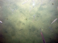
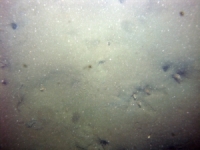
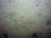
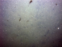
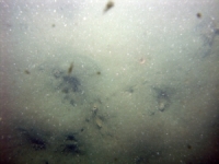
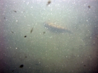
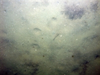
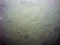
d1_PICT0538.JPG
Station # 034
Lat 41.596413
Long -70.671205
Time (UTC) 00:02:49
    Nearest Sediment Sample Info:
    • Classification = CLAYEY SILT
    • Station Number = 034
    • Distance = 114.8 meters
Image of seabed - photo.
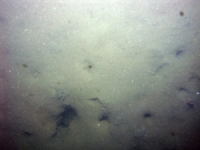
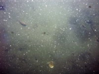
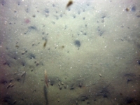
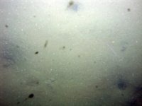
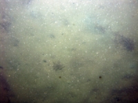
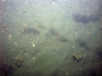
d1_PICT0539.JPG
Station # 034
Lat 41.596350
Long -70.670860
Time (UTC) 00:03:43
    Nearest Sediment Sample Info:
    • Classification = CLAYEY SILT
    • Station Number = 034
    • Distance = 85.3 meters
Image of seabed - photo.
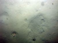
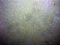
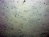
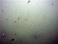
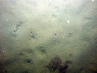
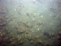
d1_PICT0540.JPG
Station # 034
Lat 41.596273
Long -70.670523
Time (UTC) 00:04:35
    Nearest Sediment Sample Info:
    • Classification = CLAYEY SILT
    • Station Number = 034
    • Distance = 55.9 meters
Image of seabed - photo.
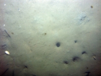
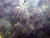
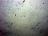
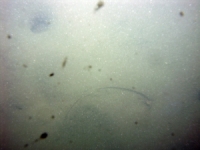
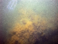
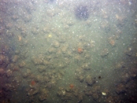
d1_PICT0541.JPG
Station # 034
Lat 41.596148
Long -70.669988
Time (UTC) 00:05:54
    Nearest Sediment Sample Info:
    • Classification = CLAYEY SILT
    • Station Number = 034
    • Distance = 9.2 meters
Image of seabed - photo.
d1_PICT0542.JPG
Station # 035
Lat 41.589757
Long -70.682845
Time (UTC) 00:25:51
    Nearest Sediment Sample Info:
    • Classification = SAND
    • Station Number = 035
    • Distance = 3.4 meters
Image of seabed - photo.
d1_PICT0543.JPG
Station # 035
Lat 41.589748
Long -70.682843
Time (UTC) 00:26:40
    Nearest Sediment Sample Info:
    • Classification = SAND
    • Station Number = 035
    • Distance = 4.4 meters
Image of seabed - photo.
d1_PICT0544.JPG
Station # 035
Lat 41.589747
Long -70.682823
Time (UTC) 00:27:06
    Nearest Sediment Sample Info:
    • Classification = SAND
    • Station Number = 035
    • Distance = 4.9 meters
Image of seabed - photo.
d1_PICT0545.JPG
Station # 035
Lat 41.589770
Long -70.682810
Time (UTC) 00:27:56
    Nearest Sediment Sample Info:
    • Classification = SAND
    • Station Number = 035
    • Distance = 3.5 meters
Image of seabed - photo.
d1_PICT0546.JPG
Station # 035
Lat 41.589780
Long -70.682817
Time (UTC) 00:28:18
    Nearest Sediment Sample Info:
    • Classification = SAND
    • Station Number = 035
    • Distance = 2.5 meters
Image of seabed - photo.
d1_PICT0547.JPG
Station # 036
Lat 41.584975
Long -70.684540
Time (UTC) 00:44:57
    Nearest Sediment Sample Info:
    • Classification = SAND
    • Station Number = 036
    • Distance = 115.8 meters
Image of seabed - photo.
d1_PICT0548.JPG
Station # 036
Lat 41.584947
Long -70.684458
Time (UTC) 00:45:10
    Nearest Sediment Sample Info:
    • Classification = SAND
    • Station Number = 036
    • Distance = 108.3 meters
Image of seabed - photo.
d1_PICT0549.JPG
Station # 036
Lat 41.584915
Long -70.684345
Time (UTC) 00:45:29
    Nearest Sediment Sample Info:
    • Classification = SAND
    • Station Number = 036
    • Distance = 98.2 meters
Image of seabed - photo.
d1_PICT0550.JPG
Station # 036
Lat 41.584857
Long -70.684155
Time (UTC) 00:45:59
    Nearest Sediment Sample Info:
    • Classification = SAND
    • Station Number = 036
    • Distance = 81.2 meters
Image of seabed - photo.
d1_PICT0551.JPG
Station # 036
Lat 41.584832
Long -70.683965
Time (UTC) 00:46:30
    Nearest Sediment Sample Info:
    • Classification = SAND
    • Station Number = 036
    • Distance = 65.3 meters
Image of seabed - photo.
d1_PICT0552.JPG
Station # 036
Lat 41.584735
Long -70.683523
Time (UTC) 00:47:40
    Nearest Sediment Sample Info:
    • Classification = SAND
    • Station Number = 036
    • Distance = 26.9 meters
Image of seabed - photo.
d1_PICT0553.JPG
Station # 037
Lat 41.584283
Long -70.674778
Time (UTC) 01:00:04
    Nearest Sediment Sample Info:
    • Classification = SANDY SILT
    • Station Number = 037
    • Distance = 91.3 meters
Image of seabed - photo.
d1_PICT0554.JPG
Station # 037
Lat 41.584272
Long -70.674688
Time (UTC) 01:00:20
    Nearest Sediment Sample Info:
    • Classification = SANDY SILT
    • Station Number = 037
    • Distance = 84 meters
Image of seabed - photo.
d1_PICT0555.JPG
Station # 037
Lat 41.584205
Long -70.674483
Time (UTC) 01:00:52
    Nearest Sediment Sample Info:
    • Classification = SANDY SILT
    • Station Number = 037
    • Distance = 65.4 meters
Image of seabed - photo.
d1_PICT0556.JPG
Station # 037
Lat 41.584073
Long -70.674187
Time (UTC) 01:01:42
    Nearest Sediment Sample Info:
    • Classification = SANDY SILT
    • Station Number = 037
    • Distance = 36.8 meters
Image of seabed - photo.
d1_PICT0557.JPG
Station # 037
Lat 41.584000
Long -70.674013
Time (UTC) 01:02:12
    Nearest Sediment Sample Info:
    • Classification = SANDY SILT
    • Station Number = 037
    • Distance = 20.2 meters
Image of seabed - photo.
d1_PICT0558.JPG
Station # 038
Lat 41.579657
Long -70.674447
Time (UTC) 01:13:36
    Nearest Sediment Sample Info:
    • Classification = SAND
    • Station Number = 038
    • Distance = 113.4 meters
Image of seabed - photo.
d1_PICT0559.JPG
Station # 038
Lat 41.579622
Long -70.674332
Time (UTC) 01:13:55
    Nearest Sediment Sample Info:
    • Classification = SAND
    • Station Number = 038
    • Distance = 103.1 meters
Image of seabed - photo.
d1_PICT0560.JPG
Station # 038
Lat 41.579565
Long -70.674155
Time (UTC) 01:14:25
    Nearest Sediment Sample Info:
    • Classification = SAND
    • Station Number = 038
    • Distance = 87.1 meters
Image of seabed - photo.
d1_PICT0561.JPG
Station # 038
Lat 41.579453
Long -70.673828
Time (UTC) 01:15:21
    Nearest Sediment Sample Info:
    • Classification = SAND
    • Station Number = 038
    • Distance = 57.1 meters
Image of seabed - photo.
d1_PICT0562.JPG
Station # 038
Lat 41.579337
Long -70.673530
Time (UTC) 01:16:12
    Nearest Sediment Sample Info:
    • Classification = SAND
    • Station Number = 038
    • Distance = 29.1 meters
Image of seabed - photo.
d1_PICT0563.JPG
Station # 039
Lat 41.572270
Long -70.691185
Time (UTC) 01:33:45
    Nearest Sediment Sample Info:
    • Classification = SANDY SILT
    • Station Number = 039
    • Distance = 112.6 meters
Image of seabed - photo.
d1_PICT0564.JPG
Station # 039
Lat 41.572260
Long -70.691082
Time (UTC) 01:34:06
    Nearest Sediment Sample Info:
    • Classification = SANDY SILT
    • Station Number = 039
    • Distance = 104 meters
Image of seabed - photo.
d1_PICT0565.JPG
Station # 039
Lat 41.572247
Long -70.690885
Time (UTC) 01:34:46
    Nearest Sediment Sample Info:
    • Classification = SANDY SILT
    • Station Number = 039
    • Distance = 87.8 meters
Image of seabed - photo.
d1_PICT0566.JPG
Station # 039
Lat 41.572232
Long -70.690777
Time (UTC) 01:35:09
    Nearest Sediment Sample Info:
    • Classification = SANDY SILT
    • Station Number = 039
    • Distance = 78.7 meters
Image of seabed - photo.
d1_PICT0567.JPG
Station # 039
Lat 41.572198
Long -70.690607
Time (UTC) 01:35:45
    Nearest Sediment Sample Info:
    • Classification = SANDY SILT
    • Station Number = 039
    • Distance = 64 meters
Image of seabed - photo.
d1_PICT0568.JPG
Station # 039
Lat 41.572175
Long -70.690490
Time (UTC) 01:36:08
    Nearest Sediment Sample Info:
    • Classification = SANDY SILT
    • Station Number = 039
    • Distance = 53.9 meters
Image of seabed - photo.
d1_PICT0569.JPG
Station # 039
Lat 41.572120
Long -70.690293
Time (UTC) 01:36:50
    Nearest Sediment Sample Info:
    • Classification = SANDY SILT
    • Station Number = 039
    • Distance = 36.4 meters
Image of seabed - photo.
d1_PICT0570.JPG
Station # 040a
Lat 41.569360
Long -70.719128
Time (UTC) 01:56:21
    Nearest Sediment Sample Info:
    • Classification = SAND
    • Station Number = 040
    • Distance = 412 meters
Image of seabed - photo.
d1_PICT0571.JPG
Station # 040a
Lat 41.569338
Long -70.719013
Time (UTC) 01:56:39
    Nearest Sediment Sample Info:
    • Classification = SAND
    • Station Number = 040
    • Distance = 402.7 meters
Image of seabed - photo.
d1_PICT0572.JPG
Station # 040a
Lat 41.569292
Long -70.718877
Time (UTC) 01:57:03
    Nearest Sediment Sample Info:
    • Classification = SAND
    • Station Number = 040
    • Distance = 390.5 meters
Image of seabed - photo.
d1_PICT0573.JPG
Station # 040a
Lat 41.569213
Long -70.718623
Time (UTC) 01:57:46
    Nearest Sediment Sample Info:
    • Classification = SAND
    • Station Number = 040
    • Distance = 368.1 meters
Image of seabed - photo.
d1_PICT0574.JPG
Station # 040a
Lat 41.569163
Long -70.718497
Time (UTC) 01:58:10
    Nearest Sediment Sample Info:
    • Classification = SAND
    • Station Number = 040
    • Distance = 356.3 meters
Image of seabed - photo.
d1_PICT0575.JPG
Station # 040a
Lat 41.569098
Long -70.718327
Time (UTC) 01:58:42
    Nearest Sediment Sample Info:
    • Classification = SAND
    • Station Number = 040
    • Distance = 340.6 meters
Image of seabed - photo.
d1_PICT0576.JPG
Station # 040a
Lat 41.569060
Long -70.718232
Time (UTC) 01:58:59
    Nearest Sediment Sample Info:
    • Classification = SAND
    • Station Number = 040
    • Distance = 331.8 meters
Image of seabed - photo.
d1_PICT0577.JPG
Station # 040a
Lat 41.569007
Long -70.718098
Time (UTC) 01:59:22
    Nearest Sediment Sample Info:
    • Classification = SAND
    • Station Number = 040
    • Distance = 319.3 meters
Image of seabed - photo.
d1_PICT0578.JPG
Station # 040a
Lat 41.568952
Long -70.717973
Time (UTC) 01:59:45
    Nearest Sediment Sample Info:
    • Classification = SAND
    • Station Number = 040
    • Distance = 307.3 meters
Image of seabed - photo.
d1_PICT0579.JPG
Station # 040a
Lat 41.568893
Long -70.717835
Time (UTC) 02:00:11
    Nearest Sediment Sample Info:
    • Classification = SAND
    • Station Number = 040
    • Distance = 294.2 meters
Image of seabed - photo.
d1_PICT0580.JPG
Station # 040a
Lat 41.568815
Long -70.717640
Time (UTC) 02:00:47
    Nearest Sediment Sample Info:
    • Classification = SAND
    • Station Number = 040
    • Distance = 276 meters
Image of seabed - photo.
d1_PICT0581.JPG
Station # 040a
Lat 41.568742
Long -70.717465
Time (UTC) 02:01:20
    Nearest Sediment Sample Info:
    • Classification = SAND
    • Station Number = 040
    • Distance = 259.6 meters
Image of seabed - photo.
d1_PICT0582.JPG
Station # 040a
Lat 41.568617
Long -70.717208
Time (UTC) 02:02:09
    Nearest Sediment Sample Info:
    • Classification = SAND
    • Station Number = 040
    • Distance = 234.2 meters
Image of seabed - photo.
d1_PICT0583.JPG
Station # 040a
Lat 41.568413
Long -70.716718
Time (UTC) 02:03:36
    Nearest Sediment Sample Info:
    • Classification = SAND
    • Station Number = 040
    • Distance = 188.4 meters
Image of seabed - photo.
d1_PICT0584.JPG
Station # 040a
Lat 41.568385
Long -70.716637
Time (UTC) 02:03:48
    Nearest Sediment Sample Info:
    • Classification = SAND
    • Station Number = 040
    • Distance = 181.3 meters
Image of seabed - photo.
d1_PICT0585.JPG
Station # 040a
Lat 41.568332
Long -70.716445
Time (UTC) 02:04:15
    Nearest Sediment Sample Info:
    • Classification = SAND
    • Station Number = 040
    • Distance = 165.7 meters
Image of seabed - photo.
d1_PICT0586.JPG
Station # 040a
Lat 41.568277
Long -70.716305
Time (UTC) 02:04:31
    Nearest Sediment Sample Info:
    • Classification = SAND
    • Station Number = 040
    • Distance = 153.2 meters
Image of seabed - photo.
d1_PICT0587.JPG
Station # 040a
Lat 41.567968
Long -70.716033
Time (UTC) 02:05:35
    Nearest Sediment Sample Info:
    • Classification = SAND
    • Station Number = 040
    • Distance = 112.9 meters
Image of seabed - photo.
d1_PICT0588.JPG
Station # 040a
Lat 41.567737
Long -70.715417
Time (UTC) 02:07:23
    Nearest Sediment Sample Info:
    • Classification = SAND
    • Station Number = 040
    • Distance = 60.1 meters
Image of seabed - photo.
d1_PICT0589.JPG
Station # 040a
Lat 41.567507
Long -70.714822
Time (UTC) 02:09:01
    Nearest Sediment Sample Info:
    • Classification = SAND
    • Station Number = 040
    • Distance = 31.6 meters
Image of seabed - photo.
d1_PICT0590.JPG
Station # 040b
Lat 41.567375
Long -70.714945
Time (UTC) 02:11:31
    Nearest Sediment Sample Info:
    • Classification = SAND
    • Station Number = 040
    • Distance = 13.7 meters
Image of seabed - photo.
d1_PICT0591.JPG
Station # 041
Lat 41.564353
Long -70.720652
Time (UTC) 02:26:11
    Nearest Sediment Sample Info:
    • Classification = MUD
    • Station Number = 041
    • Distance = 43.5 meters
Image of seabed - photo.
d1_PICT0592.JPG
Station # 041
Lat 41.564263
Long -70.720487
Time (UTC) 02:26:45
    Nearest Sediment Sample Info:
    • Classification = MUD
    • Station Number = 041
    • Distance = 26.5 meters
Image of seabed - photo.
d1_PICT0593.JPG
Station # 041
Lat 41.564205
Long -70.720368
Time (UTC) 02:27:06
    Nearest Sediment Sample Info:
    • Classification = MUD
    • Station Number = 041
    • Distance = 14.8 meters
Image of seabed - photo.
d1_PICT0594.JPG
Station # 041
Lat 41.564117
Long -70.720235
Time (UTC) 02:27:34
    Nearest Sediment Sample Info:
    • Classification = MUD
    • Station Number = 041
    • Distance = 0 meters
Image of seabed - photo.
d1_PICT0595.JPG
Station # 042
Lat 41.587968
Long -70.729145
Time (UTC) 02:49:10
    Nearest Sediment Sample Info:
    • Classification = SAND
    • Station Number = 042
    • Distance = 101.3 meters
Image of seabed - photo.
d1_PICT0596.JPG
Station # 042
Lat 41.587968
Long -70.729020
Time (UTC) 02:49:34
    Nearest Sediment Sample Info:
    • Classification = SAND
    • Station Number = 042
    • Distance = 92.7 meters
Image of seabed - photo.
d1_PICT0597.JPG
Station # 042
Lat 41.587950
Long -70.728912
Time (UTC) 02:49:56
    Nearest Sediment Sample Info:
    • Classification = SAND
    • Station Number = 042
    • Distance = 84.3 meters
Image of seabed - photo.
d1_PICT0598.JPG
Station # 042
Lat 41.587932
Long -70.728850
Time (UTC) 02:50:08
    Nearest Sediment Sample Info:
    • Classification = SAND
    • Station Number = 042
    • Distance = 79 meters
Image of seabed - photo.
d1_PICT0599.JPG
Station # 042
Lat 41.587903
Long -70.728785
Time (UTC) 02:50:22
    Nearest Sediment Sample Info:
    • Classification = SAND
    • Station Number = 042
    • Distance = 72.8 meters
Image of seabed - photo.
d1_PICT0600.JPG
Station # 042
Lat 41.587878
Long -70.728733
Time (UTC) 02:50:34
    Nearest Sediment Sample Info:
    • Classification = SAND
    • Station Number = 042
    • Distance = 67.7 meters
Image of seabed - photo.
d1_PICT0601.JPG
Station # 042
Lat 41.587802
Long -70.728590
Time (UTC) 02:51:07
    Nearest Sediment Sample Info:
    • Classification = SAND
    • Station Number = 042
    • Distance = 53.2 meters
Image of seabed - photo.
d1_PICT0602.JPG
Station # 042
Lat 41.587567
Long -70.728252
Time (UTC) 02:52:35
    Nearest Sediment Sample Info:
    • Classification = SAND
    • Station Number = 042
    • Distance = 14.8 meters
Image of seabed - photo.
d1_PICT0603.JPG
Station # 043
Lat 41.584542
Long -70.754992
Time (UTC) 03:10:01
    Nearest Sediment Sample Info:
    • Classification = SAND
    • Station Number = 043
    • Distance = 115.6 meters
Image of seabed - photo.
d1_PICT0604.JPG
Station # 043
Lat 41.584407
Long -70.754983
Time (UTC) 03:10:26
    Nearest Sediment Sample Info:
    • Classification = SAND
    • Station Number = 043
    • Distance = 102.7 meters
Image of seabed - photo.
d1_PICT0605.JPG
Station # 043
Lat 41.584335
Long -70.754963
Time (UTC) 03:10:41
    Nearest Sediment Sample Info:
    • Classification = SAND
    • Station Number = 043
    • Distance = 95.2 meters
Image of seabed - photo.
d1_PICT0606.JPG
Station # 043
Lat 41.584247
Long -70.754920
Time (UTC) 03:11:01
    Nearest Sediment Sample Info:
    • Classification = SAND
    • Station Number = 043
    • Distance = 85.4 meters
Image of seabed - photo.
d1_PICT0607.JPG
Station # 043
Lat 41.583980
Long -70.754635
Time (UTC) 03:12:22
    Nearest Sediment Sample Info:
    • Classification = SAND
    • Station Number = 043
    • Distance = 47.4 meters
Image of seabed - photo.
d1_PICT0608.JPG
Station # 043
Lat 41.583788
Long -70.754428
Time (UTC) 03:13:16
    Nearest Sediment Sample Info:
    • Classification = SAND
    • Station Number = 043
    • Distance = 19.9 meters
Image of seabed - photo.
d1_PICT0609.JPG
Station # 044
Lat 41.579913
Long -70.767353
Time (UTC) 03:27:03
    Nearest Sediment Sample Info:
    • Classification = SAND SILT CLAY
    • Station Number = 044
    • Distance = 114.1 meters
Image of seabed - photo.
d1_PICT0610.JPG
Station # 044
Lat 41.579848
Long -70.767305
Time (UTC) 03:27:19
    Nearest Sediment Sample Info:
    • Classification = SAND SILT CLAY
    • Station Number = 044
    • Distance = 105.9 meters
Image of seabed - photo.
d1_PICT0611.JPG
Station # 044
Lat 41.579725
Long -70.767187
Time (UTC) 03:27:55
    Nearest Sediment Sample Info:
    • Classification = SAND SILT CLAY
    • Station Number = 044
    • Distance = 89.1 meters
Image of seabed - photo.
d1_PICT0612.JPG
Station # 044
Lat 41.579500
Long -70.766955
Time (UTC) 03:29:05
    Nearest Sediment Sample Info:
    • Classification = SAND SILT CLAY
    • Station Number = 044
    • Distance = 57.5 meters
Image of seabed - photo.
d1_PICT0613.JPG
Station # 044
Lat 41.579378
Long -70.766840
Time (UTC) 03:29:41
    Nearest Sediment Sample Info:
    • Classification = SAND SILT CLAY
    • Station Number = 044
    • Distance = 40.9 meters
Image of seabed - photo.
d1_PICT0614.JPG
Station # 044
Lat 41.579315
Long -70.766778
Time (UTC) 03:30:01
    Nearest Sediment Sample Info:
    • Classification = SAND SILT CLAY
    • Station Number = 044
    • Distance = 32.2 meters
Image of seabed - photo.
d1_PICT0615.JPG
Station # 044
Lat 41.579252
Long -70.766712
Time (UTC) 03:30:23
    Nearest Sediment Sample Info:
    • Classification = SAND SILT CLAY
    • Station Number = 044
    • Distance = 23.3 meters
Image of seabed - photo.
d1_PICT0616.JPG
Station # 045
Lat 41.575463
Long -70.777168
Time (UTC) 03:43:22
    Nearest Sediment Sample Info:
    • Classification = CLAYEY SILT
    • Station Number = 045
    • Distance = 142.3 meters
Image of seabed - photo.
d1_PICT0617.JPG
Station # 045
Lat 41.575363
Long -70.777028
Time (UTC) 03:44:02
    Nearest Sediment Sample Info:
    • Classification = CLAYEY SILT
    • Station Number = 045
    • Distance = 126.9 meters
Image of seabed - photo.
d1_PICT0618.JPG
Station # 045
Lat 41.575243
Long -70.776917
Time (UTC) 03:44:38
    Nearest Sediment Sample Info:
    • Classification = CLAYEY SILT
    • Station Number = 045
    • Distance = 110.7 meters
Image of seabed - photo.
d1_PICT0619.JPG
Station # 045
Lat 41.575083
Long -70.776800
Time (UTC) 03:45:22
    Nearest Sediment Sample Info:
    • Classification = CLAYEY SILT
    • Station Number = 045
    • Distance = 90.5 meters
Image of seabed - photo.
d1_PICT0620.JPG
Station # 045
Lat 41.575035
Long -70.776770
Time (UTC) 03:45:35
    Nearest Sediment Sample Info:
    • Classification = CLAYEY SILT
    • Station Number = 045
    • Distance = 84.6 meters
Image of seabed - photo.
d1_PICT0621.JPG
Station # 045
Lat 41.574820
Long -70.776602
Time (UTC) 03:46:35
    Nearest Sediment Sample Info:
    • Classification = CLAYEY SILT
    • Station Number = 045
    • Distance = 57 meters
Image of seabed - photo.
d1_PICT0622.JPG
Station # 045
Lat 41.574517
Long -70.776412
Time (UTC) 03:47:47
    Nearest Sediment Sample Info:
    • Classification = CLAYEY SILT
    • Station Number = 045
    • Distance = 19.8 meters
Image of seabed - photo.
d1_PICT0623.JPG
Station # 046
Lat 41.557948
Long -70.770110
Time (UTC) 04:05:21
    Nearest Sediment Sample Info:
    • Classification = CLAYEY SILT
    • Station Number = 046
    • Distance = 189.7 meters
Image of seabed - photo.
d1_PICT0624.JPG
Station # 046
Lat 41.557897
Long -70.770068
Time (UTC) 04:05:34
    Nearest Sediment Sample Info:
    • Classification = CLAYEY SILT
    • Station Number = 046
    • Distance = 183.1 meters
Image of seabed - photo.
d2_PICT0625.JPG
Station # 047
Lat 41.550202
Long -70.755170
Time (UTC) 04:38:05
    Nearest Sediment Sample Info:
    • Classification = MUD
    • Station Number = 047
    • Distance = 0 meters
Image of seabed - photo.
d2_PICT0626.JPG
Station # 048
Lat 41.551438
Long -70.754777
Time (UTC) 04:56:59
    Nearest Sediment Sample Info:
    • Classification = CLAYEY SILT
    • Station Number = 048
    • Distance = 11.7 meters
Image of seabed - photo.
d2_PICT0630.JPG
Station # 049
Lat 41.549742
Long -70.730703
Time (UTC) 05:14:50
    Nearest Sediment Sample Info:
    • Classification = SAND SILT CLAY
    • Station Number = 049
    • Distance = 118.7 meters
Image of seabed - photo.
d2_PICT0631.JPG
Station # 049
Lat 41.549710
Long -70.730557
Time (UTC) 05:15:30
    Nearest Sediment Sample Info:
    • Classification = SAND SILT CLAY
    • Station Number = 049
    • Distance = 107 meters
Image of seabed - photo.
d2_PICT0632.JPG
Station # 049
Lat 41.549498
Long -70.730275
Time (UTC) 05:17:03
    Nearest Sediment Sample Info:
    • Classification = SAND SILT CLAY
    • Station Number = 049
    • Distance = 73.9 meters
Image of seabed - photo.
d2_PICT0633.JPG
Station # 049
Lat 41.549333
Long -70.730083
Time (UTC) 05:18:03
    Nearest Sediment Sample Info:
    • Classification = SAND SILT CLAY
    • Station Number = 049
    • Distance = 50.3 meters
Image of seabed - photo.
d2_PICT0634.JPG
Station # 050
Lat 41.536508
Long -70.722968
Time (UTC) 05:31:34
    Nearest Sediment Sample Info:
    • Classification = CLAYEY SILT
    • Station Number = 050
    • Distance = 81.6 meters
Image of seabed - photo.
d2_PICT0635.JPG
Station # 050
Lat 41.536357
Long -70.722807
Time (UTC) 05:32:35
    Nearest Sediment Sample Info:
    • Classification = CLAYEY SILT
    • Station Number = 050
    • Distance = 60.2 meters
Image of seabed - photo.
d2_PICT0636.JPG
Station # 050
Lat 41.536203
Long -70.722627
Time (UTC) 05:33:40
    Nearest Sediment Sample Info:
    • Classification = CLAYEY SILT
    • Station Number = 050
    • Distance = 37.5 meters
Image of seabed - photo.
d2_PICT0637.JPG
Station # 050
Lat 41.536053
Long -70.722427
Time (UTC) 05:34:51
    Nearest Sediment Sample Info:
    • Classification = CLAYEY SILT
    • Station Number = 050
    • Distance = 13.9 meters
Image of seabed - photo.
d2_PICT0638.JPG
Station # 051
Lat 41.535552
Long -70.709250
Time (UTC) 05:47:49
    Nearest Sediment Sample Info:
    • Classification = SAND
    • Station Number = 051
    • Distance = 77 meters
Image of seabed - photo.
d2_PICT0639.JPG
Station # 051
Lat 41.535493
Long -70.709215
Time (UTC) 05:48:12
    Nearest Sediment Sample Info:
    • Classification = SAND
    • Station Number = 051
    • Distance = 69.8 meters
Image of seabed - photo.
d2_PICT0640.JPG
Station # 051
Lat 41.535450
Long -70.709185
Time (UTC) 05:48:30
    Nearest Sediment Sample Info:
    • Classification = SAND
    • Station Number = 051
    • Distance = 64.4 meters
Image of seabed - photo.
d2_PICT0641.JPG
Station # 051
Lat 41.535020
Long -70.708902
Time (UTC) 05:50:57
    Nearest Sediment Sample Info:
    • Classification = SAND
    • Station Number = 051
    • Distance = 11.2 meters
Image of seabed - photo.
d2_PICT0642.JPG
Station # 051
Lat 41.534948
Long -70.708855
Time (UTC) 05:51:20
    Nearest Sediment Sample Info:
    • Classification = SAND
    • Station Number = 051
    • Distance = 2.3 meters
Image of seabed - photo.
d2_PICT0643.JPG
Station # 052
Lat 41.539698
Long -70.694953
Time (UTC) 06:04:18
    Nearest Sediment Sample Info:
    • Classification = SAND
    • Station Number = 052
    • Distance = 55.3 meters
Image of seabed - photo.
d2_PICT0644.JPG
Station # 052
Lat 41.539603
Long -70.694778
Time (UTC) 06:05:04
    Nearest Sediment Sample Info:
    • Classification = SAND
    • Station Number = 052
    • Distance = 37.4 meters
Image of seabed - photo.
d2_PICT0645.JPG
Station # 052
Lat 41.539517
Long -70.694630
Time (UTC) 06:05:44
    Nearest Sediment Sample Info:
    • Classification = SAND
    • Station Number = 052
    • Distance = 21.9 meters
Image of seabed - photo.
d2_PICT0646.JPG
Station # 052
Lat 41.539437
Long -70.694520
Time (UTC) 06:06:16
    Nearest Sediment Sample Info:
    • Classification = SAND
    • Station Number = 052
    • Distance = 9.1 meters
Image of seabed - photo.
d2_PICT0647.JPG
Station # 053
Lat 41.522960
Long -70.752380
Time (UTC) 06:37:30
    Nearest Sediment Sample Info:
    • Classification = SILTY SAND
    • Station Number = 053
    • Distance = 108.5 meters
Image of seabed - photo.
d2_PICT0648.JPG
Station # 053
Lat 41.522802
Long -70.752258
Time (UTC) 06:38:13
    Nearest Sediment Sample Info:
    • Classification = SILTY SAND
    • Station Number = 053
    • Distance = 88.2 meters
Image of seabed - photo.
d2_PICT0649.JPG
Station # 053
Lat 41.522700
Long -70.752173
Time (UTC) 06:38:44
    Nearest Sediment Sample Info:
    • Classification = SILTY SAND
    • Station Number = 053
    • Distance = 74.8 meters
Image of seabed - photo.
d2_PICT0650.JPG
Station # 053
Lat 41.522650
Long -70.752137
Time (UTC) 06:38:57
    Nearest Sediment Sample Info:
    • Classification = SILTY SAND
    • Station Number = 053
    • Distance = 68.6 meters
Image of seabed - photo.
d2_PICT0651.JPG
Station # 053
Lat 41.522605
Long -70.752093
Time (UTC) 06:39:11
    Nearest Sediment Sample Info:
    • Classification = SILTY SAND
    • Station Number = 053
    • Distance = 62.4 meters
Image of seabed - photo.
d2_PICT0652.JPG
Station # 053
Lat 41.522162
Long -70.751698
Time (UTC) 06:41:31
    Nearest Sediment Sample Info:
    • Classification = SILTY SAND
    • Station Number = 053
    • Distance = 3.2 meters
Image of seabed - photo.
d2_PICT0653.JPG
Station # 054
Lat 41.550193
Long -70.797353
Time (UTC) 07:14:13
    Nearest Sediment Sample Info:
    • Classification = CLAYEY SILT
    • Station Number = 054
    • Distance = 3.9 meters
Image of seabed - photo.
d2_PICT0654.JPG
Station # 054
Lat 41.550190
Long -70.797340
Time (UTC) 07:14:48
    Nearest Sediment Sample Info:
    • Classification = CLAYEY SILT
    • Station Number = 054
    • Distance = 2.9 meters
Image of seabed - photo.
d2_PICT0655.JPG
Station # 054
Lat 41.550167
Long -70.797373
Time (UTC) 07:15:23
    Nearest Sediment Sample Info:
    • Classification = CLAYEY SILT
    • Station Number = 054
    • Distance = 6.5 meters
Image of seabed - photo.
d2_PICT0656.JPG
Station # 054
Lat 41.550160
Long -70.797333
Time (UTC) 07:15:54
    Nearest Sediment Sample Info:
    • Classification = CLAYEY SILT
    • Station Number = 054
    • Distance = 4.7 meters
Image of seabed - photo.
d2_PICT0657.JPG
Station # 054
Lat 41.550158
Long -70.797323
Time (UTC) 07:19:22
    Nearest Sediment Sample Info:
    • Classification = CLAYEY SILT
    • Station Number = 054
    • Distance = 4.6 meters
Image of seabed - photo.
d2_PICT0658.JPG
Station # 055a
Lat 41.551682
Long -70.794855
Time (UTC) 07:35:14
    Nearest Sediment Sample Info:
    • Classification = GRAVEL
    • Station Number = 055
    • Distance = 133.5 meters
Image of seabed - photo.
d2_PICT0659.JPG
Station # 055a
Lat 41.551678
Long -70.794868
Time (UTC) 07:36:10
    Nearest Sediment Sample Info:
    • Classification = GRAVEL
    • Station Number = 055
    • Distance = 132.4 meters
Image of seabed - photo.
d2_PICT0660.JPG
Station # 055a
Lat 41.551690
Long -70.794867
Time (UTC) 07:37:18
    Nearest Sediment Sample Info:
    • Classification = GRAVEL
    • Station Number = 055
    • Distance = 133.2 meters
Image of seabed - photo.
d2_PICT0661.JPG
Station # 055a
Lat 41.551687
Long -70.794868
Time (UTC) 07:38:51
    Nearest Sediment Sample Info:
    • Classification = GRAVEL
    • Station Number = 055
    • Distance = 133 meters
Image of seabed - photo.
d2_PICT0662.JPG
Station # 055a
Lat 41.551675
Long -70.794882
Time (UTC) 07:39:16
    Nearest Sediment Sample Info:
    • Classification = GRAVEL
    • Station Number = 055
    • Distance = 131.2 meters
Image of seabed - photo.
d2_PICT0663.JPG
Station # 055a
Lat 41.551648
Long -70.794888
Time (UTC) 07:41:43
    Nearest Sediment Sample Info:
    • Classification = GRAVEL
    • Station Number = 055
    • Distance = 129.1 meters
Image of seabed - photo.
d2_PICT0664.JPG
Station # 055a
Lat 41.551675
Long -70.794897
Time (UTC) 07:43:35
    Nearest Sediment Sample Info:
    • Classification = GRAVEL
    • Station Number = 055
    • Distance = 130.2 meters
Image of seabed - photo.
d2_PICT0665.JPG
Station # 055b
Lat 41.551457
Long -70.795247
Time (UTC) 07:52:46
    Nearest Sediment Sample Info:
    • Classification = GRAVEL
    • Station Number = 055
    • Distance = 92.4 meters
Image of seabed - photo.
d2_PICT0666.JPG
Station # 055b
Lat 41.551423
Long -70.795320
Time (UTC) 07:53:03
    Nearest Sediment Sample Info:
    • Classification = GRAVEL
    • Station Number = 055
    • Distance = 85.2 meters
Image of seabed - photo.
d2_PICT0667.JPG
Station # 055b
Lat 41.551327
Long -70.795470
Time (UTC) 07:54:02
    Nearest Sediment Sample Info:
    • Classification = GRAVEL
    • Station Number = 055
    • Distance = 68.9 meters
Image of seabed - photo.
d2_PICT0668.JPG
Station # 055b
Lat 41.551288
Long -70.795543
Time (UTC) 07:54:26
    Nearest Sediment Sample Info:
    • Classification = GRAVEL
    • Station Number = 055
    • Distance = 61.5 meters
Image of seabed - photo.
d2_PICT0669.JPG
Station # 055b
Lat 41.551268
Long -70.795587
Time (UTC) 07:54:38
    Nearest Sediment Sample Info:
    • Classification = GRAVEL
    • Station Number = 055
    • Distance = 57.2 meters
Image of seabed - photo.
d2_PICT0670.JPG
Station # 055b
Lat 41.551232
Long -70.795668
Time (UTC) 07:55:00
    Nearest Sediment Sample Info:
    • Classification = GRAVEL
    • Station Number = 055
    • Distance = 49.3 meters
Image of seabed - photo.
d2_PICT0671.JPG
Station # 055b
Lat 41.551153
Long -70.795832
Time (UTC) 07:55:52
    Nearest Sediment Sample Info:
    • Classification = GRAVEL
    • Station Number = 055
    • Distance = 33.1 meters
Image of seabed - photo.
d2_PICT0672.JPG
Station # 055b
Lat 41.550988
Long -70.796162
Time (UTC) 07:57:43
    Nearest Sediment Sample Info:
    • Classification = GRAVEL
    • Station Number = 055
    • Distance = 0 meters
Image of seabed - photo.
d2_PICT0673.JPG
Station # 056
Lat 41.544550
Long -70.791352
Time (UTC) 08:13:19
    Nearest Sediment Sample Info:
    • Classification = SANDY SILT
    • Station Number = 056
    • Distance = 109.4 meters
Image of seabed - photo.
d2_PICT0674.JPG
Station # 056
Lat 41.544397
Long -70.791092
Time (UTC) 08:14:18
    Nearest Sediment Sample Info:
    • Classification = SANDY SILT
    • Station Number = 056
    • Distance = 82.1 meters
Image of seabed - photo.
d2_PICT0675.JPG
Station # 056
Lat 41.544095
Long -70.790728
Time (UTC) 08:15:41
    Nearest Sediment Sample Info:
    • Classification = SANDY SILT
    • Station Number = 056
    • Distance = 36.9 meters
Image of seabed - photo.
d2_PICT0676.JPG
Station # 056
Lat 41.544018
Long -70.790690
Time (UTC) 08:16:03
    Nearest Sediment Sample Info:
    • Classification = SANDY SILT
    • Station Number = 056
    • Distance = 28.7 meters
Image of seabed - photo.
d2_PICT0677.JPG
Station # 057
Lat 41.542523
Long -70.790363
Time (UTC) 08:33:25
    Nearest Sediment Sample Info:
    • Classification = CLAYEY SILT
    • Station Number = 057
    • Distance = 67.6 meters
Image of seabed - photo.
d2_PICT0678.JPG
Station # 057
Lat 41.542477
Long -70.790295
Time (UTC) 08:33:38
    Nearest Sediment Sample Info:
    • Classification = CLAYEY SILT
    • Station Number = 057
    • Distance = 61.1 meters
Image of seabed - photo.
d2_PICT0679.JPG
Station # 057
Lat 41.542403
Long -70.790212
Time (UTC) 08:33:58
    Nearest Sediment Sample Info:
    • Classification = CLAYEY SILT
    • Station Number = 057
    • Distance = 51.6 meters
Image of seabed - photo.
d2_PICT0680.JPG
Station # 058
Lat 41.537912
Long -70.787348
Time (UTC) 08:47:10
    Nearest Sediment Sample Info:
    • Classification = SAND
    • Station Number = 058
    • Distance = 60.9 meters
Image of seabed - photo.
d2_PICT0681.JPG
Station # 058
Lat 41.537845
Long -70.787363
Time (UTC) 08:47:22
    Nearest Sediment Sample Info:
    • Classification = SAND
    • Station Number = 058
    • Distance = 53.4 meters
Image of seabed - photo.
d2_PICT0682.JPG
Station # 058
Lat 41.537602
Long -70.787427
Time (UTC) 08:47:55
    Nearest Sediment Sample Info:
    • Classification = SAND
    • Station Number = 058
    • Distance = 26.7 meters
Image of seabed - photo.
d2_PICT0683.JPG
Station # 058
Lat 41.537490
Long -70.787488
Time (UTC) 08:48:12
    Nearest Sediment Sample Info:
    • Classification = SAND
    • Station Number = 058
    • Distance = 13.6 meters
Image of seabed - photo.
d2_PICT0684.JPG
Station # 059
Lat 41.542237
Long -70.854748
Time (UTC) 09:23:09
    Nearest Sediment Sample Info:
    • Classification = SANDY SILT
    • Station Number = 059
    • Distance = 111 meters
Image of seabed - photo.
d2_PICT0685.JPG
Station # 059
Lat 41.542105
Long -70.854377
Time (UTC) 09:24:22
    Nearest Sediment Sample Info:
    • Classification = SANDY SILT
    • Station Number = 059
    • Distance = 76.8 meters
Image of seabed - photo.
d2_PICT0686.JPG
Station # 059
Lat 41.541953
Long -70.853755
Time (UTC) 09:26:14
    Nearest Sediment Sample Info:
    • Classification = SANDY SILT
    • Station Number = 059
    • Distance = 22.4 meters
Image of seabed - photo.
d2_PICT0687.JPG
Station # 060
Lat 41.553310
Long -70.864130
Time (UTC) 09:42:47
    Nearest Sediment Sample Info:
    • Classification = SAND
    • Station Number = 060
    • Distance = 97.2 meters
Image of seabed - photo.
d2_PICT0688.JPG
Station # 060
Lat 41.553272
Long -70.864032
Time (UTC) 09:43:05
    Nearest Sediment Sample Info:
    • Classification = SAND
    • Station Number = 060
    • Distance = 88 meters
Image of seabed - photo.
d2_PICT0689.JPG
Station # 060
Lat 41.553218
Long -70.863897
Time (UTC) 09:43:29
    Nearest Sediment Sample Info:
    • Classification = SAND
    • Station Number = 060
    • Distance = 75.3 meters
Image of seabed - photo.
d2_PICT0690.JPG
Station # 060
Lat 41.553137
Long -70.863657
Time (UTC) 09:44:13
    Nearest Sediment Sample Info:
    • Classification = SAND
    • Station Number = 060
    • Distance = 53.3 meters
Image of seabed - photo.
d2_PICT0691.JPG
Station # 060
Lat 41.553065
Long -70.863440
Time (UTC) 09:44:52
    Nearest Sediment Sample Info:
    • Classification = SAND
    • Station Number = 060
    • Distance = 33.6 meters
Image of seabed - photo.
d2_PICT0692.JPG
Station # 061
Lat 41.545308
Long -70.877803
Time (UTC) 09:59:45
    Nearest Sediment Sample Info:
    • Classification = SANDY SILT
    • Station Number = 061
    • Distance = 81.8 meters
Image of seabed - photo.
d2_PICT0693.JPG
Station # 061
Lat 41.545282
Long -70.877748
Time (UTC) 10:00:00
    Nearest Sediment Sample Info:
    • Classification = SANDY SILT
    • Station Number = 061
    • Distance = 76.5 meters
Image of seabed - photo.
d2_PICT0694.JPG
Station # 061
Lat 41.545188
Long -70.877447
Time (UTC) 10:00:58
    Nearest Sediment Sample Info:
    • Classification = SANDY SILT
    • Station Number = 061
    • Distance = 49.5 meters
Image of seabed - photo.
d2_PICT0695.JPG
Station # 061
Lat 41.545068
Long -70.876893
Time (UTC) 10:02:41
    Nearest Sediment Sample Info:
    • Classification = SANDY SILT
    • Station Number = 061
    • Distance = 1.5 meters
Image of seabed - photo.
d2_PICT0696.JPG
Station # 062
Lat 41.550555
Long -70.899453
Time (UTC) 10:32:00
    Nearest Sediment Sample Info:
    • Classification = SAND
    • Station Number = 062
    • Distance = 187.7 meters
Image of seabed - photo.
d2_PICT0697.JPG
Station # 062
Lat 41.550558
Long -70.899478
Time (UTC) 10:32:12
    Nearest Sediment Sample Info:
    • Classification = SAND
    • Station Number = 062
    • Distance = 189.6 meters
Image of seabed - photo.
d2_PICT0698.JPG
Station # 062
Lat 41.550552
Long -70.899495
Time (UTC) 10:32:27
    Nearest Sediment Sample Info:
    • Classification = SAND
    • Station Number = 062
    • Distance = 191.2 meters
Image of seabed - photo.
d2_PICT0699.JPG
Station # 062
Lat 41.550528
Long -70.899458
Time (UTC) 10:33:04
    Nearest Sediment Sample Info:
    • Classification = SAND
    • Station Number = 062
    • Distance = 188.8 meters
Image of seabed - photo.
d2_PICT0700.JPG
Station # 062
Lat 41.550513
Long -70.899358
Time (UTC) 10:33:40
    Nearest Sediment Sample Info:
    • Classification = SAND
    • Station Number = 062
    • Distance = 181.2 meters
Image of seabed - photo.
d2_PICT0701.JPG
Station # 062
Lat 41.550598
Long -70.898862
Time (UTC) 10:35:36
    Nearest Sediment Sample Info:
    • Classification = SAND
    • Station Number = 062
    • Distance = 138.8 meters
Image of seabed - photo.
d2_PICT0702.JPG
Station # 063
Lat 41.544807
Long -70.909462
Time (UTC) 10:54:24
    Nearest Sediment Sample Info:
    • Classification = SANDY SILT
    • Station Number = 063
    • Distance = 164.9 meters
Image of seabed - photo.
d2_PICT0703.JPG
Station # 063
Lat 41.544842
Long -70.909442
Time (UTC) 10:55:10
    Nearest Sediment Sample Info:
    • Classification = SANDY SILT
    • Station Number = 063
    • Distance = 161.1 meters
Image of seabed - photo.
d2_PICT0704.JPG
Station # 063
Lat 41.544907
Long -70.909363
Time (UTC) 10:55:48
    Nearest Sediment Sample Info:
    • Classification = SANDY SILT
    • Station Number = 063
    • Distance = 151.5 meters
Image of seabed - photo.
d2_PICT0705.JPG
Station # 063
Lat 41.545008
Long -70.909222
Time (UTC) 10:56:37
    Nearest Sediment Sample Info:
    • Classification = SANDY SILT
    • Station Number = 063
    • Distance = 135.2 meters
Image of seabed - photo.
d2_PICT0706.JPG
Station # 063
Lat 41.545357
Long -70.908672
Time (UTC) 10:59:02
    Nearest Sediment Sample Info:
    • Classification = SANDY SILT
    • Station Number = 063
    • Distance = 75.2 meters
Image of seabed - photo.
d2_PICT0707.JPG
Station # 063
Lat 41.545503
Long -70.908408
Time (UTC) 11:00:12
    Nearest Sediment Sample Info:
    • Classification = SANDY SILT
    • Station Number = 063
    • Distance = 47.9 meters
Image of seabed - photo.
d2_PICT0708.JPG
Station # 063
Lat 41.545770
Long -70.907978
Time (UTC) 11:02:07
    Nearest Sediment Sample Info:
    • Classification = SANDY SILT
    • Station Number = 063
    • Distance = 1.3 meters
Image of seabed - photo.
d2_PICT0709.JPG
Station # 064
Lat 41.530403
Long -70.906760
Time (UTC) 11:15:48
    Nearest Sediment Sample Info:
    • Classification = SANDY SILT
    • Station Number = 064
    • Distance = 128 meters
Image of seabed - photo.
d2_PICT0710.JPG
Station # 064
Lat 41.530442
Long -70.906565
Time (UTC) 11:16:26
    Nearest Sediment Sample Info:
    • Classification = SANDY SILT
    • Station Number = 064
    • Distance = 111.2 meters
Image of seabed - photo.
d2_PICT0711.JPG
Station # 064
Lat 41.530517
Long -70.906167
Time (UTC) 11:17:26
    Nearest Sediment Sample Info:
    • Classification = SANDY SILT
    • Station Number = 064
    • Distance = 76.9 meters
Image of seabed - photo.
d2_PICT0712.JPG
Station # 065
Lat 41.533703
Long -70.898835
Time (UTC) 11:31:11
    Nearest Sediment Sample Info:
    • Classification = GRAVELLY SEDIMENT
    • Station Number = 065
    • Distance = 131.3 meters
Image of seabed - photo.
d2_PICT0713.JPG
Station # 065
Lat 41.533725
Long -70.898705
Time (UTC) 11:31:30
    Nearest Sediment Sample Info:
    • Classification = GRAVELLY SEDIMENT
    • Station Number = 065
    • Distance = 120.1 meters
Image of seabed - photo.
d2_PICT0714.JPG
Station # 065
Lat 41.533747
Long -70.898543
Time (UTC) 11:31:54
    Nearest Sediment Sample Info:
    • Classification = GRAVELLY SEDIMENT
    • Station Number = 065
    • Distance = 106.4 meters
Image of seabed - photo.
d2_PICT0715.JPG
Station # 065
Lat 41.533748
Long -70.897970
Time (UTC) 11:33:42
    Nearest Sediment Sample Info:
    • Classification = GRAVELLY SEDIMENT
    • Station Number = 065
    • Distance = 59.9 meters
Image of seabed - photo.
d2_PICT0716.JPG
Station # 066
Lat 41.534768
Long -70.894677
Time (UTC) 11:48:58
    Nearest Sediment Sample Info:
    • Classification = GRAVELLY SEDIMENT
    • Station Number = 065
    • Distance = 237.5 meters
Image of seabed - photo.
d2_PICT0717.JPG
Station # 066
Lat 41.534783
Long -70.894647
Time (UTC) 11:49:14
    Nearest Sediment Sample Info:
    • Classification = GRAVELLY SEDIMENT
    • Station Number = 065
    • Distance = 240.4 meters
Image of seabed - photo.
d2_PICT0718.JPG
Station # 066
Lat 41.534815
Long -70.894523
Time (UTC) 11:49:55
    Nearest Sediment Sample Info:
    • Classification = GRAVELLY SEDIMENT
    • Station Number = 065
    • Distance = 251.4 meters
Image of seabed - photo.
d2_PICT0719.JPG
Station # 066
Lat 41.534858
Long -70.893965
Time (UTC) 11:51:34
    Nearest Sediment Sample Info:
    • Classification = SAND
    • Station Number = 066
    • Distance = 269 meters
Image of seabed - photo.
d2_PICT0720.JPG
Station # 066
Lat 41.534932
Long -70.893253
Time (UTC) 11:53:25
    Nearest Sediment Sample Info:
    • Classification = SAND
    • Station Number = 066
    • Distance = 209.1 meters
Image of seabed - photo.
d2_PICT0721.JPG
Station # 066
Lat 41.534952
Long -70.893023
Time (UTC) 11:54:01
    Nearest Sediment Sample Info:
    • Classification = SAND
    • Station Number = 066
    • Distance = 189.8 meters
Image of seabed - photo.
d2_PICT0722.JPG
Station # 066
Lat 41.534962
Long -70.892858
Time (UTC) 11:54:26
    Nearest Sediment Sample Info:
    • Classification = SAND
    • Station Number = 066
    • Distance = 176 meters
Image of seabed - photo.
d2_PICT0723.JPG
Station # 066
Lat 41.535027
Long -70.892367
Time (UTC) 11:55:40
    Nearest Sediment Sample Info:
    • Classification = SAND
    • Station Number = 066
    • Distance = 134.4 meters
Image of seabed - photo.
d2_PICT0724.JPG
Station # 066
Lat 41.535103
Long -70.891575
Time (UTC) 11:57:45
    Nearest Sediment Sample Info:
    • Classification = SAND
    • Station Number = 066
    • Distance = 67.8 meters
Image of seabed - photo.
d2_PICT0725.JPG
Station # 066
Lat 41.535170
Long -70.891107
Time (UTC) 11:58:57
    Nearest Sediment Sample Info:
    • Classification = SAND
    • Station Number = 066
    • Distance = 28.1 meters

Go to the previous page of photos Go to the next page of photos
   
return to the Main Photo Index Page  

Accessibility FOIA Privacy Policies and Notices

Take Pride in America logo USA.gov logo U.S. Department of the Interior | U.S. Geological Survey
URL: http://pubsdata.usgs.gov/pubs/of/2014/1221/html/botphoto_gallery/ofr2014-1221-index_sept10a.html
Page Contact Information: GS Pubs Web Contact
Page Last Modified: Wednesday, 07-Dec-2016 20:02:45 EST