Open-File Report 2017–1098
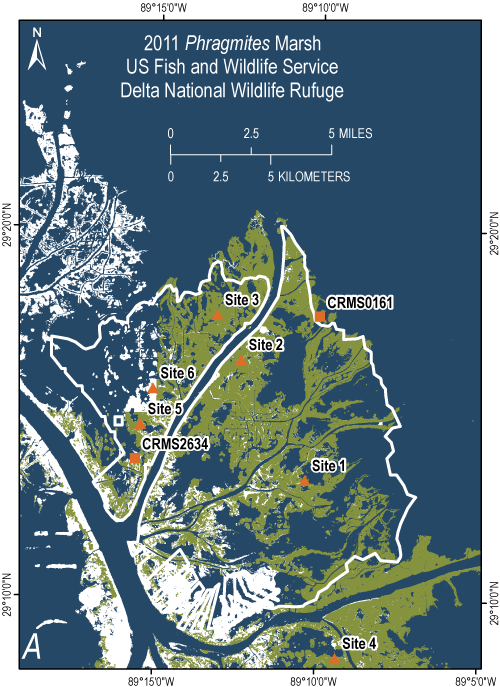
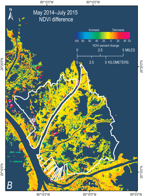 
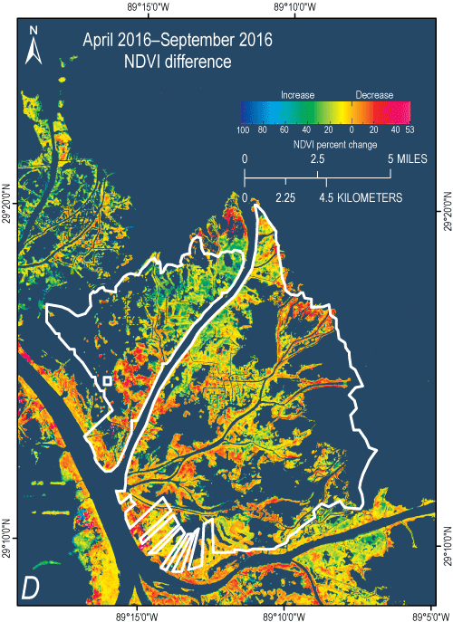 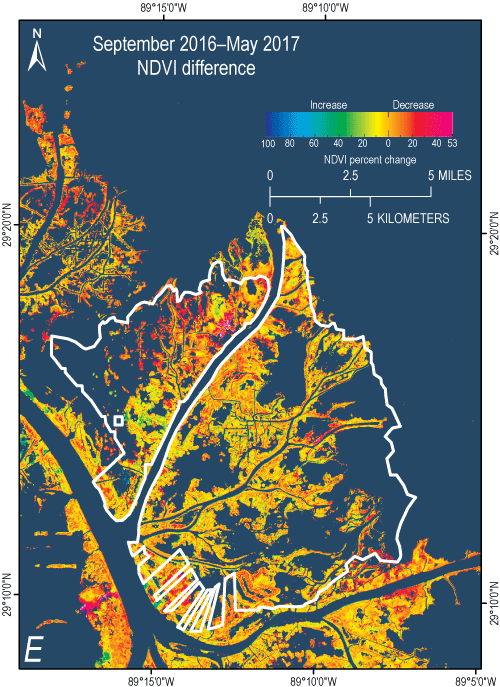
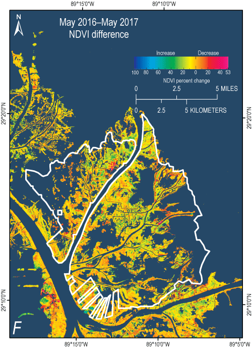
Figure 3. Maps showing U.S. Fish and Wildlife Service Delta National Wildlife Refuge (NWR) (white outline on all graphics). A, An overlay of the 2011 occurrence of Phragmites australis in and in the vicinity of the Delta NWR (Phragmites map from William Jones and Jason Dugas, U.S. Geological Survey Wetland and Aquatic Research Center). The remaining maps are closeups of normalized difference vegetation index (NDVI) changes in the Delta NWR (shown in fig. 2) displaying NDVI change from B, May 2014 to July 2015, C, July 2015 to April 2016, D, April 2016 to September 2016, E, September 2016 to May 2017, and F, May 2016 to May 2017. Colors indexed in the legend represent the percent increase or decrease of NDVI from the earlier to the later date. The May–September 2016 NDVI change is not included because of its high similarity to the April–September 2016 NDVI change map. |
First posted July 28, 2017 |

![]() U.S. Department of the Interior |
U.S. Geological Survey
U.S. Department of the Interior |
U.S. Geological Survey
URL: http://pubsdata.usgs.gov/pubs/of/2017/1098/ofr20171098_fig3.html
Page Contact Information: GS Pubs Web Contact
Page Last Modified: Friday, 28-Jul-2017 14:25:29 EDT
