 |
| Professional Paper 1643: FIGURE 37 |
Figure 37
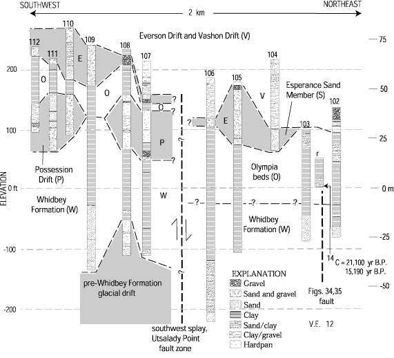
Interpretive stratigraphic correlation diagram crossing part of the Utsalady Point fault zone at Utsalady Point, northwestern Camano Island. Correlation diagram is based on lithologic logs from water wells (table 1, figure 28; numbered sections) and one outcrop (r in figure 27; figs. 34, 35). Faults dashed where inferred, queried where extent uncertain; arrows show sense of relative offset.
Use BACK button to return
Contact: Susan Rhea
This page is brought to you by the Earthquake Hazards Program
