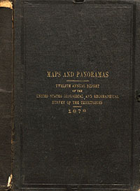
Twelfth Annual Report of the United States Geological and Geographical Survey of the Territories: Maps and panoramas
Links
- More information: Publisher Index Page (via DOI)
- Document: Report (pdf)
- Plates:
- Download citation as: RIS | Dublin Core
LIST OF SHEETS
1. Economic map of portions of Wyoming, Idaho, and Utah.
2. Geologic map of portions of Wyoming, Idaho, and Utah.
3. Geologic map of part of Central Wyoming.
4. Geologic map of parts of Western Wyoming and Southeastern Idaho.
5. Geologic map of Western Wyoming Southeastern Idaho, and Northeastern Utah.
6. Geologic map of the Yellowstone National Park.
7. Panoraramic views in the Wind River and Teton Mountains.
Suggested Citation
U.S. Geological and Geographical Survey of the Territories, 1878, Twelfth Annual Report of the United States Geological and Geographical Survey of the Territories: Maps and panoramas: Annual Report, Report: 1 p.; 10 Plates: 37.66 x 34.86 inches or smaller, https://doi.org/10.3133/70159586.
Study Area
| Publication type | Report |
|---|---|
| Publication Subtype | USGS Unnumbered Series |
| Title | Twelfth Annual Report of the United States Geological and Geographical Survey of the Territories: Maps and panoramas |
| Series title | Annual Report |
| DOI | 10.3133/70159586 |
| Year Published | 1878 |
| Language | English |
| Publisher | Government Printing Office |
| Publisher location | Washington D.C. |
| Description | Report: 1 p.; 10 Plates: 37.66 x 34.86 inches or smaller |
| Country | United States |
| State | Wyoming, Idaho, Utah |
| Other Geospatial | Yellowstone National Park, Wind River, Teton Mountains |
| Online Only (Y/N) | N |
| Additional Online Files (Y/N) | N |


