

U.S. Geological Survey Climate Science Plan—Future Research Directions
Links
- Document: Report (6.56 MB pdf) , HTML , XML
- Download citation as: RIS | Dublin Core
Executive Summary
Climate is the primary driver of environmental change and is a key consideration in defining science priorities conducted across all mission areas in the U.S. Geological Survey (USGS). Recognizing the importance of climate change to its future research agenda, the USGS’s Climate Science Steering Committee requested the development of a Climate Science Plan to identify future research directions. Subject matter experts from across the Bureau formed the USGS Climate Science Plan Writing Team, which convened in September 2022 to identify and outline the major climate science topics of future concern and develop an integrated approach to conducting climate science in support of the USGS and U.S. Department of the Interior missions.
The resulting USGS Climate Science Plan identifies three major priorities under which USGS climate science proceeds: (1) characterize climate change and associated impacts, (2) assess climate change risks and develop approaches to mitigate climate change, and (3) provide climate science tools and support. The Climate Science Plan identifies 12 specific goals to achieve the outcomes of the three priorities.
-
1. Conduct long-term, broad-scale, and multidisciplinary measurements and monitoring and research activities to define, quantify, and predict the impacts of climate change on natural and human systems;
-
2. Provide leadership to standardize measuring, monitoring, reporting, and verifying greenhouse gas emissions, lateral carbon fluxes, and carbon sinks across lands managed by the U.S. Department of the Interior (DOI);
-
3. Provide science capacity, training, tools, and infrastructure to Tribal partners; support Tribal-led science initiatives;
-
4. Conduct climate change research in partnership with the broader climate science community;
-
5. Develop improved data synthesis methods through collaborative and open science across mission areas and between the USGS and agency partners;
-
6. Translate climate change impacts into risk assessments in support of risk management strategies;
-
7. Develop new and improved risk assessments, models, and approaches for mitigating climate change, adapting to its impacts, and reducing uncertainties; design early warning systems for risk mitigation;
-
8. Investigate climate change mitigation strategies and create decision science support tools to inform climate change mitigation and adaptation;
-
9. Provide a framework that facilitates knowledge co-production needed to inform policy decisions;
-
10. Provide access to USGS data and information through novel integration and visualization approaches;
-
11. Build capacity within USGS and DOI through development of scientific training curricula; and
-
12. Coordinate science and capacity building efforts broadly across the Federal Government.
To achieve these goals, the USGS Climate Science Plan also outlines climate science guidelines—key elements for conducting climate-based research—as well as emerging opportunities to support successful climate science. The USGS Climate Science Plan provided in this circular will guide future research priorities and science-support investments, as well as continued development of the climate workforce for decades to come, ensuring that the USGS continues to serve as one of the Nation’s leading climate science agencies.
Introduction
Climate change is the defining global environmental challenge of the 21st century, and continued emissions from the burning of fossil fuels and associated Earth system feedbacks are expected to intensify and create further changes through time. These changes influence societies, economies, and infrastructure at local to global scales and threaten the persistence and functioning of plant and animal species, hydrologic systems, ecological communities, and landscapes. The intensity, frequency, and magnitude of extreme events, environmental stressors, and climate-related hazards have increased over the past few decades and are expected to continue into the coming century (Jay and others, 2023; U.S. Global Change Research Program, 2023).
The cornerstones of U.S. Geological Survey (USGS) climate science are the abilities to characterize climate change and its associated impacts, assess possible ways to mitigate climate change and these impacts, and provide relevant climate science tools and support. Through these activities, the USGS helps to provide the Nation with forward-looking, evidence-based information and approaches to assist in planning for and adapting to a changing world. This USGS Climate Science Plan defines the scope and delivery of critical climate science in the face of this uncertain future. The USGS’s long-term climate science priorities, listed below, ensure that critical science themes and activities will continue and expand along with newly available data, innovative technologies, and scientific and public information needs.
The USGS’s long-term climate science planning efforts are broadly categorized into three main priorities and include recommendations for strategic and intentional planning and programmatic investments in coming decades to maintain and expand the USGS’s research portfolio.
-
• Priority 1—Characterize Climate Change and Associated Impacts. A robust and continuous research investment is needed to understand the ongoing impacts of a changing climate on ecosystems, landscapes, and resources. This science is critical for characterizing risks and vulnerabilities and projecting potential future conditions from local to global scales; it requires a combination of systematic and scientific monitoring tools capable of modeling across different ecosystems, geographies, and timeframes.
-
• Priority 2—Assess Climate Change Risks and Develop Approaches To Mitigate Climate Change. Studies need to continue so researchers can understand and characterize the climate-related risks, hazards, and impacts to both built and natural environments; the results may inform potential mitigation and adaptation strategies. A key part of this second priority is to identify interventions or approaches to mitigate both the magnitude and pace of climate change and climate change-associated risks and impacts, including potential co-benefits and tradeoffs of mitigation and adaptation strategies.
-
• Priority 3—Provide Climate Science Tools and Support. Continued provisioning of climate science information, tools, and support services is needed to empower resource managers to prepare, respond, and adapt to climate change. This effort will involve continuous development of climate science and decision-support tools as well as climate science support services.
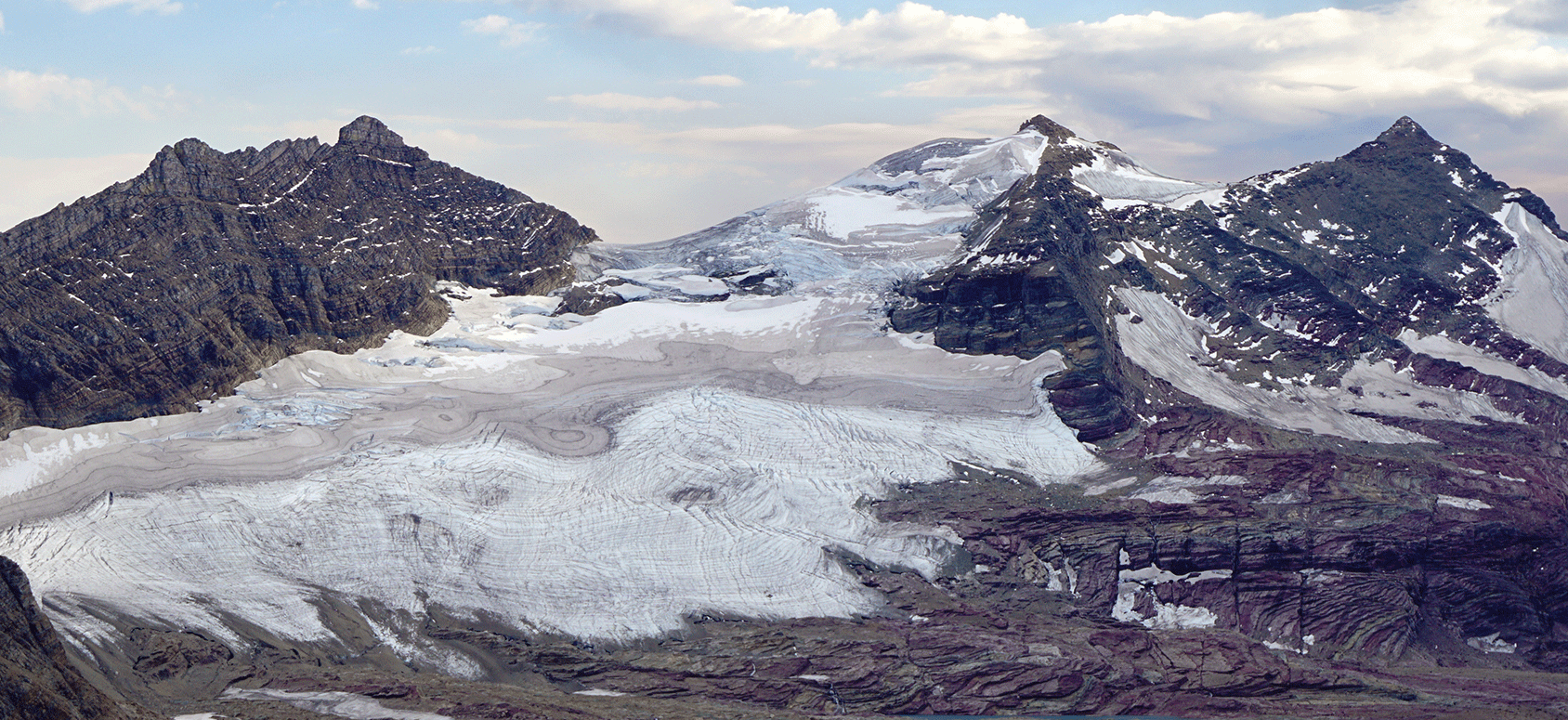
Photograph of Sperry Glacier taken in 2015 in Glacier National Park, Montana. Between 1966 and 2017, 39 glaciers in Montana were reduced in size, some by as much as 85 percent. Photograph by Adam Clark, U.S. Geological Survey.
The USGS Leadership Role in Climate Science
The USGS is a recognized scientific leader in implementing integrated, systems-based approaches for defining and quantifying the extent and pace of climate change and associated impacts on natural and human systems. The USGS mission is to observe, monitor, analyze, assess, and forecast current and evolving dynamics of complex human and natural Earth system interactions and to deliver actionable data and information at scales and timeframes relevant to decision makers. A unique interdisciplinary approach enables USGS researchers to explore the Earth’s geology, hydrology, geography, biogeochemistry, and ecology to learn from past climate change, monitor current change and status, document the factors influencing change, and project future conditions of the Nation’s lands, waters, and biota (box 1).
The USGS has accomplished this mission by leveraging both internal scientific capacity and expertise and long-standing interagency and non-Federal partnerships. The transdisciplinary and collaborative approach of USGS climate science provides scientific tools and knowledge necessary for understanding the changing impacts on people and natural resources and ecosystems. Such information is critical to informing a wide range of policymakers, resource managers, emergency managers, Tribal Nations, and the public. USGS climate science informs DOI in its role managing the Nation’s natural resources and lands. USGS science also serves Tribal and other underserved communities across the Nation as the USGS continually expands its capacity to engage these communities in developing co-produced climate science solutions. The USGS partners with numerous local, regional, State, Federal, Tribal, and international organizations, as well as academic and nongovernmental agencies, in climate-related research and implementation of solutions. USGS science is ultimately used by land managers and other decision makers to develop more informed adaptation and mitigation strategies to address a changing climate.
This USGS Climate Science Plan describes current USGS climate-science-related capacities and priorities and defines critical future research directions as a basis for strategic science planning. The plan was developed by a group of subject matter experts from across the Bureau, which convened in September 2022, and over the course of a year worked to identify the major climate science topics for continued and expanded investment in support of the USGS and DOI missions. Key terms used in this plan are defined in the glossary. This plan includes recommendations for how the USGS can make scientific investments to expand science capabilities to help decision makers while identifying future research and collaborative opportunities. The plan also makes recommendations for how the USGS can provide leadership to DOI and external partners at home and abroad, serving as a key source of science expertise on Earth system interactions.
Box 1. USGS Climate Science for Addressing Critical Problems Faced by the Nation
Climate science is provided by the U.S. Geological Survey (USGS) to support Department of the Interior priorities for addressing critical problems faced by the Nation. Key research areas are listed here, and more details on USGS climate science activities are given in appendix 1.
-
• Carbon monitoring and management for reducing greenhouse gas (GHG) emissions to mitigate climate change
-
• Assessing the national and global potential for mineral resources needed for the Nation’s clean energy transition
-
• Understanding climate change impacts on water availability for improving water-supply resilience
-
• Identifying the changing risks and early warnings of drought, flood, wildfire, coastal, and geologic hazards for health and safety
-
• Acquiring and evaluating evidence of nature-based solutions for enhancing climate change resilience of both people and the environment
-
• Identifying synergies and tradeoffs among critical natural resource management problems for sustainable land use and landscape changes
Climate Science Guidelines
Common across USGS climate science activities are the following climate science guidelines (fig. 1):
-
• USGS climate science is transdisciplinary, working across mission areas and geographic regions
-
• USGS climate science and products are impartial, robust, and scientifically defensible, and they strictly adhere to scientific integrity principles
-
• USGS climate science research directions are intentionally focused, designed, and implemented to inform policy choices
-
• USGS climate science includes the understanding that climate change impacts will likely have disproportionate effects on underserved, less resilient communities
-
• USGS climate science priorities involve a broad range of partners, including those possessing Indigenous Knowledge, in the co-production of science required for climate mitigation and adaptation
-
• USGS climate science communications reach across all communities and regions affected by climate change and its associated risks and impacts
-
• USGS climate science priorities inform opportunities to address climate change by using nature-based solutions and green infrastructure
-
• USGS climate science leadership is demonstrated throughout the DOI, the Federal research community, the Office of Science and Technology Policy (OSTP), and the U.S. Global Change Research Program (USGCRP) as established by the Global Change Research Act of 1990 (15 U.S.C. § 2921)
-
• USGS climate science priorities are aligned with those of international partners and inform international climate science efforts, including the congressionally mandated responsibilities of the USGS to the USGCRP
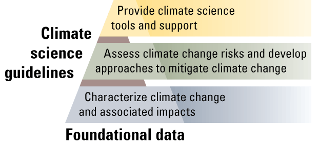
Diagram showing the three research-direction priorities for the U.S. Geological Survey (USGS) Climate Science Plan. They are built upon USGS foundational data and are conducted and informed by the climate science guidelines. Each priority tier in the pyramid builds upon the underlying priority and informs the one above; the priorities are not mutually exclusive.
Opportunities for USGS Climate Change Research
USGS climate science at national and global scales requires an ongoing commitment to defining priority research needs, maintaining core foundational data and monitoring systems, and identifying key opportunities for future climate science investments, all within the context of the climate science guidelines (box 1). Box 2 highlights several high-level opportunities within which the USGS can continue to provide state-of-the-science information on climate and climate change research.
Box 2. Opportunities To Ensure Success in USGS Climate Change Research
Actions described below could enable the U.S. Geological Survey (USGS) to meet the Nation’s needs for cutting-edge research about climate change.
-
• Plan strategically to build the workforce and acquire talent with the latest knowledge on computation, modeling, and big data analysis
-
• Make additional investments in human capital within the social sciences to improve engagement with diverse communities, co-production of knowledge and research, communication and usability of science products, and evaluation of USGS climate change activities
-
• Commit to long-term scientific innovation across mission areas and programs to ensure investment in innovative and scalable approaches to understanding climate science and risk
-
• Create a comprehensive USGS Climate Science Communications Plan to promote internal and external communications and increase coordination between scientists and dedicated public affairs specialists to help disseminate information and tools in usable formats
-
• Provide administrative and policy support from the highest levels of the USGS and the U.S. Department of the Interior to allow the development of cutting-edge science in response to observed and predicted changing environments and risks
-
• Obtain Bureau support for cross-mission area, interdisciplinary, and interagency science development
-
• Recruit the next generation of science and science-support staff from diverse communities
-
• Conduct ongoing assessments of needs and gaps in successfully implementing the USGS Climate Science Plan and take timely and proactive actions to fill those gaps in capacity and expertise
U.S. Geological Survey Climate Science Plan
The USGS Climate Science Plan details 12 goals to be achieved by intentionally prioritizing and investing in future climate science research. The goals are grouped under the three main science priorities and include a problem statement, expected outcomes to be achieved, and targeted strategies for successful implementation.
Priority 1—Characterize Climate Change and Associated Impacts
The USGS vision is to provide scientific leadership in the development of climate impact monitoring and forecasting and to work as part of the broad climate science community. In support of this vision, goals 1–5 are described below. The strategies, impacts, and outcomes related to each goal for Priority 1 are summarized in table 2.1 of appendix 2.
Problem Statement
The USGS has a long history of researching, monitoring, and assessing Earth’s systems to understand the processes and basic science of the climate cycle, its various physical and biotic components, and feedbacks among the carbon cycle, hydrologic cycle, ecosystems, and land cover changes. Monitoring, modeling, and prediction of climate change and its associated impacts on ecosystems, landscapes, and resources are critical for identifying risks and vulnerabilities and preparing for an uncertain future. This science is fundamental for advancing risk assessments and providing climate science tools and support services (fig. 1). Continued research to better characterize how climate change affects various components of Earth’s systems is critical to advancing the ability of the USGS to provide relevant science to inform DOI land management agencies, industry, the public, Tribes, and others in decision making and adaptation planning. An improved understanding of climate change impacts to both natural and human systems could allow the USGS to better pinpoint potential vulnerabilities and to predict the potential effects of ongoing and future climate change.
For example, for fiscal years 2022–2024, the USGS was tasked by the Interagency Arctic Research Policy Committee (2022) in its biennial implementation plan to collaborate on topics such as (1) delineating land cover change via remote-sensing data products; (2) understanding the rate and impacts of terrestrial and subsea permafrost degradation; (3) developing and assessing ice sheet models for better prediction of sea-level rise; (4) improving high-resolution capture of coastal processes; (5) synthesizing research and monitoring needed to improve assessments of ecosystem processes and feedbacks; (6) understanding the potential role of wildfire as a natural and essential ecological process and driver of landscape change; (7) assessing the effects of wildfire on natural and human communities and global climate; (8) improving data delivery and communication on key climate change indicators and impacts, (9) understanding climate impacts on distribution, abundance, and life history of Earth’s biota; and (10) studying and modeling processes to manage potential threats from invasive species, biotoxicoses, and zoonotic diseases. Continuing and expanded investment in these research arenas will enable better characterization of environmental responses to climate change, including impacts on wildlife, human communities, and infrastructure.
Assessing climate-driven feedbacks and interactions between human and natural systems is foundational in helping the Nation understand, manage, and respond to climate change risk. Climate change affects the frequency and intensity of extreme events—including droughts, wildfires, floods, and heat waves. These disturbance events, in turn, alter water availability and quality, ecosystem functioning, landscape stability, species and community distributions, and infrastructure. Climate-related disturbances can also have cascading effects, such as post-wildfire spread of invasive species, destabilized hillslopes and landslide hazards, changes in water quality associated with erosion, and increased surface temperatures where vegetation is reduced. Human land uses, including agriculture, forestry, and urbanization, create additional climate feedbacks from surface albedo changes, urban heat island effects, and altered carbon fluxes and storage. In total, these cumulative and often interacting stressors can amplify coastal hazards (such as vulnerability of coastal zones to storm surges and sea-level rise), alter landforms (for example, by increasing soil erosion and runoff), and transform terrestrial ecosystems (for example, by causing widespread tree mortality resulting from increasing evaporative demand and habitat and biodiversity loss). Understanding these complex, integrated feedbacks is pivotal to assessing risk, identifying vulnerable species and geographies, and informing appropriate mitigation responses.
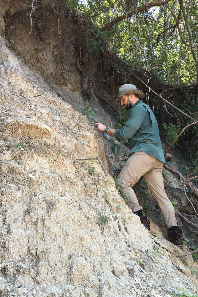
Photograph of the Socastee Formation near Myrtle Beach, South Carolina, being studied by U.S. Geological Survey geologist Robert Poirier in 2016. Fossil coral specimens were collected to date the deposit and to learn about past changes in sea level. The information may help geologists to estimate future changes in sea level. Photograph by Laura Gemery, U.S. Geological Survey.
Increased investments are needed to fill critical knowledge and capacity gaps to allow us to quantify, model, and assess climate change impacts and system feedbacks, especially given acceleration of the rate and magnitude of climate change and its emerging, cascading effects on natural and human systems.
Outcomes
Investment in science focused on understanding climate change impacts will enable more effective preparedness for and response to amplified climate risks (such as fire, drought, flooding, and permafrost changes); in turn, attenuating risks will help to mitigate or reduce the short- and long-term impacts on landscapes, species, people, and infrastructure. Further, development of approaches to more comprehensively monitor, report, and verify carbon and greenhouse gas (GHG) emissions will enable better informed carbon mitigation programs, guiding science-informed investment for both the U.S. Government and private industry (U.S. Global Change Research Program, 2018). Ultimately, the USGS will ensure that its science is available in a timely fashion for actionable decision making and for applications by other science agencies and nongovernmental partners.
Goals
The goals and recommendations for Priority 1 of the USGS Climate Science Plan support the USGS commitment to characterizing climate change and associated impacts. The strategies, impacts, and outcomes related to each goal for Priority 1 are summarized in table 2.1.
Goal 1: Conduct long-term, broad-scale, and multidisciplinary measurements and monitoring and research activities to define, quantify, and predict the impacts of climate change on natural and human systems. The USGS should continue to support integrated research—including measurements, monitoring, and forecasts of climate change and its impacts on ecosystems and human systems—at scales ranging from local to continental. This research should have a particular focus on science approaches and tools that allow for a better understanding of the feedbacks among the climate system, changes in hazard risk, disturbances, and ecosystem patterns and processes as well as the impacts of cascading and interacting natural and anthropogenic stressors on human communities, ecosystems, and species and their habitats.
Goal 2: Provide leadership to standardize measuring, monitoring, reporting, and verifying greenhouse gas emissions, lateral carbon fluxes, and carbon sinks across lands managed by the U.S. Department of the Interior. The USGS should improve methods to estimate natural and anthropogenic GHG emissions, lateral carbon (C) transfer, and biologic C sequestration domestically and internationally as outlined in the “National Strategy to Advance an Integrated U.S. Greenhouse Gas Measurement, Monitoring, and Information System” (Greenhouse Gas Monitoring and Measurement Interagency Working Group, 2023). The Interagency Working Group recommended that the USGS be one of several agencies tasked with understanding GHG emissions and sinks from terrestrial systems and determining where targeted GHG monitoring efforts would be most impactful. Further, the USGS should lead development of a measuring, monitoring, reporting, and verifying (MMRV) system for GHG emissions from wetlands (coastal blue carbon and other wetlands), aquatic systems, grasslands, geologic sources (primarily coal mines), and wildfires to include continued support from satellite-based remote sensing through the Landsat Program (https://landsat.gsfc.nasa.gov/). Robust expertise and capacity for MMRV are required for monitoring baseline conditions, including understanding feedbacks of carbon cycle processes to climate change; measuring and estimating carbon sequestration in vegetation, soils, and other reservoirs; and verifying biologic and geologic carbon dioxide removal and emissions reduction projects.
Goal 3: Provide science capacity, training, tools, and infrastructure to Tribal partners; support Tribal-led science initiatives. The USGS should partner with Tribal Nations to support and assist with Tribal climate science information and training needs and incorporate Indigenous Knowledge in climate science and knowledge co-production, when possible. The USGS should advance Tribal priorities in the development of methodologies to understand historical, long-term environmental change, traditional land management practices and associated benefits, and potential climate change impacts on Tribal lands.
Goal 4: Conduct climate change research in partnership with the broader climate science community. The USGS should position itself as a key member of interagency climate science groups such as the U.S. Global Change Research Program (USGCRP), Interagency Arctic Research Policy Committee (IARPC), Intergovernmental Panel on Climate Change (IPCC), North American Carbon Program (NACP), and Climate Change Interagency Working Group (CCIWG). By participating and leading, the USGS can ensure that appropriate Tribal and co-management partners are also involved and aware. USGS research should strengthen collaboration with agency partners and decision makers, such as the National Park Service (NPS), U.S. Fish and Wildlife Service (USFWS), National Oceanic and Atmospheric Administration (NOAA), Bureau of Indian Affairs (BIA), Bureau of Land Management (BLM), Bureau of Ocean Energy Management (BOEM), and others.
Goal 5: Develop improved data synthesis methods through collaborative and open science across mission areas and between the USGS and agency partners. The USGS should continue to build on the strength of the John Wesley Powell Center for Analysis and Synthesis, the Center for Data Integration, and other USGS entities that promote and support data synthesis and other initiatives that openly share USGS data such that integrated cross-scale and cross-disciplinary research can be used more effectively.
Priority 2—Assess Climate Change Risks and Develop Approaches To Mitigate Climate Change
The USGS vision is to translate knowledge of climate change impacts into risk assessments, to integrate monitoring and modeling of climate change impacts to improve forecasting and decision support, and to incorporate all types of knowledge, including western science and traditional, Indigenous Knowledge, into climate change mitigation and adaptation approaches. In support of this vision, goals 6–8 are described below. The strategies, impacts, and outcomes related to each goal for Priority 2 are summarized in table 2.2 of appendix 2.
Problem Statement
Improved management of natural and human systems depends on effective monitoring of climate change impacts over time, understanding the risks that climate change poses to natural and human systems, identifying carbon cycle feedbacks on climate change, and determining solutions for reducing risks, mitigating climate change, and adapting to impacts. To provide actionable science, the USGS must extend knowledge of climate change impacts (Priority 1) to understand the risks posed by those impacts as well as unintended or indirect risks that could occur through mitigation or adaptation strategies. Interactions among climate change and hazards require that science and implementation be conducted using an integrated systems-based approach. Monitoring and assessment efforts are critical for informing risk reduction activities, which encompass both mitigating climate change by reducing GHG emissions and enhancing sinks as well as reducing the risks and impacts of climate change to natural and human systems. In mitigating climate change, both nature-based solutions and technological responses need to be evaluated for co-benefit and risk tradeoffs (U.S. Department of the Interior, 2023). The USGS has the broad expertise required to lead efforts in the development of risk assessments; models that evaluate the impacts of resource management, mitigation, and adaptation strategies; forecasting approaches; and early warning systems capable of identifying tipping points in natural and human systems. These efforts can inform communication products and decision tools to be developed for climate services (Priority 3; fig. 1).
Outcomes
Characterizing the risk from climate change impacts can equip DOI and its partners with the tools and information to anticipate and mitigate the worst impacts of climate-related hazards and to improve planning for long-term management of natural resources. Further, science support for assessing adaptation and mitigation strategies will allow effective incorporation of nature-based solutions into restoration efforts, allowing DOI to maximize carbon sequestration into its managed lands and waters. The work conducted in support of this priority will also provide scientific and technological assistance for the clean energy transition, helping to avoid the worst impacts from climate change and improve health outcomes.
Goals
In support of Priority 2, the USGS should prioritize the goals and recommendations below, which are related to strategies, impacts, and outcomes described in table 2.2. The recommended activities will build and sustain the climate science leadership position of the USGS in assessing climate change risk and developing and testing approaches for mitigation and adaptation.
Goal 6. Translate climate change impacts into risk assessments in support of risk management strategies. The USGS should use knowledge, data, and tools on climate change impacts (Priority 1) to assess risks to natural and built environments, particularly with Tribal and underserved communities, and co-develop management strategies.
Goal 7. Develop new and improved risk assessments, models, and approaches for mitigating climate change, adapting to its impacts, and reducing uncertainties; design early warning systems for risk mitigation. The USGS should conduct science and develop models focused on improving understanding and reducing uncertainties in future carbon, ecosystem, and land use trajectories; nature-based solutions and technological approaches for mitigation of and adaptation to climate change; and the co-benefits and tradeoffs resulting from those potential outcomes. Integrating scenario planning into climate impact models could allow researchers to better understand plausible future outcomes, with and without human intervention. The USGS should develop early warning systems at appropriate time scales for climate change-related impacts, including but not limited to drought, landslides, permafrost thaw, wildfires, flooding, increased coastal storm frequency and intensity, and sea-level rise.
Goal 8. Investigate climate change mitigation strategies and create decision science support tools to inform climate change mitigation and adaptation. The USGS should develop and test approaches for climate change mitigation and adaptation and identify fruitful opportunities for implementation. The USGS should expand the Nation’s understanding of climate change mitigation and adaptation measures in a manner that supports decision-making processes. These expanded activities should be co-produced with land-management bureaus, particularly on lands managed by DOI, and should be integrated with nature-based solutions and MMRV programs on wetland, aquatic, and grassland ecosystems, as identified by the Greenhouse Gas Monitoring and Measurement Interagency Working Group (2023). In addition to nature-based solutions, the USGS should investigate geologic and engineering approaches to climate change mitigation.
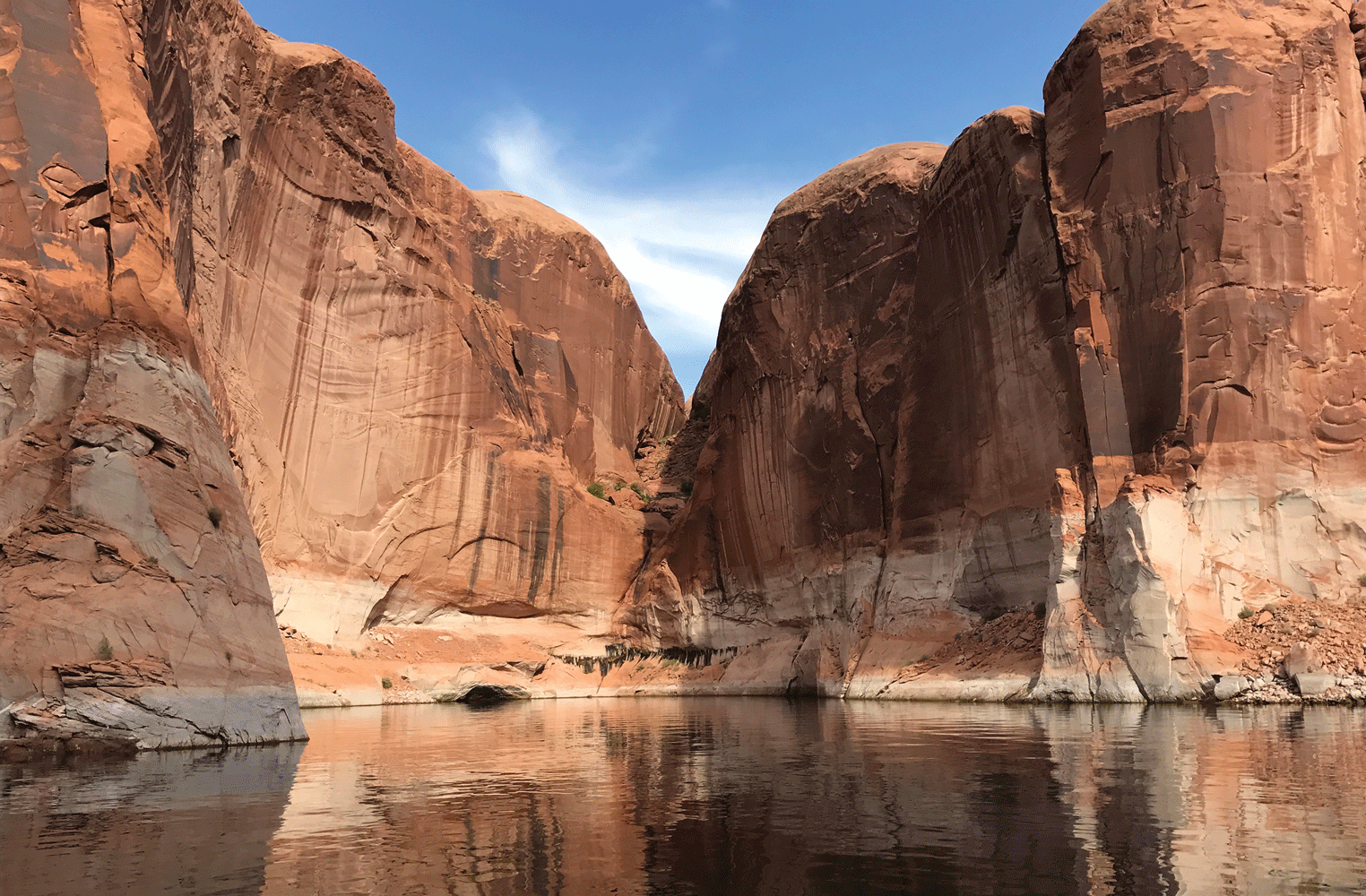
Photograph of Lake Powell, which is in Utah and Arizona. The U.S. Geological Survey has studied the lake and its variations in water levels. Photograph by Wayne Baldwin, U.S. Geological Survey.
Priority 3—Provide Climate Science Tools and Support
The USGS vision is to ensure that its partners are part of the knowledge co-production process and have access to usable climate science information, tools, and support services that empower resource managers in preparing to respond and adapt to climate change. In support of this vision, goals 9–12 are described below. The strategies, impacts, and outcomes related to each goal for Priority 3 are summarized in table 2.3 of appendix 2.
Problem Statement
Resource managers from local, Tribal, State, and Federal agencies rely on the USGS to develop and deliver climate science information to support their decision needs. The USGS is increasingly asked to help these agencies interpret and use scientific information products and decision tools. In particular, the DOI bureaus and their local, Tribal, and State partners are often unable to make effective use of rapidly changing and continuously updated climate science information. Although these groups rely on the USGS for its climate science application expertise, the USGS lacks the capacity to scale and meet the ever-growing and ever-changing climate science information needs of its agency partners. Efforts should be made to improve the USGS’s capacity to help partners find, apply, incorporate, and interpret climate science information.
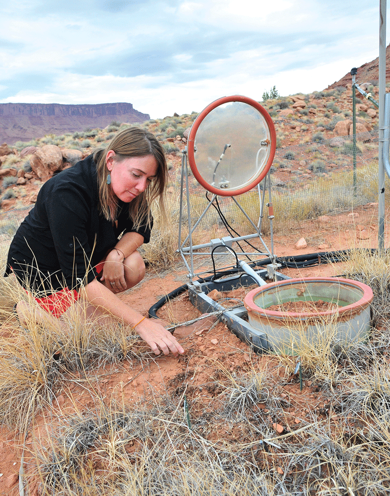
Photograph of U.S. Geological Survey ecologist Sasha Reed studying one of the outdoor testing plots created on the Colorado Plateau to expose desert biological soil crusts to different climate conditions. Changes in the crust can affect how much solar energy is reflected, increase soil erosion, or reduce soil fertility and its ability to store carbon dioxide. Photograph by Jennifer LaVista, U.S. Geological Survey.
To meet these demands, the USGS should expand efforts to provide support in the intersection between climate science and natural and cultural resource management through development of climate science and decision-support tools and support services. Part of this expansion should include investment in human capital and expertise in the social sciences, which would improve partner and stakeholder engagement as well as a better understanding of the use and usability of science products. These services and expanded expertise would provide examples; provide points of contact to identify appropriate climate science for use in natural and cultural resources planning and management; develop training for individuals in management communities to assure that best practices are used to incorporate climate science in plausible futures; develop new and innovative approaches for integrating data; provide new approaches for data visualization and data accessibility; and develop broad approaches for integrating climate science into management actions. These services would ensure that management agencies could integrate the best available climate science into everyday activities.
Outcomes
Development of a climate adaptation services framework would allow the USGS to complete the co-production of science by providing delivery of management-relevant climate information and direct technical support to a broad range of partners. Investment in capacity building would ensure that the USGS could effectively broaden the expertise available across DOI to carry out climate smart investments. Once work is completed in this category, DOI employees should be able to understand and better apply the work from climate science into multiple management decisions.
Goals
In support of Priority 3, the USGS should prioritize the goals and recommendations below, which are related to strategies, impacts, and outcomes described in table 2.3.
Goal 9: Provide a framework that facilitates knowledge co-production needed to inform policy decisions. The USGS should develop a framework to provide management-relevant climate information and direct technical support to a broad range of partners and stakeholders involved in collaborative climate adaptation. The USGS should develop new and unique approaches for knowledge co-production to ensure that climate information, data, and data formats are best suited to inform management choices among DOI bureaus and partner agencies. The USGS should develop a series of applications and decision-support tools for climate adaptation and mitigation data and information to support the next generation of USGS researchers and resource managers and inform prioritizing management options.
Goal 10: Provide access to USGS data and information through novel integration and visualization approaches. The USGS should develop new approaches to access, visualize, and interpret new and existing climate information from various platforms in ways that allow managers and decision makers to easily access information and address their specific climate adaptation needs and challenges. The USGS should develop new information management approaches, integrating data from various sources and platforms into new, innovative, and queryable data clearinghouses (such as data lake, data cube) to improve information accessibility, analysis, and use. In consultation with end users, the USGS should also develop models, platforms, and approaches to enable the production of timely and effective information visualizations and to ensure that climate science information products meet user needs and clearly communicate.
Goal 11: Build capacity within USGS and DOI through development of scientific training curricula. The USGS should create a skilled workforce specializing in the delivery of technical assistance that builds upon previous investments by the USGS. The USGS should also support the development of tools and training programs to assist partners and stakeholders in applying climate-related information in an actionable, decision-relevant context. The USGS should work with DOI partners and others to develop curricula and training approaches that allow management agencies the ability to effectively integrate climate information into resource management.
Goal 12: Coordinate science and capacity building efforts broadly across the Federal Government. The USGS should work collaboratively across Federal Government agencies to ensure that USGS data products and information are broadly available and usable. The USGS should work to integrate its climate science products with those of other agencies across government to ensure that management partners have access to all Federal climate science regardless of where it is produced.
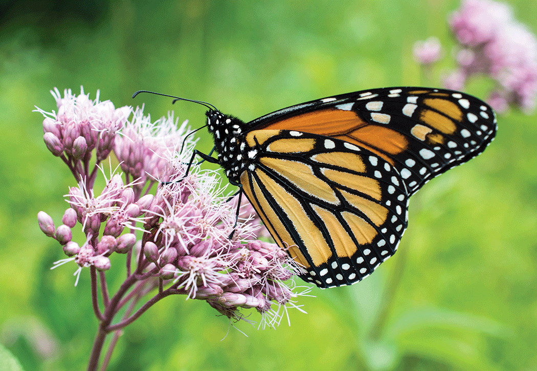
Photograph of a monarch butterfly on a Joe Pyeweed flower (Eutrochium purpureum). The eastern migratory population of monarchs (Danaus plexippus plexippus) is in decline, and the U.S. Geological Survey and partners are studying ways to help it recover. Photograph by Emily Weiser, U.S. Geological Survey.
Conclusion
The Nation’s ecosystems, Earth processes, communities, and infrastructure are all vulnerable to the impacts of a changing climate. Continued investments in understanding climate change and associated impacts, assessing climate change and potential mitigation activities to mitigate risks, and providing climate science tools and support will be critical in addressing the defining global environmental challenge of our time. The USGS is uniquely poised to meet this challenge with continued and expanded investments in climate science, as outlined in this Climate Science Plan. The document should serve as a pathway for defining future research directions; building institutional data delivery, processing, and computational capacity; and building the next generation climate science workforce and institutional capacity to ensure the Nation is prepared to meet the climate challenge with state-of-the science climate tools and science-supported mitigation strategies.
Acknowledgments
The authors would like to acknowledge the U.S. Geological Survey (USGS) Climate Science Steering Committee members for their leadership, oversight, and comments that have improved the USGS Climate Science Plan. We would like to also thank the following initial members of the USGS Climate Science Plan Writing Team for their help in the initial phase of this work: Isabella Caltabiano, Michelle Irizarry-Ortiz, Kristin Ludwig, and Ben Sleeter. The authors also wish to express their gratitude for the thoughtful reviews and feedback on the Climate Science Plan from members of the USGS Executive Leadership Team, USGS program leads, and other USGS scientists, whose collective input greatly improved the content, structure, and recommendations included in the plan.
References Cited
Greenhouse Gas Monitoring and Measurement Interagency Working Group, 2023, National Strategy to Advance an Integrated U.S. Greenhouse Gas Measurement, Monitoring, and Information System: Office of Science and Technology Policy, 70 p., accessed January 11, 2024, at https://www.whitehouse.gov/wp-content/uploads/2023/11/NationalGHGMMISStrategy-2023.pdf.
Interagency Arctic Research Policy Committee, 2022, Biennial implementation plan 2022–2024 for the Arctic research plan 2022–2026: Interagency Arctic Research Policy Committee, 60 p., accessed January 11, 2024, at https://www.iarpccollaborations.org/arp-2022-2026-implementation.html.
Jay, A.K., Crimmins, A.R., Avery, C.W., Dahl, T.A., Dodder, R.S., Hamlington, B.D., Lustig, A., Marvel, K., Méndez-Lazaro, P.A., Osler, M.S., Terando, A., Weeks, E.S., and Zycherman, A., 2023, Overview—Understanding risks, impacts, and responses, chap. 1 of U.S. Global Change Research Program, Fifth national climate assessment (Crimmins, A.R., Avery, C.W., Easterling, D.R., Kunkel, K.E., Stewart, B.C., and Maycock, T.K., eds.): U.S. Global Change Research Program, p. 1–47, accessed January 16, 2024, at https://doi.org/10.7930/NCA5.2023.CH1.
U.S. Department of the Interior, 2023, Nature-based solutions: U.S. Department of the Interior Departmental Manual, part 600, chap. 7 (600 DM 7), 9 p., accessed April 30, 2024, at https://www.doi.gov/document-library/departmental-manual/600-dm-7-nature-based-solutions.
U.S. Global Change Research Program, 2018, Second state of the carbon cycle report (SOCCR2)—A sustained assessment report (Cavallaro, N., Shrestha, G., Birdsey, R., Mayes, M.A., Najjar, R.G., Reed, S.C., Romero-Lankao, P., and Zhu, Z., eds.): U.S. Global Change Research Program, 878 p., accessed January 11, 2024, at https://doi.org/10.7930/Soccr2.2018.
U.S. Global Change Research Program, 2023, Fifth national climate assessment (Crimmins, A.R., Avery, C.W., Easterling, D.R., Kunkel, K.E., Stewart, B.C., and Maycock, T.K., eds.): U.S. Global Change Research Program, accessed March 20, 2024, at https://doi.org/10.7930/NCA5.2023.
Recommended Reading
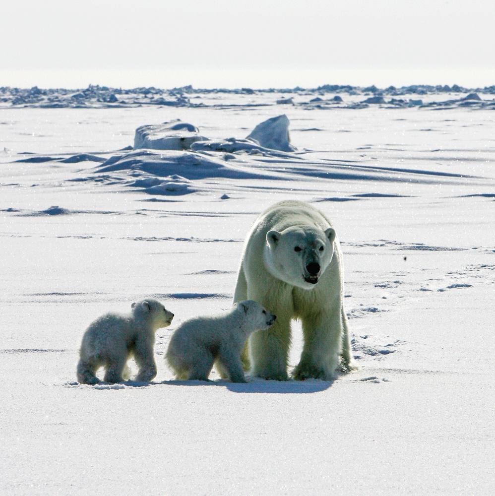
Photograph of an adult female polar bear (Ursus maritimus) and her two cubs on the sea ice of the Arctic Ocean north of the Alaska coast. Photograph by Mike Lockhart, U.S. Geological Survey.
Glossary
Scientific Terms
anthropogenic
Environmental change caused or influenced by people, either directly or indirectly.
biotoxicoses
Sickness or illness from poisoning of biologic origin or biotoxin.
blue carbon
Carbon stored in oceans and the ecosystems along ocean coasts.
Climate 101
Introductory climate science information and training workshops offered by the U.S. Geological Survey (USGS) Climate Adaptation Science Centers to help build region-specific climate literacy for the general public, natural resource managers, and domestic and international partners.
coastal blue carbon
Carbon stored along the land-sea margin, in habitats such as mangroves, salt marshes, and seagrass meadows. The term indicates a set of concepts related to the management of carbon and methane in those ecosystems and carbon accounting for greenhouse gas inventories and carbon markets.
critical minerals
Critical minerals are essential to many sectors, including the production of high-technology devices, national defense applications, and green growth-related industries. A critical mineral commodity is one that is required for various specialized applications yet is at risk for supply chain disruption. Numerous critical rare earth minerals are recovered as byproducts during the production of other mineral commodities.
cryosphere
The portions of the planet’s surface dominated by snow and ice.
data cube
A multidimensional array of data values which can be made available for cross-data queries and model analyses.
data lake
A centralized data repository which enables large-scale storage, processing, and security for large amounts of data.
DOI trust species
The Secretary of the Department of the Interior’s trusteeship includes the following: “migratory birds; anadromous fish; endangered species and marine mammals; federally owned minerals; certain federally managed water resources; and land’s [sic] managed by the Department including National Parks, National Wildlife Refuges, and BLM [Bureau of Land Management] and BOR [Bureau of Reclamation] lands. The Secretary of the Interior shall also be trustee for those natural resources for which an Indian tribe would otherwise act as trustee in those cases where the United States acts on behalf of the Indian tribe.” From https://www.doi.gov/restoration/primer/trustees.
eddy covariance tower
A tower structure and suite of instruments used to directly measure the flux density of carbon dioxide, methane, and other gases between an ecosystem and the atmosphere, without disturbing the vegetation or the soil. It produces a high-frequency, extended time series record of gas exchange that integrates across an extended footprint, hundreds of meters in length.
green infrastructure
A built or engineered solution that uses natural or living materials for its construction. It is sometimes referred to as “natural infrastructure.”
Integrated Water Availability Assessments
Potential USGS products that could provide estimates of water supply and demand in the past, present, and future. These assessments, or studies with an emphasis on quantifying and understanding water availability, could investigate historical changes in water supply and demand and their causes, and help to identify where and when the Nation may have challenges meeting its demand for water because of insufficient water quantity or quality. Definition based on https://www.usgs.gov/mission-areas/water-resources/science/integrated-water-availability-assessments.
invasive species
Invasive species are non-native organisms which are introduced or spread to new locations and which can have detrimental impacts on both the environment and the economy. Invasive species can negatively impact habitat by out-competing native species (including imperiled or ecologically important plants and animals) and also by introducing disease.
lateral flux station
Instrumentation used to measure the lateral movement of organic and inorganic carbon between one ecosystem and another. Some examples of lateral fluxes include human extraction of organic material from one location that is then deposited in another, the burning of biomass, erosion and sediment transport, and tidal exchange between wetlands and the coastal ocean. Of particular importance to carbon cycle research and climate change mitigation is lateral flux driven by aquatic exchange between uplands or wetlands and adjacent water bodies.
mission areas
USGS organizational structures by theme for scientific research. In 2024, there are five mission areas: Core Science Systems, Ecosystems, Energy and Minerals, Natural Hazards, and Water Resources.
National Water Census
The USGS National Water Census provides routinely updated and nationally consistent modeled water quantity, water quality, and water use information, along with long-term trends in observational data.
One Health
A collaborative, multisectoral, and transdisciplinary approach to optimizing health outcomes for people, animals, plants, and their shared environment, recognizing the interconnection among them while also working across scales including local, regional, national, and global scales.
paleorecord
Any record from the distant past, but especially a fossil record; the term is often used in the context of natural system records. Examples include tree rings, geologic sediment cores, packrat middens, ice cores, and pollen from buried lake-bed sediment layers.
USGS priority landscapes
Areas of place-based research that provide scientific information for management decisions and large-scale restoration of critical ecosystems and their biological communities. Current areas of focus include national parks, wildlife refuges, Bureau of Land Management lands, and priority ecosystems including the Arctic, Chesapeake Bay, Colorado River, Columbia River, Everglades, Great Lakes, Klamath River, Mississippi River, Pacific Islands, Puget Sound, Sagebrush Biome, San Francisco Bay, and Southwest deserts.
vagile
Used to describe free-swimming, unattached aquatic organisms with the freedom to move through the environment.
zoonotic diseases
Infectious diseases transmitted from animals to humans or from humans to animals.
Climate Science Plan Terms
goal
A long-term outcome that sets the current science direction.
impact
Science output that has benefits to society.
outcome
How science may impact or affect management actions.
priority
Major category of science that occurs to implement a successful climate science program.
problem statement
A short statement or description of the current issue to be improved.
recommendation
A suggestion that would move action toward goals.
strategy
Plan or action that allows achievement of goals.
vision
Outline for a future desired state within the USGS.
Appendix 1. Current Climate Science Activities in the U.S. Geological Survey
Introduction
The U.S. Geological Survey (USGS) provides scientific information necessary to understand the impacts of climate change and inform the U.S. Department of the Interior (DOI) in its role in managing Federal lands and their resources (for more information, please refer to https://www.usgs.gov/science/science-explorer/climate). USGS climate science helps people understand, adapt to, and mitigate the impacts of a changing climate. Our unique approach explores the current and past geology, hydrology, geography, biogeochemistry, and ecology of the Earth to learn from past climate change, monitor current trends, document the factors that influence change, and project future conditions of the Nation’s lands, waters, and wildlife. Our climate science portfolio spans a broad range of Earth systems, from ecological and hydrologic analyses to studies of biogeophysical and aquatic responses to climate changes to assessments of biologic and geologic carbon sequestration to investigations of environmental contaminants and pathogens affecting the health of ecosystems and people. Our work crosses multiple timescales, from reconstructing climate histories and paleoenvironments to understanding modern land use and cryosphere changes to determining new methods for projecting future conditions and risks of natural hazards.
Much of our work is based on the development of foundational data products, including our national streamgaging network, Total Water Level and Coastal Change (TWL&CC) Forecast Viewer, flood information systems, ecological indicators, drought warning systems, sea-level-rise maps, multihazard scenario tools, topographic and digital geospatial data, and the 52-year Landsat remote-sensing archive. The USGS follows strict fundamental science practices to ensure that published scientific data and information products are defensible, are of the highest quality, and can be used for actionable decision making.
The following section describes the range of current USGS capabilities in climate science and the capacity of the current workforce of the Bureau to meet the needs of our partners. This description serves as a baseline from which future research directions outlined in the body of this report can be launched.
Climate Change Impacts on Ecosystems
Water Availability
Water availability is a critical component of ecosystems. Using the Nation’s premier water data collection network, the USGS regularly assesses current water availability and develops novel methods for monitoring and predicting how changing hydrological conditions, including floods and drought, could affect communities and ecosystems. The USGS also develops and delivers projections of how future climate, land use, and land cover changes could affect water supplies, quality, and availability. The USGS performs flood-frequency analyses to provide information about the magnitude and frequency of floods based on historical records of annual maximum instantaneous peak discharge and simulates potential effects of climate change on floods. The USGS also produces topographical maps for flood assessment and risk mapping and provides spatial analytical tools to support water-resources planning and management and engineering design. USGS scientists study the impacts of droughts on humans and ecosystems and devise methods to predict, prepare for, manage, and recover from water shortages across temporal and spatial scales. This research involves understanding how climate change affects current droughts and predicting future droughts; predictions are partly based on evidence of past droughts derived from paleorecords.
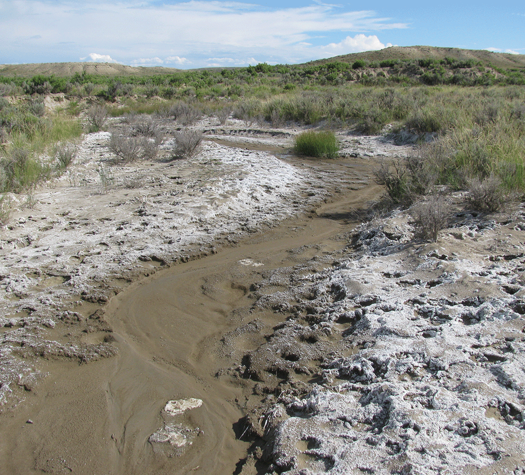
Photograph of a tributary to Muddy Creek, Wyoming, where the U.S. Geological Survey studied the salinity of the water. The white patches on the ground are natural salt crusts, which can form in dry climates. If the soil is disturbed, rain and snow can cause salt to be carried to a stream. Photograph by Carleton Bern, U.S. Geological Survey.
Ecosystem Health
The USGS characterizes the fundamental processes controlling climate impacts and quantifies those impacts on plants, wildlife, fish, and other aquatic species, particularly for DOI trust species such as migratory birds, terrestrial and marine mammals, amphibians and reptiles, plants, and threatened and endangered species. Research efforts also focus on DOI-managed lands and USGS priority landscapes (Jenni and others, 2021) to provide decision makers with current conditions and forecasts for those ecosystems and the priority species that occur there. In many ecosystems, the USGS applies the One Health approach, which is an integrated and unifying framework to determine the levels at which the health of people, animals, and the environment are linked. The One Health approach is particularly relevant to USGS research on zoonotic diseases and biologic threats and enables us to provide key wildlife and landscape information to public health partners.
Wildfire
The USGS produces and delivers scientific information, tools, and products to support science and management needs related to climate change and fire effects on people and ecosystems; assessment of post-fire hazards and impacts; and development of monitoring and modeling methods for assessing current and future climate-fire dynamics and fire risk. Research spans wildfire behavior, fuels, and role of invasive plants in amplifying fire; post-fire recovery and restoration of ecosystems; and post-fire risks of water contamination, flash floods, debris flows, and wind erosion. This research is fundamental to understanding, attributing, and quantifying the interactions of changing climate with wildfire occurrence, spatial and temporal dynamics, and impacts on human and natural communities as well as ecosystem responses and post-fire recovery.
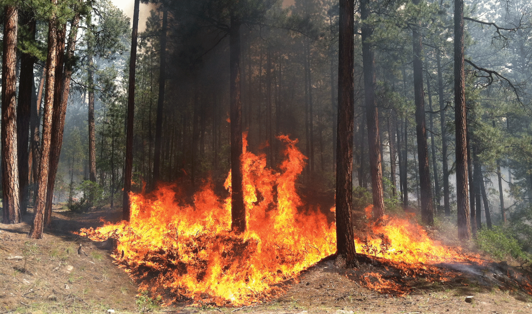
Photograph of a managed wildfire that is consuming surface fuels in New Mexico. Photograph by Rachel A. Loehman, U.S. Geological Survey.
Carbon Cycle Research and Assessments
The USGS conducts fundamental research on carbon cycling in forests, rangelands, deserts, permafrost, inland aquatic ecosystems, coastal regions, and wetlands. Major objectives of this research are to examine rates of and controls on carbon sequestration and stock changes in plants and soils, methane emissions, and lateral fluxes of carbon between ecosystems. Key questions include (1) how will these rates and processes change in response to human actions and global change, including warmer temperatures, drought, extreme precipitation events, sea-level rise, nitrogen deposition, plant community changes, and other impacts? and (2) to what degree can ecosystem management actions reduce greenhouse gas emissions and increase rates of carbon sequestration? Across the Nation, the USGS has established long-term and short-term research sites to study and compare carbon cycling processes in response to climate change and management actions. The USGS analyzes change in soil and vegetation carbon pools and measures exchanges of carbon with adjacent ecosystems and the atmosphere. The USGS maintains eddy covariance towers and lateral flux stations in these wetland and aquatic areas to study rates of carbon sequestration and flux in the context of experimentation, global change, and human activities (Baldocchi, 2014). Research results aid interpretation of satellite data, and development of models and decision-support tools. Our strength in paleoecological studies of sediment and soil cores has produced knowledge about changes in rates of carbon accretion and loss over hundreds to thousands of years. The research is commonly conducted in collaboration with DOI land management bureaus.
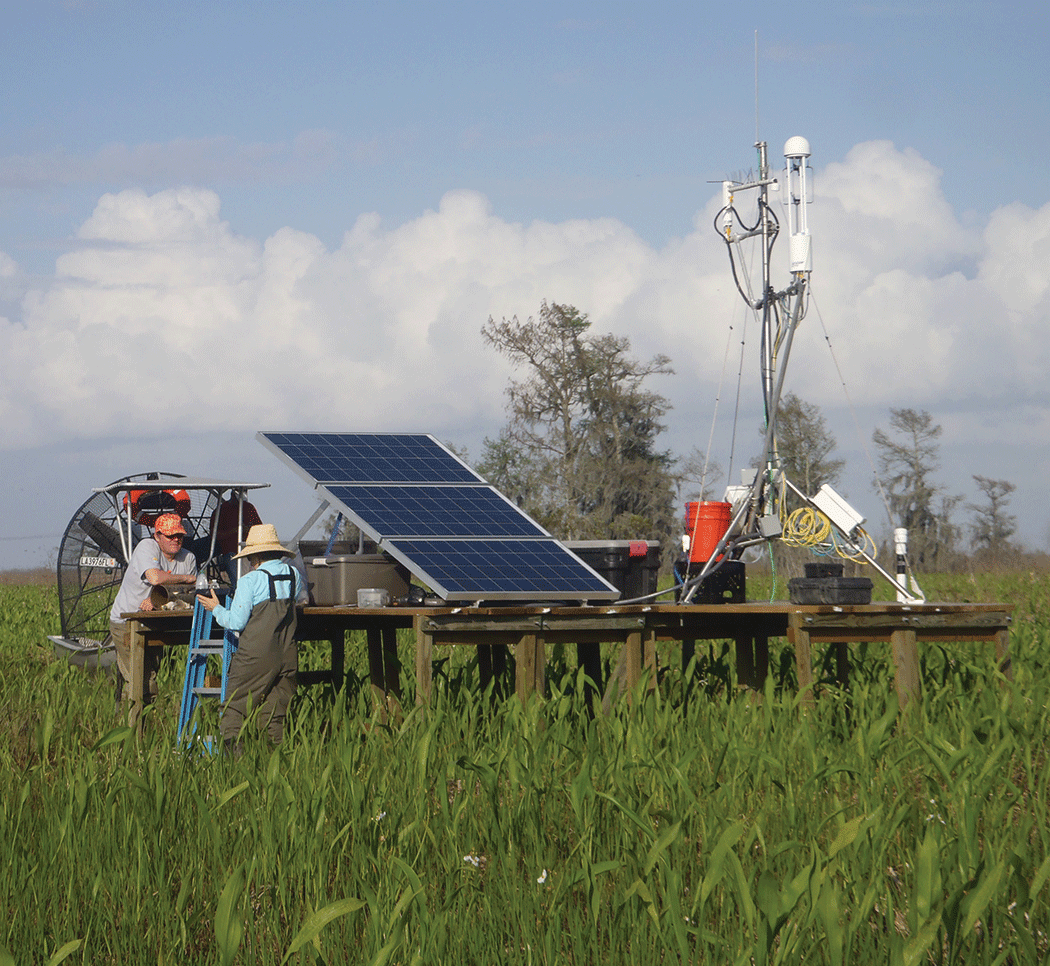
Photograph of an eddy covariance station in a tidal freshwater marsh at Salvador Wildlife Management Area, Louisiana. U.S. Geological Survey scientists and cooperators were servicing the station, which is used to assess the net exchange of two greenhouse gases from the wetlands: carbon dioxide (CO2) and methane (CH4). The data can be used to determine the carbon sequestration capacity of managed marshes. Photograph by Ken W. Krauss, U.S. Geological Survey.
Geologic Carbon Sequestration
The USGS conducts national and international research and assessments related to geologic carbon sequestration, which allows for the capture and storage of carbon in geologic formations. In some situations, injecting carbon dioxide into oil reservoirs has the potential to increase the recovery of oil and gas resources while balancing greenhouse gases created by consumption of these resources. Geologic carbon sequestration is a critical component in carbon dioxide removal strategies, such as direct air capture and bioenergy with carbon sequestration. Other ongoing USGS research identifies opportunities to use subsurface geologic formations and mine wastes for carbon dioxide mineralization (for example, turning carbon dioxide into a solid mineral to prevent escape of gases).
Biologic Carbon Sequestration
The USGS investigates ecosystem carbon cycle processes and develops carbon management science and monitoring methods. According to the U.S. Global Change Research Program’s “Second State of the Carbon Cycle Report” (2018), terrestrial, wetland, and aquatic ecosystems in the United States are significant carbon sinks, taking up approximately a quarter of the Nation’s carbon dioxide (CO2) emissions. Oceans may absorb an even larger fraction of anthropogenic emissions. The USGS conducts comprehensive national assessments of carbon sequestration (storage) and flux (flow) processes and long-term balances of carbon in major ecosystems, including forests (Schmid and others, 2003), croplands, grasslands, wetlands, and oceans in relation to both natural and anthropogenic driving forces.
Carbon Dioxide Removal Strategies
Rapid deployment of carbon dioxide removal (CDR) is recognized as a necessary component of strategies to meet climate change mitigation goals. Methods for CDR are mentioned in the U.S. “Ocean Climate Action Plan” (Ocean Policy Committee, 2023) and in a series of reports from the Intergovernmental Panel on Climate Change (IPCC) and the National Academies of Sciences, Engineering, and Medicine (for example, National Academies of Sciences, Engineering, and Medicine, 2021). Proposed CDR approaches include enhanced carbon sequestration in ecosystems, technological approaches, and coupled biologic and geologic approaches. Objectives for rapid deployment require substantial investigations of efficacy and safety of proposed approaches, as well as development of governance mechanisms.
Strategies incorporating biologic carbon sequestration are a key part of the portfolio of negative emission technologies available to decrease carbon dioxide in the atmosphere. The three main approaches are (1) preservation and enhancement of coastal blue carbon; (2) terrestrial carbon sequestration in forests, peatlands, grasslands, and agricultural lands; and (3) energy production using plant biomass combined with geologic carbon sequestration. The USGS has particular expertise in inland wetlands, coastal blue carbon, and grasslands, including measuring carbon accumulation in soils, quantifying gaseous carbon fluxes and lateral dissolved fluxes in coastal wetlands, and determining efficacy of approaches to enhance carbon sequestration.
For geologic carbon sequestration, the USGS is working with DOI partners and other Federal agencies to investigate efficacy and safety of enhanced mineral weathering. This process uses the application of crushed silicate rocks, such as basalt, or carbonate rocks, to upland and wetland soils to accelerate the natural processes by which various minerals promote absorption of carbon dioxide (CO2) from the atmosphere. The USGS is also conducting a national assessment of the potential for CO2 storage through mineralization of in-place rocks, mine waste, and other waste streams. Research includes new mapping of suitable rock bodies for mineralization, site studies to predict CO2 storage potential, and evaluation of potential environmental impacts associated with mineralization of various rock types.
Inventory of Greenhouse Gas Emissions and Sinks on Federal Lands
The USGS collaborates with other DOI bureaus and Federal agencies on a system to measure, monitor, report, and verify carbon sequestration and greenhouse gas reductions in the land use and energy sectors, ranging from energy extractive activities to wetland and vegetation management on Federal lands. The USGS provides greenhouse gas monitoring expertise to support DOI’s orphaned wells program for site plugging and emissions monitoring. Also, the USGS is working with several industry, nonprofit, and government agencies to develop methane monitoring and mitigation protocols for active and abandoned coal mines.
Land Change Science
The USGS provides expertise in remote sensing to map and monitor long-term Earth surface changes at local to global scales, including the impacts of climate change and how changing landscapes may further contribute to greenhouse gas fluxes. Since 1972, Landsat’s Earth-observing satellites have been jointly managed by the USGS and the National Aeronautics and Space Administration. Data collected by the satellites provided a foundational dataset for many other national data products used to detect change over time, including the National Land Cover Database (NLCD), the Landscape Fire and Resource Management Planning Tools (LANDFIRE), and the Land Change Monitoring, Assessment, and Projection (LCMAP) products. Dense time-series analysis of Landsat images has been used to detect changes in the distribution and condition of coastal wetland and adjacent land covers, leading to development of an algorithm for DEtection and Characterization of cOastal tiDal wEtlands change (DECODE; Yang and others, 2022). Data collected by the Landsat satellites are used to better characterize heat-wave impacts and the urban heat island effect, evapotranspiration rates, crop and vegetation health, and wildfire occurrence and severity. USGS landscape mapping and monitoring have been used to develop future land use and land cover change projections and feedbacks with climate, drought, carbon sequestration, food security, biodiversity, protected areas, ecosystem services, and water supply, demand, and use.
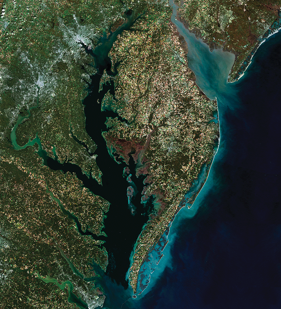
A Landsat 8 Surface Reflectance Mosaic of Chesapeake Bay created by staff of the U.S. Geological Survey’s Earth Resources Observation and Science (EROS) Center. They used Provisional Surface Reflectance data from five Landsat 8 scenes, acquired in October and November 2014.
Energy and Minerals for the Future
Clean Energy Research
The USGS conducts resource assessments and research on the geologic processes and settings that form energy resources needed to meet future clean energy goals. Included in this research is a focus on renewable and emerging resources, such as geothermal energy for heating and cooling, gas hydrates, naturally occurring hydrogen, resource extraction from brines and produced water, and geologic carbon dioxide and energy storage.
Geothermal Energy
The USGS conducts resource assessments and research to update and expand future assessments of geothermal energy resources, including low-temperature geothermal resources.
Subsurface Energy Storage
The USGS is building screening criteria and a methodology to evaluate and assess subsurface reservoirs for various energy storage options such as compressed air energy storage, pumped hydroelectric energy storage, gas (including hydrogen) storage, and geothermal storage. Wind and solar electricity production may outpace industrial power requirements, and it is important to store excess energy for later demand. The excess energy could be stored in geologic reservoirs, which have greater storage capacity than commonly used battery storage.
Paleoecology and Paleoclimatology
The USGS conducts fundamental research on the prehistoric patterns and processes that controlled plant community distributions across the globe over long geologic time scales. Using proxy environmental records of past change, including tree rings, packrat middens, sediment cores, ice cores, and other paleo-archives, USGS scientists can reconstruct the timing and extent of past changes in climate and ecosystem response. This fundamental long-term perspective on paleoecology and paleoclimate gives scientists and society a broader understanding of (1) the rates of ecosystem change in response to climate change from decades to centuries to millennia and (2) the prehistoric spatial distribution of many plant and animal species and ecosystems. This background helps researchers to characterize current and projected ecosystem change rates.
The Changing Cryosphere
The USGS runs a Benchmark Glacier Project which utilizes decades of measurements of glacial data obtained by remote sensing approaches to advance our understanding of glacier-climate interactions. We monitor glacial loss and determine the potential implications for water resources, sea-level rise, and ecosystem functioning to inform adaptive strategies. The permanent presence of the USGS in Alaska gives the Bureau unique strengths in working with the local communities dependent on northern latitude ecosystems by providing science on a changing cryosphere that is critical to the people there. Northern latitude soils and permafrost are likely to become the largest carbon feedback (also called permafrost carbon feedback) due to widespread thawing predicted for this century, making them particularly important for the global carbon cycle.
Coastal and Geologic Hazards
Coastal Hazards and Sea-Level Rise
The USGS conducts research and develops science-based tools to support decision making that leads to safer, more productive coastal communities and improved stewardship of natural resources. Research focuses on understanding geologic and ecosystem structures and processes that drive evolution of wetlands and other ecosystems under scenarios of climate and human influence; the current state and evolution of coastal landscapes and their response to natural and human-driven processes; the characteristics and processes that shape the continental shelf (which drives coastal evolution in response to climate-driven processes like storms); and the geologic and physical processes that impact shallow ocean and deep sea ecosystems, marine hazards, and mineral and energy resources. USGS scientists integrate storm and sea-level-rise projections generated by the National Oceanic and Atmospheric Administration and other partners to understand and model how those processes shape coastal landforms for applications in natural resource management and coastal restoration, among others. Modeling and forecasting capabilities range from real-time (for example, Total Water Level and Coastal Change [TWL&CC] Forecast Viewer, at https://coastal.er.usgs.gov/hurricanes/research/twlviewer/) to multidecadal (for example, Coupled-Ocean-Atmosphere-Wave-Sediment Transport [COAWST] Modeling System, at https://www.usgs.gov/centers/whcmsc/science/coawst-a-coupled-ocean-atmosphere-wave-sediment-transport-modeling-system).
Landslides
The USGS maps landslide hazards across the Nation and researches the causes of ground failure at various timescales and how those causes may change under a changing climate. USGS scientists research landslide risks that may be altered due to seismicity; land use and land cover changes; climate-induced changes in temperatures, drought, wildfires, and precipitation patterns (including extremes); permafrost degradation; glacial retreat; and sea-level rise.
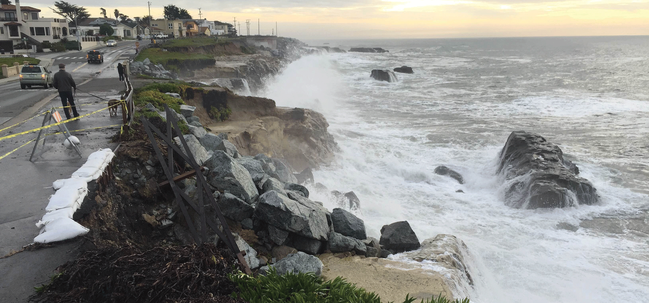
Photograph of a bluff along East Cliff Drive in Santa Cruz, California, where rip-rap is not sufficient to prevent erosion when sea level rises during big storms. Photograph by Andrew Stevens, U.S. Geological Survey.
Liquefaction
Where sea-level rise raised groundwater tables, USGS scientists have evaluated the sensitivity of the liquefaction hazard at boring sites with soil profiles. The USGS has produced regional liquefaction susceptibility maps which highlight regions more vulnerable to liquefaction due to increasing precipitation extremes and flooding, as well as location relative to seismically active regions.
Induced Seismicity
USGS scientists study how changes in stress loads on faults may occur due to climate-induced processes such as changes in surface-water storage, groundwater pumping, and fault lubrication. Researchers also evaluate whether changing stress loads may induce seismic changes. The USGS also provides science to evaluate the potential for seismicity induced by geologic carbon sequestration, hydrogen storage, and geothermal energy production, in addition to current oil-and-gas-focused efforts.
Climate Science Services
USGS scientists and staff are at the forefront of providing data for public-facing climate services. The USGS provides important tools and web platforms for data integration, accessibility, availability, and visualization. The USGS offers critical expertise that facilitates management and policy decision making by, for example, engaging State, Federal, and Tribal co-management councils; developing knowledge co-production techniques with land managers; and pioneering structured decision-making tools and models with explicit consideration of uncertainty. The USGS provides technical assistance to a variety of partners, offering expertise in ecosystem forecasting, climate model selection, and data analysis, among other areas. USGS scientists offer trainings—such as Climate 101 (introductory climate science workshops), vulnerability assessments, scenario planning, structured decision making, and adaptation strategies—to the public as well as to domestic and international partners while also building the next generation of climate scientists. The USGS leads partnership-driven research that teams scientists with natural, cultural, and land resource managers to help ecosystems, flora and fauna, and people adapt to a changing climate. Finally, the USGS is an international leader in understanding greenhouse gas emissions and carbon sequestration from forest degradation and deforestation while incorporating the role of conservation and sustainable forest management for the enhancement of forest carbon stocks in developing countries.
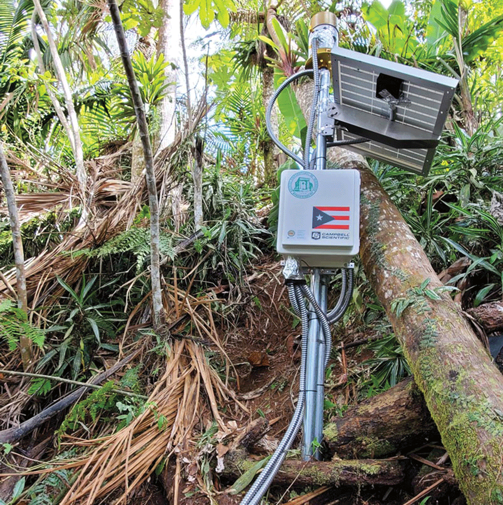
Photograph of a landslide monitoring station at Adjuntas, Puerto Rico. Photograph by Bill Schulz, U.S. Geological Survey.
References Cited
Baldocchi, D., 2014, Measuring fluxes of trace gases and energy between ecosystems and the atmosphere—The state and future of the eddy covariance method: Global Change Biology, v. 20, no. 12, p. 3600–3609, accessed April 20, 2024, at https://doi.org/10.1111/gcb.12649.
Jenni, K.E., Carter, S.K., Aumen, N.G., Bowen, Z.H., Bradford, J.B., Chotkowski, M.A., Hsu, L., Murdoch, P.S., Phillips, S.W., Pope, K.L., Schuster, R., Steinkamp, M.J., Weltzin, J., and Xian, G.Z., 2021, U.S. Geological Survey landscape science strategy 2020–2030: U.S. Geological Survey Circular 1484, 26 p., accessed April 20, 2024, at https://doi.org/10.3133/cir1484.
National Academies of Sciences, Engineering, and Medicine, 2021, Global change research needs and opportunities for 2022–2031: The National Academies Press, 108 p., accessed April 20, 2024, at https://doi.org/10.17226/26055.
Ocean Policy Committee, 2023, Ocean Climate Action Plan: Office of Science and Technology Policy, 105 p., accessed January 11, 2024, at https://www.whitehouse.gov/wp-content/uploads/2023/03/Ocean-Climate-Action-Plan_Final.pdf.
Schmid, H.P., Su, H.-B., Vogel, C.S., and Curtis, P.S., 2003, Ecosystem-atmosphere exchange of carbon dioxide over a mixed hardwood forest in northern lower Michigan: Journal of Geophysical Research: Atmospheres, v. 108, no. D14, article 4417, 19 p., accessed April 20, 2024, at https://doi.org/10.1029/2002JD003011.
U.S. Global Change Research Program (USGCRP), 2018, Second state of the carbon cycle report (SOCCR2)—A sustained assessment report (Cavallaro, N., Shrestha, G., Birdsey, R., Mayes, M.A., Najjar, R.G., Reed, S.C., Romero-Lankao, P., and Zhu, Z., eds.): U.S. Global Change Research Program, 878 p., accessed February 13, 2024, at https://doi.org/10.7930/Soccr2.2018.
Yang, X., Zhu, Z., Qiu, S., Kroeger, K.D., Zhu, Z., and Covington, S., 2022, Detection and characterization of coastal tidal wetland change in the northeastern US using Landsat time series: Remote Sensing of Environment, v. 276, accessed April 20, 2024, at https://doi.org/10.1016/j.rse.2022.113047.
Appendix 2. Goals, Strategies, Impacts, and Outcomes of the U.S. Geological Survey Climate Science Plan
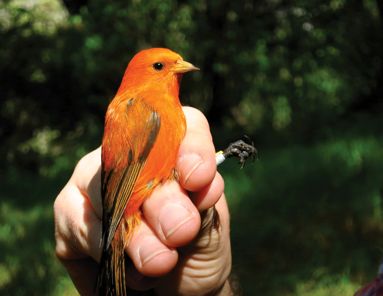
Photograph of a male Hawai‘i ‘akepa (Loxops coccineus). This bird belongs to an endangered species. Photograph by Lucas Berio Fortini, U.S. Geological Survey.
Table 2.1.
Goals, strategies, impacts, and outcomes for “Priority 1—Characterize Climate Change and Associated Impacts.”[DOI, U.S. Department of the Interior; USGS, U.S. Geological Survey]
Table 2.2.
Goals, strategies, impacts, and outcomes for “Priority 2—Assess Climate Change Risks and Develop Approaches To Mitigate Climate Change.”[DOI, U.S. Department of the Interior; USGS, U.S. Geological Survey]
Table 2.3.
Goals, strategies, impacts, and outcomes for “Priority 3—Provide Climate Science Tools and Support.”[DOI, U.S. Department of the Interior; USGS, U.S. Geological Survey]
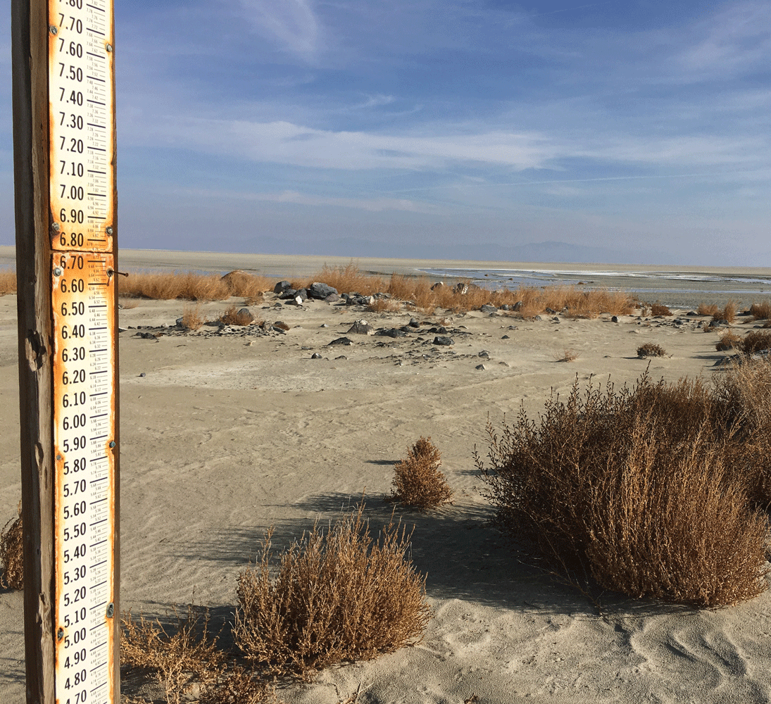
Photograph of a low water level in 2015 in the Great Salt Lake, Utah. A gage used for measuring water levels is on the dry part of the lake bed. As lakes dry out, problems may include dust storms and the release of carbon dioxide. Photograph by Michael L. Freeman, U.S. Geological Survey.
Abbreviations
BIA
Bureau of Indian Affairs
BLM
Bureau of Land Management
BOEM
Bureau of Ocean Energy Management
C
carbon
CCIWG
Climate Change Interagency Working Group
CDR
carbon dioxide removal
CO2
carbon dioxide
COAWST
Coupled-Ocean-Atmosphere-Wave-Sediment Transport Modeling System
DECODE
DEtection and Characterization of cOastal tiDal wEtlands change
DOI
U.S. Department of the Interior
GHG
greenhouse gas
IARPC
Interagency Arctic Research Policy Committee
ICAMS
Interagency Council for Advancing Meteorological Services
ICRA
Integrated Carbon Resource Assessment
IPCC
Intergovernmental Panel on Climate Change
IWAAs
Integrated Water Availability Assessments
LANDFIRE
Landscape Fire and Resource Management Planning Tools
LCMAP
Land Change Monitoring, Assessment, and Projection
MMRV
measuring, monitoring, reporting, and verifying
NACP
North American Carbon Program
NLCD
National Land Cover Database
NOAA
National Oceanic and Atmospheric Administration
NPS
National Park Service
OSTP
Office of Science and Technology Policy
TWL&CC
Total Water Level and Coastal Change
USFWS
U.S. Fish and Wildlife Service
USGCRP
U.S. Global Change Research Program
USGS
U.S. Geological Survey
For additional information, contact:
National Climate Adaptation Science Center
U.S. Geological Survey
12201 Sunrise Valley Drive
Mail Stop 516
Reston, VA 20192
Email: casc@usgs.gov
Website: https://www.usgs.gov/programs/climate-adaptation-science-centers
Publishing support provided by the U.S. Geological Survey Science Publishing Network, Reston Publishing Service Center and Pembroke Publishing Service Center
Edited by Elizabeth Good
Layout by David Bruce
XML support by Emerson Dyas and Natalie Juda
Disclaimers
Any use of trade, firm, or product names is for descriptive purposes only and does not imply endorsement by the U.S. Government.
Although this information product, for the most part, is in the public domain, it also may contain copyrighted materials as noted in the text. Permission to reproduce copyrighted items must be secured from the copyright owner.
Suggested Citation
Wilson, T., Boyles, R.P., DeCrappeo, N., Drexler, J.Z., Kroeger, K.D., Loehman, R.A., Pearce, J.M., Waldrop, M.P., Warwick, P.D., Wein, A.M., Zeigler, S.L., and Beard, T.D., Jr., 2024, U.S. Geological Survey climate science plan—Future research directions: U.S. Geological Survey Circular 1526, 30 p., https://doi.org/10.3133/cir1526.
ISSN: 2330-5703 (online)
Study Area
| Publication type | Report |
|---|---|
| Publication Subtype | USGS Numbered Series |
| Title | U.S. Geological Survey climate science plan—Future research directions |
| Series title | Circular |
| Series number | 1526 |
| DOI | 10.3133/cir1526 |
| Publication Date | September 06, 2024 |
| Year Published | 2024 |
| Language | English |
| Publisher | U.S. Geological Survey |
| Publisher location | Reston, VA |
| Contributing office(s) | Alaska Science Center, California Water Science Center, Eastern Energy Resources Science Center, Forest and Rangeland Ecosys Science Center, Volcano Science Center, Western Geographic Science Center, Woods Hole Coastal and Marine Science Center, National Climate Adaptation Science Center, Southeast Climate Adaptation Science Center, Coastal and Marine Hazards and Resources Program, Northwest Climate Adaptation Science Center |
| Description | iv, 30 p. |
| Country | United States |
| Online Only (Y/N) | Y |
| Additional Online Files (Y/N) | N |