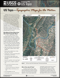
US Topo: topographic maps for the nation
Links
- More information: USGS Index Page
- Document: Report
- Superseding Publications:
- Download citation as: RIS | Dublin Core
Abstract
US Topo is the next generation of topographic maps from the U.S. Geological Survey (USGS). Arranged in the familiar 7.5-minute quadrangle format, digital US Topo maps are designed to look and feel (and perform) like the traditional paper topographic maps for which the USGS is so well known. In contrast to paper-based maps, US Topo maps provide modern technical advantages that support faster, wider public distribution and enable basic, on-screen geographic analysis for all users.
The US Topo quadrangle map has been redesigned so that map elements are visually distinguishable with the imagery turned on and off, while keeping the file size as small as possible. The US Topo map redesign includes improvements to various display factors, including symbol definitions (color, line thickness, line symbology, area fills), layer order, and annotation fonts. New features for 2013 include the following: a raster shaded relief layer, military boundaries, cemeteries and post offices, and a US Topo cartographic symbols legend as an attachment.
US Topo quadrangle maps are available free on the Web. Each map quadrangle is constructed in GeoPDF® format using key layers of geographic data (orthoimagery, roads, geographic names, topographic contours, and hydrographic features) from The National Map databases.
US Topo quadrangle maps can be printed from personal computers or plotters as complete, full-sized, maps or in customized sections, in a user-desired specific format. Paper copies of the maps can also be purchased from the USGS Store. Download links and a users guide are featured on the US Topo Web site.
US Topo users can turn geographic data layers on and off as needed; they can zoom in and out to highlight specific features or see a broader area. File size for each digital 7.5-minute quadrangle, about 30 megabytes. Associated electronic tools for geographic analysis are available free for download. The US Topo provides the Nation with a topographic product that users can quickly incorporate into decisionmaking, operational or recreational activities.
Suggested Citation
Carswell, W., 2013, US Topo: topographic maps for the nation: U.S. Geological Survey Fact Sheet 2013-3093, 2 p., https://doi.org/10.3133/fs20133093.
ISSN: 2327-6932 (online)
| Publication type | Report |
|---|---|
| Publication Subtype | USGS Numbered Series |
| Title | US Topo: topographic maps for the nation |
| Series title | Fact Sheet |
| Series number | 2013-3093 |
| DOI | 10.3133/fs20133093 |
| Year Published | 2013 |
| Language | English |
| Publisher | U.S. Geological Survey |
| Publisher location | Reston, VA |
| Contributing office(s) | National Geospatial Technical Operations Center |
| Description | 2 p. |
| Country | United States |
| Additional Online Files (Y/N) | N |


