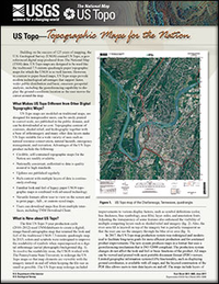
US Topo—Topographic maps for the Nation
Links
- Document: Report (3.21 MB pdf)
- Related Work: Scanning and Georeferencing Historical USGS Quadrangles
- Superseded Publications:
- Download citation as: RIS | Dublin Core
Abstract
Building on the success of 125 years of mapping, the U.S. Geological Survey created US Topo, a georeferenced digital map produced from The National Map data. US Topo maps are designed to be used like the traditional 7.5-minute quadrangle paper topographic maps for which the U.S. Geological Survey is so well known. However, in contrast to paper-based maps, US Topo maps provide modern technological advantages that support faster, wider public distribution and basic, onscreen geospatial analysis, including the georeferencing capability to display the ground coordinate location as the user moves the cursor around the map.
Suggested Citation
Fishburn, K.A., and Carswell, W.J., Jr., 2017, US Topo—Topographic maps for the Nation: U.S. Geological Survey Fact Sheet 2017–3045, 2 p., https://doi.org/10.3133/fs20173045.
ISSN: 2327-6932 (online)
ISSN: 2327-6916 (print)
Table of Contents
- What Makes US Topo Different from Other Digital Topographic Maps?
- What is New About US Topo?
- What Are the Future Plans?
| Publication type | Report |
|---|---|
| Publication Subtype | USGS Numbered Series |
| Title | US Topo—Topographic maps for the Nation |
| Series title | Fact Sheet |
| Series number | 2017-3045 |
| DOI | 10.3133/fs20173045 |
| Publication Date | June 23, 2017 |
| Year Published | 2017 |
| Language | English |
| Publisher | U.S. Geological Survey |
| Publisher location | Reston, VA |
| Contributing office(s) | National Geospatial Program |
| Description | 2 p. |
| Online Only (Y/N) | N |


