South Carolina and Landsat
Links
- Document: Report (3.62 MB pdf) , HTML , XML
- Version History: Version History (1.94 kB txt)
- Download citation as: RIS | Dublin Core
Abstract
South Carolina, the eighth State admitted to the union, transcends its size with its deep, rich history; striking beauty; vast natural resources; and extensive cultural diversity. Home to part of the Blue Ridge Mountains of the Central Appalachians, the Upstate is graced with more than 100 waterfalls, while the Lowcountry borders the Atlantic Ocean with 187 miles of coastline and 35 barrier islands. Forests cover two-thirds of the State, and forestry and agriculture together, as agribusiness, make up South Carolina’s leading industry. Two historic crops—cotton and tobacco—still rank in the top 10 commodities, though corn and soybeans now rank higher. Poultry, cattle, peanuts, and flowers also make the list (South Carolina Department of Agriculture, 2022).
South Carolina’s population totals more than five million. Other residents include a variety of wildlife, bird, reptile, and fish species, including Ursus americanus (black bears), Alligator mississippiensis (American alligators), and Tursiops truncatus (bottlenose dolphins). More than 100 tree species also reside in South Carolina, which pays homage to one with its “The Palmetto State” nickname.
South Carolina’s subtropical climate, long coastline, and lower elevations make it highly susceptible to tornado and hurricane activity and coastal flooding. Projected sea-level rise is a growing concern. A view from space can help monitor and manage natural resources on the land and in rivers, marshes, and the coast. Landsat reveals not just what an area looks like now, but also insights from decades ago.
Here are just a few ways Landsat has been used to study and benefit South Carolina.
Managing the Forests
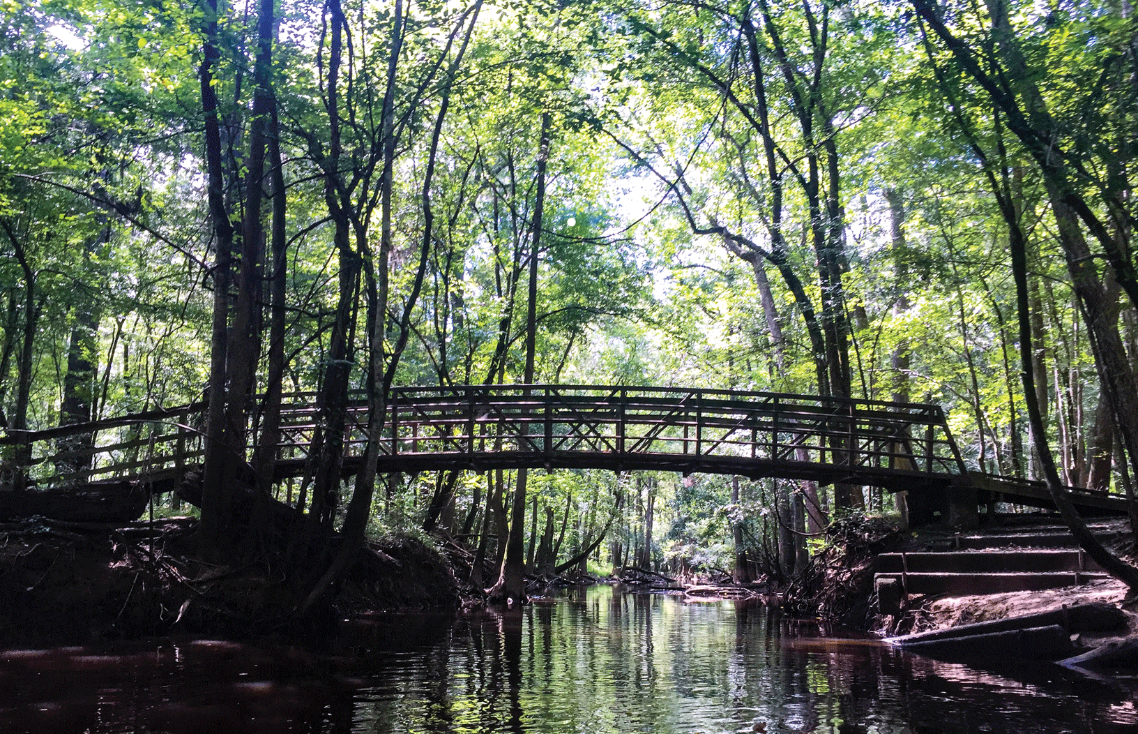
The woodlands of South Carolina contain an array of trees, from the prevalent loblolly pine to assorted oaks. Although there are several State and National forests within its boundaries, most of South Carolina’s forested land is privately owned. Forests contribute $21 billion to the State’s economy, from pulp and paper products to logging and recreation (South Carolina Forestry Commission, 2022). The South Carolina Forestry Commission is among 13 State forest agencies in the South participating in the Southern Forest Area Change Tools (SouthFACT) project. SouthFACT uses Landsat images to provide information about the location and extent of forest change (Southern Forest Area Change Tools, 2022).

Congaree National Park contains some of South Carolina’s forested land, with an old growth bottomland hardwood forest and an upland pine forest. Photograph credit: Victoria Stauffenberg, National Park Service.
Monitoring the Watersheds
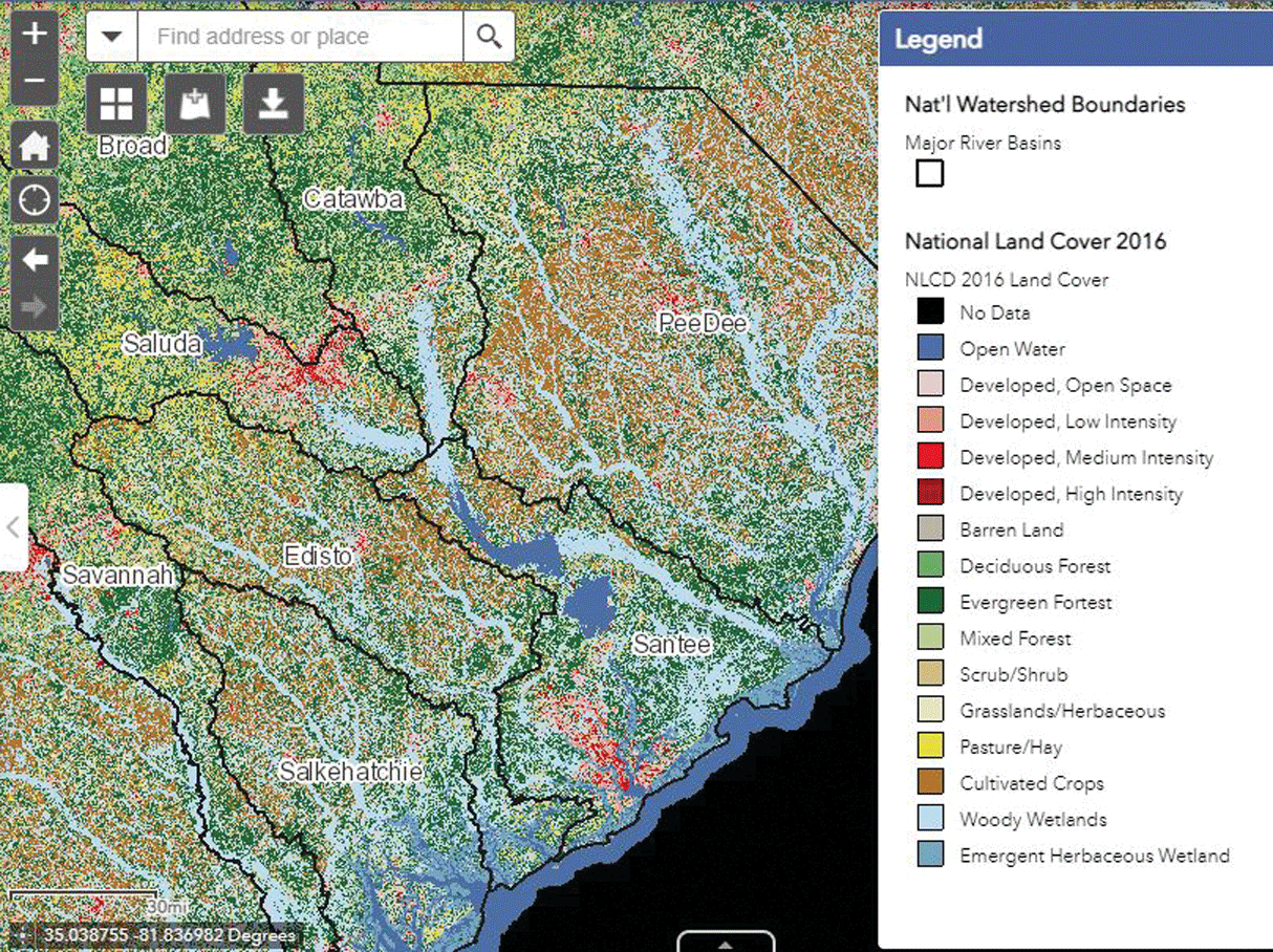
Landsat satellite imagery forms the basis of the National Land Cover Database (NLCD), whose mapping products characterize land cover and land cover change over time. This information helps managers analyze, model, and make decisions about the land. The South Carolina Department of Health and Environmental Control includes NLCD information in its Watershed Atlas (https://gis.dhec.sc.gov/watersheds/), an interactive map that provides layers of data to help understand and respond to water quality problems (South Carolina Department of Health and Environmental Control, 2019).

The South Carolina Department of Health and Environmental Control (SCDHEC) offers a Watershed Atlas showing a variety of layers, including the National Land Cover Database layer produced with Landsat data shown here. Image credit: SCDHEC.
Assessing Coastal Marshes
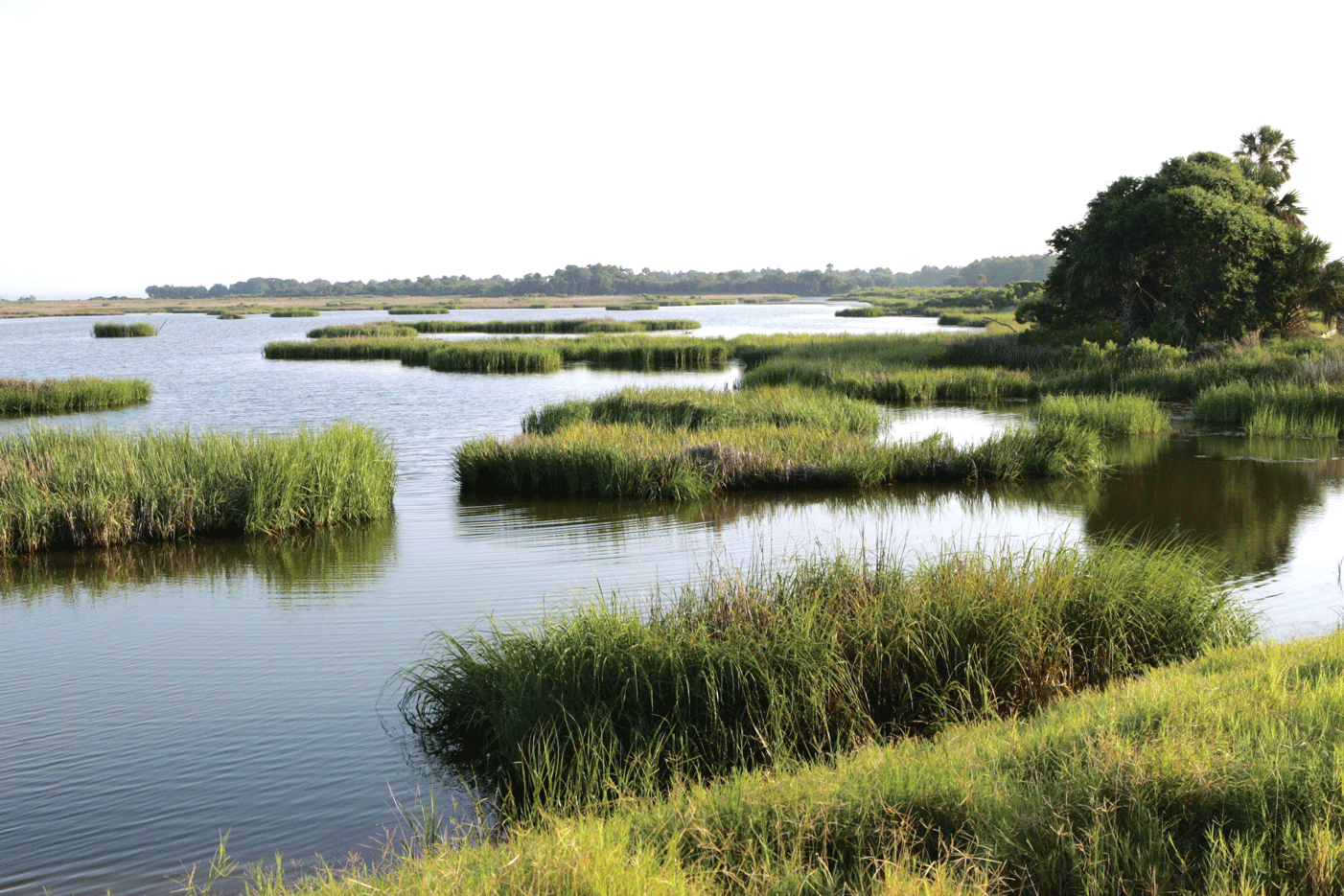
Its scale and nearly 50-year archive make Landsat invaluable for a variety of uses. One example from 2020 involved a collaboration among the South Carolina Department of Natural Resources, Department of Health and Environmental Control, and the USGS with a NASA DEVELOP project team. To understand which areas might need more resources, the DEVELOP team assessed the vulnerability of the productive salt marsh ecosystem, under potential threat from rising sea levels and upstream changes in land use near Charleston. For the analysis, the DEVELOP team used an UnVegetated-Vegetated Ratio (UVVR) method derived partly from Landsat data to map changes in vulnerability back to 1984 (Stidd and others, 2020). The National Oceanic and Atmospheric Administration (NOAA) Office for Coastal Management, located in Charleston, uses Landsat data for its Coastal Change Analysis Program (C–CAP), which produces land cover and change products and contributes to tools such as the Sea Level Rise Viewer (National Oceanic and Atmospheric Administration Office for Coastal Management, 2022).

A marsh on Bulls Island off the coast of South Carolina. Photograph credit: Steve Hillebrand, U.S. Fish and Wildlife Service.
National Land Imaging Program Benefits—South Carolina
The U.S. Geological Survey (USGS) National Land Imaging Program provides a wide range of satellite imagery and other remotely sensed and geospatial data to Government, commercial, academic, and public users. Those users can get worldwide access to Landsat satellite data through the National Land Imaging Program-funded USGS Earth Resources Observation and Science (EROS) Center.
Landsat—Critical Information Infrastructure for the Nation
Landsat is the most widely used land remote sensing data source within Federal civilian agencies. Local, State, Tribal, and Federal agencies use Landsat to monitor and forecast a wide range of land surface phenomena. Information from Landsat contributes to day-to-day decisions on land, water, and resource use that protect life and property; safeguard the environment; advance science, technology, and education; support climate change resiliency; and grow the U.S. economy. Landsat’s imagery provides a landscape-level view of land surface, inland lake, and coastal processes, both natural and human-induced. Landsat enables us to better understand the scope, nature, and speed of change to the natural and built environment.
Businesses draw upon Landsat data to provide customer-specific applications to improve logistics, resource allocation, and investment decisions. Commercial space imaging firms leverage Landsat data to refine product offerings and support new information services. A 2017 USGS study determined the total annual economic benefit of Landsat data in the United States to be $2.06 billion, far surpassing its development and operating costs (Straub and others, 2019).
Landsat 8 and Landsat 9 provide 8-day repeat coverage of the Earth’s land surfaces. The National Aeronautics and Space Administration (NASA) and the USGS are currently reviewing the findings from a joint Architecture Study Team, which will inform the design and implementation approach for Landsat Next, the follow-on mission to Landsat 9. Landsat 9 and its successors are planned to provide a sustainable, space-based system to extend the 50-year Landsat series of high-quality global land imaging measurements—the world’s longest time series of the Earth’s land surface.
The long-term availability of consistent and accurate Landsat data, combined with a no-cost data policy, allows users to analyze extensive geographic areas and to better understand and manage long-term trends in land surface change. New cloud computing and data analytics technologies use Landsat data in a wide range of decision-support tools for Government and industry. Much like global positioning system and weather data, Landsat data are used every day to help us better understand our dynamic planet.
References Cited
National Oceanic and Atmospheric Administration Office for Coastal Management, 2022, More than just data: NOAA Office for Coastal Management Digital Coast website, accessed January 6, 2022, at https://coast.noaa.gov/digitalcoast/.
South Carolina Department of Agriculture, 2022, About agriculture in South Carolina: South Carolina Department of Agriculture webpage, accessed January 6, 2022, at https://agriculture.sc.gov/about/.
South Carolina Department of Health and Environmental Control, 2019, SC Watershed Atlas: South Carolina Department of Health and Environmental Control webpage, accessed January 6, 2022, at https://scdhec.gov/environment/your-water-coast/watersheds-program/sc-watershed-atlas.
South Carolina Forestry Commission, 2022, Economic development: South Carolina Forestry Commission webpage, accessed January 6, 2022, at https://www.scfc.gov/development/economic-development/.
Southern Forest Area Change Tools, 2022, Project overview: Southern Forest Area Change Tools webpage, accessed January 6, 2022, at https://www.southfact.com/about/project_overview.
Stidd, J.T.T., Le Compte, A., Gates, E., and Nguyen, D., 2020, Utilizing airborne and space-based remote sensing imagery to implement the UnVegetated-Vegetated Ratio to assess salt marsh vulnerability in South Carolina [abs.], in American Geophysical Union, Fall Meeting 2020: Astrophysics Data System Abstract Service, December 2020, accessed January 6, 2022, at https://ui.adsabs.harvard.edu/abs/2020AGUFMB049.0009S/abstract.
Straub, C.L., Koontz, S.R., and Loomis, J.B., 2019, Economic valuation of Landsat imagery: U.S. Geological Survey Open-File Report 2019–1112, 13 p., accessed January 6, 2022, at https://pubs.er.usgs.gov/publication/ofr20191112.
For additional information on Landsat, please contact:
Program Coordinator
USGS National Land Imaging Program
12201 Sunrise Valley Drive
Reston, VA 20192
703–648–4567
The Landsat series is a joint effort of USGS and NASA. NASA develops and launches the spacecraft; USGS manages satellite operations, ground reception, data archiving, product generation, and data distribution. Funding for the National Land Imaging Program’s Landsat operations and data management is provided through the USGS.
Disclaimers
Any use of trade, firm, or product names is for descriptive purposes only and does not imply endorsement by the U.S. Government.
Although this information product, for the most part, is in the public domain, it also may contain copyrighted materials as noted in the text. Permission to reproduce copyrighted items must be secured from the copyright owner.
Suggested Citation
U.S. Geological Survey, 2022, South Carolina and Landsat (ver. 1.1, January 2023): U.S. Geological Survey Fact Sheet 2022–3005, 2 p., https://doi.org/10.3133/fs20223005.
ISSN: 2327-6932 (online)
ISSN: 2327-6916 (print)
Study Area
| Publication type | Report |
|---|---|
| Publication Subtype | USGS Numbered Series |
| Title | South Carolina and Landsat |
| Series title | Fact Sheet |
| Series number | 2022-3005 |
| DOI | 10.3133/fs20223005 |
| Edition | Version 1.0: February 18, 2022; Version 1.1: January 23, 2023 |
| Publication Date | February 18, 2022 |
| Year Published | 2022 |
| Language | English |
| Publisher | U.S. Geological Survey |
| Publisher location | Reston, VA |
| Contributing office(s) | Earth Resources Observation and Science (EROS) Center |
| Description | 2 p. |
| Country | United States |
| State | South Carolina |
| Online Only (Y/N) | N |


