Rangeland Condition Monitoring Assessment and Projection (RCMAP)
Links
- Document: Report (8.20 MB pdf) , HTML , XML
- Download citation as: RIS | Dublin Core
Abstract
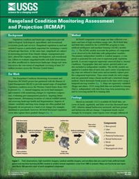
The Rangeland Condition Monitoring Assessment and Projection (RCMAP) project has partnered with the Bureau of Land Management to provide annual maps of rangeland vegetation condition across the Western United States from 1985 to present. Annual mapping can assist land managers and scientists with monitoring changes to vegetation composition, evaluating past management practices, targeting future improvements, determining locations of critical wildlife habitat, and assessing landscape health and fragmentation. Impacts of climate variability and long-term change are often gradual and frequently do not present as a land cover change (for example, shrubland to grassland); however, RCMAP fractional vegetation cover data capture these gradual changes.
Suggested Citation
Rigge, M.B., 2022, Rangeland Condition Monitoring Assessment and Projection (RCMAP): U.S. Geological Survey Fact Sheet 2022–3036, 2 p., https://doi.org/10.3133/fs20223036.
ISSN: 2327-6932 (online)
Table of Contents
- Background
- Our Work
- Method
- Findings
- Implications
- Data Availability
- References Cited
| Publication type | Report |
|---|---|
| Publication Subtype | USGS Numbered Series |
| Title | Rangeland Condition Monitoring Assessment and Projection (RCMAP) |
| Series title | Fact Sheet |
| Series number | 2022-3036 |
| DOI | 10.3133/fs20223036 |
| Publication Date | May 31, 2022 |
| Year Published | 2022 |
| Language | English |
| Publisher | U.S. Geological Survey |
| Publisher location | Reston, VA |
| Contributing office(s) | Earth Resources Observation and Science (EROS) Center |
| Description | 2 p. |
| Online Only (Y/N) | Y |


