

Louisiana and Landsat
Links
- Document: Report (4.36 MB pdf) , HTML , XML
- Version History: Version History (1 KB txt)
- Download citation as: RIS | Dublin Core
Abstract
Louisiana holds a unique historical, economic, and cultural position in the national consciousness. Its off-shore oil operations help fuel the U.S. economy. The Port of South Louisiana is the busiest in the United States by cargo volume; the nearby Port of New Orleans is the sixth busiest. The former French and Spanish colony served as a key connection to the Caribbean long before U.S. independence, and Louisiana’s multinational effects soon melded into a Creole culture that had an outsized effect on America.
That heritage remains a powerful draw for the tourism industry in Louisiana. Gulf Coast breezes carry the aromas of tropical flowers, sweet beignets, and savory crawfish through the 13 colorful blocks of New Orleans’ French Quarter. Interwoven with the sounds of jazz, rock, country music, and zydeco, the city’s charms delight more than 18 million visitors each year.
The proximity of the Gulf Coast and the city’s elevation, however—just 6.5 feet above sea level—also offer an ominous warning of the ever-present threat of climate change and natural disaster. Hurricane Katrina battered New Orleans in 2005, an incident tied to more than 1,800 deaths that marks one of the most notorious U.S. weather-related tragedies in the 21st century. Environmental changes have amplified threats from tropical storms. Through more frequent and powerful storms, sea level rise threatens low-lying areas such as Lake Charles and creates unpredictable weather patterns that threaten the cities and agricultural operations to the north.
Landsat data offer rich information that can aid in early warning, disaster response, and the monitoring of recovery from natural disasters. Its historic, unparalleled 50-year archive of repeat Earth observations also serves to guide resiliency plans and feeds modeling that can help States like Louisiana prepare for coming coastal and inland change. Here are just a few examples of how Landsat has been used to study and understand Louisiana.
Watching the Coastlines
Louisiana’s coastal wetlands offer some protection from storm surges during tropical storms, as well as refuges for shorebirds and other wildlife, but these wetlands are rapidly disappearing. In 2017, the Geological Society of America estimated coastal subsidence in Louisiana of between 6 and 20 millimeters per year (Nienhuis and others, 2017). Landsat satellites can be used to monitor coastline changes at a wide scale and to track change over time and space. One study mined the Landsat record and determined that the shoreline of Bay Champagne had retreated 292 meters from 1983 through 2018 and the area would be fully submerged in 40 years if losses continued at that pace (Dietz and others, 2018).
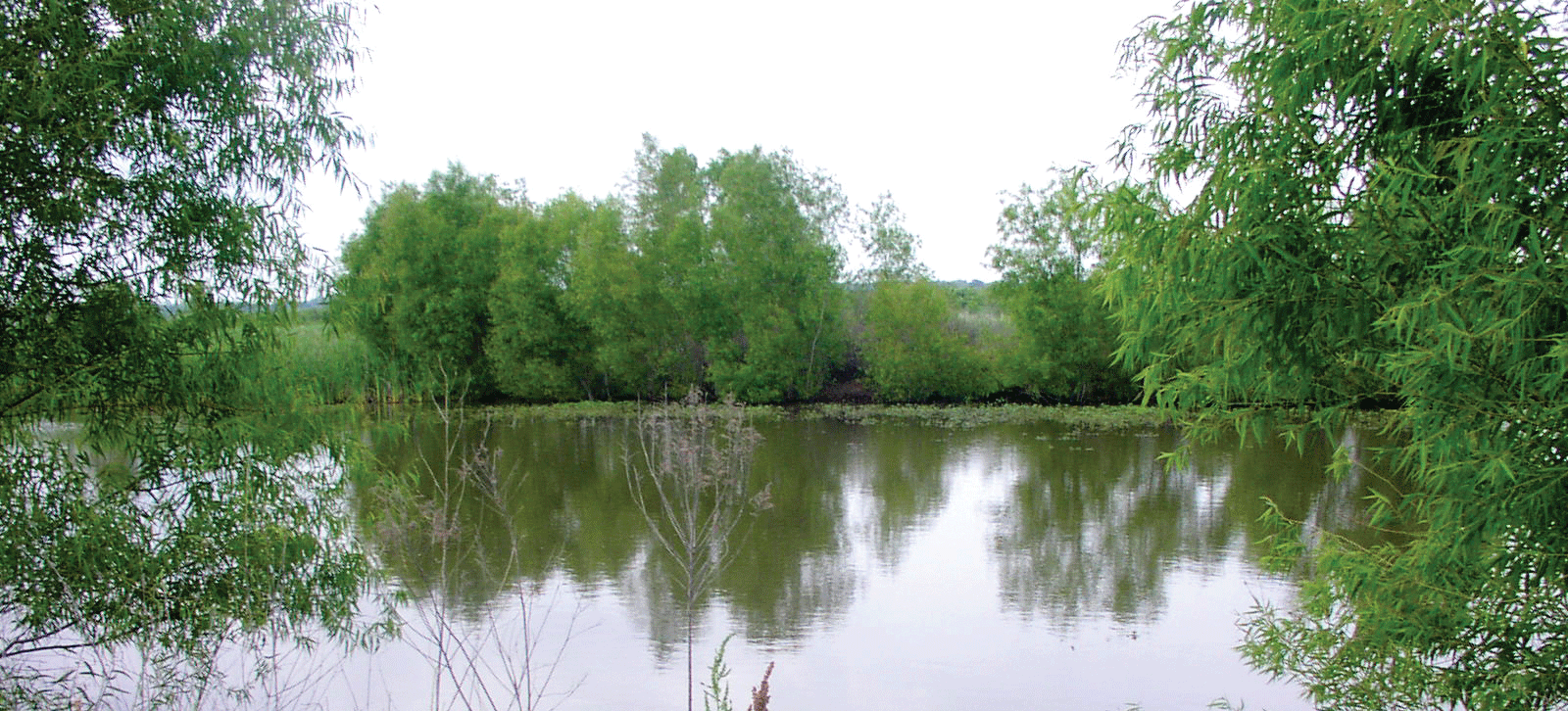
A U.S. Department of Agriculture Wetlands Reserve Program site in Natchitoches Parish, Louisiana. Photograph credit: Glenn Austin, Natural Resources Conservation Service.
Water Quality Control
From the seawater off the coast to the upstream tributaries of the Mississippi River, water quality is a critical component of Louisiana’s ecological and economic health. Landsat satellites gather imagery in bands of the electromagnetic spectrum beyond what the human eye can perceive. Peering past red, green, and blue into infrared and near-infrared wavelengths helps researchers detect dissolved organic matter or harmful algal blooms more clearly and at a wider scale. One study used Landsat and other satellite data sources to map water quality trends over time in Barataria Basin (Liu and others, 2019). Another study used Landsat imagery to track damage from the Deepwater Horizon oil spill, which released more than 200 million gallons of oil into the Gulf of America and contaminated more than 1,300 miles of coastline across several States, including Louisiana (Mo and others, 2017). That study determined that the most substantial effects to aboveground vegetation health in Louisiana’s salt marshes occurred within the first 2 years of the spill (Mo and others, 2017).
Mapping Disaster, Monitoring Recovery
With 7,721 miles of coastline, Louisiana is among the States most vulnerable to hurricanes. Landsat satellite imagery offers a powerful tool for monitoring hurricane damage and recovery. In a hurricane’s immediate aftermath, Landsat feeds into the USGS Hazards Data Distribution System, which ingests and releases satellite imagery to first responders and researchers attempting to map inundation. In the months and years afterward, Landsat’s repeat observations offer a wealth of information for tracking long-term effects (Barras, 2006). For example, 10 years after Hurricane Katrina, Landsat imagery captured swollen lakes, new waterways, and submerged marshes in some of the area’s most heavily affected wetlands (National Aeronautics and Space Administration, 2022).
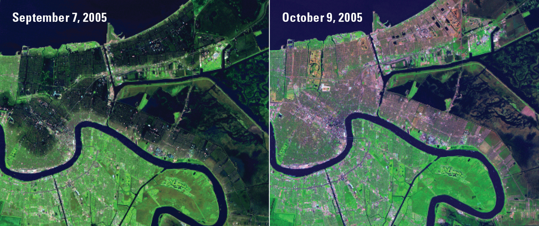
Hurricane Katrina devastated the Louisiana coastline in August 2005. These Landsat 5 images highlight the damage and the beginnings of recovery from the heavy flooding that struck New Orleans. The left image was captured on September 7, 2005, just over 1 week after the hurricane struck the city. The dark areas represent flooding. The right image from October 9, 2005, shows the previously flooded areas in shades of brown that signal destroyed vegetation. Image credits: U.S. Geological Survey.
National Land Imaging Program Benefits—Louisiana
The U.S. Geological Survey (USGS) National Land Imaging Program provides a wide range of satellite imagery and other remotely sensed and geospatial data to Government, commercial, academic, and public users. Those users can get worldwide access to Landsat satellite data through the National Land Imaging Program-funded USGS Earth Resources Observation and Science (EROS) Center.
Landsat—Critical Information Infrastructure for the Nation
Landsat is the most widely used land remote sensing data source within Federal civilian agencies. Local, State, Tribal, and Federal agencies use Landsat to monitor and forecast a wide range of land surface phenomena. Information from Landsat contributes to day-to-day decisions on land, water, and resource use that protect life and property; safeguard the environment; advance science, technology, and education; support climate change resiliency; and grow the U.S. economy. Landsat’s imagery provides a landscape-level view of land surface, inland lake, and coastal processes, both natural and human-induced. Landsat enables us to better understand the scope, nature, and speed of change to the natural and built environment.
Businesses draw upon Landsat data to provide customer-specific applications to improve logistics, resource allocation, and investment decisions. Commercial space imaging firms leverage Landsat data to refine product offerings and support new information services. A 2017 USGS study determined the total annual economic benefit of Landsat data in the United States. to be $2.06 billion, far surpassing its development and operating costs (Straub and others, 2019).
Landsat 8 and Landsat 9 provide 8-day repeat coverage of the Earth’s land surfaces. The National Aeronautics and Space Administration (NASA) and the USGS are currently reviewing the findings from a joint Architecture Study Team, which will inform the design and implementation approach for Landsat Next, the follow-on mission to Landsat 9. Landsat 9 and its successors are planned to provide a sustainable, space-based system to extend the 50-year Landsat series of high-quality global land imaging measurements—the world’s longest time series of the Earth’s land surface.
The long-term availability of consistent and accurate Landsat data, combined with a no-cost data policy, allows users to analyze extensive geographic areas and better understand and manage long-term trends in land surface change. New cloud computing and data analytics technologies use Landsat data in a wide range of decision-support tools for Government and industry. Much like global positioning systems and weather data, Landsat data are used every day to help us better understand our dynamic planet.
References Cited
Barras, J.A., 2006, Land area change in coastal Louisiana after the 2005 hurricanes—A series of three maps: U.S. Geological Survey Open-File Report 2006–1274, accessed July 19, 2022, at https://doi.org/10.3133/ofr20061274.
Dietz, M.E., Liu, K., and Bianchette, T.A., 2018, Hurricanes as a major driver of coastal erosion in the Mississippi River Delta—A multi-decadal analysis of shoreline retreat rates at Bay Champagne, Louisiana (USA): Water (Basel), v. 10, no. 10, art. 1480, 15 p., accessed July 19, 2022, at https://doi.org/10.3390/w10101480.
Liu, B., D’Sa, E.J., and Joshi, I., 2019, Multi-decadal trends and influences on dissolved organic carbon distribution in the Barataria Basin, Louisiana from in-situ and Landsat/MODIS observations: Remote Sensing of Environment, v. 228, p. 183–202. [Also available at https://doi.org/10.1016/j.rse.2019.04.023.]
Mo, Y., Kearney, M.S., and Riter, J.C.A., 2017, Post-Deepwater Horizon oil spill monitoring of Louisiana salt marshes using Landsat imagery: Remote Sensing, v. 9, no. 6, art. 547, 12 p., accessed July 19, 2022, at https://doi.org/10.3390/rs9060547.
National Aeronautics and Space Administration, 2022, Signs of Katrina linger in the marshes: National Aeronautics and Space Administration web page, accessed March 7, 2022, at https://landsat.visibleearth.nasa.gov/view.php?id=86492.
Nienhuis, J.H., Tӧrnqvist, T.C., Jankowski, K.L., Fernandes, A.M., and Keogh, M.E., 2017, A new subsidence map for coastal Louisiana: GSA Today, v. 27, no. 9, p. 58–59, accessed July 19, 2022, at https://doi.org/10.1130/GSATG337GW.1.
Straub, C.L., Koontz, S.R., and Loomis, J.B., 2019, Economic valuation of Landsat imagery: U.S. Geological Survey Open-File Report 2019–1112, 13 p., accessed April 8, 2022, at https://doi.org/10.3133/ofr20191112.
For additional information on Landsat, please contact:
Program Coordinator
USGS National Land Imaging Program
12201 Sunrise Valley Drive
Reston, VA 20192
703–648–4567
The Landsat series is a joint effort of USGS and NASA. NASA develops and launches the spacecraft; USGS manages satellite operations, ground reception, data archiving, product generation, and data distribution. Funding for the National Land Imaging Program’s Landsat operations and data management is provided through the USGS.
Disclaimers
Any use of trade, firm, or product names is for descriptive purposes only and does not imply endorsement by the U.S. Government.
Although this information product, for the most part, is in the public domain, it also may contain copyrighted materials as noted in the text. Permission to reproduce copyrighted items must be secured from the copyright owner.
Suggested Citation
U.S. Geological Survey, 2022, Louisiana and Landsat (ver. 1.1, March 2025): U.S. Geological Survey Fact Sheet 2022–3059, 2 p., https://doi.org/10.3133/fs20223059.
ISSN: 2327-6932 (online)
ISSN: 2327-6916 (print)
Study Area
| Publication type | Report |
|---|---|
| Publication Subtype | USGS Numbered Series |
| Title | Louisiana and Landsat |
| Series title | Fact Sheet |
| Series number | 2022-3059 |
| DOI | 10.3133/fs20223059 |
| Edition | Version 1.0: July 20, 2022; Version 1.1: March 19, 2025 |
| Publication Date | July 20, 2022 |
| Year Published | 2022 |
| Language | English |
| Publisher | U.S. Geological Survey |
| Publisher location | Reston, VA |
| Contributing office(s) | Earth Resources Observation and Science (EROS) Center |
| Description | 2 p. |
| Country | United States |
| State | Louisiana |
| Online Only (Y/N) | N |
| Additional Online Files (Y/N) | Y |