

Water-Quality Monitoring of the Merrimack River Watershed in Massachusetts
Links
- Document: Report (1.54 MB pdf) , HTML , XML
- Project Site: Project Site - Water Quality Monitoring of Merrimack River Watershed
- NGMDB Index Page: National Geologic Map Database Index Page (html)
- Download citation as: RIS | Dublin Core
Mission
The U.S. Geological Survey (USGS) has been working in collaboration with the Massachusetts Department of Environmental Protection (MassDEP) on a project to collect water-quality data from the Merrimack River watershed since April 2020. Twelve locations in the Merrimack River watershed are being sampled for nutrients (such as nitrogen), metals (such as aluminum), Escherichia coli bacteria, and other measures.
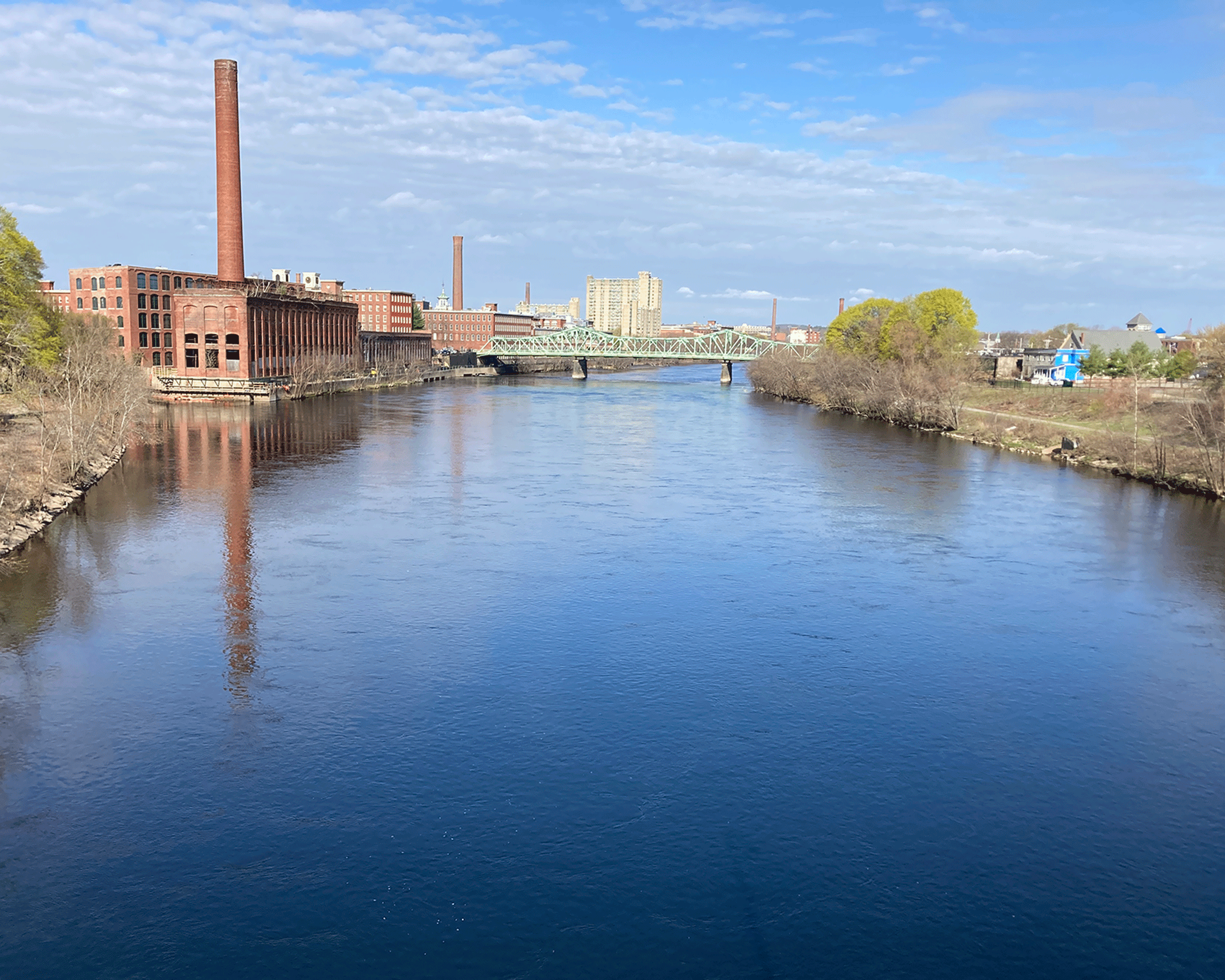
The Merrimack River was historically important for transportation and industry in both Massachusetts and New Hampshire. Photograph by U.S. Geological Survey.
Goals
-
Provide water-quality data to MassDEP to help meet Clean Water Act of 1972 requirements, and describe water-quality conditions compared to the Massachusetts-designated use criteria of the Merrimack River and selected tributaries
-
Build a database for future nitrogen modeling
-
Provide data on dissolved oxygen in marine and inland waters to:
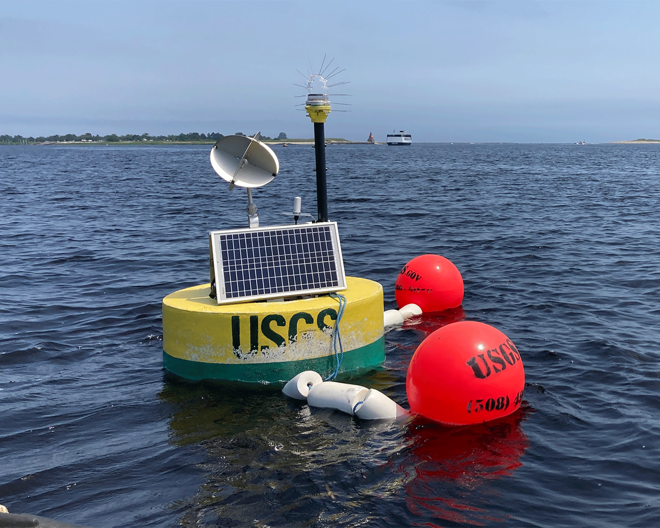
The U.S. Geological Survey uses water-quality monitoring stations and buoys like this one in the Merrimack River estuary to collect data about salinity, cloudiness, temperature, and more.
Work in the Merrimack River Estuary
-
Water-quality sample collection is planned for twice each month from May through October of each year.
-
Continuous water-quality monitoring equipment is planned to be deployed from May to October each year. Collected data can be viewed in real time, at https://waterdata.usgs.gov/nwis/uv/?site_no=011008745. Some of the real-time data collected include:
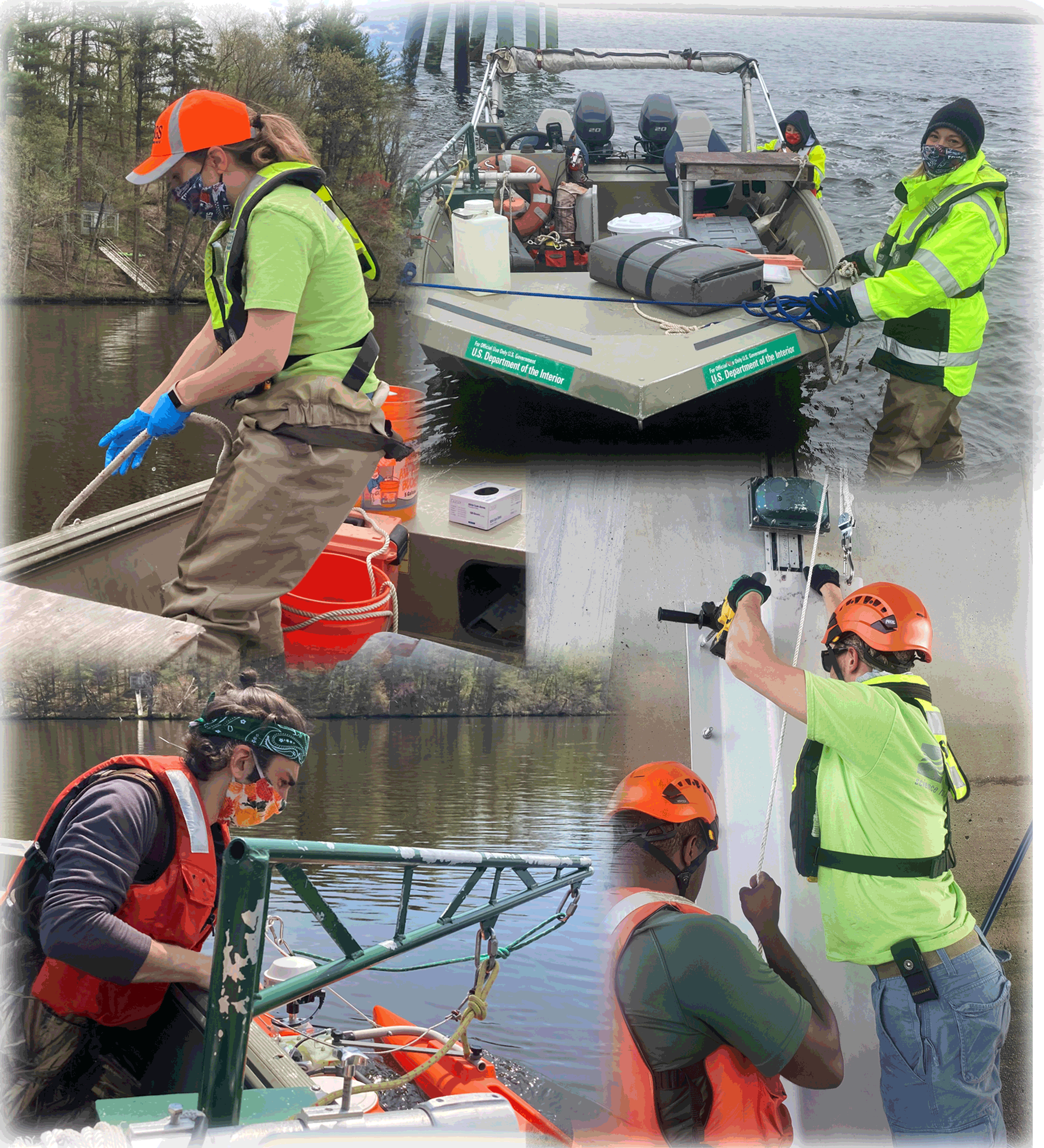
Collecting data and water samples requires expertise and specialized equipment. Technicians frequently work on boats or bridges to access the water. Photographs by the U.S. Geological Survey.
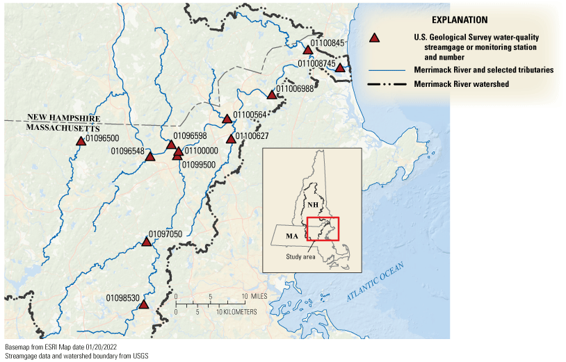
Map of the Merrimack River watershed in northeast Massachusetts and southeast New Hampshire, with locations of water-quality monitoring stations and streamgages.
Table 1.
U.S. Geological Survey water-quality streamgages and monitoring stations in the Merrimack River watershed.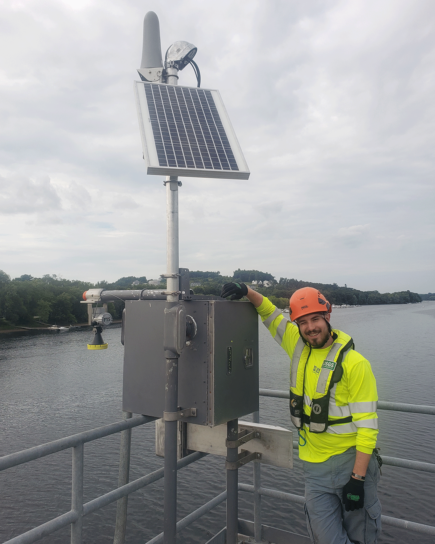
A technician stands next to a water-quality monitoring station, which collects data 24 hours a day. Regular trips are needed to maintain the station. Photograph by the U.S. Geological Survey.
Merrimack River Facts
-
• The size of the watershed is 5,010 square miles.
-
• It is the main supply of drinking water for about 500,000 residents in five Massachusetts communities.
-
• The river is home to shortnose sturgeon, an endangered fish species.
-
• Recreational uses include boating, swimming, and fishing.
Find out more at https://www.usgs.gov/centers/new-england-water-science-center/science/water-quality-monitoring-merrimack-river-watershed#overview.

Piers, docks, and boat launches are convenient places for U.S. Geological Survey scientists to access the water. Photograph by the U.S. Geological Survey.
For more information, contact:
Director, New England Water Science Center
U.S. Geological Survey
10 Bearfoot Road
Northborough, MA 01532
dc_nweng@usgs.gov
or visit our website at
https://www.usgs.gov/centers/new-england-water
Publishing support provided by the Pembroke Publishing Service Center
Disclaimers
Any use of trade, firm, or product names is for descriptive purposes only and does not imply endorsement by the U.S. Government.
Although this information product, for the most part, is in the public domain, it also may contain copyrighted materials as noted in the text. Permission to reproduce copyrighted items must be secured from the copyright owner.
Suggested Citation
Laabs, K.L., Roth, N.L., and Yates, L.K., 2022, Water-quality monitoring of the Merrimack River watershed in Massachusetts: U.S. Geological Survey General Information Product 216, 2 p., https://doi.org/10.3133/gip216.
ISSN: 2332-354X (online)
ISSN: 2332-3531 (print)
Study Area
| Publication type | Report |
|---|---|
| Publication Subtype | USGS Numbered Series |
| Title | Water-quality monitoring of the Merrimack River watershed in Massachusetts |
| Series title | General Information Product |
| Series number | 216 |
| ISBN | 978-1-4113-4484-6 |
| DOI | 10.3133/gip216 |
| Publication Date | October 27, 2022 |
| Year Published | 2022 |
| Language | English |
| Publisher | U.S. Geological Survey |
| Publisher location | Reston, VA |
| Contributing office(s) | New England Water Science Center |
| Description | 2 p. |
| Country | United States |
| State | Massachusetts |
| Other Geospatial | Merrimack River |
| Online Only (Y/N) | N |
| Additional Online Files (Y/N) | N |