Hydrogeologic characterization of the Brazos River Alluvium Aquifer, Bosque County to Fort Bend County, Texas
Links
- More Information:
- Sheets:
- Download citation as: RIS | Dublin Core
Abstract
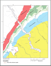
Introduction The Brazos River alluvium aquifer underlies the Brazos River in Texas from Bosque County to Fort Bend County. The aquifer, one of 21 minor aquifers in the State, supplies water for irrigation, domestic, stock, and commercial use. The Brazos River alluvium aquifer likely will become more important in the future as demand for water increases statewide. A thorough understanding of the hydrogeology of the alluvium aquifer will be the foundation for future studies in the area. During October 2006-April 2007, the U.S. Geological Survey, in cooperation with the Texas Water Development Board, conducted a study to delineate the altitude of the top, altitude of the base, and thickness of the Brazos River alluvium aquifer, and to compile and summarize available hydraulic property (specific capacity, transmissivity, and hydraulic conductivity) data. A digital elevation model was used as the altitude of the top of the aquifer. The altitude of the base of the aquifer was generated using data from wells. The study area encompasses the Brazos River alluvium aquifer in parts of Bosque, Hill, McLennan, Falls, Robertson, Milam, Brazos, Burleson, Grimes, Washington, Waller, Austin, and Fort Bend Counties and a 1.5-mile-wide lateral buffer adjacent to the aquifer. The results of this study will be used by the Texas Water Development Board for input into a ground-water availability model.
Suggested Citation
Shah, S., Houston, N.A., Braun, C.L., 2007, Hydrogeologic characterization of the Brazos River Alluvium Aquifer, Bosque County to Fort Bend County, Texas (Version 1.0): U.S. Geological Survey Scientific Investigations Map 2989, 5 Sheets: 17.00 x 22.00 inches, https://doi.org/10.3133/sim2989.
ISSN: 2329-132X (online)
| Publication type | Report |
|---|---|
| Publication Subtype | USGS Numbered Series |
| Title | Hydrogeologic characterization of the Brazos River Alluvium Aquifer, Bosque County to Fort Bend County, Texas |
| Series title | Scientific Investigations Map |
| Series number | 2989 |
| DOI | 10.3133/sim2989 |
| Edition | Version 1.0 |
| Year Published | 2007 |
| Language | English |
| Publisher | U.S. Geological Survey |
| Publisher location | Reston, VA |
| Contributing office(s) | Texas Water Science Center, U.S. Geological Survey |
| Description | 5 Sheets: 17.00 x 22.00 inches |
| Time Range Start | 2006-10-01 |
| Time Range End | 2007-04-30 |
| Online Only (Y/N) | Y |
| Additional Online Files (Y/N) | Y |


