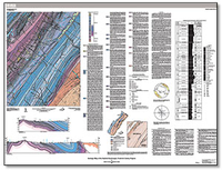
Geologic Map of the Hayfield Quadrangle, Frederick County, Virginia
Links
- Sheet: Sheet (40.1 MB pdf)
- Database: Geodatabase (139 MB zip)
- Errata: SIM 3407 (1 KB txt)
- Metadata: Metadata (202 KB zip)
- Read Me: Readme (1.94 KB txt)
- Spatial Data: Shapefiles (1.09 MB zip)
- Download citation as: RIS | Dublin Core
Abstract
The Hayfield 7.5-minute quadrangle is located within the Valley and Ridge physiographic province of northern Virginia. The quadrangle includes the topographical lowland area of the northern Great Valley to the southeast, the narrow ridge of Little North Mountain along the western edge of the Great Valley, and the broad region of elongated valleys and ridges west of Little North Mountain. The most prominent physiographic feature within the quadrangle is Great North Mountain, which extends across the northwestern portion of the quadrangle. All exposed bedrock units are Paleozoic sedimentary rocks ranging from Middle Cambrian to Late Devonian, approximately 513 to 359 Ma. The clastic and carbonate sedimentary strata in the quadrangle reflect nearshore and offshore marine and deltaic depositional environments. The deposits indicate minor sea level transgression and regression cycles along a passive continental margin during the Late Cambrian to Middle Ordovician, and major sea level changes resulting from tectonic uplift during the Late Ordovician Taconian orogeny and the Middle to Late Devonian Acadian orogeny. Compressive forces caused by the continental collision during the Paleozoic Alleghanian orogeny resulted in folding and faulting of the sedimentary rock strata, with northwestward tectonic transport. The North Mountain fault zone, spanning across the southeastern part of the quadrangle, forms the western border of the Great Valley in northern Virginia and is a series of northeast-trending thrust faults with multiple splays that separate the Silurian and Devonian shales, siltstones, and sandstones from the Cambrian and Ordovician carbonate rocks and shales. Topographic ridges in the quadrangle are primarily held up by sandstones and orthoquartzites that are relatively resistant to erosion. Surficial materials include unconsolidated alluvium, colluvium, debris flow, and terrace deposits that are assumed to be of Quaternary age. Alluvium was mapped along the larger streams; locally, some low alluvial terraces exist but have not been broken out within this unit. Debris flow deposits were mapped where recognized in the lidar-derived topographic imagery on the flanks of Great North Mountain. Colluvium (not mapped separately) covers most of the steeper slopes and fills the bottoms of many of the mountain hollows, and is composed mainly of sandstone boulders and cobbles, and fragments of chert.
Suggested Citation
Doctor, D.H., and Parker, R.A., 2018, Geologic map of the Hayfield quadrangle, Frederick County, Virginia: U.S. Geological Survey Scientific Investigations Map 3407, scale 1:24,000, https://doi.org/10.3133/sim3407.
ISSN: 2329-132X (online)
Study Area
Table of Contents
- Description of Map Units
- Explanation of Map Units
- References Cited
| Publication type | Report |
|---|---|
| Publication Subtype | USGS Numbered Series |
| Title | Geologic map of the Hayfield quadrangle, Frederick County, Virginia |
| Series title | Scientific Investigations Map |
| Series number | 3407 |
| DOI | 10.3133/sim3407 |
| Publication Date | August 01, 2018 |
| Year Published | 2018 |
| Language | English |
| Publisher | U.S. Geological Survey |
| Publisher location | Reston, VA |
| Contributing office(s) | Eastern Geology and Paleoclimate Science Center |
| Description | Sheet: 51.92 x 39.43 inches; Geodatabase; Metadata; Spatial Data; Readme |
| Country | United States |
| State | Virginia |
| County | Frederick County |
| Other Geospatial | Hayfield Quadrangle |
| Online Only (Y/N) | Y |
| Additional Online Files (Y/N) | Y |


