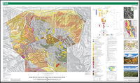
Geologic map of the Poncha Pass area, Chaffee, Fremont, and Saguache Counties, Colorado
Links
- Sheets:
- Sheet 1—Geologic Map of the Poncha Pass Area, Chaffee, Fremont, and Saguache Counties, Colorado (35.4 MB pdf)
- Sheet 1—Georeferenced Geologic Map of the Poncha Pass Area, Chaffee, Fremont, and Saguache Counties, Colorado (135 MB pdf)
- Sheet 2—Cross Sections, Geologic Map of the Poncha Pass Area, Chaffee, Fremont, and Saguache Counties, Colorado (2.99 MB pdf)
- Sheet 3—Explanation of Map Units (9.37 MB pdf)
- Data Releases:
- USGS data release - Data release for Geologic Map of the Poncha Pass Area, Chaffee, Fremont, and Saguache Counties, Colorado
- USGS data release - Argon data for Poncha Pass Geologic Map
- Read Me: Read Me (16.0 kB txt)
- Download citation as: RIS | Dublin Core
Abstract
This report presents a 1:24,000-scale geologic map, cross sections, and descriptive and interpretative text for the Poncha Pass area in central Colorado. The map area is irregular in shape, covering all of one 7 ½' quadrangle (Poncha Pass) and parts of five others (Mount Ouray, Maysville, Salida West, Salida East, and Wellsville). The map boundaries were drawn to cover all of the “Poncha mountain block,” our designation for the approximately 15-kilometer-long northwestern end of the Sangre de Cristo Mountains. The map conveys the areal distribution of (1) Proterozoic basement rocks forming the core of the Poncha mountain block, (2) overlying Eocene and Oligocene volcanic rocks, (3) Miocene and younger basin-fill deposits, (4) Quaternary surficial glacial and alluvial deposits, and (5) faults and folds affecting all of the above units. The Poncha mountain block, which lies within the Rio Grande rift, is topographically and geologically distinctive. Generally, the Rio Grande rift is internally characterized by subsided structural basins or grabens and subdued, low-relief topography rather than elevated mountain blocks. The intrarift, topographically high Poncha mountain block spans the axial part of the rift and separates the low-lying basins of the west-tilted upper Arkansas River half graben and east-northeast-tilted San Luis half graben. These distinctive aspects of the Poncha mountain block were the primary motivations to conduct geologic mapping in the area. Important questions addressed by geologic mapping and related studies in the Poncha Pass area include (1) what were the structural controls and tectonic mechanism(s) that resulted in development of the Poncha mountain block in an intrarift environment; (2) did surface uplift of the Poncha block occur during rift development in the Neogene and Quaternary, and at what rate(s); (3) how was extensional strain accommodated and relayed across the Poncha block between the opposite-polarity rift basins and flanking mountain blocks; (4) is there a clear Laramide deformational signal in rocks of the map area; and (5) have earlier Laramide contractional structures, if they exist, influenced later rift-related extensional deformation through reactivation or strain localization. Prior to our mapping, the geology of much of the Poncha Pass area had only been mapped in reconnaissance fashion, reflecting the area’s poor bedrock exposures, poor access due to the rugged terrain, and geologic complexity. The map presented here provides new details of the geology of this difficult area and helps elucidate the development of the Poncha block and improves understanding of the geologic framework and geologic history of the area.
Suggested Citation
Minor, S.A., Caine, J.S., Ruleman, C.A., Fridrich, C.J., Chan, C.F., Brandt, T.R., Holm-Denoma, C.S., Morgan, L.E., Cosca, M.A., and Grauch, V.J.S., 2019, Geologic map of the Poncha Pass area, Chaffee, Fremont, and Saguache Counties, Colorado: U.S. Geological Survey Scientific Investigations Map 3436, 4 sheets, scale 1:24,000, https://doi.org/10.3133/sim3436.
ISSN: 2329-132X (online)
Study Area
| Publication type | Report |
|---|---|
| Publication Subtype | USGS Numbered Series |
| Title | Geologic map of the Poncha Pass area, Chaffee, Fremont, and Saguache Counties, Colorado |
| Series title | Scientific Investigations Map |
| Series number | 3436 |
| DOI | 10.3133/sim3436 |
| Publication Date | September 12, 2019 |
| Year Published | 2019 |
| Language | English |
| Publisher | U.S. Geological Survey |
| Publisher location | Reston, VA |
| Contributing office(s) | Crustal Geophysics and Geochemistry Science Center, Geosciences and Environmental Change Science Center |
| Description | 4 Sheets: 60.5 x 36 inches or smaller; Data Release; Read Me |
| Country | United States |
| State | Colorado |
| County | Chaffee County, Fremont County, Saguache County |
| Other Geospatial | Poncha Pass |
| Online Only (Y/N) | Y |


