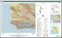
Geologic and Geophysical Maps of the Santa Maria and Part of the Point Conception 30'×60' Quadrangles, California
Links
- Document: Report (4.22 MB pdf)
- Sheets:
- Multilayered, interactive, geospatial PDF (23.0 MB pdf) Download file and view it in Adobe Acrobat DC or Adobe Reader DC to access interactive layers.
- Geologic Map (11.2 MB pdf) This file is embedded in the multilayered, interactive, geospatial PDF file
- Paleontology Samples (11.4 MB pdf) This file is embedded in the multilayered, interactive, geospatial PDF file
- Gravity: 2,000 kg/m3 (4.47 MB pdf) This file is embedded in the multilayered, interactive, geospatial PDF file
- Gravity: 2,670 kg/m3 (5.17 M pdf) This file is embedded in the multilayered, interactive, geospatial PDF file
- Aeromagnetic: Shallow (7.26 MB pdf) This file is embedded in the multilayered, interactive, geospatial PDF file
- Aeromagnetic: Medium (6.47 MB pdf) This file is embedded in the multilayered, interactive, geospatial PDF file
- Aeromagnetic: Total (6.00 MB pdf) This file is embedded in the multilayered, interactive, geospatial PDF file
- Base Map (9.34 MB pdf) This file is embedded in the multilayered, interactive, geospatial PDF file
- Related Works:
- Related Work Aeromagnetic Survey Map of the Central California Coast Ranges
- Related Work California State Waters Map Series: offshore of Refugio Beach, California
- Related Work California State Waters Map Series — Offshore of Point Conception, California
- Data Release: USGS data release - Data release -- geologic and geophysical maps of the onshore parts of the Santa Maria and Point Conception 30' x 60' quadrangles, California
- Read Me: Read Me (8.00 kB txt)
- Superseded Publications:
- Download citation as: RIS | Dublin Core
Abstract
Suggested Citation
Sweetkind, D.S., Langenheim, V.E., McDougall-Reid, K., Sorlien, C.C., Demas, S.C., Tennyson, M.E., and Johnson, S.Y., 2021, Geologic and geophysical maps of the Santa Maria and part of the Point Conception 30'×60' quadrangles, California: U.S. Geological Survey Scientific Investigations Map 3472, 1 sheet, scale 1:100,000, 58-p. pamphlet, https://doi.org/10.3133/sim3472. [Supersedes USGS Open-File Reports 95–25 and 92–189.]
ISSN: 2329-132X (online)
Study Area
Table of Contents
- Introduction
- Previous Mapping
- Present Compilation
- Paleontology
- Stratigraphy
- Structures
- Potential-Field Anomalies
- Acknowledgments
- Acknowledgments
- Description of Map Units
- References Cited
- Appendix 1. Tables of Locations for Paleontological Samples
- Appendix 2. Foraminifer Fossil Checklist Tables
| Publication type | Report |
|---|---|
| Publication Subtype | USGS Numbered Series |
| Title | Geologic and geophysical maps of the Santa Maria and part of the Point Conception 30'×60' quadrangles, California |
| Series title | Scientific Investigations Map |
| Series number | 3472 |
| DOI | 10.3133/sim3472 |
| Publication Date | August 02, 2021 |
| Year Published | 2021 |
| Language | English |
| Publisher | U.S. Geological Survey |
| Publisher location | Reston, VA |
| Contributing office(s) | Central Energy Resources Science Center, Geology, Minerals, Energy, and Geophysics Science Center, Geosciences and Environmental Change Science Center, Pacific Coastal and Marine Science Center |
| Description | Report: vi, 58 p.; 9 Sheets: 57.14 x 35.04 inches or smaller; Data Release; ReadMe; Related Works |
| Country | United States |
| State | California |
| Online Only (Y/N) | Y |


