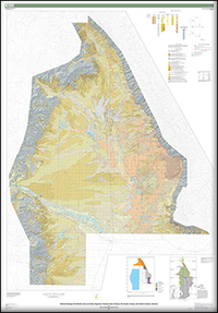
Surficial Geology of the Northern San Luis Valley, Saguache, Fremont, Custer, Alamosa, Rio Grande, Conejos, and Costilla Counties, Colorado
Links
- Sheets:
- Related Works:
- Scientific Investigations Map 3342— Geologic map of the Alamosa 30’ × 60’ quadrangle, south-central Colorado
- Scientific Investigations Map 3346— Geologic map of the Poncha Pass area, Chaffee, Fremont, and Saguache Counties, Colorado
- Data Release: USGS data release - Data release for Surficial Geology of the Northern San Luis Valley, Saguache, Fremont, Custer, Alamosa, Rio Grande, Conejos, and Costilla Counties, Colorado
- Read Me: Read Me (7.0 kB txt)
- Download citation as: RIS | Dublin Core
Abstract
Suggested Citation
Ruleman, C.A., and Brandt, T.R., 2021, Surficial geology of the northern San Luis Valley, Saguache, Fremont, Custer, Alamosa, Rio Grande, Conejos, and Costilla Counties, Colorado: U.S. Geological Survey Scientific Investigations Map 3475, 2 sheets, scale 1:75,000, https://doi.org/10.3133/sim3475.
ISSN: 2329-132X (online)
Study Area
| Publication type | Report |
|---|---|
| Publication Subtype | USGS Numbered Series |
| Title | Surficial geology of the northern San Luis Valley, Saguache, Fremont, Custer, Alamosa, Rio Grande, Conejos, and Costilla Counties, Colorado |
| Series title | Scientific Investigations Map |
| Series number | 3475 |
| DOI | 10.3133/sim3475 |
| Publication Date | June 22, 2021 |
| Year Published | 2021 |
| Language | English |
| Publisher | U.S. Geological Survey |
| Publisher location | Reston, VA |
| Contributing office(s) | Geosciences and Environmental Change Science Center |
| Description | 4 Sheets: 52.81 x 75.84 inches or smaller; ReadMe; Data Release |
| Country | United States |
| State | Colorado |
| County | Saguache County, Fremont County, Custer County, Alamosa County, Rio Grande County, Conejos County, Costilla County |
| Online Only (Y/N) | Y |


