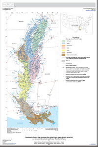
Altitude of the Potentiometric Surface in the Mississippi River Valley Alluvial Aquifer, Spring 2020
Links
- Document: Pamphlet (13.5 MB pdf)
- Sheets:
- Dataset: U.S. Geological Survey National Water Information System database — USGS water data for the Nation
- Data Release: USGS data release - Datasets used to map the potentiometric surface, Mississippi River Valley alluvial aquifer, spring 2020
- Download citation as: RIS | Dublin Core
Abstract
The purpose of this report is to present a potentiometric-surface map for the Mississippi River Valley alluvial aquifer (MRVA). The source data for the map were groundwater-altitude data from wells measured manually or continuously generally in spring 2020 and from the altitude of the top of the water surface measured generally on April 9, 2020, in rivers in the area.
Suggested Citation
McGuire, V.L., Seanor, R.C., Asquith, W.H., Strauch, K.R., Nottmeier, A.M., Thomas, J.C., Tollett, R.W., and Kress, W.H., 2021, Altitude of the potentiometric surface in the Mississippi River Valley alluvial aquifer, spring 2020: U.S. Geological Survey Scientific Investigations Map 3478, 5 sheets, includes 14-p. pamphlet, https://doi.org/10.3133/sim3478.
ISSN: 2329-132X (online)
Study Area
Table of Contents
- Acknowledgments
- Introduction
- Study Area Description
- Data and Methods
- Potentiometric-Surface Map, Spring 2020
- Summary
- References Cited
| Publication type | Report |
|---|---|
| Publication Subtype | USGS Numbered Series |
| Title | Altitude of the potentiometric surface in the Mississippi River Valley alluvial aquifer, spring 2020 |
| Series title | Scientific Investigations Map |
| Series number | 3478 |
| DOI | 10.3133/sim3478 |
| Publication Date | September 13, 2021 |
| Year Published | 2021 |
| Language | English |
| Publisher | U.S. Geological Survey |
| Publisher location | Reston, VA |
| Contributing office(s) | Nebraska Water Science Center |
| Description | Pamphlet: vi, 14p.; 5 Sheets: 30.00 x 46.00 inches or smaller; Data Release; Dataset |
| Country | United States |
| State | Arkansas, Illinois, Kentucky, Louisiana, Mississippi, Missouri, Tennessee |
| Other Geospatial | Mississippi River Valley Alluvial Aquifer |
| Online Only (Y/N) | Y |
| Additional Online Files (Y/N) | Y |


