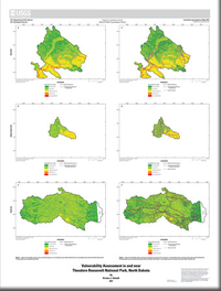
Vulnerability Assessment in and near Theodore Roosevelt National Park, North Dakota
Links
- Document: Report (2.50 MB pdf) , XML
- Sheet: Sheet 1 (9.56 MB pdf)
- Dataset: U.S. Geological Survey National Water Information System database — USGS water data for the Nation
- Download citation as: RIS | Dublin Core
Abstract
Theodore Roosevelt National Park is in western North Dakota and was established in 1978 under the National Wilderness Preservation system to preserve and protect the qualities of the North Dakota Badlands, including the wildlife, scenery, and wilderness. The park is made up of three units (North, Elkhorn Ranch, and South) that are connected by the Little Missouri River, which was identified by the National Park Service as a significant resource essential to fulfilling the park's purpose. The development of oil and gas (OG) resources has expanded in the past two decades in the region surrounding Theodore Roosevelt National Park. This expansion of OG development outside park boundaries increases the potential for adverse environmental and economic effects inside the park boundaries, especially for the hydrologic processes within Theodore Roosevelt National Park.
This report assesses the vulnerability of critical components that contribute to supporting plants and wildlife of the Northwestern Great Plains ecological region and Theodore Roosevelt National Park’s mission of preservation. Critical components include land cover, slope, soil saturated hydraulic conductivity, distance to Ovis canadensis (Shaw, 1804) (bighorn sheep) critical habitat, distance to springs, distance to rivers and streams, and distance to surficial aquifers. The study area included all the 12-digit hydrologic units within the watershed boundary dataset that intersect Theodore Roosevelt National Park or are within the 12-digit hydrologic units for Little Missouri River tributaries that flow into the park. Critical components that had existing publicly available geographic data were assessed and assigned vulnerability index values. These values were then summed to develop a vulnerability score and mapped. OG development and associated transportation infrastructure, referred to as “stressors” in this report, with publicly available geographic data were mapped, and then flow paths were generated starting from the stressor locations to assess their likelihood to contaminate vulnerable areas within the study area.
The North Unit had the most area with moderate, high, and very high vulnerability. These areas occurred all across the southern and eastern parts of the North Unit where the Little Missouri River, surficial aquifer, wetland type land covers, and bighorn sheep critical habitat are present. Several stressor flow paths from pipelines and highways cross these areas and may pose the most risk to the vulnerable areas identified. In the Elkhorn Ranch Unit, areas with moderate, high, and very high vulnerability were in the southeastern part of the unit, where the Little Missouri River, surficial aquifer, wetland type land covers, and bighorn sheep critical habitat are present. The stressor flow paths in the Elkhorn Ranch Unit follow the length of the Little Missouri River and all its tributaries in the study area. The stressor flow paths originated from crude oil wells and pipelines. In the South Unit, one area had moderate, high, and very high vulnerability. This area is where the Little Missouri River and bighorn sheep critical range are present. The stressor flow paths in the South Unit follow the length of the Little Missouri River and nearly all its tributaries in the study area. Several stressor flow paths cross the one identified vulnerable area that originated from crude oil wells.
Suggested Citation
Valseth, K.J., 2021, Vulnerability assessment in and near Theodore Roosevelt National Park, North Dakota: U.S. Geological Survey Scientific Investigations Map 3479, pamphlet 9 p., 1 sheet, https://doi.org/10.3133/sim3479.
ISSN: 2329-132X (online)
Study Area
Table of Contents
- Acknowledgments
- Abstract
- Introduction
- Data Sources
- Methods for Vulnerability Assessment
- Vulnerability Assessment Results
- References Cited
| Publication type | Report |
|---|---|
| Publication Subtype | USGS Numbered Series |
| Title | Vulnerability assessment in and near Theodore Roosevelt National Park, North Dakota |
| Series title | Scientific Investigations Map |
| Series number | 3479 |
| DOI | 10.3133/sim3479 |
| Publication Date | October 04, 2021 |
| Year Published | 2021 |
| Language | English |
| Publisher | U.S. Geological Survey |
| Publisher location | Reston, VA |
| Contributing office(s) | Dakota Water Science Center |
| Description | Pamphlet: vi, 9 p.; 1 Sheet: 23.50 x 31.10 inches; Dataset |
| Country | United States |
| State | North Dakota |
| Other Geospatial | Theodore Roosevelt National Park |
| Online Only (Y/N) | Y |


