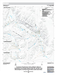
Groundwater Potentiometric-Surface Altitude in 2022 and Groundwater-Level Changes Between 1968, 1991, and 2022, in the Alluvial Aquifer in the Big Lost River Valley, South-Central Idaho
Links
- Document: Sheet (2.9 MB pdf) , HTML , XML
- Additional Report Piece: Pamphlet (3.3 MB pdf)
- Data Release: USGS data release - Groundwater potentiometric-surface contours and well numbers used to map groundwater potentiometric-surface altitude in 2022 and groundwater-level changes between 1968, 1991, and 2022 in the alluvial aquifer in the Big Lost River Valley, south-central Idaho
- Download citation as: RIS | Dublin Core
Abstract
The U.S. Geological Survey and the Idaho Department of Water Resources measured groundwater levels during spring 2022 and autumn 2022 to create detailed potentiometric-surface maps for the alluvial aquifer in the Big Lost River Valley in south-central Idaho. Wells were assigned to shallow, intermediate, and deep water-bearing units based on well depth, groundwater potentiometric-surface altitude, and hydrogeologic unit. Potentiometric-surface contours were created for each of the three water-bearing units for spring 2022 and autumn 2022. Groundwater flow generally follows topography down valley to the south. The groundwater-level data also were used to calculate changes in groundwater levels from spring to autumn 2022 and from historical measurement events in 1968 and 1991 to 2022. Groundwater levels declined at most wells from spring 1968 to spring 2022 and from spring 1991 to spring 2022. Although groundwater-level changes are sensitive to interannual wet and dry periods, long-term groundwater-level declines suggest that recharge and down-valley groundwater flows are insufficient to fully recover groundwater-level declines from pumping in some parts of the alluvial aquifer in the Big Lost River Valley.
Suggested Citation
Ducar, S.D., and Zinsser, L.M., 2023, Groundwater potentiometric-surface altitude in 2022 and groundwater-level changes between 1968, 1991, and 2022, in the alluvial aquifer in the Big Lost River Valley, south-central Idaho: U.S. Geological Survey Scientific Investigations Map 3509, 1 sheet, scale 1:150,000, 11-p. pamphlet, https://doi.org/10.3133/sim3509.
ISSN: 2329-132X (online)
Study Area
Table of Contents
- Acknowledgments
- Abstract
- Introduction
- Methods
- Discussion
- Summary
- References Cited
| Publication type | Report |
|---|---|
| Publication Subtype | USGS Numbered Series |
| Title | Groundwater potentiometric-surface altitude in 2022 and groundwater-level changes between 1968, 1991, and 2022, in the alluvial aquifer in the Big Lost River Valley, south-central Idaho |
| Series title | Scientific Investigations Map |
| Series number | 3509 |
| DOI | 10.3133/sim3509 |
| Publication Date | September 27, 2023 |
| Year Published | 2023 |
| Language | English |
| Publisher | U.S. Geological Survey |
| Publisher location | Reston, VA |
| Contributing office(s) | Idaho Water Science Center |
| Description | Pamphlet: viii, 11 p.; Map: 22.51 × 30.00 inches |
| Country | United States |
| State | Idaho |
| Other Geospatial | Big Lost River Valley |
| Online Only (Y/N) | Y |
| Additional Online Files (Y/N) | Y |


