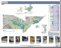
Geologic Framework and Hydrostratigraphy of the Edwards and Trinity Aquifers Within Parts of Bandera and Kendall Counties, Texas
Links
-
Documents:
- Sheet (19.4 MB pdf) - Geologic Framework and Hydrostratigraphy of the Edwards and Trinity Aquifers Within Parts of Bandera and Kendall Counties, Texas
- Pamphlet (1.61 MB pdf)
- Data Release: USGS data release - Geospatial dataset for the geologic framework and hydrostratigraphy of the Edwards and Trinity aquifers within parts of Bandera and Kendall Counties, Texas, at 1:24,000
- Download citation as: RIS | Dublin Core
Abstract
The karstic Edwards and Trinity aquifers are classified as major sources of water in south-central Texas by the Texas Water Development Board. During 2019–23 the U.S. Geological Survey, in cooperation with the Edwards Aquifer Authority, mapped and described the geology and hydrostratigraphy of the rocks composing the Edwards and Trinity aquifers within parts of Bandera and Kendall Counties from field observations of the surficial expressions of the rocks. The thicknesses of the mapped lithostratigraphic and hydrostratigraphic units were also estimated from field observations in the study area.
The Cretaceous rocks in the study area are part of the Trinity Group and Edwards Group. The groups, formations, and members are composed primarily of layers of marls, shales, and limestones. The limestones are composed of mudstone through grainstone, framestone and boundstone, dolomite, and argillaceous and evaporitic rocks.
The principal structural feature in the study area is the Balcones fault zone. The Balcones fault zone is the result of late Oligocene and early Miocene extensional faulting and fracturing that was a result of the eastern Edwards Plateau uplift. In the Balcones fault zone, most of the faults in the study area are high-angle to vertical, en echelon, normal faults that are predominantly downthrown to the southeast.
Hydrostratigraphically, the rocks exposed in the study area are those that contain the Edwards aquifer, the upper zone of the Trinity aquifer, and the middle zone of the Trinity aquifer. Descriptions of the hydrostratigraphic units, thicknesses, hydrologic function, porosity types, and field identification and observations are provided, including those for the informal Bandera and Love Creek hydrostratigraphic units of the Edwards aquifer, which were identified through the mapping for this study.
Suggested Citation
Clark, A.K., Morris, R.R., and Lamberts, A.P., 2024, Geologic framework and hydrostratigraphy of the Edwards and Trinity aquifers within parts of Bandera and Kendall Counties, Texas: U.S. Geological Survey Scientific Investigations Map 3518, 1 sheet, scale 1:24,000, 11-p. pamphlet, https://doi.org/10.3133/sim3518.
ISSN: 2329-132X (online)
Study Area
Table of Contents
- Acknowledgments
- Abstract
- Introduction
- Methods of Investigation
- Geologic Framework
- Hydrostratigraphy
- Summary
- References Cited
| Publication type | Report |
|---|---|
| Publication Subtype | USGS Numbered Series |
| Title | Geologic framework and hydrostratigraphy of the Edwards and Trinity aquifers within parts of Bandera and Kendall Counties, Texas |
| Series title | Scientific Investigations Map |
| Series number | 3518 |
| DOI | 10.3133/sim3518 |
| Publication Date | March 11, 2024 |
| Year Published | 2024 |
| Language | English |
| Publisher | U.S. Geological Survey |
| Publisher location | Reston, VA |
| Contributing office(s) | Oklahoma-Texas Water Science Center |
| Description | Pamphlet: vi, 11 p., 1 Sheet: 49.01 x 39.83 inches; Data Release |
| Country | United States |
| State | Texas |
| County | Bandera County, Kendall County |
| Other Geospatial | Edwards and Trinity Aquifers |
| Online Only (Y/N) | Y |


