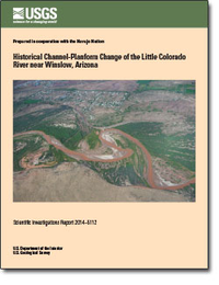
Historical channel-planform change of the Little Colorado River near Winslow, Arizona
Links
- More information: USGS Index Page (html)
- Document: Report (pdf)
- Plates:
- Database: Database
- Metadata:
- NGMDB Index Page: National Geologic Map Database Index Page (html)
- Download citation as: RIS | Dublin Core
Abstract
This study evaluates channel-planform adjustment on an alluvial reach of the Little Colorado River and documents the geomorphic evolution of the channel through an analysis of aerial photographs and orthophotographs for the period 1936–2010. The Little Colorado River has adjusted to the effects of an extreme flood in 1923 and a subsequent decline in peak discharge and mean annual flow by channel narrowing: the channel width and area of the river have decreased by approximately 90 percent over the study period. Although deposition historically exceeds erosion, lateral migration exacerbates localized erosion, particularly near hydraulic controls. Despite repeated cutoff and avulsion, the Little Colorado River has steadily increased in length and sinuosity over a period of 74 years.
Changes in temperature and precipitation are likely affecting the discharge of the Little Colorado River near and downstream of Winslow, Ariz. Nonparametric methods of trend detection determine whether the probability distribution of temperature, precipitation, and peak streamflow has changed over time. Time-series plots of temperature and precipitation show statistically significant trends at the 99-percent-confidence level when evaluated with a Mann-Kendall test. An increasing trend was indicated in mean daily minimum air temperature (Tmin), whereas decreasing trends were indicated in both annual precipitation (Pann) and monsoon-seasonal precipitation (Pjas), as well as in peak discharge.
Suggested Citation
Block, D.L., 2014, Historical channel-planform change of the Little Colorado River near Winslow, Arizona: U.S. Geological Survey Scientific Investigations Report 2014-5112, Report: v, 24 p.; 2 Plates: 26.0 x 44.0 inches and 21.85 x 16.67 inches; Database; Metadata: XML; Metadata: HTML, https://doi.org/10.3133/sir20145112.
ISSN: 2328-0328 (online)
Study Area
| Publication type | Report |
|---|---|
| Publication Subtype | USGS Numbered Series |
| Title | Historical channel-planform change of the Little Colorado River near Winslow, Arizona |
| Series title | Scientific Investigations Report |
| Series number | 2014-5112 |
| DOI | 10.3133/sir20145112 |
| Year Published | 2014 |
| Language | English |
| Publisher | U.S. Geological Survey |
| Publisher location | Reston, VA |
| Contributing office(s) | Geology, Minerals, Energy, and Geophysics Science Center |
| Description | Report: v, 24 p.; 2 Plates: 26.0 x 44.0 inches and 21.85 x 16.67 inches; Database; Metadata: XML; Metadata: HTML |
| Country | United States |
| State | Arizona |
| Other Geospatial | Little Colorado River |
| Datum | North American Datum 1983 |
| Projection | Universal Transverse Mercator projection, zone 12 |
| Scale | 24000 |
| Online Only (Y/N) | Y |
| Additional Online Files (Y/N) | Y |


