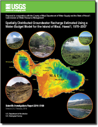
Spatially distributed groundwater recharge estimated using a water-budget model for the Island of Maui, Hawai`i, 1978–2007
Links
- Document: Report (9 MB pdf)
- Data Release: Data Release - Mean annual water-budget components for the Island of Maui, Hawaii, for average climate conditions, 1978-2007 rainfall and 2010 land cover (version 2.0)
- Version History: Version History (2 KB txt)
- Download citation as: RIS | Dublin Core
Abstract
Demand for freshwater on the Island of Maui is expected to grow. To evaluate the availability of fresh groundwater, estimates of groundwater recharge are needed. A water-budget model with a daily computation interval was developed and used to estimate the spatial distribution of recharge on Maui for average climate conditions (1978–2007 rainfall and 2010 land cover) and for drought conditions (1998–2002 rainfall and 2010 land cover). For average climate conditions, mean annual recharge for Maui is about 1,309 million gallons per day, or about 44 percent of precipitation (rainfall and fog interception). Recharge for average climate conditions is about 39 percent of total water inflow consisting of precipitation, irrigation, septic leachate, and seepage from reservoirs and cesspools. Most recharge occurs on the wet, windward slopes of Haleakalā and on the wet, uplands of West Maui Mountain. Dry, coastal areas generally have low recharge. In the dry isthmus, however, irrigated fields have greater recharge than nearby unirrigated areas. For drought conditions, mean annual recharge for Maui is about 1,010 million gallons per day, which is 23 percent less than recharge for average climate conditions. For individual aquifer-system areas used for groundwater management, recharge for drought conditions is about 8 to 51 percent less than recharge for average climate conditions. The spatial distribution of rainfall is the primary factor determining spatially distributed recharge estimates for most areas on Maui. In wet areas, recharge estimates are also sensitive to water-budget parameters that are related to runoff, fog interception, and forest-canopy evaporation. In dry areas, recharge estimates are most sensitive to irrigated crop areas and parameters related to evapotranspiration.
Suggested Citation
Johnson, A.G., Engott, J.A., Bassiouni, Maoya, and Rotzoll, Kolja, 2018, Spatially distributed groundwater recharge estimated using a water-budget model for the Island of Maui, Hawai`i, 1978–2007 (ver. 2.0, February 2018): U.S. Geological Survey Scientific Investigations Report 2014–5168, 53 p., https://doi.org/10.3133/sir20145168.
ISSN: 2328-0328 (online)
Study Area
Table of Contents
- Abstract
- Introduction
- Description of Maui
- Water-Budget Model
- Model Input
- Model Exclusions and Limitations
- Model Randomness
- Water-Budget and Groundwater-Recharge Estimates
- Suggestions for Future Study and Additional Data Collection
- Summary and Conclusions
- References Cited
| Publication type | Report |
|---|---|
| Publication Subtype | USGS Numbered Series |
| Title | Spatially distributed groundwater recharge estimated using a water-budget model for the Island of Maui, Hawai`i, 1978–2007 |
| Series title | Scientific Investigations Report |
| Series number | 2014-5168 |
| DOI | 10.3133/sir20145168 |
| Edition | Version 1.0: Originally posted December 14, 2014; Version 2.0: February 26, 2018 |
| Publication Date | December 14, 2014 |
| Year Published | 2018 |
| Language | English |
| Publisher | U.S. Geological Survey |
| Publisher location | Reston, VA |
| Contributing office(s) | Pacific Islands Water Science Center |
| Description | Report: v, 53 p.; Data Release |
| Country | United States |
| State | Hawai'i |
| Other Geospatial | Maui |


