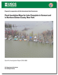
Flood-inundation maps for Lake Champlain in Vermont and in northern Clinton County, New York
Links
- Document: Report (1.54 MB pdf)
- Superseding Publications:
- Download citation as: RIS | Dublin Core
Abstract
Digital flood-inundation maps for an approximately100-mile length of Lake Champlain in Addison, Chittenden, Franklin, and Grand Isle Counties in Vermont and northern Clinton County in New York were created by the U.S. Geological Survey (USGS) in cooperation with the International Joint Commission (IJC). The flood-inundationmaps, which can be accessed through the International Joint Commission (IJC) Web site at http://www.ijc.org/en_/, depict estimates of the areal extent flooding correspondingto selected water levels (stages) at the USGS lake gage on the Richelieu River (Lake Champlain) at Rouses Point, N.Y. (station number 04295000). In this study, wind and seiche effects (standing oscillating wave with a long wavelength) were not taken into account and the flood-inundation mapsreflect 11 stages (elevations) for Lake Champlain that are static for the study length of the lake. Near-real-time stages at this lake gage, and others on Lake Champlain, may be obtained on the Internet from the USGS National Water Information System at http://waterdata.usgs.gov/ or the National Weather Service Advanced Hydrologic Prediction Service at http:/water.weather.gov/ahps/, which also forecasts flood hydrographs at the Richelieu River (Lake Champlain) at Rouses Point.
Static flood boundary extents were determined for LakeChamplain in Addison, Chittenden, Franklin, and Grand Isle Counties in Vermont and northern Clinton County in New York using recently acquired (2013–2014) lidar (light detection and ranging) and may be referenced to any of the five USGS lake gages on Lake Champlain. Of these five lakgages, USGS lake gage 04295000, Richelieu River (Lake Champlain) at Rouses Point, N.Y., is the only USGS lake gage that is also a National Weather Service prediction location. Flood boundary extents for the Lake Champlain static flood-inundation map corresponding to the May 201 flood(103.2 feet [ft], National Geodetic Vertical Datum [NGVD] 29) were evaluated by comparing these boundary extents against the inundation area extents determined for the May 2011 flood (which incorporated documented high-water marksfrom the flood of May 201) (Bjerklie and others, 2014).
A digital elevation model (DEM) was created by USGS, within a geographic information system (GIS), from the recently flown and processed light detection and ranging(lidar) data (2013–2014) in Vermont and the lake shore area of northern Clinton County in New York. The lidar data have a vertical accuracy of 0.3 to 0.6-ft (9.6 to 18.0-centimeters [cm]) and a horizontal resolution of 2.3 to 4.6 ft (0.7 to 1.4 meters). This DEM was used in determining the floodboundary for 11 flood stages at 0.5-ft intervals from 100.0 to104.0 ft (NGVD 29) and 1-ft intervals from 104.0 to 106.0 ft (NGVD 29) as referenced to the USGS lake gage 04295000, Richelieu River (Lake Champlain) at Rouses Point, N.Y. In addition, the May 2011 flood-inundation area for elevation103.20 ft (NGVD 29) (102.77 ft, North American Vertical Datum [NAVD] 88) was determined from this DEM. The May 2011 flood is the highest recorded lake water level (stage)at the Rouses Point, N.Y., lake gage. Flood stages greater than 101.5 ft (NGVD 29) exceed the “major flood stage”as defined by the NationalWeather Service for USGS lake gage 04295000.
The availability of these maps, along with Internet information regarding current stage from the USGS lake gage and forecasted high-flow stages from the NationalWeather Service, will provide emergency management personnel and residents with information that is critical for flood responseactivities such as evacuations and road closures, as well as for post-flood recovery eforts.
Suggested Citation
Flynn, R.H., and Hayes, Laura, 2016, Flood-inundation maps for Lake Champlain in Vermont and in northern Clinton County, New York: U.S. Geological Survey Scientific Investigations Report 2016–5060, 11 p., https://dx.doi.org/10.3133/sir20165060.
ISSN: 2328-0328 (online)
Study Area
Table of Contents
- Acknowledgments
- Abstract
- Introduction
- Creation of Flood-Inundation-Map Library
- Estimating Potential Losses Due to Flooding
- Summary
- References Cited
| Publication type | Report |
|---|---|
| Publication Subtype | USGS Numbered Series |
| Title | Flood-inundation maps for Lake Champlain in Vermont and in northern Clinton County, New York |
| Series title | Scientific Investigations Report |
| Series number | 2016-5060 |
| DOI | 10.3133/sir20165060 |
| Publication Date | June 30, 2016 |
| Year Published | 2016 |
| Language | English |
| Publisher | U.S. Geological Survey |
| Publisher location | Reston, VA |
| Contributing office(s) | NH/VT office of New England Water Science Center |
| Description | vi, 11 p. |
| Country | United States |
| State | New York, Vermont |
| Other Geospatial | Lake Champlain |
| Online Only (Y/N) | Y |
| Additional Online Files (Y/N) | N |


