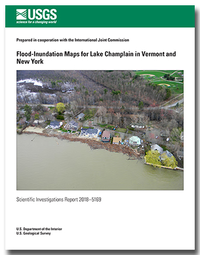
Flood-Inundation Maps for Lake Champlain in Vermont and New York
Links
- Document: Report (1.30 MB pdf)
- Application Site: Application Site - Flood Inundation Mapper
- Data Releases:
- USGS data release - Flood-inundation shapefiles and grids for Lake Champlain in Vermont and New York
- USGS data release - Flood-Inundation Shapefiles and Grids for Lake Champlain in Vermont and New York
- Superseded Publications:
- Download citation as: RIS | Dublin Core
Abstract
In 2016, digital flood-inundation maps along the shoreline of Lake Champlain in Addison, Chittenden, Franklin, and Grand Isle Counties in Vermont and northern Clinton County in New York were created by the U.S. Geological Survey (USGS) in cooperation with the International Joint Commission (IJC). This report discusses the creation of updated static digital flood-inundation mapping, in 2018, to include the entire shoreline of Lake Champlain in the United States. The flood-inundation maps, which can be accessed through the USGS Flood Inundation Mapping Science website at http://water.usgs.gov/osw/flood_inundation/, depict estimates of the areal extent of flooding corresponding to selected water-surface elevations (stages) at the USGS lake gages on Lake Champlain.
As a result of the record setting floods of May 2011 in Lake Champlain and the Richelieu River, the U.S. and Canadian governments requested that the IJC issue a reference for a study to identify how flood forecasting, preparedness, and mitigation could be improved in the Lake Champlain–Richelieu River Basin. The IJC submitted the Lake Champlain–Richelieu River Plan of Study to the governments of Canada and the United States in 2013. The flood-inundation maps in this study are one aspect of the task work outlined in the IJC 2013 Plan of Study.
Wind and seiche effects (standing oscillating wave with a long wavelength) that can influence flooding along the Lake Champlain shoreline were not represented. The flood-inundation maps reflect 11 stages for Lake Champlain that are static for the entire area of the lake. Near-real-time stages at the USGS gages on Lake Champlain may be obtained from the USGS National Water Information System website at http://waterdata.usgs.gov/ (https://doi.org/10.5066/F7P55KJN) or from the National Weather Service Advanced Hydrologic Prediction Service at http://water.weather.gov/ahps/.
Updated static flood-inundation boundary extents were created for Lake Champlain in Franklin, Chittenden, Addison, Rutland, and Grand Isle Counties in Vermont and Clinton, Essex, and Washington Counties in New York by using recently acquired (2009, 2012, 2014, and 2015) light detection and ranging (lidar) data. The corresponding flood-inundation maps may be referenced to any of the four active USGS lake gages on Lake Champlain. Of these four active lake gages, USGS lake gage 04295000, Richelieu River (Lake Champlain) at Rouses Point, N.Y.; USGS lake gage 04294500, Lake Champlain at Burlington, Vt.; USGS lake gage 04279085 Lake Champlain north of Whitehall, N.Y.; and USGS lake gage 04294413, Lake Champlain at Port Henry, N.Y., only the Richelieu River (Lake Champlain) at Rouses Point, N.Y., gage also serves as a National Weather Service prediction location. Lake Champlain static flood-inundation map boundary extents corresponding to the May 2011 peak flood stage (103.20 feet [ft], National Geodetic Vertical Datum of 1929 [NGVD 29], as recorded at the USGS Rouses Point lake gage, were compared to the flood-inundation area extents determined from satellite imagery for the May 2011 flood (which incorporated documented high-water marks from the flood of May 2011) and were found to be in good agreement. The May 2011 flood is the highest recorded lake water level (stage) at the Rouses Point, N.Y., and Burlington, Vt., lake gages. Flood stages greater than 101.5 ft (NGVD 29) exceed the “major flood stage” as defined by the National Weather Service for USGS lake gage 04295000.
Updated digital elevation models (DEMs) were created from the recent lidar data for Lake Champlain in Vermont and New York. These DEMs were used in determining the flood-inundation boundary and associated depth grids for 11 flood stages at 0.5-ft or 1-ft intervals from 100.0 to 106.0 ft (NGVD 29) as referenced to the USGS lake gages. In addition, the May 2011 flood-inundation area for elevation 103.20 ft (NGVD 29) (102.77 ft, North American Vertical Datum of 1988) was determined from these updated DEMs.
The availability of these maps, along with online information regarding current stages at the USGS lake gages and forecasted high-flow stages from the National Weather Service at USGS lake gage 04295000, Richelieu River (Lake Champlain) at Rouses Point, N.Y., will provide emergency management personnel and residents with information that is critical for flood response activities such as evacuations and road closures, as well as for post-flood recovery efforts.
Suggested Citation
Flynn, R.H., and Hayes, L., 2019, Flood-inundation maps for Lake Champlain in Vermont and New York: U.S. Geological Survey Scientific Investigations Report 2018–5169, 14 p., https://doi.org/10.3133/sir20185169. [Supersedes USGS Scientific Investigations Report 2016–5060.]
ISSN: 2328-0328 (online)
Study Area
Table of Contents
- Acknowledgments
- Abstract
- Introduction
- Creation of Flood-Inundation-Map Series
- Estimating Potential Losses Due to Flooding
- Summary
- References Cited
| Publication type | Report |
|---|---|
| Publication Subtype | USGS Numbered Series |
| Title | Flood-inundation maps for Lake Champlain in Vermont and New York |
| Series title | Scientific Investigations Report |
| Series number | 2018-5169 |
| DOI | 10.3133/sir20185169 |
| Publication Date | March 07, 2019 |
| Year Published | 2019 |
| Language | English |
| Publisher | U.S. Geological Survey |
| Publisher location | Reston, VA |
| Contributing office(s) | New England Water Science Center |
| Description | Report: v, 14 p.; Application Site; Data release |
| Country | United States |
| State | New York, Vermont |
| County | Addison, Chittenden, Clinton, Franklin, Grand Isle |
| Other Geospatial | Lake Champlain |
| Online Only (Y/N) | Y |
| Additional Online Files (Y/N) | N |


