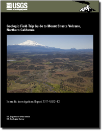
Geologic field-trip guide to Mount Shasta Volcano, northern California
Links
-
Documents:
- Report (25 MB pdf)
- Map of field-trip stops at Mount Shasta Volcano (2.5 MB GeoPDF) - - To use the map, users need to download and install a mapping application for smartphone or tablet such as Avenza or Terra Go Toolbar.
- Larger Work: This publication is Chapter K3 of Field-trip guides to selected volcanoes and volcanic landscapes of the western United States
- Related Works:
- Scientific Investigations Report 2017-5022-K - Chapter K: Overview for geologic field-trip guides to volcanoes of the Cascades Arc in northern California
- Scientific Investigations Report 2017-5022-K1 - Chapter K1: Geologic Field-Trip Guide to Medicine Lake Volcano, Northern California, Including Lava Beds National Monument
- Scientific Investigations Report 2017-5022-K2 - Chapter K2: Geologic Field-Trip Guide to the Lassen Segment of the Cascades Arc, Northern California
- Download citation as: RIS | Dublin Core
Abstract
The southern part of the Cascades Arc formed in two distinct, extended periods of activity: “High Cascades” volcanoes erupted during about the past 6 million years and were built on a wider platform of Tertiary volcanoes and shallow plutons as old as about 30 Ma, generally called the “Western Cascades.” For the most part, the Shasta segment (for example, Hildreth, 2007; segment 4 of Guffanti and Weaver, 1988) of the arc forms a distinct, fairly narrow axis of short-lived small- to moderate-sized High Cascades volcanoes that erupted lavas, mainly of basaltic-andesite or low-silica-andesite compositions. Western Cascades rocks crop out only sparsely in the Shasta segment; almost all of the following descriptions are of High Cascades features except for a few unusual localities where older, Western Cascades rocks are exposed to view along the route of the field trip.
The High Cascades arc axis in this segment of the arc is mainly a relatively narrow band of either monogenetic or short-lived shield volcanoes. The belt generally averages about 15 km wide and traverses the length of the Shasta segment, roughly 100 km between about the Klamath River drainage on the north, near the Oregon-California border, and the McCloud River drainage on the south (fig. 1). Superposed across this axis are two major long-lived stratovolcanoes and the large rear-arc Medicine Lake volcano. One of the stratovolcanoes, the Rainbow Mountain volcano of about 1.5–0.8 Ma, straddles the arc near the midpoint of the Shasta segment. The other, Mount Shasta itself, which ranges from about 700 ka to 0 ka, lies distinctly west of the High Cascades axis. It is notable that Mount Shasta and Medicine Lake volcanoes, although volcanologically and petrologically quite different, span about the same range of ages and bracket the High Cascades axis on the west and east, respectively.
The field trip begins near the southern end of the Shasta segment, where the Lassen Volcanic Center field trip leaves off, in a field of high-alumina olivine tholeiite lavas (HAOTs, referred to elsewhere in this guide as low-potassium olivine tholeiites, LKOTs). It proceeds around the southern, western, and northern flanks of Mount Shasta and onto a part of the arc axis. The stops feature elements of the Mount Shasta area in an approximately chronological order, from oldest to youngest.
Suggested Citation
Christiansen, R.L., Calvert, A.T., and Grove T.L., 2017, Geologic field-trip guide to Mount Shasta volcano, northern California: U.S. Geological Survey Scientific Investigations Report 2017-5022-K3, 33 p., https://doi.org/10.3133/sir20175022K3.
ISSN: 2328-0328 (online)
Study Area
Table of Contents
- Preface
- Contributing Authors
- Introduction
- Tectonic Setting
- Regional Volcanism
- Eruptive History of Mount Shasta
- Parental Magmas and Petrologic Evolution of the Mount Shasta Suite
- Glacial Geology
- Volcano-Related Hazards
- Road Log
- References Cited
| Publication type | Report |
|---|---|
| Publication Subtype | USGS Numbered Series |
| Title | Geologic field-trip guide to Mount Shasta Volcano, northern California |
| Series title | Scientific Investigations Report |
| Series number | 2017-5022 |
| Chapter | K3 |
| DOI | 10.3133/sir20175022K3 |
| Publication Date | August 18, 2017 |
| Year Published | 2017 |
| Language | English |
| Publisher | U.S. Geological Survey |
| Publisher location | Reston, VA |
| Contributing office(s) | Volcano Science Center |
| Description | ix, 33 p. |
| Country | United States |
| State | California |
| Other Geospatial | Mount Shasta |
| Online Only (Y/N) | Y |


