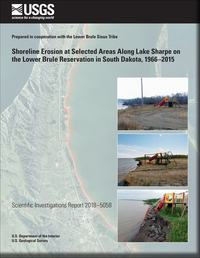
Shoreline erosion at selected areas along Lake Sharpe on the Lower Brule Reservation in South Dakota, 1966–2015
Links
- Document: Report (5.34 MB pdf)
- Plate: Plate 1 - (7.98 MB pdf) Soil Type and Land Cover Interactions with Erosion Measurements near Lower Brule, South Dakota
- Data Release: USGS data release - Data to document shoreline erosion at selected locations along Lake Sharpe on the Lower Brule Reservation in South Dakota, 1966–2015
- Download citation as: RIS | Dublin Core
Abstract
The Lower Brule Reservation in central South Dakota is losing land because of shoreline erosion along Lake Sharpe, a reservoir on the Missouri River, which has caused detrimental effects for the Lower Brule Sioux Tribe including losses of cultural sites, recreation access points, wildlife habitat, irrigated cropland, and landmass. To better understand and quantify shoreline erosion, the Lower Brule Sioux Tribe and the U.S. Geological Survey cooperated on a series of data-collection efforts and study of shoreline erosion along Lake Sharpe. Data collected or compiled for 1966–2015 were used to describe and quantify shoreline erosion along Lake Sharpe. The progression of shoreline erosion near the community of Lower Brule, South Dakota, was tracked by comparing current or recent aerial imagery with existing historical maps. At 33 evaluation lines along a 7-mile reach of Lake Sharpe shoreline near Lower Brule, cumulative change of shoreline from 1966 to 2010 ranged from about −224 feet of deposition to 770 feet of erosion.
Photographic and location data were collected for this study to understand the processes affecting erosion and estimate erosion rates. Photographs were collected only in the 7-mile reach near Lower Brule, but locations of the bank over time were collected at the 7-mile reach and two additional reaches within the Lower Brule Reservation. Global navigation satellite system equipment was used in real-time kinematic mode to collect bank locations along three reaches of interest. Reach-length data were collected four times between November 2011 and November 2012. A small, unmanned aerial system (drone) was used to capture digital video along the shoreline of the 7-mile reach.
Water-level fluctuations contribute to the number of wet-dry cycles experienced by the soils at the shoreline or bank. The soils present under the current (2017) location of the reservoir are predominantly terrace alluvium, consisting of sand and silt. Detailed soils data for Lyman County indicate that the dominant soil type along the southern part of the shoreline in the 7-mile reach is Bullcreek clay. Weather within the study area can affect the erosion rate. Air temperature can potentially affect erosion rates by freezing and thawing water and soils. Mean hourly wind speeds vary somewhat throughout the year but averaged 13.3 miles per hour. The direction of prevailing winds near Lower Brule indicates that there are several miles of fetch to build large waves.
Annual erosion rates calculated or measured throughout this study varied by location. Long-term annual average erosion rates of the 7-mile reach, as calculated by image analysis, ranged from −5.1 feet per year (deposition) to 17.5 feet per year (erosion). Short-term annual erosion rates measured using global navigation satellite system equipment during 2010–12 ranged from about 0 to 31.7 feet per year for the 7-mile reach. Existing scour countermeasures have been effective variably. Fieldstone rip-rap seems to have stabilized the shoreline, whereas tree strips paralleling the shoreline seem to have slowed erosion.
Suggested Citation
Thompson, R.F., and Stamm, J.F., 2018, Shoreline erosion at selected areas along Lake Sharpe on the Lower Brule Reservation, South Dakota, 1966–2015: U.S. Geological Survey Scientific Investigations Report 2018–5058, 29 p., https://doi.org/10.3133/sir20185058.
ISSN: 2328-0328 (online)
Study Area
Table of Contents
- Acknowledgments
- Abstract
- Introduction
- Data Collection and Analysis Methods
- Available Data from Other Sources
- Shoreline Erosion Along Lake Sharpe
- Summary
- References Cited
- Appendix
| Publication type | Report |
|---|---|
| Publication Subtype | USGS Numbered Series |
| Title | Shoreline erosion at selected areas along Lake Sharpe on the Lower Brule Reservation in South Dakota, 1966–2015 |
| Series title | Scientific Investigations Report |
| Series number | 2018-5058 |
| DOI | 10.3133/sir20185058 |
| Publication Date | June 21, 2018 |
| Year Published | 2018 |
| Language | English |
| Publisher | U.S. Geological Survey |
| Publisher location | Reston, VA |
| Contributing office(s) | South Dakota Water Science Center |
| Description | Report: vi, 29 p.; Plate: 33.11 x 46.81 inches; Data Release |
| Country | United States |
| State | South Dakota |
| City | Lower Brule |
| Other Geospatial | Lake Sharpe |
| Online Only (Y/N) | Y |
| Additional Online Files (Y/N) | Y |


