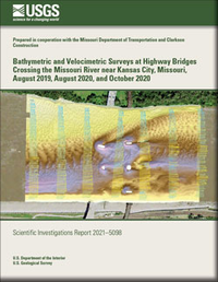
Bathymetric and Velocimetric Surveys at Highway Bridges Crossing the Missouri River near Kansas City, Missouri, August 2019, August 2020, and October 2020
Links
- Document: Report (38.0 MB pdf) , XML
- Dataset: U.S. Geological Survey National Water Information System database — USGS water data for the Nation
- Data Release: USGS Data Release - Bathymetry and velocity data from surveys at highway bridges crossing the Missouri River in Kansas City, Missouri, in August 2019, August 2020, and October 2020
- Download citation as: RIS | Dublin Core
Abstract
Bathymetric and velocimetric data were collected by the U.S. Geological Survey, in cooperation with the Missouri Department of Transportation, near 9 bridges at 8 highway crossings of the Missouri River near Kansas City, Missouri, on August 13–14, 2019. A multibeam echosounder mapping system was used to obtain channel-bed elevations for river reaches about 1,550 to 1,660 feet longitudinally and generally extending laterally across the active channel from bank to bank during moderate flood-flow conditions. These surveys indicated the channel conditions at the time of the surveys and provided characteristics of scour holes that may be useful in developing predictive guidelines or equations for scour holes. These data also may be useful to the Missouri Department of Transportation as a low to moderate flood-flow assessment of the bridges for stability and integrity issues with respect to bridge scour during floods.
Bathymetric data were collected around every pier that was in water, except around the nose of one pier that was surrounded by a persistent debris raft. Scour holes were present at most piers for which bathymetry could be obtained, except those on banks or surrounded by riprap. The observed scour holes at the surveyed bridges generally were examined with respect to shape and depth.
Comparisons between bathymetric surfaces from previous surveys and this study do not indicate any consistent correlation in channel-bed elevations with streamflow conditions at the times of the surveys. The predominant overall scour observed between the various surveys implies the channel bed in the 2019 surveys might have been rebounding from more substantial scour caused by the high streamflow earlier in March and June 2019, which was the highest streamflow since 1993. Pier size and nose shape had a substantial effect on the size of the scour hole observed at a given pier. Many of the piers at the Kansas City area bridges have wide or blunt noses caused by exposed footings, seal courses, or caissons, which resulted in large, deep scour holes at most piers. Several of the structures had piers that were skewed to primary approach flow; and, at most of the structures, the scour hole was deeper and longer on the side of the pier with impinging flow than the leeward side, with some amount of deposition on the leeward side, as typically has been observed at piers skewed to approach flow.
Limited additional bathymetric data were collected by the U.S. Geological Survey, in cooperation with Clarkson Construction, near the main channel piers of the U.S. Highway 169 (Broadway) and the Interstate 435 (Randolph) bridges on August 17 and October 23, 2020, to determine the channel-bed conditions before and after installation of scour countermeasures near those piers. Survey results from before and after installation of these countermeasures show these features had a substantial effect on mitigating the observed scour at these piers, particularly when compared to piers at other sites without such features.
Suggested Citation
Huizinga, R.J., 2022, Bathymetric and velocimetric surveys at highway bridges crossing the Missouri River near Kansas City, Missouri, August 2019, August 2020, and October 2020: U.S. Geological Survey Scientific Investigations Report 2021–5098, 112 p., https://doi.org/10.3133/sir20215098.
ISSN: 2328-0328 (online)
Study Area
Table of Contents
- Acknowledgments
- Abstract
- Introduction
- Results of Bathymetric and Velocimetric Surveys
- Summary and Conclusions
- References Cited
- Glossary
- Appendix 1. Shaded Triangulated Irregular Network Images of the Channel and Side of Pier for Each Surveyed Pier
| Publication type | Report |
|---|---|
| Publication Subtype | USGS Numbered Series |
| Title | Bathymetric and velocimetric surveys at highway bridges crossing the Missouri River near Kansas City, Missouri, August 2019, August 2020, and October 2020 |
| Series title | Scientific Investigations Report |
| Series number | 2021-5098 |
| DOI | 10.3133/sir20215098 |
| Publication Date | January 31, 2022 |
| Year Published | 2022 |
| Language | English |
| Publisher | U.S. Geological Survey |
| Publisher location | Reston, VA |
| Contributing office(s) | Central Midwest Water Science Center |
| Description | Report: xii, 112 p.; Data Release; Dataset |
| Country | United States |
| State | Missouri |
| City | Kansas City |
| Other Geospatial | Missouri River |
| Online Only (Y/N) | Y |


