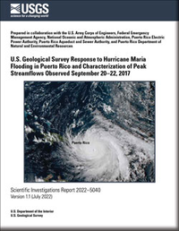
U.S. Geological Survey Response to Hurricane Maria Flooding in Puerto Rico and Characterization of Peak Streamflows Observed September 20–22, 2017
Links
- Document: Report (23.6 MB pdf) , HTML , XML
- Plate: Plate 1 (22.8 MB pdf)
- Appendixes:
- Dataset: USGS National Water Information System database —USGS water data for the Nation
- Data Release: USGS data release - Data files for USGS response to Hurricane Maria flooding in Puerto Rico and characterization of peak streamflows observed September 20–22, 2017
- Version History: Version History (1 kB txt)
- Download citation as: RIS | Dublin Core
Abstract
Hurricane Maria struck the island of Puerto Rico on September 20, 2017, as a Category 4 storm. The hurricane traversed the island from southeast to northwest and produced recorded 48-hour rainfall totals of up to 30.01 inches. Estimates of the human death toll range from 2,975 to 4,645, possibly more.
The U.S. Geological Survey (USGS) hydrologic monitoring network sustained substantial wind and flood damage during the hurricane. Eighty-five of the 300 hydrologic monitoring stations operating in Puerto Rico and the U.S. Virgin Islands prior to the passage of Hurricane Maria were destroyed or damaged. During the weeks and months after the hurricane, USGS field crews in Puerto Rico prioritized repair of the hydrologic monitoring network and collected hydrologic information to characterize the magnitude of observed peak streamflows at 20 streamgage and to develop new theoretical stage-streamflow relations for 58 streamgages where stream channels were substantially altered; the theoretical stage-streamflow relations were used to estimate Hurricane Maria peak streamflows for 39 of those sites. As part of a pilot program, USGS field crews installed continuous slope-area monitoring equipment at two remote streamgages to automate the collection of high-streamflow stage data.
Hurricane Maria peak streamflows and rankings were determined for 73 USGS streamgages in Puerto Rico. New rank 1 period-of-record peak streamflows occurred at 28 sites, rank 2 period-of-record peak streamflows occurred at 17 sites, and rank 3 period-of-record peak streamflows occurred at 9 sites; period-of-record peak streamflows at the remaining 19 sites either ranked from 4th to 20th or were not ranked. Annual exceedance probabilities for 53 unregulated peak streamflows ranged from greater than 50.0 percent (recurrence interval of less than 2 years) to 0.3 percent (recurrence interval of 333 years), with the majority (28 of 53) in the range of 10.0–2.1 percent (recurrence intervals of 10–48 years).
A comparison of period-of-record ranks for the largest flood events that have occurred in Puerto Rico since the 1960s indicated that Hurricane Maria produced more record peak streamflows than either Hurricane Hortense in 1996 or Hurricane Georges in 1998. Limited pre-1960s hydrologic data preclude quantitative comparison with earlier storms.
As part of this study, a maximum peak-streamflow envelope curve for Puerto Rico was developed using historical peak-streamflow information available through 2017. Other post-Hurricane Maria USGS activities summarized in this report include (1) Global Navigation Satellite System surveys at all stations in the USGS hydrologic monitoring network, used to tie the network to the Puerto Rico Vertical Datum of 2002; and (2) telemetered monitoring of the Lago Guajataca Dam in northwestern Puerto Rico, which was damaged and at risk of failure from October to December 2017.
Suggested Citation
Gómez-Fragoso, J., Smith, M., and Santiago, M., 2022, U.S. Geological Survey response to Hurricane Maria flooding in Puerto Rico and characterization of peak streamflows observed September 20–22, 2017 (ver. 1.1, July 2022): U.S. Geological Survey Scientific Investigations Report 2022–5040, 105 p., 6 app., 1 pl., https://doi.org/10.3133/sir20225040.
ISSN: 2328-0328 (online)
Study Area
Table of Contents
- Acknowledgments
- Abstract
- Introduction
- Methods
- Results
- Other USGS Activities in Response to Hurricane Maria
- Summary and Conclusions
- References Cited
- Appendix 1. U.S. Geological Survey Hydrologic Monitoring Network in Puerto Rico in 2017, Prior to Hurricane Maria
- Appendix 2. Indirect Measurements of Peak Streamflow, Made at Selected Sites in Puerto Rico After the Passage of Hurricane Maria
- Appendix 3. Development of Stage-Streamflow Relations at Selected Sites in Puerto Rico, 2018
- Appendix 4. 50093000 Río Marín Near Patillas (Case Study)—Continuous Slope Area Method to Determine Stage-Streamflow Relations
- Appendix 5. Station Information, Peak Gage Height and Streamflow, Period of Record Rank, Number of Peak Streamflows, and Estimated Annual Exceedance Probability for Selected U.S. Geological Survey Streamgages in Puerto Rico, September 20–22, 2017
- Appendix 6. Station Information, Period of Record, Number of Peak Streamflows, Historical Rank 1 Peak Streamflow and Date, and Operational Status of Site During Hurricane Maria for 181 Unregulated Sites in Puerto Rico
| Publication type | Report |
|---|---|
| Publication Subtype | USGS Numbered Series |
| Title | U.S. Geological Survey response to Hurricane Maria flooding in Puerto Rico and characterization of peak streamflows observed September 20–22, 2017 |
| Series title | Scientific Investigations Report |
| Series number | 2022-5040 |
| DOI | 10.3133/sir20225040 |
| Edition | Version 1.0: June 29, 2022; Version 1.1: July 13, 2022 |
| Publication Date | June 29, 2022 |
| Year Published | 2022 |
| Language | English |
| Publisher | U.S. Geological Survey |
| Publisher location | Reston, VA |
| Contributing office(s) | Caribbean-Florida Water Science Center |
| Description | Report: ix, 105 p.; 6 Appendixes; 1 Plate: 33.08 × 18.40 inches; Data Release; Dataset |
| Country | United States |
| State | Puerto Rico |
| Online Only (Y/N) | Y |
| Additional Online Files (Y/N) | Y |


