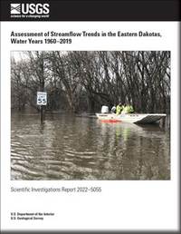
Assessment of Streamflow Trends in the Eastern Dakotas, Water Years 1960–2019
Links
- Document: Report (13.7 MB pdf) , HTML , XML
- Dataset: USGS National Water Information System database —USGS water data for the Nation
- Download citation as: RIS | Dublin Core
Abstract
Hydrologic extremes, whether periods of drought or flooding, are occurring more frequently with greater severity and can have substantial economic impacts. Along with flooding, the timing and volume of streamflow also is changing across the United States. The focus of this report is to characterize a unique trend in mean annual streamflow occurring in eastern North and South Dakota, hereafter referred to as the eastern Dakotas, that is not being observed anywhere else in the conterminous United States.
Streamflow records for 1,853 U.S. Geological Survey streamgages obtained from the U.S. Geological Survey National Water Information System database with a continuous record of mean annual streamflow during water years 1960–2019 were included in this study. Using a Kendall tau statistical test (p-value less than or equal to 0.10), 573 streamgages had a statistically significant upward trend in mean annual streamflow and are primarily located in the Midwest and northeastern United States. Of the streamgages, 182 had a statistically significant downward trend and are located primarily in the western and southeastern States. Several sites had increases in streamflow between 100 and 500 percent. Most of the streamgages with the highest increases in mean annual streamflow are along the same rivers in the eastern Dakotas, regardless of basin size.
A comparison of mean annual streamflow of the last decade (2010–19) to the first decade (1960–69) of the study period shows that the largest increases in annual streamflow volumes in the United States also are in the eastern Dakotas. Among all 1,853 streamgages in the United States, the Sheyenne River near Warwick, North Dakota (U.S. Geological Survey station 05056000), has the greatest percent change, with an increase of 486 percent. Several factors may be contributing to increasing trends in streamflow in the eastern Dakotas and may include, in part, precipitation changes owing to climatic variation within the region, geologic makeup of the subsurface, and land-use changes. A better understanding of these research areas will help producers, resource managers, and infrastructure engineers to make more informed environmental and economic decisions.
Suggested Citation
Norton, P.A., Delzer, G.C., Valder, J.F., Tatge, W.S., and Ryberg, K.R., 2022, Assessment of streamflow trends in the eastern Dakotas, water years 1960–2019: U.S. Geological Survey Scientific Investigations Report 2022–5055, 11 p., https://doi.org/10.3133/sir20225055.
ISSN: 2328-0328 (online)
Study Area
Table of Contents
- Abstract
- Introduction
- Methods of Analysis Used in Assessing Streamflow Trends
- Spatial Analysis of Streamflow Trends
- Potential Factors Contributing to Increasing Streamflow Trends
- Summary
- References Cited
| Publication type | Report |
|---|---|
| Publication Subtype | USGS Numbered Series |
| Title | Assessment of streamflow trends in the eastern Dakotas, water years 1960–2019 |
| Series title | Scientific Investigations Report |
| Series number | 2022-5055 |
| DOI | 10.3133/sir20225055 |
| Publication Date | June 17, 2022 |
| Year Published | 2022 |
| Language | English |
| Publisher | U.S. Geological Survey |
| Publisher location | Reston, VA |
| Contributing office(s) | Dakota Water Science Center |
| Description | Report: iv, 11 p.; Dataset |
| Country | United States |
| State | North Dakota, South Dakota |
| Online Only (Y/N) | Y |


