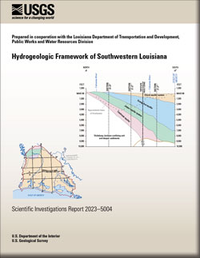
Hydrogeologic Framework of Southwestern Louisiana
Links
- Document: Report (11.4 MB pdf) , HTML , XML
- Data Release: USGS data release—Altitudes and thicknesses of hydrogeologic units of southwestern Louisiana
- Download citation as: RIS | Dublin Core
Abstract
A hydrogeologic framework was constructed for the Coastal Lowlands aquifer system in southwestern Louisiana. Data from previous hydrogeologic and geologic studies were synthesized and expanded using 2,242 geophysical logs to map 4 hydrogeologic units: the Chicot aquifer system, Evangeline aquifer, Jasper aquifer system, and Catahoula aquifer. Raster surfaces were created for the base and thickness of each unit to provide a generalized framework that can be used for regional groundwater studies and as a foundation for additional or local refinement.
Suggested Citation
Lindaman, M.A., 2023, Hydrogeologic framework of southwestern Louisiana: U.S. Geological Survey Scientific Investigations Report 2023–5004, 31 p., https://doi.org/10.3133/sir20235004.
ISSN: 2328-0328 (online)
Study Area
Table of Contents
- Acknowledgments
- Abstract
- Introduction
- Methodology
- Characteristics of Hydrogeologic Units
- Summary
- References Cited
| Publication type | Report |
|---|---|
| Publication Subtype | USGS Numbered Series |
| Title | Hydrogeologic framework of southwestern Louisiana |
| Series title | Scientific Investigations Report |
| Series number | 2023-5004 |
| DOI | 10.3133/sir20235004 |
| Publication Date | July 28, 2023 |
| Year Published | 2023 |
| Language | English |
| Publisher | U.S. Geological Survey |
| Publisher location | Reston, VA |
| Contributing office(s) | Lower Mississippi-Gulf Water Science Center |
| Description | Report: viii, 31 p.; Data Release |
| Country | United States |
| State | Louisiana |
| Online Only (Y/N) | Y |


