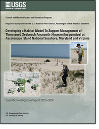
Developing a Habitat Model To Support Management of Threatened Seabeach Amaranth (Amaranthus pumilus) at Assateague Island National Seashore, Maryland and Virginia
Links
- Document: Report (14.8 MB pdf) , HTML , XML
- Data Releases:
- USGS data release - Assateague Island seabeach amaranth survey data—2001 to 2018
- USGS data release - Seabeach amaranth presence-absence and barrier island geomorphology metrics as relates to shorebird habitat for Assateague Island National Seashore—2008, 2010, and 2014
- Download citation as: RIS | Dublin Core
Abstract
Amaranthus pumilus (seabeach amaranth) is a federally threatened plant species that has been the focus of restoration efforts at Assateague Island National Seashore (ASIS). Despite several years with strong population numbers prior to 2010, monitoring efforts have revealed a significant decline in the seabeach amaranth population since that time, the causes of which have been unclear. To examine potential causes for the population decreases, and to help inform management practices for the future, we first evaluated 20 years of plant population data and three seasons of physical landscape characteristics of seabeach amaranth sites spanning the period of decline to assess how these may have contributed to decreases in habitat. Plant population trends, grazing data, and precipitation data indicate the population declines coincided with severe storms and periods of drought. Furthermore, we found that plants tended to occur at sites on portions of ASIS that were lower elevation on narrower regions of the island than sites where plants were not observed. Secondly, using two different data sampling schemes, we developed Bayesian networks to calculate probabilities of habitat and evaluate the importance of different variables, particularly morphologic metrics, included in the Bayesian networks. Model analyses showed that variables capturing the presence of, and proximity to, the seed bank were important for accurate hindcasts, and that specific barrier-island morphologies tended to occur at sites where seabeach amaranth was observed. More specifically, favorable habitat sites tended to be those more likely to experience overwash during high-water events, consistent with the long-held observations that the plants tend to occur in disturbance-prone settings. Model outputs provide spatially explicit maps of relative habitat suitability and helped to identify high-priority areas for amaranth protection. The modeling effort may also assist in determining the management actions most likely to result in the preservation of a long-term sustainable population.
Suggested Citation
Gutierrez, B.T., and Lentz, E.E., 2023, Developing a habitat model to support management of threatened seabeach amaranth (Amaranthus pumilus) at Assateague Island National Seashore, Maryland and Virginia: U.S. Geological Survey Scientific Investigations Report 2023–5034, 62 p., https://doi.org/10.3133/sir20235034.
ISSN: 2328-0328 (online)
Study Area
Table of Contents
- Acknowledgments
- Abstract
- Introduction
- Methods
- Results
- Discussion
- Summary
- References Cited
- Appendix 1. Bayesian Network Configuration, Initial Performance Testing and Scores, and Hindcast Evaluation
| Publication type | Report |
|---|---|
| Publication Subtype | USGS Numbered Series |
| Title | Developing a habitat model to support management of threatened seabeach amaranth (Amaranthus pumilus) at Assateague Island National Seashore, Maryland and Virginia |
| Series title | Scientific Investigations Report |
| Series number | 2023-5034 |
| DOI | 10.3133/sir20235034 |
| Publication Date | April 26, 2023 |
| Year Published | 2023 |
| Language | English |
| Publisher | U.S. Geological Survey |
| Publisher location | Reston, VA |
| Contributing office(s) | Woods Hole Coastal and Marine Science Center |
| Description | Report: viii, 62 p.; 2 Data Releases |
| Country | United States |
| State | Maryland, Virginia |
| Other Geospatial | Assateague Island National Seashore |
| Online Only (Y/N) | Y |
| Additional Online Files (Y/N) | N |


