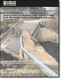
Flood of October 31 to November 3, 2019, in the East Canada Creek, West Canada Creek, and Sacandaga River Basins in Central New York
Links
- Document: Report (10.9 MB pdf) , HTML , XML
- Data Release: USGS data release - Flood-frequency data for six selected streamgages following the central New York flood of October 31–November 3, 2019
- NGMDB Index Page: National Geologic Map Database Index Page (html)
- Download citation as: RIS | Dublin Core
Abstract
Between October 31 and November 3, 2019, historic flooding in localized areas of the Mohawk Valley and southern Adirondack region in central New York State resulted in one fatality and an estimated $33 million in damages. Flooding resulted from high-intensity, hyperlocal rainfall in the region within a 24-hour period between October 31 and November 1, 2019, at the end of a much wetter than average October. In that 24-hour period, rainfall amounts largely ranged from 2 to 5 inches in the most heavily affected parts of the region, but a maximum rainfall amount for the region of 7 inches was recorded in Speculator, New York. This rainfall total for a 24-hour period for this location is estimated to have between a 200- and 500-year recurrence interval. The most severe flooding to result from the rainfall was mainly in the Sacandaga River basin, which is within the upper Hudson River basin, and in the East and West Canada Creek basins, which are within the Mohawk River basin.
Streamflow, stage, and reservoir elevation data, collected by the U.S. Geological Survey, are documented in this report. Flooding resulted in new peak streamflow records at five of six U.S. Geological Survey streamgages in the region that have periods of record of at least 20 years, including at three streamgages that have been in operation for about 100 years. At the sixth streamgage, this flooding resulted in the second highest peak streamflow in its 71-year period of record. For all six streamgages, estimates of flood magnitudes for selected annual exceedance probabilities were updated using the peak streamflows from the flooding. Additionally, the annual exceedance probabilities for the six respective peak streamflows were all estimated to be less than 1 percent (greater than a 100-year recurrence interval). At three of those six streamgages, however, previous annual peak streamflows of comparable magnitudes (within 10 percent) have also happened within the past 20 years.
Suggested Citation
Graziano, A.P., Gazoorian, C.L., Smith, T.L., and Lilienthal, A.G., III, 2024, Flood of October 31 to November 3, 2019, in the East Canada Creek, West Canada Creek, and Sacandaga River basins in central New York: U.S. Geological Survey Scientific Investigations Report 2023–5126, 37 p., https://doi.org/10.3133/sir20235126.
ISSN: 2328-0328 (online)
Study Area
Table of Contents
- Acknowledgments
- Abstract
- Introduction
- Antecedent Conditions
- Precipitation
- Methods
- Peak Streamflows and Stages
- Flood Magnitudes for Selected Annual Exceedance Probabilities
- Annual Exceedance Probabilities for the Flood of October 31 to November 3, 2019
- Comparison to Past Floods
- Summary
- References Cited
| Publication type | Report |
|---|---|
| Publication Subtype | USGS Numbered Series |
| Title | Flood of October 31 to November 3, 2019, in the East Canada Creek, West Canada Creek, and Sacandaga River basins in central New York |
| Series title | Scientific Investigations Report |
| Series number | 2023-5126 |
| DOI | 10.3133/sir20235126 |
| Publication Date | January 17, 2024 |
| Year Published | 2024 |
| Language | English |
| Publisher | U.S. Geological Survey |
| Publisher location | Reston, VA |
| Contributing office(s) | New York Water Science Center |
| Description | Report: vii, 37 p.; Data Release |
| Country | United States |
| State | New York |
| Other Geospatial | East Canada Creek basin, West Canada Creek basin, Sacandaga River basin |
| Online Only (Y/N) | Y |
| Additional Online Files (Y/N) | N |


