
|
|
Scientific Investigations Map 2940 |
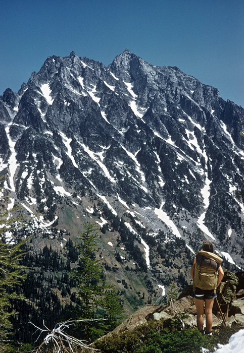
| Kt-1. Mount Stuart, viewed from point near Lake Ingalls [Wnw], is granodiorite and quartz diorite of the Mount Stuart batholith, included in the Late Cretaceous tonalitic stitching plutons (Kt). The batholith intruded ultramafic rock of the Ingalls terrane (Jis), which crops out in the lower slopes of the peak and in the foreground. View image with annotation |
|
Other photos that show unit Kt:
        |